Ketapang Regency
Ketapang Regency is a regency in the south of the province of West Kalimantan, on the island of Borneo in Indonesia. Ketapang Regency occupies an area of 31,588 km², and at the census in 2010 it had 427,460 inhabitants following the splitting off of five districts in the north-west of the regency in 2007 to form the new North Kayong Regency; the latest official estimate (as at mid 2019) is 512,783.[2] The principal town lies at Ketapang.
Ketapang Regency
Kabupaten Ketapang | |
|---|---|
 Seal | |
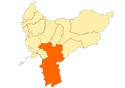 Location within West Kalimantan | |
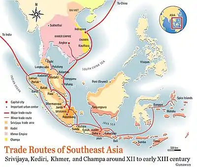 Ketapang was part of Tanjungpura Kingdom | |
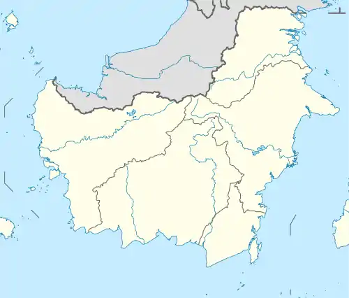 Ketapang Regency Location in Kalimantan and Indonesia  Ketapang Regency Ketapang Regency (Indonesia) | |
| Coordinates: 1.5833°S 110.5000°E | |
| Country | Indonesia |
| Province | West Kalimantan |
| Capital | Ketapang |
| Government | |
| • Regent | Martin Rantan |
| • Vice Regent | Suprapto S |
| Area | |
| • Total | 31,588 km2 (12,196 sq mi) |
| Population (2019)[1] | |
| • Total | 512,783 |
| • Density | 16/km2 (42/sq mi) |
| Time zone | UTC+7 (IWST) |
| Area code | (+62) 534 |
| Website | ketapangkab |
Administrative Districts
Following the splitting off of the five districts to form the North Kayong Regency in 2007, the Ketapang Regency now consists of twenty districts (kecamatan), tabulated below with their areas and their populations at the 2010 Census,[3] and their officially estimated populations in mid 2019.[4] The table includes the number of administrative villages (rural desa and urban kelurahan) in each district, and its post code.
| Name | Area in km2 | Pop'n Census 2010 | Pop'n Estimate mid 2019 | No. of vill. | Post code |
|---|---|---|---|---|---|
| Kendawangan | 5,859 | 32,505 | 38.800 | 19 | 78862 |
| Manis Mata | 2,912 | 24,627 | 35,526 | 22 | 78864 |
| Marau | 1,160 | 11,901 | 14,640 | 10 | 78865 |
| Singkup | 227 | 6,154 | 6,891 | 8 | 78866 |
| Air Upas | 793 | 16,620 | 20,935 | 9 | 78863 |
| Jelai Hulu | 1,358 | 15,648 | 16,578 | 22 | 78876 |
| Tumbang Titi | 1,198 | 23,286 | 23,753 | 25 | 78877 |
| Pemahan | 326 | 4,446 | 5,153 | 7 | 78874 |
| Sungai Melayu Rayak | 122 | 11,650 | 12,833 | 11 | 78875 |
| Matan Hilir Selatan | 1,813 | 30,528 | 34,740 | 11 | 78822 |
| Benua Kayong | 349 | 35,165 | 44,463 | 11 | 78821 -78822 |
| Matan Hilir Utara | 720 | 14,739 | 16,848 | 5 | 78813 |
| Delta Pawan (Ketapang town) | 74 | 71,509 | 98,696 | 9 | 78811 -78813 |
| Muara Pawan | 611 | 13,109 | 14,615 | 8 | 78810 |
| Nanga Tayap | 1,728 | 27,490 | 28,756 | 20 | 78873 |
| Sandai | 1,779 | 24,474 | 28,857 | 13 | 78870 |
| Hulu Sungai | 4,685 | 11,553 | 11,741 | 12 | 78871 |
| Sungai Laur | 1,651 | 16,702 | 19,053 | 19 | 78872 |
| Simpang Hulu | 3,175 | 27,847 | 31,795 | 15 | 78850 |
| Simpang Dua | 1,048 | 7,507 | 8,110 | 6 | 78854 |
| Totals | 31,588 | 427,460 | 512,783 | 262 |
References
- Badan Pusat Statistik, Jakarta, 2020.
- Badan Pusat Statistik, Jakarta, 2020.
- Biro Pusat Statistik, Jakarta, 2011.
- Badan Pusat Statistik, Jakarta, 2020.
Regencies and cities of West Kalimantan | ||
|---|---|---|
Capital: Pontianak | ||
| Regencies | ||
| Cities | ||
