Melawi Regency
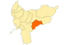
Melawi Regency is a regency of West Kalimantan province of Indonesia. It was created in 2003 from part of Sintang Regency. It covers an area of 10,640.8 km2, and had a population of 178,645 at the 2010 Census[2] and 195,667 at the 2015 Census; the latest official estimate (for mid 2019) is 208,417.[3] The principal town lies at Nanga Pinoh.
Melawi Regency | |
|---|---|
 Coat of arms | |
 Location within West Kalimantan | |
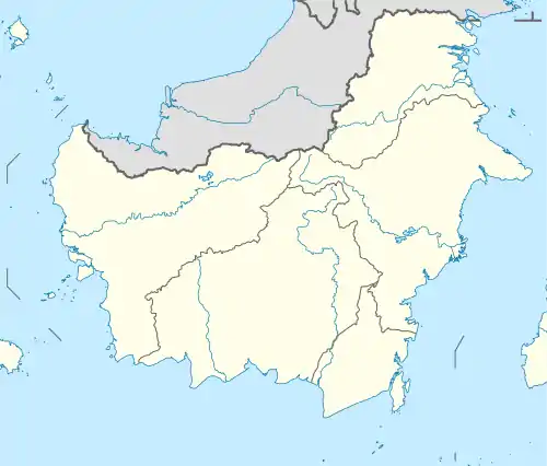
 Melawi Regency Location in Kalimantan and Indonesia  Melawi Regency Melawi Regency (Indonesia) | |
| Coordinates: 0.3361°S 111.6981°E | |
| Country | Indonesia |
| Province | West Kalimantan |
| Capital | Nanga Pinoh |
| Government | |
| • Regent | Panji |
| • Vice Regent | Dadi Sunarya Usfa Yursa |
| Area | |
| • Total | 10,640.80 km2 (4,108.44 sq mi) |
| Population (2019)[1] | |
| • Total | 208,417 |
| • Density | 20/km2 (51/sq mi) |
| Time zone | UTC+7 (IWST) |
| Area code | (+62) 561 |
| Website | melawikab |
Administrative Districts
Melawi Regency consists of eleven districts (kecamatan), tabulated below with their areas and their populations at the 2010 Census,[4] together with the latest official estimates (for mid 2017).[5] The table also includes the number of administrative villages (rural desa and urban keluraham) in each district, its post code and their administrative centres:
| Name | Area in km2 | Pop'n Census 2010 | Pop'n Estimate mid 2017 | No. of vill. | Post code | Admin centre |
|---|---|---|---|---|---|---|
| Sokan | 1,577.2 | 14,773 | 16,415 | 18 | 79675 | Nanga Sokan |
| Tanah Pinoh | 739.3 | 14,178 | 14,824 | 12 | 79674 | Kota Baru |
| Tanah Pinoh Barat (West Tanah Pinoh) | 829.0 | 11,433 | 12,185 | 10 | 79676 | Ulak Muid |
| Sayan | 1,166.3 | 15,639 | 16,876 | 18 | 79673 | Nanga Sayan |
| Belimbing | 1,238.0 | 20,191 | 22,186 | 17 | 79671 | Pemuar |
| Belimbing Hulu (Upper Belimbing) | 454.0 | 8,687 | 8,088 | 8 | 79670 | Tiong Keranjik |
| Nanga Pinoh | 617.2 | 39,604 | 52,752 | 17 | 79672 | Nanga Pinoh |
| Pinoh Selatan (South Pinoh) | 931.0 | 9,974 | 12,981 | 12 | 79677 | Manggala |
| Pinoh Utara (North Pinoh) | 890.0 | 11,501 | 12,332 | 19 | 79678 | Tekelak |
| Ella Hilir (Lower Ella) | 1,136.7 | 15,280 | 16,108 | 19 | 79681 | Nanga Ella Hilir |
| Menukung | 1,062.1 | 17,385 | 17,559 | 19 | 79682 | Menukung Kota |
| Totals | 10,640.0 | 178,645 | 202,306 | 169 |
References
- Badan Pusat Statistik, Jakarta, 2020.
- Biro Pusat Statistik, Jakarta, 2011.
- Badan Pusat Statistik, Jakarta, 2020.
- Biro Pusat Statistik, Jakarta, 2011.
- Badan Pusat Statistik, Jakarta, 2020.
This article is issued from Wikipedia. The text is licensed under Creative Commons - Attribution - Sharealike. Additional terms may apply for the media files.
