Limerick, Ontario
Limerick is a small township in Hastings County, Ontario, Canada, near Limerick Lake. It is located 80 kilometres (50 mi) north of Belleville between Madoc and Bancroft and served by Ontario Highway 62 and Township Road 620.[2] The Township is bordered by the Town of Bancroft, Township of Wollaston and the joined Townships of Tudor and Cashel. The township is heavily forested, as is the shoreline of the Limerick Lake, the main industry in the township being forestry and logging. The population of Limerick Township is approx. 300 full-year residents, and another 1000 seasonal residents.
Limerick | |
|---|---|
| Township of Limerick | |
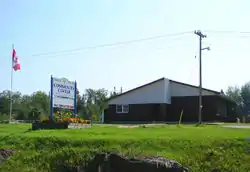 Community centre | |
 | |
 Limerick | |
| Coordinates: 44°54′N 77°40′W | |
| Country | |
| Province | |
| County | Hastings |
| Incorporated | 1887 |
| Government | |
| • Type | Township |
| • Mayor | Carl Stefanski |
| • Federal riding | Hastings—Lennox and Addington |
| • Prov. riding | Prince Edward—Hastings |
| Area | |
| • Land | 205.37 km2 (79.29 sq mi) |
| Population (2016[1]) | |
| • Total | 346 |
| • Density | 1.7/km2 (4/sq mi) |
| Time zone | UTC-5 (EST) |
| • Summer (DST) | UTC-4 (EDT) |
| Postal Code | K0L |
| Area code(s) | 613 and 343 |
| Website | www.township.limerick. on.ca |
It was named in 1887 after the city of Limerick in Ireland.[3]
Communities
The township of Limerick comprises a number of villages and hamlets, including the following communities such as Martins Landing, Ormsby (44.881°N 77.749°W), St. Ola, Steenburg Lake; Brinklow, Ormsby Junction
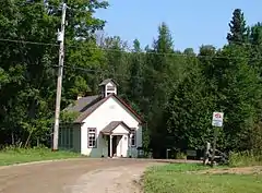 Old school house in Ormsby |
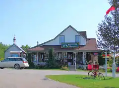 Country store in Ormsby |
Demographics
| Canada census – Limerick, Ontario community profile | |||
|---|---|---|---|
| 2016 | 2011 | 2006 | |
| Population: | 346 (-1.7% from 2011) | 352 (-3.3% from 2006) | 364 (+0.6% from 2001) |
| Land area: | 205.37 km2 (79.29 sq mi) | 205.68 km2 (79.41 sq mi) | 200.59 km2 (77.45 sq mi) |
| Population density: | 1.7/km2 (4.4/sq mi) | 1.7/km2 (4.4/sq mi) | 1.8/km2 (4.7/sq mi) |
| Median age: | 55.1 (M: 55.7, F: 53.8) | 51.6 (M: 51.2, F: 52.2) | |
| Total private dwellings: | 541 | 427 | 565 |
| Median household income: | $42,880 | $27,333 | |
| References: 2016[4] 2011[5] 2006[6] earlier[7] | |||
| Year | Pop. | ±% |
|---|---|---|
| 1991 | 347[8] | — |
| 1996 | 396 | +14.1% |
| 2001 | 362 | −8.6% |
| 2006 | 364 | +0.6% |
| 2011 | 352 | −3.3% |
| 2016 | 346 | −1.7% |
| [9][5][1] | ||
First Official Language Spoken:[5]
- English as first language: 100%
- French as first language: 0%
- English and French as first language: 0%
- Other as first language: 0%
References
- "Census Profile, 2016 Census: Limerick, Township". Statistics Canada. Retrieved June 15, 2019.
- Cameron Bevers. "History of Secondary Highway 620". Retrieved September 24, 2020.
- Limerick Township History since 1888. By Mrs. Thomas Ham, Steenburg, Ontario. First published in The North Hastings Review circa 1955. Accessed 31 May 2020.
- "2016 Community Profiles". 2016 Canadian Census. Statistics Canada. February 21, 2017. Retrieved 2019-06-15.
- "2011 Community Profiles". 2011 Canadian Census. Statistics Canada. July 5, 2013. Retrieved 2012-03-01.
- "2006 Community Profiles". 2006 Canadian Census. Statistics Canada. March 30, 2011. Retrieved 2012-03-01.
- "2001 Community Profiles". 2001 Canadian Census. Statistics Canada. February 17, 2012.
- Statistics Canada (1992). Profile of census divisions and subdivision in Ontario. Part A. Supply and Services Canada. p. 141. ISBN 0-660-57210-9.
- Statistics Canada: 1996, 2001, 2006 census
External links
Places adjacent to Limerick, Ontario | |
|---|---|
| Cities |  | |
|---|---|---|
| Towns | ||
| Townships | ||
| First Nations | ||
| Indian reserves | ||
| ||
