Lock and Dam No. 25
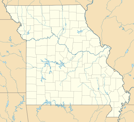
Lock and Dam No. 25 is a lock and dam located near Winfield, Missouri on the Upper Mississippi River around river mile 241.4. The movable portion of the dam is 1,296 feet (395.0 m) long and consists of three roller gates and 14 tainter gates. A 2,566 feet (782.1 m) submersible dike extends to the Illinois shore. A 5 miles (8.0 km) long dike is part of the facility extending upstream on the Missouri side of the river. The main lock is 110 feet (33.5 m) wide by 600 feet (182.9 m) long.[2] In 2004, the facility was listed in the National Register of Historic Places as Lock and Dam No. 25 Historic District, #04000184 covering 3,164 acres (12.8 km2), 2 buildings, 7 structures, 2 objects.
 Lock and Dam No. 25 |
 |
 Mississippi River Lock and Dam No. 25 | |
| Location | Richwood Precinct, Calhoun County, Illinois / Burr Oak Township, Lincoln County, Missouri, near Winfield, Missouri, USA |
|---|---|
| Coordinates | 39°00′17″N 90°41′11″W |
| Construction began | 1935 |
| Opening date | May 18, 1939 |
| Operator(s) | |
| Dam and spillways | |
| Impounds | Upper Mississippi River |
| Length | 1,296 feet (395.0 m) |
| Reservoir | |
| Creates | Pool 25 |
| Total capacity | 176,000 acre⋅ft (0.217 km3) |
| Catchment area | 142,000 sq mi (370,000 km2) |
| Surface area | 18,000 acres (73 km2) |
Lock and Dam No. 25 Historic District | |
  | |
| Location | 10 Sandy Slough Rd., Winfield, Missouri |
| Area | 316.4 acres (128.0 ha) |
| Built | 1939 |
| Architect | US Army Corps of Engineers; Griffin, Almern Frederick |
| MPS | Upper Mississippi River 9-Foot Navigation Project MPS |
| NRHP reference No. | 04000184[1] |
| Added to NRHP | March 10, 2004 |
References
External links
- USGS Reach 2, Pool 25
- Historic American Engineering Record documentation:
- HAER No. MO-37, "Upper Mississippi River Nine-Foot Channel Project, Lock & Dam No. 25, Cap au Gris, Lincoln County, MO", 93 photos, 9 data pages, 7 photo caption pages
- HAER No. MO-50, "Upper Mississippi River Nine-Foot Channel Project, Lock & Dam Nos. 24-27, Clarksville, Pike County, MO", 125 data pages
| List of locks and dams of the Upper Mississippi River | ||
|---|---|---|
| Upstream: Lock and Dam No. 24 |
Downstream: Melvin Price Locks and Dam | |
| Topics | |
|---|---|
| Lists by state |
|
| Lists by insular areas | |
| Lists by associated state | |
| Other areas | |
| Related | |
| |
This article is issued from Wikipedia. The text is licensed under Creative Commons - Attribution - Sharealike. Additional terms may apply for the media files.