Lock and Dam No. 18
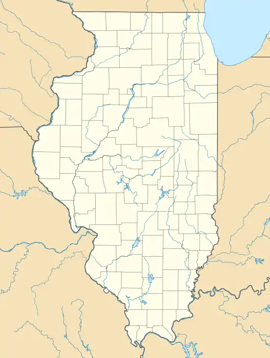
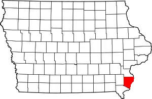
Lock and Dam No. 18 is a lock and dam located near Gladstone, Illinois and Burlington, Iowa on the Upper Mississippi River around river mile 410.5. The movable dam is 1,350 feet (411.5 m) and consists of 3 roller gates and 14 tainter gates. The lock is 110 feet (33.5 m) wide by 600 feet (182.9 m) long. In 2004, the facility was listed in the National Register of Historic Places as Lock and Dam No. 18 Historic District, #04000178 covering 2,049 acres (8.3 km2), 1 building, 4 structures and 4 objects.
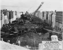 Public Works Administration Project and Army Corps of Engineers Lock and Dam No. 18 construction |
 |
 Mississippi River Lock and Dam No. 18 | |
| Location | Tama Township, Des Moines County, Iowa / Gladstone Township, Henderson County, Illinois, near Gladstone, Illinois, USA |
|---|---|
| Coordinates | 40°52′54″N 91°01′27″W |
| Construction began | 1934 |
| Opening date | September 8, 1937 |
| Operator(s) | |
| Dam and spillways | |
| Impounds | Upper Mississippi River |
| Length | 1,350 feet (411.5 m) |
| Reservoir | |
| Creates | Pool 18 |
| Total capacity | 90,000 acre⋅ft (0.11 km3) |
| Catchment area | 113,600 sq mi (294,000 km2) |
Lock and Dam No. 18 Historic District | |
  | |
| Location | 1.5 mi. N of unnamed cty rd. from Gladstone, Gladstone, Illinois |
| Area | 204.9 acres (82.9 ha) |
| Built | 1937 |
| Architect | US Army Corps of Engineers; Abbott, Edwin E., Et al. |
| MPS | Upper Mississippi River 9-Foot Navigation Project MPS |
| NRHP reference No. | 04000178[1] |
| Added to NRHP | March 10, 2004 |
Hydroelectric plant
In March 2009, local officials started discussing plans to install a hydroelectric generating plant on the dam.[2]
References
- "National Register Information System". National Register of Historic Places. National Park Service. July 9, 2010.
- Burlington Hawkeye
External links
![]() Media related to Mississippi River Lock and Dam number 18 at Wikimedia Commons
Media related to Mississippi River Lock and Dam number 18 at Wikimedia Commons
- Historic American Engineering Record (HAER) No. IL-29, "Mississippi River 9-Foot Channel Project, Lock & Dam No. 18, Upper Mississippi River, Gladstone, Henderson County, IL"
- Lock and Dam No. 18 - U.S. Army Corps of Engineers
| List of locks and dams of the Upper Mississippi River | ||
|---|---|---|
| Upstream: Lock and Dam No. 17 |
Downstream: Lock and Dam No. 19 | |
| Topics | |
|---|---|
| Lists by state |
|
| Lists by insular areas | |
| Lists by associated state | |
| Other areas | |
| Related | |
| |
This article is issued from Wikipedia. The text is licensed under Creative Commons - Attribution - Sharealike. Additional terms may apply for the media files.