Merrymeeting River
The Merrymeeting River is a 10.0-mile-long (16.1 km)[1] river in the Lakes Region of central New Hampshire in the United States. It is a tributary of Lake Winnipesaukee, part of the Merrimack River watershed.
| Merrymeeting River | |
|---|---|
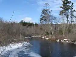 The Merrymeeting River in Alton, New Hampshire | |
  | |
| Location | |
| Country | United States |
| State | New Hampshire |
| Counties | Strafford, Belknap |
| Towns | New Durham, Alton |
| Physical characteristics | |
| Source | Merrymeeting Lake |
| • location | New Durham |
| • coordinates | 43°28′38″N 71°10′44″W |
| • elevation | 647 ft (197 m) |
| Mouth | Lake Winnipesaukee |
• location | Alton Bay |
• coordinates | 43°28′12″N 71°14′2″W |
• elevation | 504 ft (154 m) |
| Length | 10.0 mi (16.1 km) |
| Basin features | |
| Tributaries | |
| • left | Coffin Brook |
The river begins at the outlet of Merrymeeting Lake in the town of New Durham. The river flows south through a chain of ponds to the village proper of New Durham. After passing under New Hampshire Route 11, the river enters Merrymeeting Marsh and turns sharply to the northwest, the course it will take the rest of the way to its end. The river crosses a small dam at Alton and reaches Lake Winnipesaukee at the community of Alton Bay, the southernmost point on the lake.
See also
This article is issued from Wikipedia. The text is licensed under Creative Commons - Attribution - Sharealike. Additional terms may apply for the media files.