Montfrin
Montfrin is a commune in the Gard department in southern France.
Montfrin | |
|---|---|
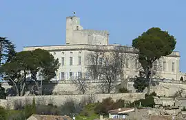 Chateau | |
.svg.png.webp) Coat of arms | |
Location of Montfrin 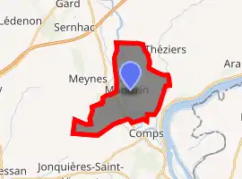
| |
 Montfrin  Montfrin | |
| Coordinates: 43°52′34″N 4°35′39″E | |
| Country | France |
| Region | Occitanie |
| Department | Gard |
| Arrondissement | Nîmes |
| Canton | Redessan |
| Intercommunality | Pont du Gard |
| Government | |
| • Mayor (2008–2014) | Claude Martinet |
| Area 1 | 15.29 km2 (5.90 sq mi) |
| Population (2017-01-01)[1] | 3,189 |
| • Density | 210/km2 (540/sq mi) |
| Time zone | UTC+01:00 (CET) |
| • Summer (DST) | UTC+02:00 (CEST) |
| INSEE/Postal code | 30179 /30490 |
| Elevation | 7–78 m (23–256 ft) (avg. 21 m or 69 ft) |
| 1 French Land Register data, which excludes lakes, ponds, glaciers > 1 km2 (0.386 sq mi or 247 acres) and river estuaries. | |
Population
The residents are called Montfrinois.
| Year | Pop. | ±% |
|---|---|---|
| 1962 | 1,779 | — |
| 1968 | 2,055 | +15.5% |
| 1975 | 2,089 | +1.7% |
| 1982 | 2,404 | +15.1% |
| 1990 | 2,685 | +11.7% |
| 1999 | 2,934 | +9.3% |
| 2008 | 2,980 | +1.6% |
Geography
Montfrin is located between Nîmes and Avignon, 10 km (6.2 mi) from Pont du Gard. The Gardon flows through the commune.
History
In Roman times, the place was called Mons Ferinus (mountain of the ferocious animals).
Charles Martel fought a battle there against the Saracens in 736, four years after the Battle of Tours.
The village has attracted celebrities during its history (including François I, Richelieu, Molière), and until the French Revolution, due to the presence of a "healing" spring, the spring of Fontcluse. A story says that the virtues of the spring were discovered by Charles Martel, who witnessed the healing of wounded soldiers after the battle.
Personalities
- Keith Floyd until his death in 2009
See also
References
- "Populations légales 2017". INSEE. Retrieved 6 January 2020.
| Wikimedia Commons has media related to Montfrin. |
| Authority control |
|
|---|