Starland County
Starland County is a municipal district located in southern Alberta Canada.
Starland County | |
|---|---|
Municipal district | |
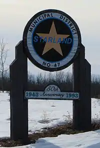 Boundary sign | |
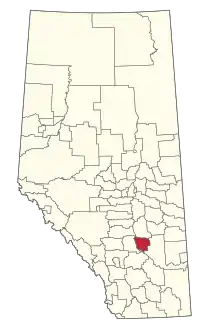 Location within Alberta | |
| Country | Canada |
| Province | Alberta |
| Region | Red Deer |
| Federal riding | Battle River—Crowfoot |
| Established | 1943 |
| Incorporated | 1912 |
| 1998 (name change) | |
| Government | |
| • Reeve | Steve Wannstrom |
| • Governing body | Starland County Council |
| • Office location | Morrin |
| Area (2016)[2] | |
| • Land | 2,559.95 km2 (988.40 sq mi) |
| Population (2016)[2] | |
| • Total | 2,066 |
| • Density | 0.8/km2 (2/sq mi) |
| Time zone | UTC-7 (MST) |
| Website | starlandcounty.com |
The municipality was incorporated in 1912, and established in the current boundaries in 1943, under the name Municipal District of Morrin No. 277. The name was changed the same year to Municipal District of Starland No. 277. Its name was changed again to Starland County in 1998.
Demographics
In the 2016 Census of Population conducted by Statistics Canada, Starland County recorded a population of 2,066 living in 611 of its 693 total private dwellings, a 0.4% change from its 2011 population of 2,057. With a land area of 2,559.95 km2 (988.40 sq mi), it had a population density of 0.8/km2 (2.1/sq mi) in 2016.[2]
Starland County's 2013 municipal census counted a population of 2,071.[3]
In the 2011 Census, Starland County had a population of 2,057 living in 586 of its 664 total dwellings, a -13.2% change from its 2006 population of 2,371. With a land area of 2,557.7 km2 (987.5 sq mi), it had a population density of 0.8/km2 (2.1/sq mi) in 2011.[4]
Communities and localities
|
The following urban municipalities are surrounded by Starland County:[5]
The following hamlets are located within Starland County:[5]
|
The following localities are located within Starland County:[6]
|
Attractions
- McLaren Dam Recreation Area
- Michichi Dam Recreation Area
- Starland Recreation Area
References
- Alberta Municipal Affairs: Municipal Officials Search
- "Population and dwelling counts, for Canada, provinces and territories, and census subdivisions (municipalities), 2016 and 2011 censuses – 100% data (Alberta)". Statistics Canada. February 8, 2017. Retrieved February 8, 2017.
- "2013 Municipal Affairs Population List" (PDF) (PDF). Alberta Municipal Affairs. November 20, 2013. ISBN 978-1-4601-1418-6. Retrieved December 5, 2013.
- "Population and dwelling counts, for Canada, provinces and territories, and census subdivisions (municipalities), 2011 and 2006 censuses (Alberta)". Statistics Canada. February 8, 2012. Retrieved February 8, 2012.
- "Specialized and Rural Municipalities and Their Communities" (PDF). Alberta Municipal Affairs. 2012-03-01. Retrieved 2012-08-12.
- "Standard Geographical Classification (SGC) 2006, Economic Regions: 4805031 - Starland County, geographical codes and localities, 2006". Statistics Canada. 2010-03-05. Retrieved 2012-08-12.
External links
Places adjacent to Starland County | |
|---|---|