Mumurva, Arizona
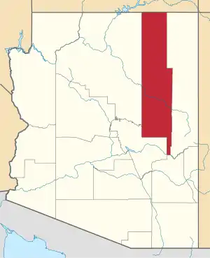
Mumurva, also known as Monusva Spring Well or Mumurs-va, is a populated place situated in Navajo County, Arizona.[2] Mumurva became the official name as a result of a Board on Geographic Names decision in 1995. It has an estimated elevation of 5,971 feet (1,820 m) above sea level.[1]
Mumurva, Arizona | |
|---|---|
 Mumurva Location within the state of Arizona  Mumurva Mumurva (the United States) | |
| Coordinates: 35°53′03″N 110°41′21″W | |
| Country | United States |
| State | Arizona |
| County | Navajo |
| Elevation | 5,971 ft (1,820 m) |
| Time zone | UTC-7 (Mountain (MST)) |
| • Summer (DST) | UTC-7 (MST) |
| Area code(s) | 928 |
| FIPS code | 04-48140 |
| GNIS feature ID | 45583 |
References
- "Feature Detail Report for: Mumurva". Geographic Names Information System. United States Geological Survey.
- "Mumurva (in Navajo County, AZ) Populated Place Profile". AZ Hometown Locator. Retrieved November 27, 2016.
This article is issued from Wikipedia. The text is licensed under Creative Commons - Attribution - Sharealike. Additional terms may apply for the media files.