Second Mesa, Arizona
Second Mesa is a census-designated place (CDP) in Navajo County, Arizona, on the Hopi Reservation, atop the 5,700-foot (1,740 m) mesa. As of the 2010 census, the CDP population was 962, spread among three Hopi Indian villages, Musungnuvi (or Mishongnovi), Supawlavi (or Sipaulovi), and Songoopavi (or Shungopavi). The Hopi Cultural Center is on Second Mesa.
Second Mesa, Arizona | |
|---|---|
 Mishongnovi as seen from the Arizona State Route 264 at the ascent to Shungopavi | |
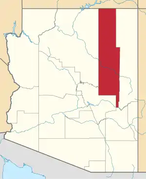
 Location in Navajo County and the state of Arizona | |
 Second Mesa, Arizona Location in the United States | |
| Coordinates: 35°49′3″N 110°30′15″W | |
| Country | United States |
| State | Arizona |
| County | Navajo |
| Area | |
| • Total | 40.14 sq mi (103.96 km2) |
| • Land | 40.12 sq mi (103.92 km2) |
| • Water | 0.01 sq mi (0.04 km2) |
| Elevation | 5,700 ft (1,737 m) |
| Population (2010) | |
| • Total | 962 |
| • Estimate (2016)[2] | N/A |
| Time zone | UTC-7 (MST) |
| ZIP code | 86043 |
| Area code(s) | 928 |
| FIPS code | 04-65280 |
| GNIS feature ID | 0042897 |
Geography
Second Mesa is located at 35°49′3″N 110°30′15″W (35.817613, -110.504281).[3]
According to the United States Census Bureau, the CDP has a total area of 26.5 square miles (69 km2).
Demographics
| Historical population | |||
|---|---|---|---|
| Census | Pop. | %± | |
| 2000 | 814 | — | |
| 2010 | 962 | 18.2% | |
| U.S. Decennial Census[4] | |||
| Languages (2000) [5] | Percent |
|---|---|
| Spoke Hopi at home | 74.44% |
| Spoke English at home | 25.56% |
At the 2000 census there were 814 people, 209 households, and 169 families in the CDP. The population density was 30.8 people per square mile (11.9/km²). There were 255 housing units at an average density of 9.6/sq mi (3.7/km²). The racial makeup of the CDP was 96.93% Native American, 1.23% White, 0.12% Asian, 0.12% from other races, and 1.60% from two or more races. 0.37% of the population were Hispanic or Latino of any race.[6] Of the 209 households 45.9% had children under the age of 18 living with them, 45.0% were married couples living together, 33.5% had a female householder with no husband present, and 18.7% were non-families. 17.2% of households were one person and 8.1% were one person aged 65 or older. The average household size was 3.89 and the average family size was 4.39.
The age distribution was 40.4% under the age of 18, 10.2% from 18 to 24, 24.6% from 25 to 44, 17.1% from 45 to 64, and 7.7% 65 or older. The median age was 25 years. For every 100 females, there were 95.2 males. For every 100 females age 18 and over, there were 90.9 males.
The median household income was $22,981 and the median family income was $23,947. Males had a median income of $22,679 versus $21,898 for females. The per capita income for the CDP was $6,089. About 32.7% of families and 36.3% of the population were below the poverty line, including 36.6% of those under age 18 and 23.8% of those age 65 or over.
Education
Second Mesa is a part of the Cedar Unified School District. Hopi High School serves Second Mesa.
The Hopi Lavayi Nest Model Program, a pilot Hopi language revitalization project for families with children birth through age five was launched in the village of Sipaulovi."[7]

References
- "2016 U.S. Gazetteer Files". United States Census Bureau. Retrieved Jul 18, 2017.
- "Population and Housing Unit Estimates". Retrieved June 9, 2017.
- "US Gazetteer files: 2010, 2000, and 1990". United States Census Bureau. 2011-02-12. Retrieved 2011-04-23.
- "Census of Population and Housing". Census.gov. Retrieved June 4, 2016.
- https://apps.mla.org/cgi-shl/docstudio/docs.pl?map_data_results
- "U.S. Census website". United States Census Bureau. Retrieved 2008-01-31.
- Pardo, Cynthia (2013-10-18). "Preserving Hopi Language - Crucial to Children's Early Success". Navajo-Hopi Observer. Flagstaff, Arizona. Archived from the original on 2013-10-29. Retrieved 2013-10-24.
External links
| Wikimedia Commons has media related to Second Mesa, Arizona. |
- Hopi Cultural Center, Second Mesa