N60 road (Ireland)
The N60 road is a national secondary road in Ireland, linking Roscommon town to Castlebar, County Mayo. The main towns along the route are Roscommon, Ballymoe, Castlerea, Ballyhaunis, Claremorris, Balla, and Castlebar.
| |
|---|---|
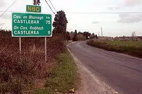 N60 road sign heading north out of Ballymoe | |
| Route information | |
| Length | 92.217 km (57.301 mi) |
| Location | |
| Primary destinations |
|
| Road network | |
The quality of the road varies significantly, with County Roscommon having a better alignment. The worst section of the route is between Castlebar and Claremorris, where some stretches are dangerously narrow. This section of the route is also the busiest, with up to 7,000 vehicles daily. The N60 in County Mayo has seen minor realignment works carried out since the 1970s. The largest project to date is the Claremorris relief road, which was constructed in two stages between 1988 and 2000. This relief road removes the majority of the 7,000 vehicles daily from Claremorris town centre, in particular Mount Street—which was once notorious for tailbacks, as traffic previously gave way to the busy N17 that passed through the town prior to the opening of the N17 bypass in 2001.
A new route between Castlebar and Claremorris has been in planning for many years; it will bypass the village of Balla when constructed.
Route

The official description of the N60 from the Roads Act 1993 (Classification of National Roads) Order 2012 [1] reads:
- N60: Roscommon — Castlebar, County Mayo
- Between its junction with N61 at Cloonbrackna in the county of Roscommon and its junction with N5 at Humbert Way in the town of Castlebar in the county of Mayo via Racecourse Road, Lissagallan and Drumatemple in the county of Roscommon: Ballymoe Bridge at the boundary between the county of Roscommon and the county of Galway: Ballymoe in the county of Galway: Harristown; Saint Patrick Street and Main Street at Castlerea; Fortaugustus, Ballinlough and Scregg in the county of Roscommon: Coolnafarna, Devlis; Abbey Street, Bridge Street and Clare Street at Ballyhaunis; Hazelhill, Brickeens, Cuilmore and Clare; Inner Relief Road and Mount Street in the town of Claremorris; Lugatemple, Brees, Balla, Moat, Manulla Bridge, Breaghwy and Kilkenny in the county of Mayo: and Station Road in the town of Castlebar.
The route originally continued from Castlebar to Westport; however, this section became part of the N5 in 1994.
The N60 is 92.4 kilometres (57.4 mi) long (map of the road).