Narbal
Narbal is a tehsil, town and a block in central Kashmir's Budgam district. It is located on the sides of Srinagar-Gulmarg road and the bank of a flood channel and river Sukhnag in the Budgam district in the Indian administered union territory of Jammu and Kashmir.[1][2]
Narbal
The Gateway of Gulmarg | |
|---|---|
Town | |
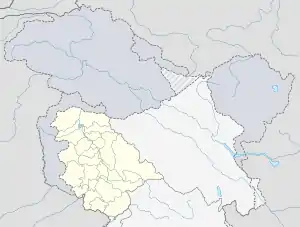
 Narbal Location in Jammu and Kashmir, India  Narbal Narbal (India) | |
| Coordinates: 34.118699920162875°N 74.67277804169375°E | |
| Country | |
| Union territory | Jammu and Kashmir |
| District | Budgam |
| Time zone | UTC+5:30 (IST) |
| PIN | 193401 |
| Telephone code | 1951 |
Geography
As per government records, the block number of Narbal is 14. The block has 51 villages and there are a total of 11,343 homes in this block. It is located some 15 km (9.3 mi) north to Srinagar and 16 km (9.9 mi) west of district headquarter Budgam. It is surrounded by Beerwah tehsil towards the south, Pattan tehsil towards the west and Srinagar towards the east. Srinagar, Magam and Budgam are the nearby cities or towns. River Sukhnag passes through the town and is the major source of water in the area. [3] Narbal is known for a cricket ground because of its huge area where people from all over Kashmir are seen playing cricket, football, and other sports. Narbal is home to the shrine of a well known Islamic scholar Syed Amir-ud-din who built famous Jamia Masjid of Narbal.
Access
Mazhom railway station is the nearby railway station located six kilometres from Narbal. Srinagar International Airport is located around 16 km (9.9 mi) from here.[3]
Economy
The count of employed people of Narbal block is 24,513, yet 62,953 are un-employed. And out of 24,513 employed people, 3,871 persons are fully reliant on farming. The major source of income in Narbal is agriculture and mostly people are dependent on it. Rice and maize are the commonly grown crops here.
References
- "South Kashmir: 2 Lashkar Militants Killed In Anantnag Gunfight". Kashmir Observer. 22 February 2020. Retrieved 2 March 2020.
- "3 Militants, 1 CRPF Jawan Killed In Gunbattle Near Srinagar; Family Disputes Police's Claim About 3rd". Outlookindia. Retrieved 2 March 2020.
- "Narbal (b), Narbal Village information | Soki.In". soki.in.
