Charari Sharief
Charar-i-Sharief (variously spelled Chrar-e-Sharif, Charari Shareef, etc.) is a town and a notified area committee in Budgam district in the Indian administered union territory of Jammu and Kashmir, India.
Charari Sharief
Charar-i-sharief | |
|---|---|
Town | |
| Nickname(s): Chaar | |
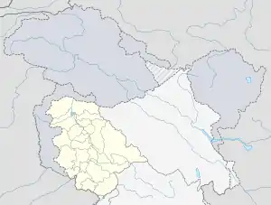
 Charari Sharief Location in Jammu and Kashmir, India  Charari Sharief Charari Sharief (India) | |
| Coordinates: 33.862°N 74.766°E | |
| Country | |
| Union territory | Jammu and Kashmir |
| District | Budgam |
| Elevation | 1,933 m (6,342 ft) |
| Population (2011) | |
| • Total | 11,533 |
| Languages | |
| • Official | Urdu, Kashmiri |
| Time zone | UTC+5:30 (IST) |
| Vehicle registration | JK04 |
The town was given the status of block in January 2014. The town is divided into 10 wards. Each ward has a municipal councillor.
The famous mohallas of Charar-i-Sharief are: Talab-e-Kalan or Bada Talab, Trajibal, Court Road, Gulshanabad, Nowhar, Baghi Noor U Din Nowhar, Jabl-e-Noor, Wazabagh, Alamdar colony, Zaloosa and Kumar Mohalla.
Charar-i-Sharief is considered one of the most sacrosanct Muslim shrines in Kashmir. It is situated approximately 28 km (17 mi) from Srinagar, en route to Yusmarg. The Shrine of Charar-i-Sharief is approximately 600 years old. It is popularly known as the "Sheikh Noor-ud-Din Wali".
Geography
Charari Sharief has an average elevation of 1,933 metres (6,345 feet) above mean sea level.[1]
Demographics
As of 2011 India census,[2] Charar i Sharief had a population of 15,000. Males constitute 53% of the population and females 47%. Charar i Sharief has an average literacy rate of 59%, lower than the national average of 59.5%; with male literacy of 58% and female literacy of 38%. 12% of the population is under 6 years of age.
Municipal committee
Municipal Committee Charar-E-Sharief is an Urban Local Body which administrates the town of Charar-E-Sharief in Budgam district, Jammu and Kashmir, India. It has 13 elected members. Its last elections took place on 10 October 2018.
Keys: INC (11) Vacant (2)
| # | Name | Municipal Ward | Reservation Status | Party |
|---|---|---|---|---|
| 1 | Maheen Munir | Karim Abad | Women Open | INC |
| 2 | Zahid Jan Baba | Sheer Abad | Open | INC |
| 3 | Vacant | Shah Abad | Open | N/A |
| 4 | Vacant | Reshi Abad | Women Open | INC |
| 5 | Imtiyaz Ahmad Dar | Wazabagh | Open | INC |
| 6 | Vacant | Noor Abad | Open | INC |
| 7 | Vacant | Sharief Abad | Women Open | INC |
| 8 | Hamid Hussain | Gulshan Abad A | Open | INC |
| 9 | Anjil Zahid | Gulshan Abad B | Open | INC |
| 10 | Jawiara | Nudreshi Colony | Women Open | INC |
| 11 | Vacant | Almadar Basti 1 | Open | N/A |
| 12 | Bilal Ahmad Teli | Almadar Basti 2 | Open | INC |
| 13 | Tariq Ahmad Dar | Rozabal | Open | INC |
See also
References
- Wikimapia:Satellite Pictures
- "Census of India 2001: Data from the 2001 Census, including cities, villages and towns (Provisional)". Census Commission of India. Archived from the original on 16 June 2004. Retrieved 1 November 2008.
External links
- Holy Places (Budgam District official website)