Khan Sahib, Jammu and Kashmir
Khan Sahib (Urdu: خان صاحب) is a town (city) and a notified area committee in Budgam district in the central Kashmir, union territory of Jammu and Kashmir, India. This town is the most developed town in kashmir valley. The area is mostly coverd by karewas. The area comprises of more than 92 villages.
KhanSahib | |
|---|---|
Town | |
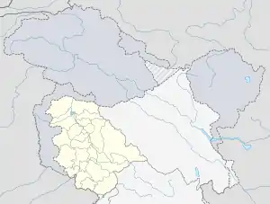
 KhanSahib Location in Jammu and Kashmir, India  KhanSahib KhanSahib (India) | |
| Coordinates: 33.956341°N 74.665253°E | |
| Country | |
| Union Territory | Jammu and Kashmir |
| District | Budgam |
| Population (2011) | |
| • Total | 13,698 |
| • Rank | 8th |
| • Density | 32/km2 (80/sq mi) |
| Languages kashmiri | |
| • Official urdu | Urdu |
| Time zone | UTC+5:30 (IST) |
| Vehicle registration | JK04 |
Demographics
Khan Sahib had a population of 2,038 As of 2001 India census.[1] Males constitute 50% of the population and females 50%. Khan Sahib has an average literacy rate of 89%, : male literacy is 87, and female literacy is 62%. In Khan Sahib, 12% of the population is under 6 years of age
Municipal committee
Municipal Committee Khansahib is an local body which administrates the town of Khansahib in Budgam district, Jammu and Kashmir, India. It has 7 elected members. Its last elections took place on 8 October 2018.
Keys: Independent (7)
| # | Name | Municipal Ward | Reservation Status | Party |
|---|---|---|---|---|
| 1 | Parveen Akhter | Shah Mohalla | Women Open | Independent |
| 2 | Bashir Ahmed Nazar | Malpora | Open | Independent |
| 3 | Tanvir Gul | Syed Soliyah Colony | Open | Independent |
| 4 | Ateeqa | Astan Mohalla | Women Open | Independent |
| 5 | Mohd. Iqbal Shah | Mukdam Mohalla | Open | Independent |
| 6 | Fayad Ahmed Shah | Iqbal Colony | Open | Independent |
| 7 | Irfan Ah. Khan | Umer Colony | Open | Independent |
References
- "Census of India 2001: Data from the 2001 Census, including cities, villages and towns (Provisional)". Census Commission of India. Archived from the original on 16 June 2004. Retrieved 1 November 2008.