Chadoora
Chadoora is a town and a Municipal committee in Budgam district in Indian administered union territory of Jammu and Kashmir.
Chadoora | |
|---|---|
Town in Budgam | |
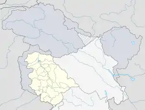
 Chadoora Location in Jammu and Kashmir, India Show map of Jammu and Kashmir Chadoora Chadoora (India) Show map of India | |
| Coordinates: 33.80°N 75.10°E / 33.80; 75.10 | |
| Country | |
| Union territory | Jammu and Kashmir |
| District | Budgam |
| Elevation | 1,577 m (5,174 ft) |
| Population (2011) | |
| • Total | 212,233 |
| Languages | |
| • Official | Urdu, Kashmiri |
| Time zone | UTC+5:30 (IST) |
| Pin code | 191113 |
| Vehicle registration | JK04 |
| Website | budgam |
Location
Chadoora is a big town, and under this tehsil, there are more than one hundred villages such as Zoohama, Ranger, Sursyar, Dadaompora, Hanjora, Sogam, Bogam, Gundi Maqsood, Batpora, Lolipora, Daulatpur, Dooniwari, Panzan, Porwar to name a few.
The other nearest localities include Wathora, Bulbulpora, Hussipora, Gopalpora, Kralpora, Bagat Kanipora.
The pincode is 191113.
References
| Passes |  | |
|---|---|---|
| Valleys | ||
| Cities | ||
| Towns |
| |
| Rivers | ||
| Glaciers | ||
| Lakes | ||
| Mountains | ||
| Hill stations and Mughal gardens | ||
| Protected Areas | ||
| See also | ||
| Subdivisions | |
|---|---|
| Municipalities | |
| Tehsils | |
| Blocks | |
| Tourist attractions |
|
| Villages | |
| Railway | |
| Airport | |
This article is issued from Wikipedia. The text is licensed under Creative Commons - Attribution - Sharealike. Additional terms may apply for the media files.