National Register of Historic Places listings in Amador County, California
This is a list of the National Register of Historic Places listings in Amador County, California.
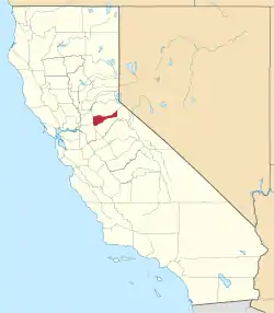
Location of Amador County in California
This is intended to be a complete list of the properties and districts on the National Register of Historic Places in Amador County, California, United States. Latitude and longitude coordinates are provided for many National Register properties and districts; these locations may be seen together in a Google map.[1]
There are 21 properties and districts listed on the National Register in the county.
- This National Park Service list is complete through NPS recent listings posted January 29, 2021.[2]
Current listings
| [3] | Name on the Register[4] | Image | Date listed[5] | Location | City or town | Description |
|---|---|---|---|---|---|---|
| 1 | Amador County Hospital Building | 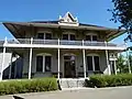 Amador County Hospital Building |
February 23, 1972 (#72000215) |
708 Court St. 38°21′08″N 120°45′59″W |
Jackson | |
| 2 | John A. Butterfield House |  John A. Butterfield House |
September 11, 1986 (#86002412) |
115 Broadway 38°20′49″N 120°46′15″W |
Jackson | |
| 3 | Chichizola Family Store Complex | .jpg.webp) Chichizola Family Store Complex |
August 14, 1992 (#92000979) |
1316-1330 Jackson Gate Rd. 38°22′03″N 120°46′23″W |
Jackson | |
| 4 | Grace Blair DePue House and Indian Museum | 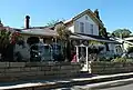 Grace Blair DePue House and Indian Museum |
May 7, 1982 (#82002169) |
215 Court St. 38°20′58″N 120°46′13″W |
Jackson | |
| 5 | Fiddletown | 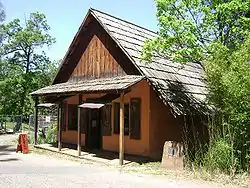 Fiddletown |
June 7, 1978 (#78000655) |
Off CA 49 38°30′20″N 120°45′41″W |
Fiddletown | |
| 6 | Five Mile Drive-Sutter Creek Bridge | 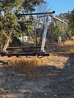 Five Mile Drive-Sutter Creek Bridge |
April 11, 1986 (#86000734) |
Five Mile Drive 38°21′14″N 120°57′27″W |
Ione | |
| 7 | Indian Grinding Rock | 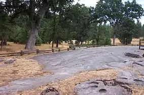 Indian Grinding Rock |
May 6, 1971 (#71000133) |
Indian Grinding Rock State Historic Park 38°25′27″N 120°38′36″W |
Volcano | |
| 8 | Ione City Centenary Church | 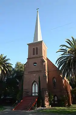 Ione City Centenary Church |
May 26, 1977 (#77000287) |
150 W. Marlette St. 38°21′00″N 120°55′58″W |
Ione | |
| 9 | Jackson Downtown Historic District | 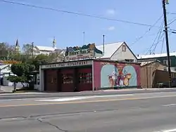 Jackson Downtown Historic District |
April 14, 2000 (#00000365) |
Roughly along Main St. from 215 Main St. to 14 Broadway 38°20′57″N 120°46′22″W |
Jackson | |
| 10 | Kennedy Mine Historic District | 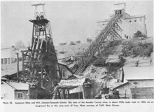 Kennedy Mine Historic District |
January 22, 2009 (#08001347) |
12594 Kennedy Mine Rd. 38°22′02″N 120°46′54″W |
Jackson | |
| 11 | Kennedy Tailing Wheels | 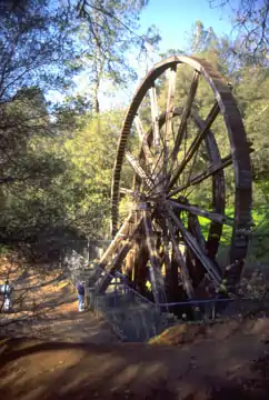 Kennedy Tailing Wheels |
July 7, 1981 (#81000146) |
Jackson Gate Rd. 38°21′34″N 120°46′16″W |
Jackson | |
| 12 | Kirkwood Lake Tract | December 11, 2010 (#09001054) |
1/2 mile north of California State Route 88 along the shoreline of Lake Kirkwood in the Eldorado National Forest 38°42′23″N 120°05′18″W |
Pioneer | ||
| 13 | Knight's Foundry and Shops |  Knight's Foundry and Shops |
July 1, 1975 (#75000423) |
13 Eureka St. 38°23′36″N 120°47′00″W |
Sutter Creek | |
| 14 | William J. Paugh House |  William J. Paugh House |
June 5, 2007 (#07000507) |
406 Pitt St. 38°21′05″N 120°46′14″W |
Jackson | |
| 15 | Preston Castle | .jpg.webp) Preston Castle |
July 30, 1975 (#75000422) |
N of Ione on Preston Ave. 38°21′40″N 120°56′09″W |
Ione | |
| 16 | Saint Sava Serbian Orthodox Church |  Saint Sava Serbian Orthodox Church |
March 6, 1986 (#86000385) |
724 N. Main 38°21′21″N 120°46′31″W |
Jackson | |
| 17 | Scully Ranch |  Scully Ranch |
November 21, 1978 (#78000656) |
Marlette St. 38°21′13″N 120°57′34″W |
Ione | |
| 18 | St. George Hotel | 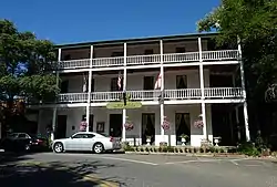 St. George Hotel |
September 7, 1984 (#84000757) |
2 Main St. 38°26′31″N 120°37′47″W |
Volcano | |
| 19 | Sutter Creek Grammar School |  Sutter Creek Grammar School |
December 12, 1976 (#76000477) |
Between Broad and Cole Sts. 38°23′43″N 120°47′01″W |
Sutter Creek | |
| 20 | C.W. Swain House | --E._Side.jpg.webp) C.W. Swain House |
October 8, 2014 (#14000824) |
311 Church & 330 Buena Vista Sts. 38°21′01″N 120°55′58″W |
Ione | |
| 21 | George and Eliza Withington House |  George and Eliza Withington House |
January 14, 2015 (#14001148) |
10 Welch Ln. 38°21′17″N 120°56′02″W |
Ione |
See also
| Wikimedia Commons has media related to National Register of Historic Places in Amador County, California. |
References
- The latitude and longitude information provided in this table was derived originally from the National Register Information System, which has been found to be fairly accurate for about 99% of listings. Some locations in this table may have been corrected to current GPS standards.
- "National Register of Historic Places: Weekly List Actions". National Park Service, United States Department of the Interior. Retrieved on January 29, 2021.
- Numbers represent an alphabetical ordering by significant words. Various colorings, defined here, differentiate National Historic Landmarks and historic districts from other NRHP buildings, structures, sites or objects.
- "National Register Information System". National Register of Historic Places. National Park Service. July 9, 2010.
- The eight-digit number below each date is the number assigned to each location in the National Register Information System database, which can be viewed by clicking the number.
Municipalities and communities of Amador County, California, United States | ||
|---|---|---|
| Cities | Amador County map | |
| CDPs | ||
| Unincorporated communities | ||
| Ghost towns |
| |
| Footnotes | ‡This CDP also has portions in an adjacent county or counties | |
| ||
| Topics | |
|---|---|
| Lists by state |
|
| Lists by insular areas | |
| Lists by associated state | |
| Other areas | |
| Related | |
| |
This article is issued from Wikipedia. The text is licensed under Creative Commons - Attribution - Sharealike. Additional terms may apply for the media files.