National Register of Historic Places listings in Berrien County, Michigan
This is a list of the National Register of Historic Places listings in Berrien County, Michigan.
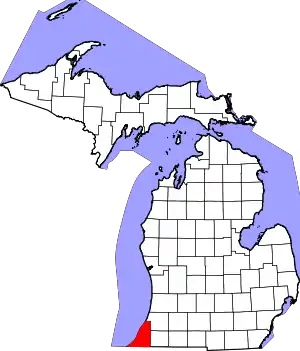
Location of Berrien County in Michigan
This is intended to be a complete list of the properties and districts on the National Register of Historic Places in Berrien County, Michigan, United States. Latitude and longitude coordinates are provided for many National Register properties and districts; these locations may be seen together in a map.[1]
There are 30 properties and districts listed on the National Register in the county.
- This National Park Service list is complete through NPS recent listings posted February 5, 2021.[2]
Current listings
| [3] | Name on the Register[4] | Image | Date listed[5] | Location | City or town | Description |
|---|---|---|---|---|---|---|
| 1 | Avery Road-Galien River Bridge | _01.JPG.webp) Avery Road-Galien River Bridge |
December 17, 1999 (#99001577) |
Avery Rd. over the Galien River 41°52′27″N 86°33′17″W |
Weesaw Township | |
| 2 | Berrien Springs Courthouse |  Berrien Springs Courthouse |
February 16, 1970 (#70000265) |
Corner of Union and Cass Sts. 41°56′53″N 86°20′28″W |
Berrien Springs | |
| 3 | Blossomland Bridge |  Blossomland Bridge |
December 17, 1999 (#99001576) |
M-63 over the St. Joseph River 42°06′45″N 86°28′40″W |
St. Joseph | |
| 4 | Buchanan Downtown Historic District | 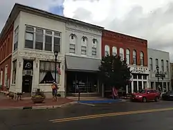 Buchanan Downtown Historic District |
September 2, 2009 (#09000678) |
Front Street, between 117 West and 256 East; parts of Main Street, between 108 and 210-212; and 114 N. Oak Street 41°49′39″N 86°21′37″W |
Buchanan | |
| 5 | Buchanan North and West Neighborhoods Historic District | 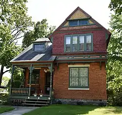 Buchanan North and West Neighborhoods Historic District |
November 30, 2011 (#11000863) |
Roughly bounded by Main, 4th, Chippewa, W. Front, S. Detroit, Chicago, Clark, Roe, and Charles Sts. 41°49′42″N 86°21′54″W |
Buchanan | |
| 6 | Henry A. Chapin House | 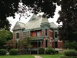 Henry A. Chapin House |
July 30, 1981 (#81000304) |
508 E. Main St. 41°49′45″N 86°15′12″W |
Niles | |
| 7 | Rock S. Edwards Farmstead | 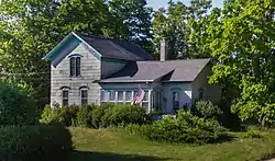 Rock S. Edwards Farmstead |
July 21, 1995 (#95000868) |
3503 Edwards Rd. (Sodus Pkwy.) 42°03′10″N 86°22′21″W |
Sodus Township | |
| 8 | Fidelity Building | 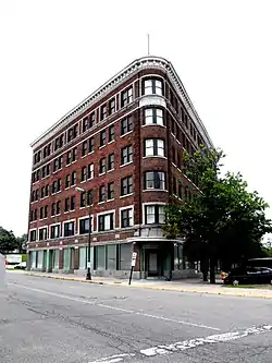 Fidelity Building |
February 14, 2002 (#02000042) |
162 Pipestone St. 42°06′52″N 86°27′15″W |
Benton Harbor | |
| 9 | Fort St. Joseph Site |  Fort St. Joseph Site |
May 24, 1973 (#73000944) |
Bond St. along the St. Joseph River[6] 41°48′54″N 86°15′39″W |
Niles | |
| 10 | Lakeside Inn |  Lakeside Inn |
July 16, 2009 (#09000521) |
15251 Lakeshore Rd. 41°50′49″N 86°40′32″W |
Lakeside | |
| 11 | Ring Lardner House | 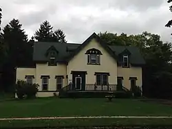 Ring Lardner House |
March 16, 1972 (#72000595) |
519 Bond St. 41°49′22″N 86°15′17″W |
Niles | |
| 12 | Mary's City of David | 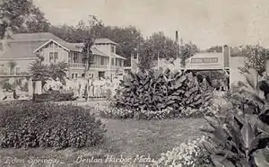 Mary's City of David |
April 15, 2009 (#09000201) |
1158 E. Britain Ave. 42°06′32″N 86°25′51″W |
Benton Charter Township | |
| 13 | Moccasin Bluff Site | 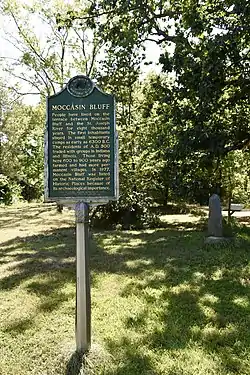 Moccasin Bluff Site |
April 13, 1977 (#77000710) |
Red Bud Trail[7] 41°51′20″N 86°22′00″W |
Buchanan | |
| 14 | Niles Downtown Historic District |  Niles Downtown Historic District |
June 21, 2007 (#07000568) |
Sycamore, Main, and Cedar between Front and 5th 41°49′47″N 86°15′22″W |
Niles | |
| 15 | Niles Railroad Depot | 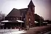 Niles Railroad Depot |
September 19, 1979 (#09000085) |
598 Dey St. 41°50′14″N 86°15′08″W |
Niles | |
| 16 | Ninth District Lighthouse Depot | 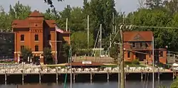 Ninth District Lighthouse Depot |
December 2, 1993 (#93001348) |
128 N. Pier 42°06′51″N 86°29′09″W |
St. Joseph | |
| 17 | North Watervliet Road-Paw Paw Lake Outlet Bridge | 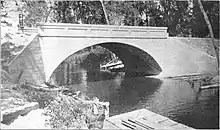 North Watervliet Road-Paw Paw Lake Outlet Bridge |
December 17, 1999 (#99001575) |
N. Watervliet Rd. over Paw Paw Lake outlet 42°12′28″N 86°15′00″W |
Watervliet Township | Demolished in 2008 |
| 18 | Old Berrien County Courthouse Complex | 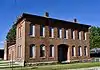 Old Berrien County Courthouse Complex |
April 29, 1982 (#82004941) |
Roughly bounded by Cass, Kimmel, Madison, and Union Sts. 41°56′53″N 86°20′28″W |
Berrien Springs | |
| 19 | Old US Post Office |  Old US Post Office |
September 12, 1985 (#85002152) |
322 E. Main St. 41°49′46″N 86°16′02″W |
Niles | |
| 20 | Paine Bank | 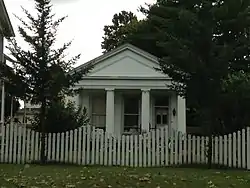 Paine Bank |
May 8, 1973 (#73000945) |
1008 Oak St. 41°49′36″N 86°14′52″W |
Niles | |
| 21 | Wendell P. and Harriet Rounds Robbins House | 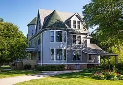 Wendell P. and Harriet Rounds Robbins House |
May 2, 2007 (#07000385) |
680 Pipestone St. 42°06′17″N 86°26′38″W |
Benton Harbor | |
| 22 | Sandburg House | 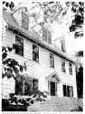 Sandburg House |
April 14, 1972 (#72001470) |
Poet's Path[8] 41°53′00″N 86°37′50″W |
Harbert | |
| 23 | Shiloh House | 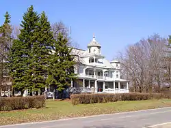 Shiloh House |
September 29, 1972 (#72000594) |
1055 E. Britain Rd. 42°06′30″N 86°25′57″W |
Benton Harbor | |
| 24 | Snow Flake Motel | 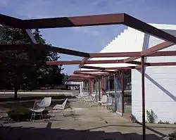 Snow Flake Motel |
April 13, 1998 (#98000270) |
3822 Red Arrow Highway 42°02′55″N 86°30′56″W |
Lincoln Township | Building demolished March 27, 2006[9] |
| 25 | South Berrien Center Union Church and Cemetery |  South Berrien Center Union Church and Cemetery |
December 12, 2002 (#02001506) |
10408 M-140 41°55′46″N 86°16′19″W |
Berrien | |
| 26 | St. Joseph North Pier Inner and Outer Lights | 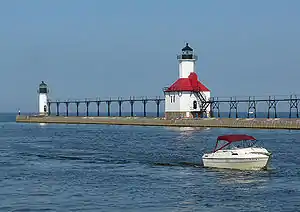 St. Joseph North Pier Inner and Outer Lights |
November 9, 2005 (#05001211) |
On the north pier of the mouth of the St. Joseph River, 0.9 mi (1.4 km) west of the M-63 bridge 42°06′57″N 86°29′32″W |
St. Joseph | |
| 27 | Union Block | 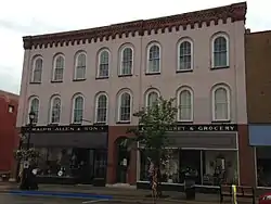 Union Block |
August 22, 2007 (#07000746) |
114 E. Front St. 41°49′37″N 86°21′38″W |
Buchanan | |
| 28 | Union Meat Market | 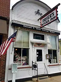 Union Meat Market |
September 22, 1972 (#72000596) |
14 S. Elm St. 41°48′01″N 86°36′38″W |
Three Oaks | |
| 29 | Warren Featherbone Company Office Building |  Warren Featherbone Company Office Building |
January 23, 1986 (#86000117) |
3 N. Elm St. 41°48′05″N 86°36′38″W |
Three Oaks | |
| 30 | Zinc Collar Pad Company Building | 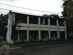 Zinc Collar Pad Company Building |
July 1, 2009 (#09000472) |
304 S. Oak St. 41°49′30″N 86°21′40″W |
Buchanan |
See also
| Wikimedia Commons has media related to National Register of Historic Places in Berrien County, Michigan. |
References
- The latitude and longitude information provided in this table was derived originally from the National Register Information System, which has been found to be fairly accurate for about 99% of listings. Some locations in this table may have been corrected to current GPS standards.
- "National Register of Historic Places: Weekly List Actions". National Park Service, United States Department of the Interior. Retrieved on February 5, 2021.
- Numbers represent an alphabetical ordering by significant words. Various colorings, defined here, differentiate National Historic Landmarks and historic districts from other NRHP buildings, structures, sites or objects.
- "National Register Information System". National Register of Historic Places. National Park Service. April 24, 2008.
- The eight-digit number below each date is the number assigned to each location in the National Register Information System database, which can be viewed by clicking the number.
- Nassaney, Michael S., et al. "The Search for Fort St. Joseph (1691-1781) in Niles, Michigan". Midcontinental Journal of Archaeology 28.2 (2003): 107-144: 122.
- The NRIS lists the Moccasin Bluff Site as "Address Restricted." However, the State of Michigan has erected a historical marker at the site (Moccasin Bluff from MichMarkers.org).
- The NRIS gives the location of the Sandburg House as "address restricted." However, sources give the location as on "Poet's Path". The geo-coordinates are approximate.
- "Demolition of Snowflake Motel begins". The Herald-Palladium. 2006-03-28. p. A1. Retrieved 2012-11-20.
| Lists by county |
|  |
|---|---|---|
| Other lists |
| |
Municipalities and communities of Berrien County, Michigan, United States | ||
|---|---|---|
| Cities | Map of Michigan highlighting Berrien County | |
| Villages | ||
| Charter townships | ||
| General law townships | ||
| CDPs | ||
| Other unincorporated communities | ||
| Indian reservation | ||
| Footnotes | ‡This populated place also has portions in an adjacent county or counties | |
| ||
This article is issued from Wikipedia. The text is licensed under Creative Commons - Attribution - Sharealike. Additional terms may apply for the media files.