National Register of Historic Places listings in Bay County, Michigan
The following is a list of Registered Historic Places in Bay County, Michigan.
- This National Park Service list is complete through NPS recent listings posted February 5, 2021.[1]
| [2] | Name on the Register[3] | Image | Date listed[4] | Location | City or town | Description |
|---|---|---|---|---|---|---|
| 1 | Bay City Downtown Historic District | 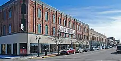 Bay City Downtown Historic District |
September 12, 1985 (#85002338) |
Roughly bounded by Saginaw River, Second and Adam Sts. and Center Ave. 43°36′00″N 83°53′18″W |
Bay City | |
| 2 | Bay City Masonic Temple | 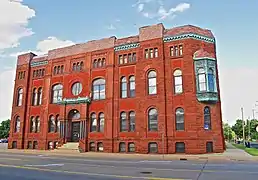 Bay City Masonic Temple |
May 3, 2016 (#16000216) |
700 N. Madison Ave. 43°35′49″N 83°53′04″W |
Bay City | |
| 3 | Bay County Building |  Bay County Building |
March 25, 1982 (#82002825) |
515 Center Ave. 43°35′54″N 83°53′06″W |
Bay City | |
| 4 | Center Avenue Neighborhood Residential District | 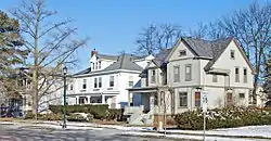 Center Avenue Neighborhood Residential District |
April 22, 1982 (#82002826) |
Roughly bounded by N. Madison, Green, & Center Aves., 4th, 5th, 6th, & 10th Sts., Carroll Rd. & Nurmi Dr. 43°35′48″N 83°52′14″W |
Bay City | The original 1982 district was roughly bounded by Green and N. Madison Aves, 5th and 6th Sts. The boundaries were increased on December 12, 2012 (refnum 12001027) to those noted, which encompass the original boundaries. |
| 5 | City Hall | 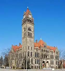 City Hall |
July 18, 1975 (#75000936) |
301 Washington St. 43°35′36″N 83°53′21″W |
Bay City | |
| 6 | James Clements Airport Administration Building | 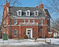 James Clements Airport Administration Building |
November 22, 1982 (#82000494) |
614 S. River Rd. 43°32′52″N 83°53′31″W |
Bay City | |
| 7 | USS Edson (DD-946) |  USS Edson (DD-946) |
June 21, 1990 (#90000333) |
Saginaw River 43°36′50″N 83°52′10″W |
Bay City | |
| 8 | Elm Lawn Cemetery | 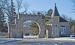 Elm Lawn Cemetery |
May 18, 2006 (#06000404) |
300 Ridge Rd. 43°35′19″N 83°51′29″W |
Bay City | |
| 9 | Fletcher Site |  Fletcher Site |
April 16, 1971 (#71001018) |
Btw Marquette Ave. and the Saginaw River[5] 43°36′30″N 83°53′30″W |
Bay City | |
| 10 | Mercy Hospital and Elizabeth McDowell Bialy Memorial House | Mercy Hospital and Elizabeth McDowell Bialy Memorial House |
April 22, 1980 (#80001848) |
15th and Water Sts. 43°35′11″N 83°53′34″W |
Bay City | |
| 11 | Midland Street Commercial District | 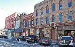 Midland Street Commercial District |
April 22, 1982 (#82002827) |
Roughly bounded by John, Vermont, Catherine and Litchfield Sts. 43°36′06″N 83°53′57″W |
Bay City | |
| 12 | Odd Fellows Valley Lodge No. 189 Building | 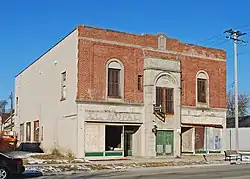 Odd Fellows Valley Lodge No. 189 Building |
July 19, 2010 (#10000474) |
1900 Broadway Ave. 43°34′11″N 83°53′38″W |
Bay City | |
| 13 | Pere Marquette Railroad Depot, Bay City Station | 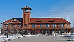 Pere Marquette Railroad Depot, Bay City Station |
April 15, 1982 (#82002828) |
919 Boutell Pl. 43°36′00″N 83°53′06″W |
Bay City | |
| 14 | Sage Library | 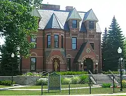 Sage Library |
December 31, 1979 (#79001149) |
100 E. Midland St. 43°36′06″N 83°54′17″W |
Bay City | |
| 15 | Saginaw River Light Station | 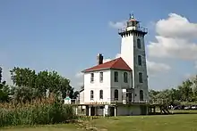 Saginaw River Light Station |
July 19, 1984 (#84001373) |
Coast Guard St. 43°38′08″N 83°51′01″W |
Bay City | |
| 16 | Tromble House | 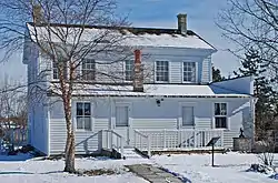 Tromble House |
January 25, 1973 (#73000943) |
Veterans Memorial Park 43°35′28″N 83°53′59″W |
Bay City |
Former listings
| [2] | Name on the Register | Image | Date listed | Date removed | Location | City or town | Summary |
|---|---|---|---|---|---|---|---|
| 1 | Bay City Bascule Bridge | 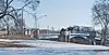 Bay City Bascule Bridge |
November 30, 1999 (#99001465) | April 20, 2015 | M-13/M-84 over East Channel of Saginaw River 43°34′46″N 83°53′59″W |
Bay City |
See also
| Wikimedia Commons has media related to National Register of Historic Places in Bay County, Michigan. |
- List of Registered Historic Places in Michigan
- List of Michigan State Historic Sites in Bay County, Michigan
References
- "National Register of Historic Places: Weekly List Actions". National Park Service, United States Department of the Interior. Retrieved on February 5, 2021.
- Numbers represent an alphabetical ordering by significant words. Various colorings, defined here, differentiate National Historic Landmarks and historic districts from other NRHP buildings, structures, sites or objects.
- "National Register Information System". National Register of Historic Places. National Park Service. April 24, 2008.
- The eight-digit number below each date is the number assigned to each location in the National Register Information System database, which can be viewed by clicking the number.
- The NRIS lists the Fletcher Site as "Address Restricted." References (Robert C. Mainfort (July 1985), "Wealth, Space, and Status in a Historic Indian Cemetery" (PDF), American Antiquity, 50 (3): 555–579) show the site as being between Marquette Avenue and the Saginaw River. Geo-coordinates are approximate.
| Lists by county |
|  |
|---|---|---|
| Other lists |
| |
| Topics | |
|---|---|
| Lists by state |
|
| Lists by insular areas | |
| Lists by associated state | |
| Other areas | |
| Related | |
| |
This article is issued from Wikipedia. The text is licensed under Creative Commons - Attribution - Sharealike. Additional terms may apply for the media files.