National Register of Historic Places listings in Emmet County, Michigan
This is a list of the National Register of Historic Places listings in Emmet County, Michigan.
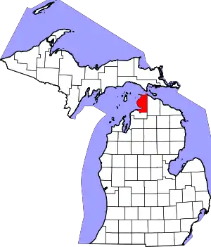
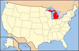
Location of Emmet County in Michigan
This is intended to be a complete list of the properties and districts on the National Register of Historic Places in Emmet County, Michigan, United States. Latitude and longitude coordinates are provided for many National Register properties and districts; these locations may be seen together in a map.[1]
There are 52 properties and districts listed on the National Register in the county, including three National Historic Landmarks.
- This National Park Service list is complete through NPS recent listings posted February 5, 2021.[2]
Current listings
| [3] | Name on the Register[4] | Image | Date listed[5] | Location | City or town | Description |
|---|---|---|---|---|---|---|
| 1 | J. B. Allen House | 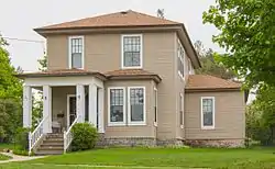 J. B. Allen House |
September 10, 1986 (#86001973) |
822 Grove St. 45°22′14″N 84°56′51″W |
Petoskey | |
| 2 | Isaac Bartram House |  Isaac Bartram House |
September 10, 1986 (#86001975) |
508 Wachtel Ave. 45°22′23″N 84°57′46″W |
Petoskey | |
| 3 | Bay View |  Bay View |
March 16, 1972 (#72000613) |
Northeast of Petoskey on US 31 45°22′57″N 84°55′56″W |
Petoskey | Established in 1876 as a Methodist camp meeting, this romantically-planned campground was converted to an independent chautauqua in 1885, a role it served until 1915. These two uniquely American community forms are exemplified in this extensive and well-preserved complex. |
| 4 | Chief Andrew J. Blackbird House | 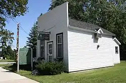 Chief Andrew J. Blackbird House |
April 14, 1972 (#72000611) |
368 E. Main St. 45°25′49″N 84°59′05″W |
Harbor Springs | The Chief Andrew J. Blackbird House, also known as the Andrew J. Blackbird Museum, was built as the home of Chief Andrew Blackbird, an Odawa (Ottawa) tribe leader, historian, and proponent of Indian civil rights. The house currently operates as a museum of American Indian artifacts. |
| 5 | W. S. Carmichael House |  W. S. Carmichael House |
September 10, 1986 (#86001977) |
301 Jackson St. 45°22′16″N 84°57′50″W |
Petoskey | |
| 6 | Chesapeake & Ohio Railway Station | Chesapeake & Ohio Railway Station |
October 15, 1970 (#70000270) |
Pioneer Park, W. Lake St. 45°22′31″N 84°57′33″W |
Petoskey | Also known as the Chicago & West Michigan Railway Station; now used as the Little Traverse History Museum |
| 7 | I. N. Debenham House | 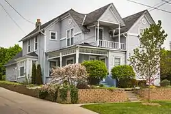 I. N. Debenham House |
September 10, 1986 (#86001979) |
1101 Emmet St. 45°22′00″N 84°57′31″W |
Petoskey | |
| 8 | James and Jean Douglas House | May 3, 2016 (#16000232) |
3490 S. Lake Shore Dr. 45°30′04″N 85°05′51″W |
Friendship Township | Designed by renowned architect Richard Meier, this Modern house sits on a steep lot overlooking Lake Michigan. | |
| 9 | East Mitchell Street Historic District | November 12, 1986 (#86001983) |
Roughly bounded by Rose, Kalamazoo, State, Howard, Michigan, and Division 45°22′24″N 84°56′59″W |
Petoskey | The East Mitchell Street Historic District is a residential districts occupying 31 blocks. It contains 294 residential properties, predominantly frame structures, 1 1⁄2 to 2 1⁄2 stories high. Architectural styles include Victorian, Queen Anne, Shingle style, Colonial Revival, Radford-type, Bungalow, and other period designs, dating from the late 1800s through the 1930s. | |
| 10 | Gerhard Fochtman House |  Gerhard Fochtman House |
September 10, 1986 (#86001998) |
1004 Waukazoo Ave. 45°22′07″N 84°57′12″W |
Petoskey | |
| 11 | Fort Michilimackinac | 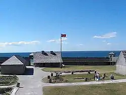 Fort Michilimackinac |
October 15, 1966 (#66000395) |
Near Mackinac Bridge at the southern end of the Mackinac Bridge 45°47′12″N 84°43′58″W |
Mackinaw City | Fort Michilimackinac was an 18th-century French, and later British, fort and trading post. Built around 1715 and abandoned in 1783, it is preserved as an open-air historical museum, with several reconstructed wooden buildings and palisade. |
| 12 | Fourth Ward Polling Place | September 10, 1986 (#86002001) |
209 Washington St. 45°22′06″N 84°57′29″W |
Petoskey | Does not exist | |
| 13 | Meyer Fryman House |  Meyer Fryman House |
September 10, 1986 (#86002002) |
211 Michigan St. 45°22′23″N 84°57′29″W |
Petoskey | |
| 14 | Grace Methodist Episcopal Church | 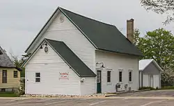 Grace Methodist Episcopal Church |
September 10, 1986 (#86002012) |
625 Connable St. 45°22′15″N 84°58′08″W |
Petoskey | The Grace Methodist Episcopal Church, constructed between 1903 and 1908, is a single-story frame church building with a gabled roof. |
| 15 | Grand Rapids and Indiana Railroad Harbor Springs Depot |  Grand Rapids and Indiana Railroad Harbor Springs Depot |
December 7, 2000 (#00001487) |
111 W. Bay St. 45°25′43″N 84°59′22″W |
Harbor Springs | |
| 16 | Grays Reef Light Station |  Grays Reef Light Station |
November 9, 2005 (#05001210) |
In northeastern Lake Michigan, 3.8 mi (6.1 km) west of Waugashance Island 45°46′00″N 85°09′12″W |
Bliss Township | The Grays Reef Light was constructed in 1936 to warn ships away from the shoals at Waugoshance Point. |
| 17 | Ernest Hemingway Cottage |  Ernest Hemingway Cottage |
November 24, 1968 (#68000026) |
6502 Lake Grove Rd. 45°16′50″N 85°00′04″W |
Petoskey | Boyhood summer home of author Ernest Hemingway. His father built the house in 1900 when Hemingway was a year old and it was here the future writer learned to hunt and fish and appreciate the outdoor life he came to celebrate in his writings. |
| 18 | Bert and John Hobbins House |  Bert and John Hobbins House |
September 10, 1986 (#86002013) |
1024 Emmet St. 45°22′03″N 84°57′33″W |
Petoskey | |
| 19 | Hosman and Wheeler Meat Market |  Hosman and Wheeler Meat Market |
September 10, 1986 (#86002015) |
621 Ingalls Ave. 45°22′14″N 84°57′56″W |
Petoskey | |
| 20 | John Kabler House |  John Kabler House |
September 10, 1986 (#86002017) |
415 Jackson St. 45°22′17″N 84°58′01″W |
Petoskey | |
| 21 | Frank Lesher House |  Frank Lesher House |
September 10, 1986 (#86002018) |
122 Sheridan St. 45°21′54″N 84°57′36″W |
Petoskey | |
| 22 | A. Malin House | 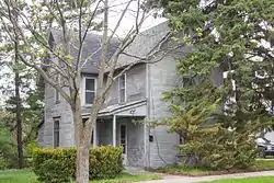 A. Malin House |
September 10, 1986 (#86002020) |
54 Bridge St. 45°22′07″N 84°57′46″W |
Petoskey | |
| 23 | George and Eugene Markle House |  George and Eugene Markle House |
September 10, 1986 (#86002023) |
701 Kalamazoo St. 45°22′14″N 84°56′43″W |
Petoskey | |
| 24 | George McManus House |  George McManus House |
September 10, 1986 (#86002026) |
121 State St. 45°22′19″N 84°57′33″W |
Petoskey | |
| 25 | Elias Meyers House |  Elias Meyers House |
September 10, 1986 (#86002030) |
912 Baxter St. 45°22′08″N 84°57′39″W |
Petoskey | |
| 26 | Jacob Miller House | 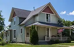 Jacob Miller House |
September 10, 1986 (#86002031) |
307 Jackson St. 45°22′16″N 84°57′51″W |
Petoskey | |
| 27 | Mineral Well Park |  Mineral Well Park |
March 25, 1987 (#86002036) |
W. Lake St. 45°22′31″N 84°57′37″W |
Petoskey | |
| 28 | John Nyman House |  John Nyman House |
September 10, 1986 (#86002039) |
915 Emmet St. 45°22′07″N 84°57′31″W |
Petoskey | |
| 29 | G. W. Olin House |  G. W. Olin House |
September 10, 1986 (#86002042) |
610 Kalamazoo St. 45°22′17″N 84°56′44″W |
Petoskey | |
| 30 | Sarah Pennington House |  Sarah Pennington House |
September 10, 1986 (#86002045) |
719 Maple St. 45°22′09″N 84°58′07″W |
Petoskey | |
| 31 | Petoskey Downtown Historic District |  Petoskey Downtown Historic District |
November 12, 1986 (#86002048) |
Roughly bounded by Rose, Division, Michigan, and Petoskey 45°22′30″N 84°57′19″W |
Petoskey | The Petoskey Downtown Historic District consists of 102 commercial properties and two institutional structures, located along 10 blocks in Petoskey's business district, primarily along East Mitchell and Howard streets. The contributing structures range in date from 1879 to the 1920s. |
| 32 | Petoskey Grocery Company Building |  Petoskey Grocery Company Building |
September 10, 1986 (#86002051) |
616 Petoskey St. 45°22′16″N 84°57′27″W |
Petoskey | Also known as the George T. Zipp Lumber Company Building, this commercial building is a three-story brick Queen Anne commercial structure built on a trapezoidal plan. It is now the Emmet County Professional Office Building. |
| 33 | Petoskey Public Works Utility Building |  Petoskey Public Works Utility Building |
September 13, 1986 (#86002056) |
106 W. Lake St. 45°22′31″N 84°57′39″W |
Petoskey | The Petoskey Public Works Utility Building is a two-story concrete Moderne structure. The exterior walls are grooved, referencing the fluting seen in classical piers. |
| 34 | Ponshewaing Point Site | May 5, 1972 (#72001473) |
Ponshewaing Point[6] 45°25′00″N 84°48′00″W |
Ponshewaing | The Ponshewaing Point Site (designated 20EM18) is an archaeological site located on Ponshewaing Point in Crooked Lake. The site was in use from approximately AD 800 - 1500, covering several Middle and Late Woodland period occupations. | |
| 35 | Phillip Rehkopf House |  Phillip Rehkopf House |
September 10, 1986 (#86002069) |
918 Howard St. 45°22′06″N 84°57′21″W |
Petoskey | |
| 36 | Saint Ignatius Church and Cemetery |  Saint Ignatius Church and Cemetery |
January 31, 2007 (#06001328) |
101 N. Lamkin Rd. 45°33′06″N 85°06′56″W |
Readmond Township | The area around this church has been an Odawa village (formerly known as Wa-Ga-Nak-A-Sa or Middle Village) since at least the 1700s. In 1741, a Roman Catholic chapel was established at this location in a bark longhouse. The first structure was replaced by a more substantial version, dedicated by Father Frederic Baraga, in 1833. That church was destroyed by fire on Easter Sunday, April 21, 1889, and this church was constructed to replace it. Adjacent to the church is the Middle Village Cemetery, which contains rows of white crosses marking gravesites. |
| 37 | George Schantz House and Store | George Schantz House and Store |
September 10, 1986 (#86002072) |
534 Wachtel Ave. 45°22′19″N 84°57′47″W |
Petoskey | |
| 38 | Frank Schapler House | 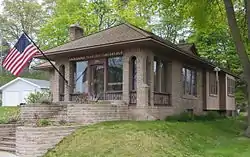 Frank Schapler House |
September 10, 1986 (#86002074) |
106 E. Lake St. 45°22′30″N 84°57′39″W |
Petoskey | |
| 39 | Seventh Day Adventist Church |  Seventh Day Adventist Church |
September 10, 1986 (#86002077) |
224 Michigan St. 45°22′21″N 84°57′26″W |
Petoskey | The old Seventh Day Adventist Church is a two-story frame Queen Anne structure with a front-gable roof and an entrance tower at one end topped with an onion-like dome. It was originally built in 1891 as a Seventh-day Adventist church, and was later sold to The Church of Jesus Christ of Latter-day Saints. |
| 40 | Shafer's Grocery and Residence |  Shafer's Grocery and Residence |
September 10, 1986 (#86002079) |
1018 Emmet St. 45°22′04″N 84°57′33″W |
Petoskey | Shafer's Grocery and Residence consists of two attached structures: a single-story frame commercial store, and an attached two-story gabled residence with a front porch running the full width of the house. |
| 41 | Shay Complex | 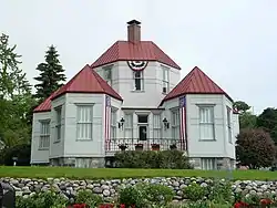 Shay Complex |
November 7, 1972 (#72000612) |
Main and Judd Sts. 45°25′49″N 84°59′02″W |
Harbor Springs | Originally a complex of three buildings constructed by Ephraim Shay, only one structure, the house, remains. It is unique in its hexagon shape and all-metal construction. |
| 42 | Skillagalee Light Station | 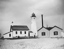 Skillagalee Light Station |
July 19, 1984 (#84001389) |
Southwest of Waugoshance Island 45°40′35″N 85°10′18″W |
Cross Village | More commonly known as the Ile Aux Galets Light, the Skillagalee Light warns shipping away from the shoals at Waugoshance Point. A light was first constructed here in 1851; the current structure dates from 1888. |
| 43 | St. Francis Solanus Mission | 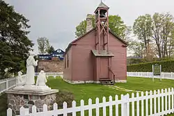 St. Francis Solanus Mission |
March 16, 1972 (#72000614) |
475 W. Lake St. 45°22′32″N 84°58′03″W |
Petoskey | St. Francis Solanus Mission is a historic mission on W. Lake Street in Petoskey. It is the only existing building in the Arbre Croche district dating from the time of Bishop Frederic Baraga, and is the oldest building still standing in Petoskey, as well as one of the oldest in northern lower Michigan. |
| 44 | Stout House |  Stout House |
September 10, 1986 (#86002080) |
606 Grove St. 45°22′14″N 84°57′05″W |
Petoskey | |
| 45 | Trinity Evangelical Church |  Trinity Evangelical Church |
September 10, 1986 (#86002082) |
219 State St. 45°22′14″N 84°57′21″W |
Petoskey | The Trinity Evangelical Church is a 2 1⁄2-story Classical Revival brick structure with a single-story polygonal entrance and a gable roof. The Trinity Evangelical congregation constructed this church in 1929. As of 2017, the building houses the New Life Anglican Church. |
| 46 | Jacob VanZolenburg House |  Jacob VanZolenburg House |
September 10, 1986 (#86002083) |
203 State St. 45°22′20″N 84°57′32″W |
Petoskey | |
| 47 | Waugoshance Light Station | 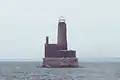 Waugoshance Light Station |
August 4, 1983 (#83000841) |
Northwest of Waugoshance Island 45°46′30″N 85°05′19″W |
Waugoshance Island | The Waugoshance Light was constructed in 1851 to warn ships away from the shoals at Waugoshance Point. The light was deactivated in 1912, and has been abandoned since. |
| 48 | J. M. Wells House |  J. M. Wells House |
September 10, 1986 (#86002084) |
203 W. Lake St. 45°22′29″N 84°57′45″W |
Petoskey | |
| 49 | West Mitchell Street Bridge |  West Mitchell Street Bridge |
September 10, 1986 (#86002085) |
W. Mitchell St. at Bear River 45°22′26″N 84°57′39″W |
Petoskey | The West Mitchell Street Bridge is a seven-span Moderne highway bridge, constructed of reinforced concrete, with broad ogee arches supporting each span. |
| 50 | White Shoal Light Station |  White Shoal Light Station |
July 19, 1984 (#84001391) |
Northwest of Waugashance Island 45°50′32″N 85°08′07″W |
Mackinaw City | The White Shoal Light was constructed in 1912 to warn ships away from the shoals at Waugoshance Point. |
| 51 | Wycamp Creek Site | March 11, 1971 (#71001022) |
Address Restricted 45°39′08″N 85°00′10″W |
Levering | The Wycamp Creek Site (designated 20EM4) is an archaeological site located in a small dune field near Lake Michigan, on a Nipissing terrace near Wycamp Creek. It is likely this site was occupied more or less continuously throughout the Late Middle and Late Woodland period. | |
| 52 | Zion Evangelical Lutheran Church |  Zion Evangelical Lutheran Church |
September 10, 1986 (#86002086) |
812 Petoskey St. 45°22′11″N 84°57′27″W |
Petoskey | The Zion Evangelical Lutheran Church is a one-story Late Victorian frame structure. It was erected 1892 for the Zion Evangelical Church congregation, who used the church until 1949. In 1951, the Petoskey Mennonite Church purchased the building; they used the building until 2015. As of 2017, the building is used by the Unitarian Universalist Congregation of Petoskey as their "Chapel of Our Guardian Angels." |
See also
| Wikimedia Commons has media related to National Register of Historic Places in Emmet County, Michigan. |
References
- The latitude and longitude information provided in this table was derived originally from the National Register Information System, which has been found to be fairly accurate for about 99% of listings. Some locations in this table may have been corrected to current GPS standards.
- "National Register of Historic Places: Weekly List Actions". National Park Service, United States Department of the Interior. Retrieved on February 5, 2021.
- Numbers represent an alphabetical ordering by significant words. Various colorings, defined here, differentiate National Historic Landmarks and historic districts from other NRHP buildings, structures, sites or objects.
- "National Register Information System". National Register of Historic Places. National Park Service. March 13, 2009.
- The eight-digit number below each date is the number assigned to each location in the National Register Information System database, which can be viewed by clicking the number.
- The NRIS gives the location of the Ponshewaing Point Site as "address restricted, but references (Richard Foster Flint; J Gordon Ogden III; Irving Rouse; Minze Stuiver, eds. (1974), Radiocarbon, 16) give the location. Geocoordinates are approximate.
| Lists by county |
|  |
|---|---|---|
| Other lists |
| |
Municipalities and communities of Emmet County, Michigan, United States | ||
|---|---|---|
| Cities | Map of Michigan highlighting Emmet County.svg | |
| Villages | ||
| Civil township | ||
| CDPs | ||
| Ghost towns | ||
| Indian reservations | ||
| Footnotes | ‡This populated place also has portions in an adjacent county or counties | |
| ||
This article is issued from Wikipedia. The text is licensed under Creative Commons - Attribution - Sharealike. Additional terms may apply for the media files.