National Register of Historic Places listings in Ottawa County, Michigan
The following is a list of Registered Historic Places in Ottawa County, Michigan.
- This National Park Service list is complete through NPS recent listings posted February 5, 2021.[1]
| [2] | Name on the Register[3] | Image | Date listed[4] | Location | City or town | Description |
|---|---|---|---|---|---|---|
| 1 | Battle Point Site |  Battle Point Site |
August 14, 1973 (#73000956) |
Battle Point, Grand River[5] 43°02′20″N 86°08′40″W |
Crockery Township | |
| 2 | Aloys Bilz House | 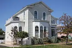 Aloys Bilz House |
December 14, 1987 (#87002139) |
107 S. Division St. 43°04′34″N 86°12′03″W |
Spring Lake | |
| 3 | Isaac Cappon House | 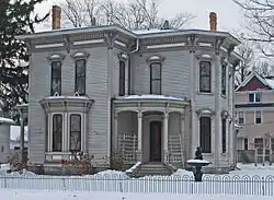 Isaac Cappon House |
January 26, 1984 (#84001478) |
228 W. 9th St. 42°47′21″N 86°07′04″W |
Holland | |
| 4 | Max and Esther De Pree House |  Max and Esther De Pree House |
April 17, 2017 (#100000886) |
279 S. Division St. 42°48′24″N 86°00′17″W |
Zeeland | |
| 4 | De Zwaan Windmill | 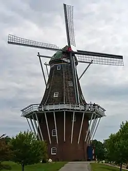 De Zwaan Windmill |
April 17, 2018 (#100002333) |
Windmill Island Gardens, 1 Lincoln Ave. 42°47′58″N 86°05′45″W |
Holland | |
| 4 | Edward P. Ferry House | 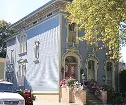 Edward P. Ferry House |
March 19, 1982 (#82002860) |
514 Lafayette St. 43°03′35″N 86°13′38″W |
Grand Haven | |
| 5 | Fruitport Road–Pettys Bayou Bridge |  Fruitport Road–Pettys Bayou Bridge |
December 17, 1999 (#99001535) |
Fruitport Rd. over Pettys Bayou 43°05′22″N 86°10′31″W |
Spring Lake Township | |
| 6 | Egbert H. Gold Estate | 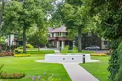 Egbert H. Gold Estate |
December 27, 1984 (#84000548) |
1116 Marigold Ln. 42°46′51″N 86°09′21″W |
Holland | |
| 7 | Grand Haven Historic District |  Grand Haven Historic District |
September 6, 2016 (#16000584) |
Washington Ave, adjacent Sts Harbor Dr. through 600 blocks 43°03′53″N 86°14′01″W |
Grand Haven | |
| 8 | Grand Rapids, Grand Haven and Muskegon Railway Depot | 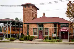 Grand Rapids, Grand Haven and Muskegon Railway Depot |
February 6, 1973 (#73002294) |
363 W. Main St. 43°03′51″N 85°56′13″W |
Coopersville | |
| 9 | Grand Trunk Western Railroad Grand Haven Coal Tipple |  Grand Trunk Western Railroad Grand Haven Coal Tipple |
September 6, 2016 (#16000583) |
300 Block of N. Harbor Dr. in Chinook Pier Park 43°04′05″N 86°13′51″W |
Grand Haven | |
| 10 | Holland Downtown Historic District |  Holland Downtown Historic District |
October 4, 1990 (#90001534) |
Roughly Eighth St. from just east of College Ave. to River Ave. and River Ave. from Ninth St. to just north of Eighth St. 42°47′24″N 86°06′26″W |
Holland | |
| 11 | Holland Harbor Lighthouse | 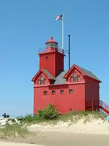 Holland Harbor Lighthouse |
July 20, 1978 (#78001509) |
South Pier, Holland Harbor 42°46′22″N 86°12′44″W |
Holland | |
| 12 | Holland Historic District |  Holland Historic District |
May 12, 1983 (#83000889) |
11th, 12th, 13th Sts., and Washington, Maple, and Pine Aves.; also roughly bounded by River Ave., Pine Ave., 16th St., 14th St., Columbia Ave., 13th St., Central Ave., and 10th St. 42°47′12″N 86°06′48″W |
Holland | Second set of boundaries represents a boundary increase of August 10, 1990 |
| 13 | Holland Old City Hall and Fire Station | 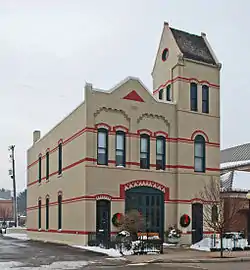 Holland Old City Hall and Fire Station |
January 11, 1985 (#85000063) |
108 E. 8th St. 42°47′24″N 86°06′08″W |
Holland | |
| 14 | Holland Reformed Protestant Dutch Church | 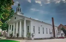 Holland Reformed Protestant Dutch Church |
August 23, 1990 (#90001243) |
57 E. 10th St. 42°47′20″N 86°06′17″W |
Holland | Also known as the Pillar Church |
| 15 | Hudsonville Christian School |  Hudsonville Christian School |
March 27, 2008 (#08000224) |
5692 School Ave. 42°52′20″N 85°51′53″W |
Hudsonville | |
| 16 | Lakewood Farm |  Lakewood Farm |
November 25, 2020 (#100005825) |
264 Lakeshore Ave 42°48′18″N 86°12′35″W |
Holland | |
| 17 | Thomas and Anna Morrissey House | 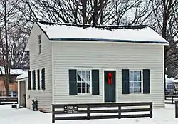 Thomas and Anna Morrissey House |
March 29, 1999 (#99000337) |
190 W. 9th St. 42°47′21″N 86°06′58″W |
Holland | |
| 18 | Olive Township District No. 1 School | 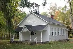 Olive Township District No. 1 School |
August 14, 1998 (#98001061) |
11611 Stanton St. 42°56′11″N 86°04′21″W |
Olive Township | |
| 19 | Ottawa Beach Historic District |  Ottawa Beach Historic District |
April 14, 1995 (#95000451) |
Ottawa Beach Rd. 42°46′34″N 86°12′22″W |
Park Township | |
| 20 | Pere Marquette Railway Locomotive #1223 | 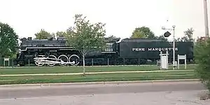 Pere Marquette Railway Locomotive #1223 |
December 7, 2000 (#00001490) |
Chinook Pier Park, Jackson Ave. 43°04′04″N 86°13′48″W |
Grand Haven | |
| 21 | Piers and Revetments at Grand Haven, Michigan |  Piers and Revetments at Grand Haven, Michigan |
October 23, 1995 (#95001161) |
Mouth of Grand R. 43°03′32″N 86°15′22″W |
Grand Haven | |
| 22 | Nathaniel and Esther (Savidge) Robbins House | 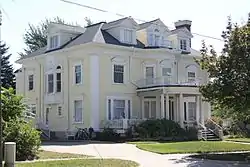 Nathaniel and Esther (Savidge) Robbins House |
April 16, 2009 (#09000203) |
20 S. 5th Ave. 43°03′45″N 86°13′35″W |
Grand Haven | |
| 23 | Spoonville Site |  Spoonville Site |
March 30, 1973 (#73002158) |
Crockery Creek and Grand River[5] 43°02′40″N 86°04′30″W |
Crockery Township | |
| 24 | Third Reformed Church of Holland | 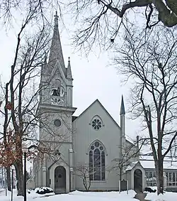 Third Reformed Church of Holland |
April 16, 1971 (#71000418) |
110 W. 12th St. 42°47′07″N 86°06′45″W |
Holland | |
| 25 | Benjamin Van Raalte House | 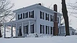 Benjamin Van Raalte House |
December 4, 1989 (#89000790) |
1076 Sixteenth St. 42°46′53″N 86°03′43″W |
Holland |
See also
| Wikimedia Commons has media related to National Register of Historic Places in Ottawa County, Michigan. |
- List of Registered Historic Places in Michigan
- List of Michigan State Historic Sites in Ottawa County, Michigan
References
- "National Register of Historic Places: Weekly List Actions". National Park Service, United States Department of the Interior. Retrieved on February 5, 2021.
- Numbers represent an alphabetical ordering by significant words. Various colorings, defined here, differentiate National Historic Landmarks and historic districts from other NRHP buildings, structures, sites or objects.
- "National Register Information System". National Register of Historic Places. National Park Service. April 24, 2008.
- The eight-digit number below each date is the number assigned to each location in the National Register Information System database, which can be viewed by clicking the number.
- Both the Battle Point and Spoonville sites are listed by the NRIS as "Address Restricted." However, the Ottawa County Park System gives the general location for both sites (Marjorie Bethke Viveen, Historic River Road: A Self-Guided Auto Tour for all Seasons (PDF), Ottawa County Parks). Geo-coordinates are approximate.
| Lists by county |
|  |
|---|---|---|
| Other lists |
| |
| Topics | |
|---|---|
| Lists by state |
|
| Lists by insular areas | |
| Lists by associated state | |
| Other areas | |
| Related | |
| |
This article is issued from Wikipedia. The text is licensed under Creative Commons - Attribution - Sharealike. Additional terms may apply for the media files.