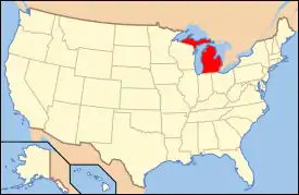
National Register of Historic Places listings in Kalamazoo County, Michigan
The following is a list of Registered Historic Places in Kalamazoo County, Michigan.
- This National Park Service list is complete through NPS recent listings posted January 29, 2021.[1]
| [2] | Name on the Register[3] | Image | Date listed[4] | Location | City or town | Description |
|---|---|---|---|---|---|---|
| 1 | The Acres | 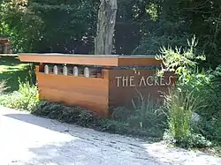 The Acres |
May 19, 2004 (#04000458) |
10036, 10069, 11090, 11108 and 11185 Hawthorne Dr. 42°15′42″N 85°24′32″W |
Charleston Township | |
| 2 | Peter B. Appeldorn House | 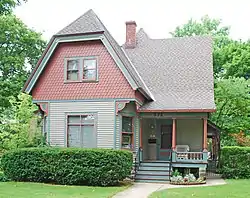 Peter B. Appeldorn House |
May 27, 1983 (#83000854) |
532 Village St. 42°16′59″N 85°35′30″W |
Kalamazoo | |
| 3 | Booth-Dunham Estate | 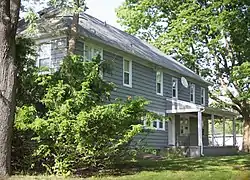 Booth-Dunham Estate |
April 1, 1998 (#98000271) |
6059 S. Ninth St. 42°13′45″N 85°40′37″W |
Texas Charter Township | |
| 4 | Bronson Park Historic District | Bronson Park Historic District |
May 27, 1983 (#83000855) |
Roughly bounded by S. Rose, S. Park, W. Lovell, and W. Michigan Aves. 42°17′24″N 85°35′10″W |
Kalamazoo | |
| 5 | Eric and Margaret Ann (Davis) Brown House | 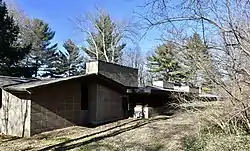 Eric and Margaret Ann (Davis) Brown House |
April 26, 2016 (#16000200) |
2806 Taliesin Dr. 42°15′48″N 85°37′58″W |
Kalamazoo | |
| 6 | Isaac Brown House | 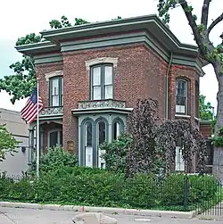 Isaac Brown House |
May 27, 1983 (#83000856) |
427 S. Burdick St. 42°17′17″N 85°34′58″W |
Kalamazoo | |
| 7 | Climax Post Office Building | 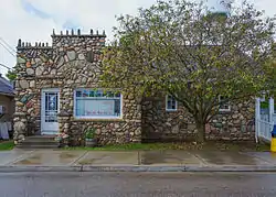 Climax Post Office Building |
January 27, 1999 (#99000053) |
107 N. Main St. 42°14′19″N 85°20′10″W |
Climax | |
| 8 | William S. Delano House | 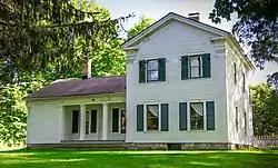 William S. Delano House |
August 9, 1979 (#79001157) |
N of Kalamazoo at 555 W. E Ave. 42°21′42″N 85°35′51″W |
Kalamazoo | |
| 9 | Desenberg Building | 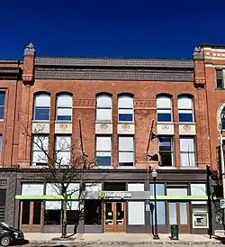 Desenberg Building |
August 13, 1979 (#79001158) |
251 E. Michigan Ave. 42°17′33″N 85°34′51″W |
Kalamazoo | |
| 10 | Benjamin and Maria (Ogden) Drake Farm | 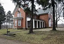 Benjamin and Maria (Ogden) Drake Farm |
December 12, 2012 (#12001031) |
927 N. Drake Rd. 42°18′03″N 85°39′12″W |
Kalamazoo | |
| 11 | Engine House No. 3 | 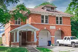 Engine House No. 3 |
May 27, 1983 (#83000857) |
607 Charlotte Ave. 42°17′51″N 85°33′52″W |
Kalamazoo | Note NRIS erroneously tags this as a delisted property, confusing it with The Harriett (refnum 83000057). |
| 12 | Fanckboner-Nichols Farmstead | 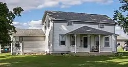 Fanckboner-Nichols Farmstead |
May 2, 2007 (#07000387) |
5992 West VW Ave. 42°07′18″N 85°39′55″W |
Prairie Ronde Township | |
| 13 | John Gibbs House | 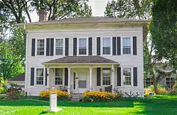 John Gibbs House |
May 27, 1983 (#83000858) |
3403 Parkview Ave. 42°15′35″N 85°38′25″W |
Kalamazoo | |
| 14 | Henry Gilbert House | 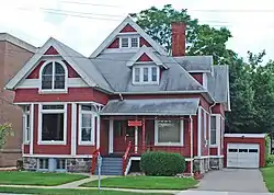 Henry Gilbert House |
May 27, 1983 (#83000859) |
415 W. Lovell 42°17′19″N 85°35′16″W |
Kalamazoo | |
| 15 | Richard and Mary Woodward Gregory House | 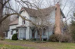 Richard and Mary Woodward Gregory House |
June 20, 2002 (#02000666) |
913 E. Augusta Rd. 42°20′35″N 85°20′38″W |
Augusta | |
| 16 | Haymarket Historic District | 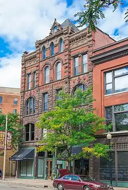 Haymarket Historic District |
May 27, 1983 (#83000860) |
Michigan Ave. between Portage St. and the Grand Rapids and Indiana railroad line; also 105-141 E. Michigan Ave. 42°17′33″N 85°34′49″W |
Kalamazoo | Second set of addresses represents a boundary increase of May 4, 2011 |
| 17 | Henderson Park-West Main Hill Historic District | 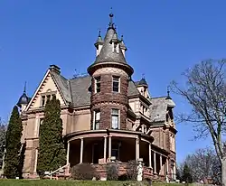 Henderson Park-West Main Hill Historic District |
July 21, 1995 (#95000871) |
Roughly bounded by W. Main, Thompson, Academy, Monroe, W. Lovell and Valley Sts. and Prairie Ave. 42°17′29″N 85°36′21″W |
Kalamazoo | |
| 18 | Illinois Envelope Co. Building | 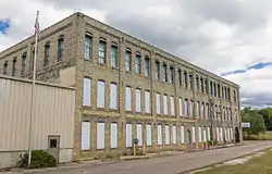 Illinois Envelope Co. Building |
May 27, 1983 (#83000861) |
400 Bryant St. 42°16′19″N 85°34′40″W |
Kalamazoo | |
| 19 | Kalamazoo State Hospital Water Tower | 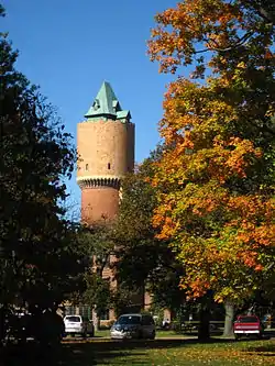 Kalamazoo State Hospital Water Tower |
March 16, 1972 (#72000624) |
Oakland Dr. 42°16′37″N 85°36′28″W |
Kalamazoo | |
| 20 | Silas W. Kendall House | 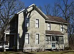 Silas W. Kendall House |
December 28, 1990 (#90001958) |
7540 Stadium Dr., Oshtemo Township 42°15′19″N 85°41′52″W |
Kalamazoo | |
| 21 | Ladies Library Association Building | 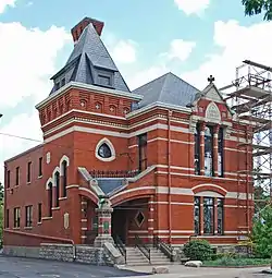 Ladies Library Association Building |
July 8, 1970 (#70000274) |
333 S. Park St. 42°17′20″N 85°35′13″W |
Kalamazoo | |
| 22 | Lawrence and Chapin Building | 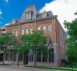 Lawrence and Chapin Building |
May 27, 1983 (#83000862) |
201 N. Rose St. 42°17′34″N 85°35′07″W |
Kalamazoo | |
| 23 | Lee Paper Company Mill Complex | 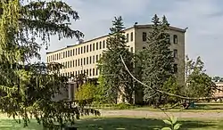 Lee Paper Company Mill Complex |
August 11, 2016 (#16000524) |
300 W. Highway St. 42°06′51″N 85°32′16″W |
Vicksburg | |
| 24 | David Lilienfeld House |  David Lilienfeld House |
January 23, 1986 (#86000119) |
447 W. South St. 42°17′22″N 85°35′18″W |
Kalamazoo | |
| 25 | The Marlborough | 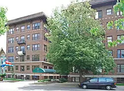 The Marlborough |
May 27, 1983 (#83000863) |
471 W. South St. 42°17′22″N 85°35′21″W |
Kalamazoo | |
| 26 | Masonic Temple Building | 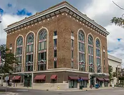 Masonic Temple Building |
May 12, 1980 (#80001876) |
309 N. Rose St. 42°17′38″N 85°35′06″W |
Kalamazoo | |
| 27 | Michigan Central Depot | 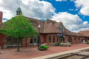 Michigan Central Depot |
June 11, 1975 (#75000949) |
459 N. Burdick St. 42°17′44″N 85°35′03″W |
Kalamazoo | |
| 28 | Henry Montague House | 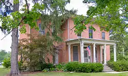 Henry Montague House |
May 27, 1983 (#83000864) |
814 Oakland Dr. 42°17′01″N 85°35′55″W |
Kalamazoo | |
| 29 | The Oaklands | 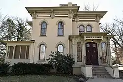 The Oaklands |
May 27, 1983 (#83000865) |
1815 W. Michigan Ave. 42°17′01″N 85°36′41″W |
Kalamazoo | |
| 30 | Old Central High School | 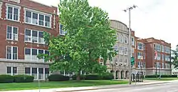 Old Central High School |
August 16, 1983 (#83000866) |
714 S. Westnedge Ave. 42°17′05″N 85°35′26″W |
Kalamazoo | |
| 31 | Old Fire House No. 4 | 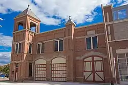 Old Fire House No. 4 |
May 27, 1983 (#83000867) |
526 N. Burdick St. 42°17′50″N 85°34′59″W |
Kalamazoo | |
| 32 | Oshtemo Town Hall | 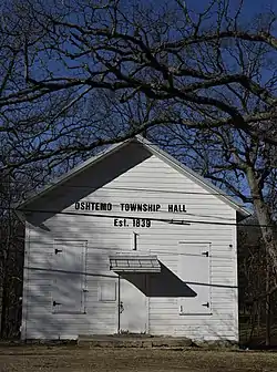 Oshtemo Town Hall |
May 19, 2004 (#04000459) |
10 S. Eighth St. 42°17′19″N 85°41′15″W |
Oshtemo Charter Township | |
| 33 | Portage Street Fire Station | 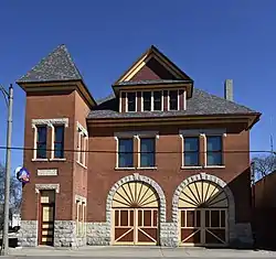 Portage Street Fire Station |
September 12, 1985 (#85002150) |
1249 Portage St. 42°16′46″N 85°34′12″W |
Kalamazoo | |
| 34 | Alonzo T. Prentice House | 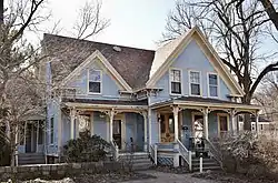 Alonzo T. Prentice House |
May 27, 1983 (#83000868) |
839 W. Lovell St. 42°17′19″N 85°35′42″W |
Kalamazoo | |
| 35 | Richland Historic District | 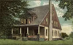 Richland Historic District |
April 11, 1997 (#97000278) |
7567-8020 N. 32nd, 8023-8047 Church, 8951-8965 Park Sts., 8650-8118 E. D Ave., 8760-8905 Gull Rd., 9057-9063 RR 42°22′27″N 85°27′26″W |
Richland | |
| 36 | Rickman Hotel |  Rickman Hotel |
December 9, 1994 (#94001425) |
345 N. Burdick 42°17′39″N 85°35′01″W |
Kalamazoo | |
| 37 | Martin W. Roberts House | 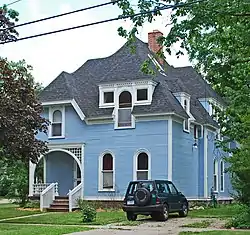 Martin W. Roberts House |
May 27, 1983 (#83000869) |
703 Wheaton Ave. 42°16′54″N 85°35′33″W |
Kalamazoo | |
| 38 | Rose Place Historic District | 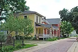 Rose Place Historic District |
May 27, 1983 (#83000870) |
Rose Pl. 42°16′58″N 85°35′08″W |
Kalamazoo | |
| 39 | Enoch Shaffer House | 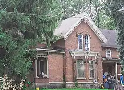 Enoch Shaffer House |
May 27, 1983 (#83000871) |
1437 Douglas Ave. 42°18′22″N 85°36′12″W |
Kalamazoo | |
| 40 | Patrick and Sarah Dobbins Shields House | 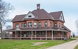 Patrick and Sarah Dobbins Shields House |
July 24, 2007 (#07000745) |
6681 N. 2nd St. 42°21′19″N 85°44′46″W |
Alamo | |
| 41 | South Street Historic District | 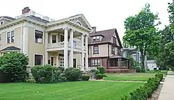 South Street Historic District |
August 28, 1979 (#79001159) |
South St. between Oakland Dr. and Westnedge Ave.; also roughly W. Lovell St. from Oakland Dr. to Pearl St. and Academy St. east of Oakland 42°17′22″N 85°35′32″W |
Kalamazoo | Second set of boundaries represents a boundary increase of April 14, 1995 |
| 42 | Sparks-Anderson House | 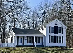 Sparks-Anderson House |
April 7, 2014 (#14000125) |
7653 W. Main St. 42°17′43″N 85°41′58″W |
Oshtemo Township | |
| 43 | State Hospital Gatehouse | 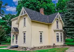 State Hospital Gatehouse |
May 27, 1983 (#83000872) |
1006 Oakland Dr. 42°16′53″N 85°36′00″W |
Kalamazoo | |
| 44 | Andrew J. Stevens House | 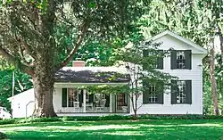 Andrew J. Stevens House |
May 27, 1983 (#83000873) |
4024 Oakland Dr. 42°15′04″N 85°36′52″W |
Kalamazoo | |
| 45 | Stuart Area Historic District |  Stuart Area Historic District |
May 27, 1983 (#83000874) |
Roughly bounded by the Michigan Central railroad line, Douglas, Forbes, W. Main, North, and Elm Sts., and Kalamazoo and Grand Aves.; also roughly along Ransom and Willard Sts., Allen Boulevard and Eleanor St., and 425-433 Douglas St. and 818 North St. 42°17′40″N 85°35′54″W |
Kalamazoo | Second set of boundaries represents a boundary increase of July 20, 1995 |
| 46 | Charles E. Stuart House | 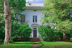 Charles E. Stuart House |
March 16, 1972 (#72000625) |
427 Stuart Ave. 42°17′43″N 85°35′53″W |
Kalamazoo | |
| 47 | Dr. Nathan M. Thomas House | 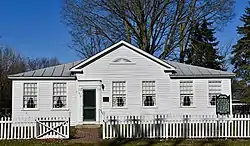 Dr. Nathan M. Thomas House |
April 22, 1982 (#82002843) |
613 E. Cass St. 42°06′59″N 85°37′47″W |
Schoolcraft | |
| 48 | United States Post Office | United States Post Office |
December 26, 2017 (#100001930) |
410 W. Michigan Ave. 42°17′30″N 85°35′16″W |
Kalamazoo | |
| 49 | Vine Area Historic District | 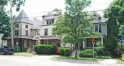 Vine Area Historic District |
August 16, 1983 (#83000875) |
Roughly bounded by S. Rose, S. Westnedge, W. Walnut, and Ranney Sts. 42°17′05″N 85°35′12″W |
Kalamazoo | |
| 50 | William L. Welsh Terrace | 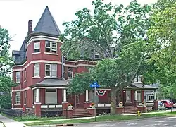 William L. Welsh Terrace |
May 27, 1983 (#83000876) |
101-105 W. Dutton St. 42°17′05″N 85°35′00″W |
Kalamazoo |
Former listings
| [2] | Name on the Register | Image | Date listed | Date removed | Location | City or town | Summary |
|---|---|---|---|---|---|---|---|
| 1 | East Hall | 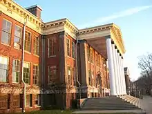 East Hall |
February 23, 1978 (#78001501) | March 7, 2017 | Oakland Dr. 42°17′10″N 85°35′47″W |
Kalamazoo | |
| 2 | Fountain of the Pioneers | 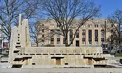 Fountain of the Pioneers |
June 28, 2016 (#16000417) | August 19, 2019 | Bronson Park, bounded by Academy, Rose, South & Park Sts. 42°17′25″N 85°35′08″W |
Kalamazoo | Removed from the park in 2018[5] and delisted in 2019.[6] |
| 3 | Western State Normal School Historic District | Western State Normal School Historic District |
August 10, 1990 (#90001230) | March 7, 2017 | Roughly bounded by Stadium Dr., Oliver St., and Davis St. 42°17′08″N 85°35′58″W |
Kalamazoo |
See also
- List of Registered Historic Places in Michigan
- List of Michigan State Historic Sites in Kalamazoo County, Michigan
References
- "National Register of Historic Places: Weekly List Actions". National Park Service, United States Department of the Interior. Retrieved on January 29, 2021.
- Numbers represent an alphabetical ordering by significant words. Various colorings, defined here, differentiate National Historic Landmarks and historic districts from other NRHP buildings, structures, sites or objects.
- "National Register Information System". National Register of Historic Places. National Park Service. April 24, 2008.
- The eight-digit number below each date is the number assigned to each location in the National Register Information System database, which can be viewed by clicking the number.
- https://www.smithsonianmag.com/smart-news/fountain-depicting-armed-white-settler-towering-over-native-american-be-removed-kalamazoo-180968855/
- "National Register of Historic Places: Weekly List 20190823". National Park Service. Retrieved August 30, 2019.
External links
 Media related to National Register of Historic Places in Kalamazoo County, Michigan at Wikimedia Commons
| Lists by county |
|  |
|---|---|---|
| Other lists |
| |
| Topics | |
|---|---|
| Lists by state |
|
| Lists by insular areas | |
| Lists by associated state | |
| Other areas | |
| Related | |
| |
This article is issued from Wikipedia. The text is licensed under Creative Commons - Attribution - Sharealike. Additional terms may apply for the media files.