National Register of Historic Places listings in Fresno County, California
This is a list of the National Register of Historic Places listings in Fresno County, California.
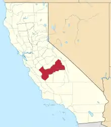
Location of Fresno County in California
This is intended to be a complete list of the properties and districts on the National Register of Historic Places in Fresno County, California, United States. Latitude and longitude coordinates are provided for many National Register properties and districts; these locations may be seen together in an online map.[1]
There are 45 properties and districts listed on the National Register in the county, including 1 National Historic Landmark.
- This National Park Service list is complete through NPS recent listings posted February 5, 2021.[2]
Current listings
| [3] | Name on the Register[4] | Image | Date listed[5] | Location | City or town | Description |
|---|---|---|---|---|---|---|
| 1 | Azteca Theater |  Azteca Theater |
March 27, 2017 (#100000779) |
836-840 F St. 36°43′44″N 119°47′36″W |
Fresno | |
| 2 | Bank of Italy | 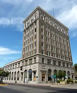 Bank of Italy |
October 29, 1982 (#82000963) |
1015 Fulton Mall 36°44′02″N 119°47′22″W |
Fresno | |
| 3 | Ben Gefvert Ranch Historic District |  Ben Gefvert Ranch Historic District |
January 7, 2011 (#10001117) |
4770 W. Whites Bridge Rd. 36°44′07″N 119°51′36″W |
Fresno | |
| 4 | Big Creek Hydroelectric System Historic District | 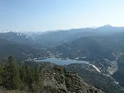 Big Creek Hydroelectric System Historic District |
July 26, 2016 (#16000468) |
Roughly from Big Creek to Northern Los Angeles 37°19′23″N 119°18′58″W |
Big Creek | |
| 5 | Birdwell Rock Petroglyph Site |  Birdwell Rock Petroglyph Site |
March 12, 2003 (#03000117) |
Address Restricted |
Coalinga | |
| 6 | H. H. Brix Mansion |  H. H. Brix Mansion |
September 15, 1983 (#83001178) |
2844 Fresno St. 36°44′31″N 119°46′56″W |
Fresno | |
| 7 | Coalinga Polk Street School | May 6, 1982 (#82002175) |
S. 5th and E. Polk Sts. 36°08′11″N 120°21′15″W |
Coalinga | 1908 school listed in 1982, destroyed by earthquake in 1983. | |
| 8 | Dinkey Creek Bridge |  Dinkey Creek Bridge |
September 5, 1996 (#96000911) |
Off Dinkey Creek Rd., W of Camp Fresno, Sierra National Forest 37°04′02″N 119°09′14″W |
Dinkey Creek | |
| 9 | Einstein House |  Einstein House |
January 31, 1978 (#78000662) |
1600 M St. 36°44′33″N 119°47′34″W |
Fresno | |
| 10 | Forestiere Underground Gardens | Forestiere Underground Gardens |
October 28, 1977 (#77000293) |
5021 W. Shaw Ave. 36°48′26″N 119°52′51″W |
Fresno | |
| 11 | Fresno Bee Building | .jpg.webp) Fresno Bee Building |
November 1, 1982 (#82000964) |
1555 Van Ness Ave. 36°44′25″N 119°47′41″W |
Fresno | |
| 12 | Fresno Brewing Company Office and Warehouse | 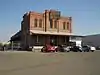 Fresno Brewing Company Office and Warehouse |
January 5, 1984 (#84000773) |
100 M St. 36°43′38″N 119°46′32″W |
Fresno | |
| 13 | Fresno County Hall of Records | 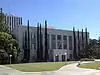 Fresno County Hall of Records |
December 22, 2011 (#11000932) |
2281 Tulare St. 36°44′10″N 119°47′14″W |
Fresno | |
| 14 | Fresno Memorial Auditorium | 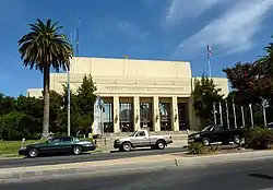 Fresno Memorial Auditorium |
May 10, 1994 (#94000427) |
2425 Fresno St. 36°44′23″N 119°47′15″W |
Fresno | |
| 15 | Fresno Republican Printery Building | 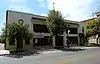 Fresno Republican Printery Building |
January 2, 1979 (#79000474) |
2130 Kern St. 36°44′01″N 119°47′11″W |
Fresno | |
| 16 | Fresno Sanitary Landfill | 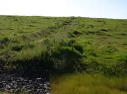 Fresno Sanitary Landfill |
August 7, 2001 (#01001050) |
West and Jensen Aves. 36°42′24″N 119°49′37″W |
Fresno | First modern landfill in the US, this closed landfill is also a Superfund site. |
| 17 | Gamlin Cabin | 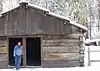 Gamlin Cabin |
March 8, 1977 (#77000123) |
NW of Wilsonia 36°44′56″N 118°58′13″W |
Wilsonia | |
| 18 | Holy Trinity Armenian Apostolic Church |  Holy Trinity Armenian Apostolic Church |
July 31, 1986 (#86002097) |
2226 Ventura St. 36°43′54″N 119°46′54″W |
Fresno | |
| 19 | Hotel Californian |  Hotel Californian |
April 21, 2004 (#04000333) |
851 Van Ness Ave. 36°44′03″N 119°47′17″W |
Fresno | |
| 20 | Hotel Fresno | September 13, 2018 (#100002910) |
1241-1263 Broadway Plz. 36°44′09″N 119°47′38″W |
Fresno | ||
| 21 | M. Theo Kearney Park and Mansion |  M. Theo Kearney Park and Mansion |
March 13, 1975 (#75000426) |
7160 Kearney Blvd. 36°43′32″N 119°55′04″W |
Fresno | |
| 22 | Paul Kindler House |  Paul Kindler House |
October 29, 1982 (#82000965) |
1520 E. Olive Ave 36°45′26″N 119°47′27″W |
Fresno | |
| 23 | Knapp Cabin | 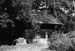 Knapp Cabin |
December 20, 1978 (#78000291) |
W of Cedar Grove in Kings Canyon National Park 36°47′02″N 118°38′09″W |
Cedar Grove | |
| 24 | Maubridge Apartments |  Maubridge Apartments |
May 6, 1982 (#82002176) |
2344 Tulare St. 36°44′12″N 119°47′07″W |
Fresno | |
| 25 | Meux House |  Meux House |
January 13, 1975 (#75000427) |
1007 R St. 36°44′23″N 119°46′53″W |
Fresno | |
| 26 | John Muir Memorial Shelter | 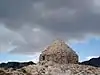 John Muir Memorial Shelter |
August 15, 2016 (#16000576) |
At the top of Muir Pass in Kings Canyon National Park 37°06′43″N 118°40′15″W |
Grant Cove | |
| 27 | Old Administration Building, Fresno City College | 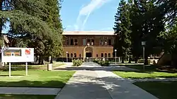 Old Administration Building, Fresno City College |
May 1, 1974 (#74000510) |
1101 University Ave. 36°46′04″N 119°47′51″W |
Fresno | |
| 28 | Old Fresno Water Tower | 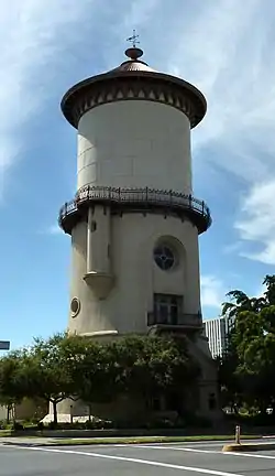 Old Fresno Water Tower |
October 14, 1971 (#71000139) |
2444 Fresno St. 36°44′21″N 119°47′11″W |
Fresno | |
| 29 | Orange Cove Santa Fe Railway Depot | 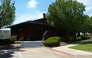 Orange Cove Santa Fe Railway Depot |
August 29, 1978 (#78000668) |
633 E. Railroad Ave. 36°37′23″N 119°18′42″W |
Orange Cove | |
| 30 | Alexander Pantages Theater | 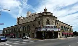 Alexander Pantages Theater |
February 23, 1978 (#78000663) |
1400 Fulton St. 36°44′17″N 119°47′40″W |
Fresno | |
| 31 | Physicians Building | 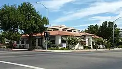 Physicians Building |
November 20, 1978 (#78000664) |
2607 Fresno St. 36°44′26″N 119°47′06″W |
Fresno | |
| 32 | Reedley National Bank |  Reedley National Bank |
February 28, 1985 (#85000352) |
1100 G St. 36°35′47″N 119°26′58″W |
Reedley | |
| 33 | Reedley Opera House Complex | 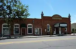 Reedley Opera House Complex |
April 5, 1984 (#84000774) |
10th and G Sts. 36°35′49″N 119°27′03″W |
Reedley | |
| 34 | Rehorn House |  Rehorn House |
January 8, 1982 (#82002177) |
1050 S St. 36°44′29″N 119°46′50″W |
Fresno | |
| 35 | Frank Romain House | 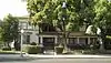 Frank Romain House |
January 11, 1982 (#82002178) |
2055 San Joaquin St. 36°44′30″N 119°47′46″W |
Fresno | |
| 36 | San Joaquin Light & Power Corporation Building | 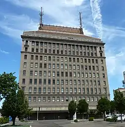 San Joaquin Light & Power Corporation Building |
January 3, 2006 (#05001497) |
1401 Fulton St. 36°44′13″N 119°47′41″W |
Fresno | |
| 37 | Santa Fe Hotel |  Santa Fe Hotel |
March 14, 1991 (#91000287) |
935 Santa Fe Ave. 36°44′16″N 119°46′56″W |
Fresno | |
| 38 | Santa Fe Passenger Depot | 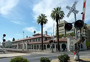 Santa Fe Passenger Depot |
November 7, 1976 (#76000482) |
2650 Tulare St. 36°44′18″N 119°46′55″W |
Fresno | |
| 39 | Shorty Lovelace Historic District | 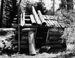 Shorty Lovelace Historic District |
January 31, 1978 (#78000293) |
E of Pinehurst on Kings Canyon National Park 36°44′26″N 118°31′03″W |
Pinehurst | A series of cabins built by trapper Shorty Lovelace. |
| 40 | Southern Pacific Passenger Depot |  Southern Pacific Passenger Depot |
March 21, 1978 (#78000665) |
1033 H St. 36°43′57″N 119°47′33″W |
Fresno | |
| 41 | Stoner House | October 17, 1985 (#85003145) |
21143 E. Weldon Ave. 36°45′53″N 119°24′31″W |
Sanger | Craftsman bungalow mansion built on a hilltop in 1910. | |
| 42 | Tower Theatre |  Tower Theatre |
September 24, 1992 (#92001276) |
1201 N. Wishon Ave. 36°45′28″N 119°48′05″W |
Fresno | |
| 43 | Twining Laboratories | 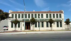 Twining Laboratories |
March 26, 1991 (#91000308) |
2527 Fresno St. 36°45′29″N 119°47′12″W |
Fresno | |
| 44 | Warehouse Row |  Warehouse Row |
March 24, 1978 (#78000666) |
722, 744, and 764 P St. 36°44′10″N 119°46′40″W |
Fresno | |
| 45 | Y.W.C.A. Building |  Y.W.C.A. Building |
September 21, 1978 (#78000667) |
1660 M St. 36°44′35″N 119°47′35″W |
Fresno |
See also
| Wikimedia Commons has media related to National Register of Historic Places in Fresno County, California. |
References
- The latitude and longitude information provided in this table was derived originally from the National Register Information System, which has been found to be fairly accurate for about 99% of listings. Some locations in this table may have been corrected to current GPS standards.
- "National Register of Historic Places: Weekly List Actions". National Park Service, United States Department of the Interior. Retrieved on February 5, 2021.
- Numbers represent an alphabetical ordering by significant words. Various colorings, defined here, differentiate National Historic Landmarks and historic districts from other NRHP buildings, structures, sites or objects.
- "National Register Information System". National Register of Historic Places. National Park Service. July 9, 2010.
- The eight-digit number below each date is the number assigned to each location in the National Register Information System database, which can be viewed by clicking the number.
| Topics | |
|---|---|
| Lists by state |
|
| Lists by insular areas | |
| Lists by associated state | |
| Other areas | |
| Related | |
| |
This article is issued from Wikipedia. The text is licensed under Creative Commons - Attribution - Sharealike. Additional terms may apply for the media files.