National Register of Historic Places listings in Fulton County, Illinois
This is a list of the National Register of Historic Places listings in Fulton County, Illinois.
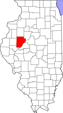
Location of Fulton County in Illinois
This is intended to be a complete list of the properties and districts on the National Register of Historic Places in Fulton County, Illinois, United States. Latitude and longitude coordinates are provided for many National Register properties and districts; these locations may be seen together in a map.[1]
There are 42 properties and districts listed on the National Register in the county. Another two properties were formerly listed but have been removed.
- This National Park Service list is complete through NPS recent listings posted February 5, 2021.[2]
Current listings
| [3] | Name on the Register | Image | Date listed[4] | Location | City or town | Description |
|---|---|---|---|---|---|---|
| 1 | Babylon Bend Bridge | 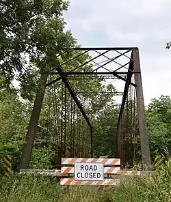 Babylon Bend Bridge |
October 29, 1980 (#80001355) |
Illinois Route 123 40°35′25″N 90°20′52″W |
Ellisville | |
| 2 | Bernadotte Bridge | 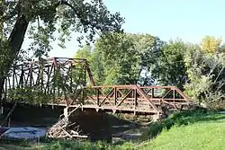 Bernadotte Bridge |
October 29, 1980 (#80001360) |
Illinois Route 2 40°24′13″N 90°19′15″W |
Smithfield | |
| 3 | Buckeye Bridge | 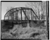 Buckeye Bridge |
October 29, 1980 (#80001361) |
Spans Spoon River 40°31′54″N 90°18′40″W |
Smithfield | Replaced in 1994 |
| 4 | Chicago, Burlington and Quincy Railroad Station | 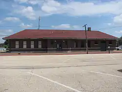 Chicago, Burlington and Quincy Railroad Station |
August 31, 1993 (#93000842) |
Along 4th Ave. between E. Elm St. and E. Chestnut St. 40°33′23″N 90°01′44″W |
Canton | |
| 5 | Edith Chipman House | 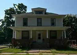 Edith Chipman House |
November 7, 1996 (#96001290) |
201 W. 3rd St. 40°17′43″N 90°25′44″W |
Vermont | |
| 6 | Dickson Mounds |  Dickson Mounds |
May 5, 1972 (#72000457) |
Off County Road 4 40°21′03″N 90°06′31″W |
Lewistown | |
| 7 | Robert Dilworth House | 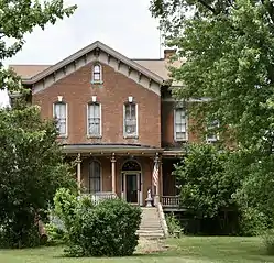 Robert Dilworth House |
November 12, 1993 (#93001236) |
606 E. 5th St. 40°17′39″N 90°25′11″W |
Vermont | |
| 8 | Duncan Mills Bridge | October 29, 1980 (#80001356) |
West of Havana 40°20′28″N 90°11′27″W |
Lewistown | Demolished. | |
| 9 | William Franklin and Rebecca Durell House | 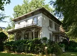 William Franklin and Rebecca Durell House |
November 7, 1996 (#96001292) |
408 W. 5th St. 40°17′38″N 90°25′55″W |
Vermont | |
| 10 | Duvall-Ash Farmstead | November 12, 1993 (#93001237) |
Off Illinois Route 9, 1 mile east and 1.2 miles north of its junction with Illinois Route 97 40°34′40″N 90°08′23″W |
Fiatt | ||
| 11 | East Waterford School | 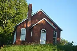 East Waterford School |
November 10, 2009 (#09000897) |
Junction of North Dickson Mounds Rd. and East Prairie Rd. 40°20′59″N 90°06′55″W |
Lewistown | |
| 12 | Edward Hamer House |  Edward Hamer House |
November 7, 1996 (#96001293) |
200 W. 2nd St. 40°17′48″N 90°25′45″W |
Vermont | |
| 13 | Patterson Hamer House | 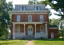 Patterson Hamer House |
November 7, 1996 (#96001287) |
405 W. 5th St. 40°17′36″N 90°25′52″W |
Vermont | |
| 14 | William Hoopes House | 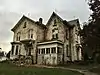 William Hoopes House |
November 7, 1996 (#96001285) |
204 N. Liberty St. 40°17′45″N 90°25′44″W |
Vermont | |
| 15 | Lucinda Hunter House | 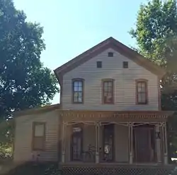 Lucinda Hunter House |
November 7, 1996 (#96001286) |
101 E. 8th St. 40°17′26″N 90°25′38″W |
Vermont | |
| 16 | Indian Ford Bridge | 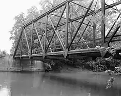 Indian Ford Bridge |
October 29, 1980 (#80001357) |
Illinois Route 20 40°41′25″N 90°17′24″W |
London Mills | Now demolished. |
| 17 | Larson Site |  Larson Site |
November 21, 1978 (#78001145) |
Waterford Rd. north of the Waterford Cemetery[5] 40°20′36″N 90°07′52″W |
Lewistown | |
| 18 | London Mills Bridge | 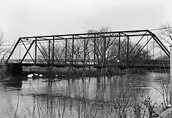 London Mills Bridge |
October 29, 1980 (#80001358) |
Illinois Route 39 40°42′36″N 90°16′00″W |
London Mills | Now demolished. |
| 19 | Charles Emmor McCormick House | 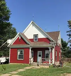 Charles Emmor McCormick House |
November 7, 1996 (#96001284) |
712 W. 3rd St. 40°17′45″N 90°26′05″W |
Vermont | |
| 20 | Joab Mershon House | 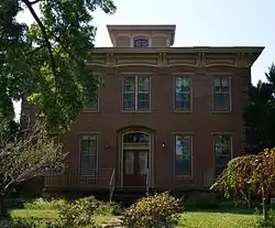 Joab Mershon House |
November 7, 1996 (#96001294) |
507 W. 5th St. 40°17′36″N 90°25′59″W |
Vermont | |
| 21 | Daniel O'Connell House |  Daniel O'Connell House |
November 7, 1996 (#96001288) |
115 N. Union St. 40°17′43″N 90°25′34″W |
Vermont | |
| 22 | Oak Hill Cemetery |  Oak Hill Cemetery |
November 13, 1995 (#95001240) |
1000 block of N. Main St. (Illinois Routes 97 and 100) 40°24′08″N 90°09′24″W |
Lewistown | |
| 23 | Odd Fellows Opera Block | 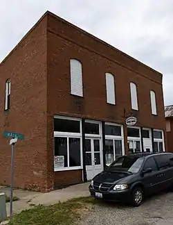 Odd Fellows Opera Block |
August 8, 1996 (#96000876) |
Southwestern corner of the junction of Main and Mechanic Sts. 40°37′36″N 90°18′16″W |
Ellisville | |
| 24 | Ogden-Fettie Site | 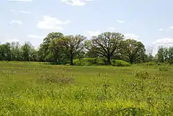 Ogden-Fettie Site |
July 31, 1972 (#72000458) |
South of Lewistown 40°20′27″N 90°07′06″W |
Lewistown | |
| 25 | Orendorf Site | September 13, 1977 (#77000484) |
Western side of U.S. Route 24 near the northern end of the Duck Creek Cooling Pond[6] 40°29′15″N 89°57′06″W |
Canton | ||
| 26 | Ulysses G. Orendorff House | 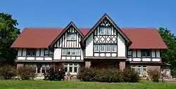 Ulysses G. Orendorff House |
December 9, 1971 (#71000292) |
345 W. Elm St. 40°33′25″N 90°02′33″W |
Canton | |
| 27 | Henry H. Page House | 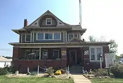 Henry H. Page House |
November 7, 1996 (#96001289) |
221 N. Union St. 40°17′46″N 90°25′34″W |
Vermont | |
| 28 | Hiram Palmer House | 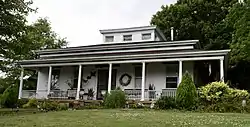 Hiram Palmer House |
May 20, 1999 (#99000589) |
703 E. Fort St. 40°41′53″N 89°59′38″W |
Farmington | |
| 29 | Parlin Library | 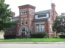 Parlin Library |
May 6, 1994 (#94000434) |
210 E. Chestnut St. 40°33′24″N 90°01′53″W |
Canton | |
| 30 | Harvey Lee Ross House | 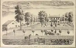 Harvey Lee Ross House |
November 7, 1996 (#96001295) |
602 S. Main St. 40°17′20″N 90°25′41″W |
Vermont | |
| 31 | Seville Bridge |  Seville Bridge |
October 29, 1980 (#80001359) |
Spans the Spoon River in Seville 40°28′22″N 90°17′27″W |
Seville | |
| 32 | Sheets Site | December 22, 1978 (#78001146) |
County Road 14, west of Lewistown[7] 40°24′01″N 90°12′40″W |
Lewistown | ||
| 33 | Sleeth Site | 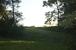 Sleeth Site |
May 17, 1979 (#79000837) |
Northeast of the junction of U.S. Route 24 and Pollitt Rd.[8] 40°25′27″N 90°00′00″W |
Liverpool | |
| 34 | Elsworth Snowden House | 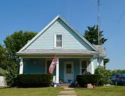 Elsworth Snowden House |
November 7, 1996 (#96001283) |
504 W. 3rd St. 40°17′44″N 90°26′00″W |
Vermont | |
| 35 | South Fulton Churchhouse | 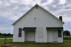 South Fulton Churchhouse |
October 28, 1994 (#94001264) |
2.2 miles south of the junction of Astoria-Bader Rd. and U.S. Route 24 40°11′45″N 90°21′26″W |
Astoria | |
| 36 | St. James Episcopal Church | 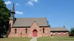 St. James Episcopal Church |
December 31, 1974 (#74000761) |
Northeastern corner of the junction of MacArthur and Broadway 40°23′56″N 90°09′06″W |
Lewistown | |
| 37 | Stapleford-Hoover-Whitney House | 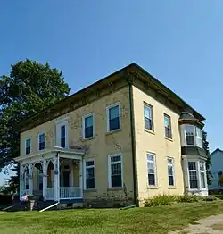 Stapleford-Hoover-Whitney House |
November 7, 1996 (#96001291) |
401 N. Main St. 40°17′51″N 90°25′38″W |
Vermont | |
| 38 | Table Grove Community Church | 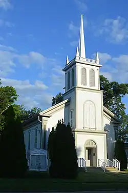 Table Grove Community Church |
February 9, 1979 (#79003783) |
N. Broadway and W. Liberty Sts. 40°22′00″N 90°25′32″W |
Table Grove | |
| 39 | Tampico Mounds | May 14, 1979 (#79000838) |
West of the junction of U.S. Route 24 and County Road 8[9] 40°24′58″N 90°00′56″W |
Maples Mill | ||
| 40 | Tartar's Ferry Bridge | Tartar's Ferry Bridge |
October 29, 1980 (#80001363) |
Spans the Spoon River southwest of Smithfield 40°26′47″N 90°21′02″W |
Smithfield | |
| 41 | Vermont Historic District | 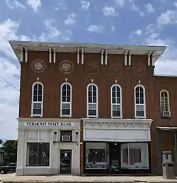 Vermont Historic District |
November 24, 1997 (#97001334) |
Roughly bounded by 2nd, Union, 4th, and Liberty Sts. 40°17′42″N 90°25′40″W |
Vermont | |
| 42 | Vermont Masonic Hall | 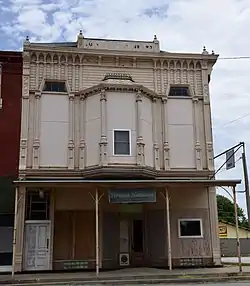 Vermont Masonic Hall |
November 16, 1988 (#88002236) |
N. Main St. 40°17′42″N 90°25′39″W |
Vermont |
Former listing
| [3] | Name on the Register | Image | Date listed | Date removed | Location | City or town | Summary |
|---|---|---|---|---|---|---|---|
| 1 | Carithers Store Building |  Carithers Store Building |
August 3, 1987 (#87001262) | January 6, 2020 | Table Grove village square, west of U.S. Route 136 40°21′58″N 90°25′32″W |
Table Grove | |
| 2 | Elrod Bridge | October 29, 1980 (#80001362) | December 8, 1995 | Southeast of Smithville spanning the Spoon River 40°23′29″N 90°15′16″W |
Smithfield | Destroyed by a tornado in 1995. |
See also
| Wikimedia Commons has media related to National Register of Historic Places in Fulton County, Illinois. |
References
- The latitude and longitude information provided in this table was derived originally from the National Register Information System, which has been found to be fairly accurate for about 99% of listings. Some locations in this table may have been corrected to current GPS standards.
- "National Register of Historic Places: Weekly List Actions". National Park Service, United States Department of the Interior. Retrieved on February 5, 2021.
- Numbers represent an alphabetical ordering by significant words. Various colorings, defined here, differentiate National Historic Landmarks and historic districts from other NRHP buildings, structures, sites or objects.
- The eight-digit number below each date is the number assigned to each location in the National Register Information System database, which can be viewed by clicking the number.
- Maruszak, Kathleen. National Register of Historic Places Inventory/Nomination: Larson Site. National Park Service, 1977-09, 6.
- Maruszak, Kathleen. National Register of Historic Places Inventory/Nomination: Orendorf Site. National Park Service, 1976-11-09, 2.
- Maruszak, Kathleen, and Debi A. Jones. National Register of Historic Places Inventory/Nomination: Sheets Site. National Park Service, 1978-06, 2.
- Maruszak, Kathleen, and Debi A. Jones. National Register of Historic Places Inventory/Nomination: Sleeth Site. National Park Service, 1978-09, 4.
- Maruszak, Kathleen, and Debi A. Jones. National Register of Historic Places Inventory/Nomination: Tampico Mounds. National Park Service, 1978-09, 5.
| Topics | |
|---|---|
| Lists by state |
|
| Lists by insular areas | |
| Lists by associated state | |
| Other areas | |
| Related | |
| |
Municipalities and communities of Fulton County, Illinois, United States | ||
|---|---|---|
| Cities | Map of Illinois highlighting Fulton County | |
| Town | ||
| Villages | ||
| Townships | ||
| Unincorporated communities | ||
| Ghost towns | ||
| Footnotes | ‡This populated place also has portions in an adjacent county or counties | |
| ||
This article is issued from Wikipedia. The text is licensed under Creative Commons - Attribution - Sharealike. Additional terms may apply for the media files.