National Register of Historic Places listings in Lewis and Clark County, Montana
This is a list of the National Register of Historic Places listings in Lewis and Clark County, Montana.
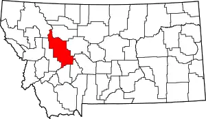
Location of Lewis and Clark County in Montana
This is intended to be a complete list of the properties and districts on the National Register of Historic Places in Lewis and Clark County, Montana, United States. The locations of National Register properties and districts for which the latitude and longitude coordinates are included below, may be seen in a map.[1]
There are 76 properties and districts listed on the National Register in the county.
- This National Park Service list is complete through NPS recent listings posted January 29, 2021.[2]
Current listings
| [3] | Name on the Register | Image | Date listed[4] | Location | City or town | Description |
|---|---|---|---|---|---|---|
| 1 | Algeria Shrine Temple | _-_Lewis_and_Clark_County%252C_Montana.png.webp) Algeria Shrine Temple |
April 14, 1988 (#88000434) |
Neill and Park Aves. 46°35′43″N 112°02′21″W |
Helena | |
| 2 | Alice Creek Historic District |  Alice Creek Historic District |
June 6, 2007 (#06000531) |
Helena National Forest[5] 47°08′22″N 112°27′30″W |
Lincoln | |
| 3 | Appleton House No. 9 | 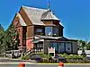 Appleton House No. 9 |
November 7, 1995 (#95001264) |
1999 Euclid Ave. 46°36′20″N 112°03′52″W |
Helena | |
| 4 | Appleton House No. 13 | 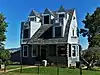 Appleton House No. 13 |
October 25, 1982 (#82000593) |
2200 Cannon 46°36′24″N 112°04′05″W |
Helena | |
| 5 | Joshua and Martha Armitage House | May 10, 2005 (#05000408) |
1117 E. Broadway 46°35′04″N 112°01′13″W |
Helena | ||
| 6 | Benton Avenue Cemetery | _-_Lewis_and_Clark_County%252C_Montana.png.webp) Benton Avenue Cemetery |
July 24, 2003 (#03000689) |
1800 N. Benton Ave. 46°36′16″N 112°02′31″W |
Helena | |
| 7 | Charles A. Broadwater House | August 27, 2008 (#08000825) |
1104 Williams St. 46°36′21″N 112°05′19″W |
Helena | ||
| 8 | Cathedral of Saint Helena | 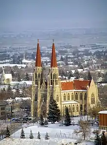 Cathedral of Saint Helena |
April 30, 1980 (#80004270) |
530 N. Ewing St. 46°35′25″N 112°01′57″W |
Helena | |
| 9 | Childs Carriage House | 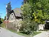 Childs Carriage House |
November 7, 1995 (#95001263) |
318 E. 6th Ave. 46°35′15″N 112°02′00″W |
Helena | |
| 10 | William C. Crum House | 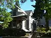 William C. Crum House |
May 30, 1997 (#97000502) |
535 5th Ave. 46°35′09″N 112°01′50″W |
Helena | |
| 11 | Crump-Howard House | 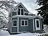 Crump-Howard House |
April 24, 2017 (#100000914) |
1003 9th Ave. 46°35′19″N 112°01′25″W |
Helena | |
| 12 | D.H. Cuthbert House | 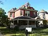 D.H. Cuthbert House |
May 4, 1995 (#95000536) |
602 N. Ewing 46°35′28″N 112°01′53″W |
Helena | |
| 13 | Dearborn River High Bridge | 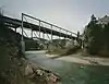 Dearborn River High Bridge |
December 18, 2003 (#03001298) |
15 miles (24 km) southwest of Augusta on Bean Lake Rd. 47°16′52″N 112°23′25″W |
Augusta | |
| 14 | Donovan-Mayer House | 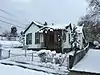 Donovan-Mayer House |
December 28, 2005 (#05001471) |
46 S. Howie St. 46°35′14″N 112°02′38″W |
Helena | |
| 15 | Dorsey Grocery and Residence | 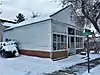 Dorsey Grocery and Residence |
April 24, 2017 (#100000915) |
401 N. Hoback St. 46°35′17″N 112°01′32″W |
Helena | |
| 16 | Eagle's Site | October 7, 1993 (#93000995) |
Address Restricted |
Helena | part of the Archeological Resources of the Upper Missouri River Corridor Multiple Property Submission (MPS) | |
| 17 | Christmas Gift Evans House | 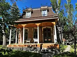 Christmas Gift Evans House |
April 16, 1980 (#80004271) |
404 N. Benton Ave. 46°35′27″N 112°02′27″W |
Helena | |
| 18 | Robert and Elizabeth Fisk House | 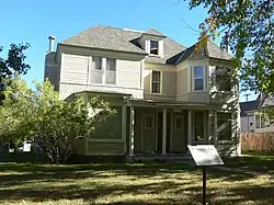 Robert and Elizabeth Fisk House |
January 17, 2007 (#06001248) |
319 N. Rodney St. 46°35′15″N 112°01′56″W |
Helena | |
| 19 | Forestvale Cemetery | 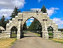 Forestvale Cemetery |
February 21, 1990 (#90000145) |
490 Forestvale Rd. 46°39′22″N 112°02′09″W |
Helena | |
| 20 | Former Montana Executive Mansion | 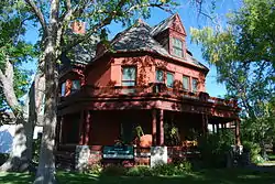 Former Montana Executive Mansion |
April 28, 1970 (#70000357) |
6th Ave. and Ewing St. 46°35′16″N 112°02′03″W |
Helena | |
| 21 | Fort Harrison Veterans' Hospital Historic District | December 20, 2016 (#16000874) |
2 mi. NW. of Helena 46°37′05″N 112°06′06″W |
Helena vicinity | ||
| 22 | Gehring Ranch | August 28, 2017 (#100001504) |
5488 Lincoln Rd. W. 46°43′31″N 112°08′28″W |
Helena vicinity | ||
| 23 | Gilman State Bank | December 1, 1983 (#83003993) |
Main St. 47°30′35″N 112°21′34″W |
Gilman | ||
| 24 | Gilpatrick-Root House | 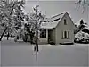 Gilpatrick-Root House |
August 10, 2005 (#05000883) |
604 Dearborn Ave. 46°35′35″N 112°02′32″W |
Helena | |
| 25 | Haight-Bridgewater House |  Haight-Bridgewater House |
March 14, 2014 (#14000080) |
502 Peosta Ave. 46°36′09″N 112°02′30″W |
Helena | |
| 26 | Hauser Mansion |  Hauser Mansion |
February 12, 1979 (#79001404) |
720 Madison Ave. 46°35′43″N 112°02′39″W |
Helena | |
| 27 | Helena Historic District |  Helena Historic District |
June 2, 1972 (#72000737) |
Irregular pattern from Hauser Boulevard to Acropolis and between Garfield and Rodney Sts.; also roughly bounded by Cruse, Neill and Park Aves., and Lawrence; also bounded by E. 6th, N. Davis, Broadway, and N. Rodney Sts. 46°34′34″N 112°02′26″W |
Helena | Second and third sets of boundaries represent boundary increases of June 14, 1990 and October 7, 1993 |
| 28 | Helena Railroad Depot Historic District |  Helena Railroad Depot Historic District |
December 15, 2004 (#03001330) |
Roughly bounded by Railroad and Helena Aves., Gallatin St., N. Sanders St., and N. Harris St. 46°35′58″N 112°00′52″W |
Helena | |
| 29 | Helena South-Central Historic District |  Helena South-Central Historic District |
July 28, 1986 (#86002274) |
Roughly bounded by Broadway, S. Davis St., the city limits, and S. Warren St. 46°34′52″N 112°02′15″W |
Helena | |
| 30 | Helena West Main Street Historic District |  Helena West Main Street Historic District |
February 22, 1996 (#96000119) |
500-600 blocks of W. Main St. 46°34′43″N 112°03′03″W |
Helena | |
| 31 | Joe and Carrie Hilger Ranch |  Joe and Carrie Hilger Ranch |
August 31, 2001 (#01000922) |
Sleeping Giant Ranch, 20 miles (32 km) north of Helena[6] 46°49′30″N 111°57′44″W |
Helena | |
| 32 | Home of Peace |  Home of Peace |
May 24, 2006 (#06000425) |
Alexander St. between Brady St. and Custer Ave. 46°36′53″N 112°03′01″W |
Helena | |
| 33 | House of the Good Shepherd Historic District | _-_Lewis_and_Clark_County.png.webp) House of the Good Shepherd Historic District |
December 23, 1993 (#93001448) |
Area surrounding the junction of 9th Ave. and N. Hoback St. 46°35′15″N 112°01′30″W |
Helena | |
| 34 | John H. Huseby House |  John H. Huseby House |
December 26, 2012 (#12001086) |
511 E. 6th Ave. 46°35′11″N 112°01′54″W |
Helena | |
| 35 | Herman Kemna House | August 18, 1992 (#92001056) |
635 1st St. 46°34′47″N 112°01′45″W |
Helena | ||
| 36 | T. H. Kleinschmidt House | _-_Lewis_and_Clark_County%252C_Montana.png.webp) T. H. Kleinschmidt House |
August 6, 1980 (#80004272) |
1823 Highland Ave. 46°34′58″N 112°00′25″W |
Helena | |
| 37 | Kluge House | 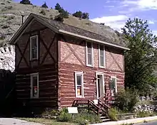 Kluge House |
April 28, 1970 (#70000358) |
540 W. Main St. 46°35′22″N 111°55′47″W |
Helena | |
| 38 | Lewis and Clark County Hospital Historic District | 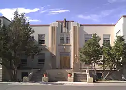 Lewis and Clark County Hospital Historic District |
November 19, 2002 (#02001101) |
3404 Cooney Dr. 46°37′20″N 112°02′12″W |
Helena | Old Cooney Home |
| 39 | Lincoln Community Hall | 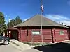 Lincoln Community Hall |
January 22, 1987 (#86003674) |
Montana Highway 200 46°57′20″N 112°41′11″W |
Lincoln | |
| 40 | Lincoln Lodge | 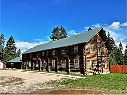 Lincoln Lodge |
October 23, 1986 (#86002931) |
Stemple Pass Rd. 46°57′23″N 112°40′50″W |
Lincoln | |
| 41 | Lyman-Neel Residence | 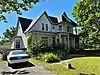 Lyman-Neel Residence |
March 29, 2019 (#100003590) |
309 N. Rodney St. 46°35′15″N 112°02′00″W |
Helena | |
| 42 | Mann Gulch Wildfire Historic District | 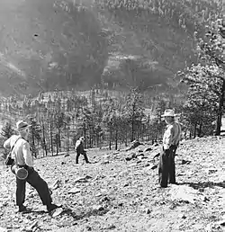 Mann Gulch Wildfire Historic District |
May 19, 1999 (#99000596) |
Mann Gulch, a tributary of the Missouri River 46°53′09″N 111°53′58″W |
Helena | |
| 43 | Methodist-Episcopal Church of Marysville | January 5, 1984 (#84002489) |
3rd St. 46°45′05″N 112°17′58″W |
Marysville | ||
| 44 | Missouri River Bridge | .jpg.webp) Missouri River Bridge |
January 4, 2010 (#09001181) |
Milepost 11 on Old U.S. Route 91 47°01′08″N 112°00′44″W |
Wolf Creek | part of the Montana's Historic Steel Truss Bridges MPS |
| 45 | Montana Aeronautics Commission Operations Historic District |  Montana Aeronautics Commission Operations Historic District |
July 31, 2017 (#100001392) |
2630 Airport Rd. 46°36′09″N 111°59′35″W |
Helena | Original 1958 Structure and adjacent 1965 garage. |
| 46 | Montana State Arsenal, Armory and Drill Hall | _-_Lewis_and_Clark_County%252C_Montana.png.webp) Montana State Arsenal, Armory and Drill Hall |
February 14, 2002 (#02000048) |
1100 N. Main 46°35′54″N 112°01′55″W |
Helena | |
| 47 | Montana State Capitol Building |  Montana State Capitol Building |
February 17, 1981 (#81000660) |
Central Ave. and Main St. 46°35′09″N 112°01′12″W |
Helena | |
| 48 | Montana State Capitol Campus Historic District |  Montana State Capitol Campus Historic District |
February 23, 2016 (#16000033) |
Bounded by E. Broadway & N. Carson Sts., E. 8th & N. Montana Aves. 46°35′06″N 112°01′07″W |
Helena | |
| 49 | Montana State Fairgrounds Racetrack | December 20, 2006 (#06001136) |
98 W. Custer Ave. 46°37′17″N 112°03′22″W |
Helena | ||
| 50 | Montana Veterans and Pioneers Memorial Building | _-_Lewis_and_Clark_County%252C_Montana.png.webp) Montana Veterans and Pioneers Memorial Building |
December 15, 2004 (#04001357) |
225 N. Roberts 46°35′11″N 112°00′55″W |
Helena | |
| 51 | Mount Helena Historic District |  Mount Helena Historic District |
January 9, 1997 (#96001568) |
Promontory roughly bounded by LeGrande Canon Boulevard, Last Chance and Grizzly Gulches, and the Helena National Forest boundary 46°35′15″N 112°03′28″W |
Helena | |
| 52 | John T. Murphy House |  John T. Murphy House |
August 1, 1984 (#84002495) |
418 N. Benton Ave. 46°35′28″N 112°02′25″W |
Helena | |
| 53 | Olsen House | _-_Lewis_and_Clark_County%252C_Montana.png.webp) Olsen House |
March 22, 1991 (#91000333) |
516 N. Park 46°35′33″N 112°02′23″W |
Helena | |
| 54 | Francis and Hannah Pope House |  Francis and Hannah Pope House |
June 27, 2007 (#07000591) |
327 N. Rodney 46°35′16″N 112°01′55″W |
Helena | |
| 55 | Porter Flats Apartments | _-_Lewis_and_Clark_County%252C_Montana.png.webp) Porter Flats Apartments |
January 14, 1993 (#92001761) |
335 N. Ewing St. 46°35′15″N 112°02′02″W |
Helena | |
| 56 | C.B. Power Bungalow | April 7, 1995 (#95000380) |
1.2 miles (1.9 km) north of Interstate 15 and 1 mile (1.6 km) west of U.S. Route 287 47°02′48″N 112°03′52″W |
Wolf Creek | ||
| 57 | Quinn's Garage | March 27, 2020 (#100005163) |
206 Main St. 47°29′33″N 112°23′32″W |
Augusta | ||
| 58 | Thomas P. Regan Cabin | January 8, 2003 (#02001686) |
McDonald Pass 46°34′42″N 112°18′12″W |
Helena | ||
| 59 | Sheep Creek Bridge | April 28, 2011 (#11000225) |
Milepost 5 on Recreation Rd. 46°58′39″N 112°04′53″W |
Wolf Creek vicinity | Reinforced Concrete Bridges in Montana, 1900-1958 MPS | |
| 60 | Silver City Cemetery (Lewis and Clark County, Montana) | April 26, 2020 (#100005209) |
Approximately 12 miles (19 km) north-northwest of Helena, MT Coordinates missing |
Silver City vicinity | ||
| 61 | Silver Creek School | August 11, 1980 (#80004273) |
North of Helena on Sierra Rd. 46°39′37″N 112°00′27″W |
Helena | ||
| 62 | Silver King Ranch |  Silver King Ranch |
March 10, 1992 (#92000114) |
Roughly 15 miles (24 km) northeast of Lincoln in the Helena National Forest 47°04′26″N 112°33′30″W |
Lincoln | |
| 63 | Morris Silverman House |  Morris Silverman House |
June 14, 1982 (#82004636) |
412 N. Rodney St. 46°35′20″N 112°01′52″W |
Helena | |
| 64 | Spalding-Gunn House | 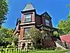 Spalding-Gunn House |
December 27, 2006 (#06001187) |
433 Clarke St. 46°35′29″N 112°02′41″W |
Helena | |
| 65 | Stearns Hall | 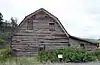 Stearns Hall |
April 7, 1995 (#95000382) |
2 miles (3.2 km) north of the junction of Montana Highways 200 and 434 47°12′27″N 112°16′33″W |
Wolf Creek | |
| 66 | Stedman Foundry and Machine Company | April 4, 1996 (#96000370) |
2650 Euclid Ave. 46°36′32″N 112°04′30″W |
Helena | ||
| 67 | Summit Lodge | May 17, 1990 (#90000723) |
30 miles (48 km) northwest of Helena in the Helena National Forest 46°47′50″N 112°27′11″W |
Helena | ||
| 68 | Temple Emanu-El | 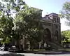 Temple Emanu-El |
July 11, 2002 (#02000724) |
515 N. Ewing St. 46°35′24″N 112°01′54″W |
Helena | |
| 69 | Unemployment Compensation Commission Building | _-_Lewis_and_Clark_County%252C_MT.png.webp) Unemployment Compensation Commission Building |
May 18, 2012 (#12000285) |
1315 -1327 Lockey Ave. 46°35′06″N 112°01′11″W |
Helena | Now Department of Labor and Industry, Walt Sullivan Building |
| 70 | Wassweiler Hotel and Bath Houses | 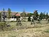 Wassweiler Hotel and Bath Houses |
August 1, 1978 (#78001688) |
West of Helena on U.S. Route 12 46°35′51″N 112°06′18″W |
Helena | |
| 71 | Western Clay Manufacturing Company | May 9, 1985 (#85001052) |
2915 Country Club Rd. 46°36′53″N 112°04′53″W |
Helena | ||
| 72 | Western Life Insurance Company Helena Branch Office | 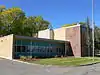 Western Life Insurance Company Helena Branch Office |
September 10, 2012 (#12000784) |
600 N. Park Ave. 46°35′38″N 112°02′27″W |
Helena | |
| 73 | Wick-Seiler House | 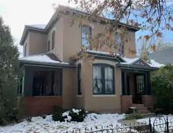 Wick-Seiler House |
August 2, 2000 (#00000873) |
729 11th Ave. 46°35′22″N 112°01′38″W |
Helena | |
| 74 | Williams Street Bridge | November 29, 2006 (#06001094) |
Williams St. crossing Ten Mile Creek, north of the junction of Williams St. and Broadwater Ave. 46°36′19″N 112°05′14″W |
Helena | ||
| 75 | Wolf Creek Hotel | 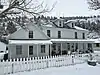 Wolf Creek Hotel |
November 7, 1997 (#97001381) |
Junction of Main St. and Bissonmett St. 47°00′23″N 112°04′09″W |
Wolf Creek | |
| 76 | Young Women's Christian Association (Independent) | _(2012)_-_Lewis_and_Clark_County%252C_Montana.png.webp) Young Women's Christian Association (Independent) |
December 27, 1984 (#84000569) |
501 N. Park St. 46°35′49″N 112°02′35″W |
Helena |
See also
| Wikimedia Commons has media related to National Register of Historic Places in Lewis and Clark County, Montana. |
References
- The latitude and longitude information provided in this table was derived originally from the National Register Information System, which has been found to be fairly accurate for about 99% of listings. Some locations in this table may have been corrected to current GPS standards.
- "National Register of Historic Places: Weekly List Actions". National Park Service, United States Department of the Interior. Retrieved on January 29, 2021.
- Numbers represent an alphabetical ordering by significant words. Various colorings, defined here, differentiate National Historic Landmarks and historic districts from other NRHP buildings, structures, sites or objects.
- The eight-digit number below each date is the number assigned to each location in the National Register Information System database, which can be viewed by clicking the number.
- Coordinates derived from the GNIS feature record for the Alice Creek Ranger Cabin
- Coordinates derived from its GNIS feature record
| Topics | |
|---|---|
| Lists by state |
|
| Lists by insular areas | |
| Lists by associated state | |
| Other areas | |
| Related | |
| |
Municipalities and communities of Lewis and Clark County, Montana, United States | ||
|---|---|---|
| City | Lewis and Clark County map | |
| Town | ||
| CDPs | ||
| Other unincorporated communities | ||
| Ghost town | ||
| ||
This article is issued from Wikipedia. The text is licensed under Creative Commons - Attribution - Sharealike. Additional terms may apply for the media files.