National recreation area
There are 40 protected areas in the United States designated as national recreation areas (NRA). They are established by an act of the United States Congress to preserve enhanced recreational opportunities in places with significant natural and scenic resources. National recreation areas emphasize a variety of activities for visitors, including hiking, camping, boating, fishing, swimming, biking, horseback riding, and wildlife viewing, in areas that include multiple-use management including both conservation and limited utilization of natural resources. They have diverse features without universal context, being established around reservoirs, in urban areas, and within forests. Due to their size, diversity of activities, and proximity to population centers, NRAs are among the most visited units of the National Park System, with six among the thirty most visited sites.[1]
.jpg.webp)
The first NRA was Lake Mead National Recreation Area, which was created by a 1936 agreement between the U.S. Bureau of Reclamation, which had built Hoover Dam, and the National Park Service, which had the experience managing visitors in the outdoors. Because the reservoir had disturbed the natural state of the environment, a new designation was devised that allowed for more intensive land use while maintaining the NPS's role in conservation and historic preservation. The system of NRAs grew as the Bureau of Reclamation (USBR) constructed more dams near urban areas where there was a need for outdoor recreation.
NRAs are managed by the National Park Service (NPS), United States Forest Service (USFS), and the Bureau of Land Management (BLM). Of the NPS's 18 sites, 12 are based around large reservoirs emphasizing water recreation, and 5 are near urban areas and include both historic preservation and outdoor recreation.[2] Of the USFS's 22 sites, 5 are at or near reservoirs, and the rest are exemplary recreation sites within national forests.
They are located in 26 states; California and Washington have the most, each with four. NRAs of the Forest Service have a total area of 3,261,818 acres (13,200.11 km2),[3] and those of the National Park service have a total area of 3,714,735 acres (15,033.00 km2).[4] The Bureau of Land Management's one NRA (the largest) is approximately 1,000,000 acres (4,000 km2).
History
Origins
The U.S. Bureau of Reclamation (USBR) was planning the construction of Boulder Dam (now Hoover Dam) in the late 1920s and saw the potential for recreation at the scenic area around the future Lake Mead, to then be the world's largest reservoir. The car was expanding access to travel in the growing Southwest and the USBR wanted to bring about the outdoor activities that would be enabled by its enormous project, but it lacked the experience and desire to provide facilities and services for recreation. Following the controversy of the Hetch Hetchy Reservoir that flooded a scenic valley in Yosemite National Park, the National Park Service (NPS) sought to balance its conservation and recreation efforts with dams, and it could provide the expertise for such visitor infrastructure at the Boulder Canyon Project.[5]
A proposed 8,000 sq mi (21,000 km2) Virgin National Park in the region pushed by Secretary of the Interior Ray Lyman Wilbur was praised for its scenic and historic resources but rejected in 1929 by NPS Director Horace M. Albright due the inherent lack of a natural landscape expected for a national park. The NPS nevertheless wanted to manage the significant lands but under a new designation that would not violate national parks' purpose of preservation. Farming interests in the Arizona Strip area also wanted to keep their grazing access to the public lands. Louis C. Cramton led further studies of the area between the dam site and Grand Canyon National Park in 1932 and recommended the creation of Grand Canyon National Monument (II)[6] for the pristine upstream eastern section; it would later be incorporated into the park. Cramton proposed that the western section, which had less spectacular scenery, the dam and reservoir, livestock grazing, and mining, but nationally important recreational importance, be designated as the "Boulder Canyon National Reservation", consistent with terminology used in the National Park Service Organic Act. A bill to establish it was introduced in Congress in 1933 with mixed support and failed to advance.[5]
As part of the New Deal, President Franklin D. Roosevelt strongly promoted tourism to an enlarged National Park Service, with increased emphasis on recreation at facilities constructed by the Civilian Conservation Corps. Despite the lack of legislation establishing the reservation, the USBR's inability to manage the influx of tourists at the newly finished Lake Mead led Interior Secretary Harold L. Ickes to allow for negotiation of a memorandum of agreement that gave the NPS jurisdiction of the reserved lands and surface of the lake, but not Boulder Dam itself, maintaining mining and grazing so long as they do not disrupt recreation. Ickes signed it on October 13, 1936, establishing the Boulder Dam Recreation Area, and the NPS quickly built significant infrastructure for sightseeing visitors and contracted with concessionaires. This was a major compromise and precedent that expanded the Park Service's mission beyond the strict conservation of national parks and monuments to include broader outdoor recreation that coexists with other land uses.[5]
The Park, Parkway, and Recreation Area Study Act of 1936[7] had the NPS analyze the needs for outdoor recreation and collaboration with state and local governments.[5] It officially expanded its mission beyond national parks. In the 1940s, under the leadership of associate director Conrad L. Wirth, the NPS prepared a National Recreation Plan and conducted a number of studies with the USBR and the United States Army Corps of Engineers (USACE) assessing the natural impact, recreational opportunities, and significance of proposed reservoirs.[8]
In 1947 the Boulder Dam Recreation Area was renamed Lake Mead National Recreation Area and expanded to include Lake Mohave above the USBR's Davis Dam. This interagency partnership would be successful in creating many recreation areas at reservoirs: nine more were created by agreement with USBR and two more with other dam agencies in the next two decades. However, it contributed to the controversial proposals of Echo Park Dam and Bridge Canyon Dam in existing NPS areas that were canceled after considerable opposition from environmentalists.[5]
These new sites were mainly designated as just "recreation areas" since they did not necessarily have national significance. Several would be transferred to the United States Forest Service (USFS) and other agencies, being more efficient for management. USFS took over Shasta Lake Recreation Area in Shasta National Forest in 1948 as its first.[9] The Forest Service had traditionally focused on forestry for timber and custodial management, and the 1950s saw debate among the agencies, extraction interests, and conservationists as demand for recreation increased the need for multiple-use planning. The Multiple-Use Sustained-Yield Act of 1960 for the first time established recreation as well as wildlife as an equal priority for the Forest Service with range, timber, and watershed oversight.[10][11]
Further development
In 1963, the Recreation Advisory Council, created by executive order of President John F. Kennedy and composed of five major government officials,[12] issued a policy that recognized the need for and established criteria for establishing NRAs.[13] The council recommended that NRAs should focus on growing "recreation demand" more than preservation, conservation, or development; have significant natural and recreational quality greater than that of state lands, even if not as unique as other parts of the National Park System; and provide opportunity for recreation consistent with other federal public lands programs. It outlined seven mandatory criteria and six secondary criteria for establishing NRAs, including a minimum size, ability to attract a significant number of visitors from nearby and beyond its state, and filling a regional need with recreation as the dominant purpose. The policy also called for national recreation areas to be established by acts of Congress and for them to be able to be managed by multiple agencies as necessary, including as partnerships with states.[13] The Bureau of Outdoor Recreation (rather than the NPS) was charged with studying proposals and referring them to the council for recommendation. This process gave flexibility to the NPS and USFS to develop their own guidelines for unmet future recreational needs.[8]
In response Congress made Lake Mead National Recreation Area the first such area to be established by statute in 1964, eventually codifying most of the existing recreation areas under the new national designation. Lake Mead is still the largest NRA and is the most visited among those at reservoirs. The first new NRA under the administration of the USFS was Spruce Knob-Seneca Rocks National Recreation Area, established in 1965. Congress initially authorized Delaware Water Gap NRA in 1965 with the expectation that the Tocks Island Reservoir would serve the New York and Philadelphia areas as the first NRA east of the Mississippi River, but local and environmental opposition led to the dam's cancellation. The NRA remains as the forested area intended to be flooded by the Delaware River.[14] Mount Rogers NRA was also delayed and downsized.[8]
A 1968 NPS publication outlined policies for administration of recreational areas, which would be distinct from its natural and historical areas.[15] This included not only NRAs but also national lakeshores and seashores, national parkways, and some national scenic riverways; at that time there were 22 such areas,[7] and recreation would be the dominant resource objective, but with multiple intensive uses allowed.[8] But because most units contained a combination of natural, historic, and recreational lands, separate policy manuals for each were replaced in 1975 with one that would tailor policies in each park respective to the purpose of zones within.[14]
In 1972 Congress established two NRAs in urban areas as the first urban national parks, Golden Gate NRA in the San Francisco area and Gateway NRA in New York City, both with beaches, historic military sites, and natural conservation areas. Spearheaded by Director George Hartzog,[8] this controversially expanded the Park Service's responsibilities into local urban recreation (in addition to the National Capital Parks), and the NPS opposed the creation of Santa Monica Mountains NRA west of Los Angeles and Cuyahoga Valley NRA south of Cleveland.[14] The latter was redesignated a national park in 2000.[16] Chattahoochee River NRA north of Atlanta joined them in 1978 and Boston Harbor Islands NRA in 1996. The Santa Monica Mountains and Boston Harbor Islands are partnerships with state parks and local agencies.[14]
Mount Hood is the newest NRA, designated in 2009. The Land and Water Conservation Fund provided funding for the purchase of land at several NRAs.[17]
Management
Three federal agencies manage the NRAs. The National Park Service, in the Department of the Interior, manages 18, the U.S. Forest Service, in the Department of Agriculture, manages 22, and the Bureau of Land Management, in the Department of the Interior, manages one. One NRA, Whiskeytown–Shasta–Trinity, comprises three units, two of which are Forest Service and one is National Park Service. The NPS sites are stand-alone units of the National Park System, while the USFS sites are all part of national forests except Land Between the Lakes. Several of the larger USFS NRAs are managed equivalent to a ranger district, but most are designated areas within one. The Green Mountain National Forest is the only one with two NRAs. The Forest Service manages its NRAs as "showcases" of its management standards so that their programs, services, and facilities are better than its other recreation sites.[18] The USBR operates dams in the West, with eleven NRAs built around them,[19] while the United States Army Corps of Engineers primarily operates dams in the East, with reservoirs or areas near four part of NRAs; three more are based around reservoirs operated by other agencies.
As the primary focus of land management is recreation (rather than conservation), limited land use such as grazing, logging, and mineral leasing is permitted only if it does not interfere with the recreational use of the land.[7] The establishing legislation of each NRA usually specifies multiple purposes of the designation.[18] Hunting is by default banned in areas of the National Park Service unless explicitly permitted by law;[20] 15 of 18 NRAs of the NPS[21] allow hunting – and it is generally permitted in National Forest lands – in accordance with local rules.
List of national recreation areas
The Mississippi National River and Recreation Area and Big South Fork National River and Recreation Area share many features with the NRAs but are classified by the NPS with the national rivers and are not listed here. Additional places designated just as recreation areas are not listed here. The USFS and BLM do not collect precise visitor data.
| Name | Image | Location | Agency | Date established[22][23] | Area[3][4] | Visitors (2019)[1] | Description |
|---|---|---|---|---|---|---|---|
| Allegheny | 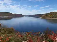 |
Pennsylvania 41.66°N 79.03°W |
USFS | Oct 30, 1984 | 24,149 acres (97.7 km2) | This conserves forests on both sides of a portion of the Allegheny Reservoir and a smaller separate area adjacent to the Allegheny River, featuring several hiking trails and campsites. Allegheny National Forest.[24] | |
| Amistad | 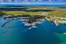 |
Texas 29.45°N 101.05°W |
NPS | Nov 28, 1990 | 62,945 acres (254.7 km2) | 1,267,900 | The 1969 Amistad Dam forms the Amistad Reservoir on the Rio Grande at the border with Mexico. Monarch butterflies migrate through the area every fall, and wildlife along the reservoir's shores includes javelina, mouflon and aoudad sheep, and blackbuck antelope. Clear water provides for excellent scuba diving, with complex caves for experts.[25] |
| Arapaho |  |
Colorado 40.14°N 105.81°W |
USFS | Oct 11, 1978 | 34,621 acres (140.1 km2) | This NRA adjacent to Rocky Mountain National Park has five reservoirs of the Colorado-Big Thompson Project, the largest of which is Lake Granby. The lakes are a popular place to boat and fish, camp and hike, and horseback ride. Ospreys and bald eagles are prevalent, among other wildlife of the Rocky Mountains. Arapaho-Roosevelt National Forest.[26] | |
| Bighorn Canyon | 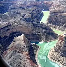 |
Montana, Wyoming 45.03°N 108.26°W |
NPS | Oct 15, 1966 | 120,296 acres (486.8 km2) | 249,659 | The Yellowtail Dam, completed in 1967, formed Bighorn Lake on the Bighorn River, which provide opportunities for wildlife viewing, hiking, boating, and trout fishing. Visitors can tour four historic ranches or cycle near the prehistoric Bad Pass Trail. Wild mustangs roam in the overlapping Pryor Mountains Wild Horse Range.[27] |
| Boston Harbor Islands | 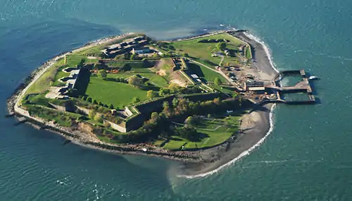 |
Massachusetts 42.31°N 70.94°W |
NPS | Nov 12, 1996 | 1,482 acres (6.0 km2) | 34 islands and peninsulas in Boston Harbor make an urban oasis with open space for hiking or tide pooling. Seasonal ferries and private boats provide access to America's second oldest lighthouse, Boston Light, and the Civil War-era Fort Warren. It is managed by a partnership that includes a Massachusetts state park of the same name.[28] | |
| Chattahoochee River |  |
Georgia 33.98°N 84.32°W |
NPS | Aug 15, 1978 | 12,509 acres (50.6 km2) | 3,393,133 | Fifteen sections of park land tightly follow the Chattahoochee River for 48 miles (77 km) below the Buford Dam. Each unit has hiking trails, but visitors can also float down the river in a canoe, kayak, or boat.[29] |
| Chickasaw |  |
Oklahoma 34.50°N 96.97°W |
NPS | Mar 17, 1976 | 9,898 acres (40.1 km2) | 1,422,612 | The original Platt National Park was a small but popular area of mineral springs donated by the Chickasaw people. The high-output springs form Travertine Creek, with several small waterfalls alongside trails. The Lake of the Arbuckles was dammed in 1966 and protected as Arbuckle NRA. It has a significant bass population and nearby campgrounds. The two were merged in 1976.[30] |
| Curecanti | .jpg.webp) |
Colorado 38.46°N 107.17°W |
NPS | Feb 11, 1965 | 43,590 acres (176.4 km2) | 836,034 | This lies around the Blue Mesa, Morrow Point and Crystal Reservoirs on the Gunnison River upriver of its Black Canyon. Visitors can take a guided boat tour on Morrow Point with views of waterfalls and the Curecanti Needle. All three reservoirs offer boating, camping, and hiking.[31] |
| Delaware Water Gap |  |
New Jersey, Pennsylvania 41.15°N 74.91°W |
NPS | Sep 1, 1965 | 68,708 acres (278.1 km2) | 3,374,865 | Originally intended to surround a reservoir formed by the Tocks Island Dam, it became a larger natural area around 40 miles (64 km) of the free-flowing Delaware River when the project was canceled. Historic hamlets that would have been inundated are open for tours. A biking and hiking trail runs the length of it parallel to the river, as does a segment of the Appalachian Trail. Rock climbers can scale cliffs of the Delaware Water Gap.[32] |
| Ed Jenkins | 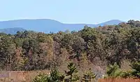 |
Georgia 34.63°N 84.2°W |
USFS | Dec 11, 1991 | 23,545 acres (95.3 km2) | Springer Mountain, the southern end of the Appalachian Trail, is the centerpiece of this portion of the Blue Ridge Mountains. Its forests protect streams of the Chattahoochee River watershed. Chattahoochee–Oconee National Forest. | |
| Flaming Gorge | _23-9-2014_12-49-13.JPG.webp) |
Wyoming, Utah 40.91°N 109.42°W |
USFS | Oct 1, 1968 | 189,817 acres (768.2 km2) | The Flaming Gorge Reservoir (Flaming Gorge Dam) was named for the bright red sandstone cliffs of this canyon of the Green River. It has several marinas and boat-in campsites. Ashley National Forest.[33] | |
| Gateway | 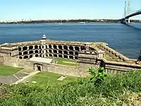 |
New York, New Jersey 40.45°N 73.99°W |
NPS | Oct 27, 1972 | 26,606 acres (107.7 km2) | 9,405,622 | This urban NRA has three segments around the Hudson–Raritan Estuary. At Sandy Hook in New Jersey, visitors can relax on seven beaches and tour Fort Hancock and Sandy Hook Light, the country's oldest.[34] Jamaica Bay in Brooklyn and Queens provides habitat for birds, turtles, and horseshoe crabs in its salt marshes, islands, and dunes. Several peninsulas around the bay offer beaches and park space, including Floyd Bennett Field, a repurposed airfield that has the only campground in New York City and several sporting facilities. On Staten Island the historic Fort Wadsworth guarded The Narrows for two centuries and Great Kills Park offers a beach, nature trails, and a marina. |
| Gauley River | 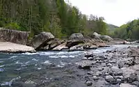 |
West Virginia 38.20°N 80.89°W |
NPS | Oct 26, 1988 | 11,565 acres (46.8 km2) | 119,282 | The 25 miles (40 km) of the Gauley River downstream of the Summersville Dam and 5 miles (8.0 km) of the Meadow River offer world-class whitewater rafting with Class V rapids six weekends in the fall when water is released from the dam. There are a few river access points for fishing.[35] |
| Glen Canyon | 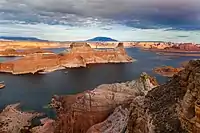 |
Utah, Arizona 36.99°N 111.48°W |
NPS | Oct 27, 1972 | 1,254,116 acres (5,075.2 km2) | 4,330,563 | The area around Lake Powell, formed by the Glen Canyon Dam on the Colorado River, is rich with sandstone formations where rivers eroded down sweeping canyons leaving scores of towering buttes, natural arches, and striated cliffs. Scenic vistas include Horseshoe Bend, Hole in the Rock, and Rainbow Bridge National Monument.[36] |
| Golden Gate |  |
California 37.80°N 122.46°W |
NPS | Oct 27, 1972 | 82,116 acres (332.3 km2) | 15,002,227 | Combining historic sites and beaches in San Francisco with the hills of the Marin Headlands and ridges of the San Francisco Peninsula, this NRA is the most visited unit of the National Park System. The urban waterfront area includes for history buffs the penitentiary of Alcatraz Island, the Presidio of San Francisco, the Sutro Baths ruins, and Fort Point. Across the Golden Gate hikers can wander through wooded valleys and among coast redwoods of Muir Woods National Monument.[37] |
| Grand Island |  |
Michigan 46.50°N 86.66°W |
USFS | May 17, 1990 | 13,571 acres (54.9 km2) | Grand Island is in Lake Superior and accessible by a short ferry from the Upper Peninsula near Pictured Rocks National Lakeshore. Sandy beaches are reached by hiking or mountain biking on trails along coastal cliffs. Hiawatha National Forest.[38] | |
| Hells Canyon | .jpg.webp) |
Oregon, Idaho 45.6°N 116.5°W |
USFS | Dec 31, 1975 | 661,097 acres (2,675.4 km2) | Hells Canyon is the deepest river gorge in North America, with the east rim reaching up to 8,043 ft (2,452 m) above the Snake River. Whitewater rafters paddle downstream of the Hells Canyon Dam as hikers look down from scenic overlooks on rim trails. Historic sites include Nez Perce petroglyphs on canyon walls, gold mining piles, and homestead ranches. Wallowa–Whitman National Forest, Nez Perce National Forest, Payette National Forest.[39] | |
| Jemez | .jpg.webp) |
New Mexico 35.77°N 106.68°W |
USFS | Oct 12, 1993 | 57,732 acres (233.6 km2) | Part of the homeland of the Jemez Pueblo people, this NRA sits among red rock canyons, cliffs, and mesas in the Jemez Mountains. Colorful cottonwood and aspen trees stand over river fishing sites and hiking trails. Waterfalls, hot springs, and campsites are mainly along the Jemez River near the Valles Caldera. Santa Fe National Forest.[40] | |
| Lake Chelan |  |
Washington 48.32°N 120.67°W |
NPS | Oct 2, 1968 | 61,946 acres (250.7 km2) | 38,785 | Part of the North Cascades National Park Complex along with Ross Lake NRA, this is nestled around the Stehekin Valley at the north end of Lake Chelan. It is accessible only by ferry up the lake to Stehekin, where there are campgrounds and cabins, or backpacking on the Pacific Crest Trail.[41] |
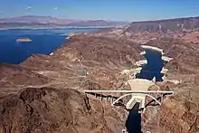
| Lake Mead | 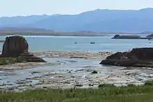 |
Nevada, Arizona 36.07°N 114.80°W |
NPS | Oct 8, 1964 | 1,495,815 acres (6,053.3 km2) | 7,499,049 | Lake Mead (Hoover Dam) and Lake Mohave (Davis Dam) are surrounded by three major desert ecosystems with slot canyons, summits, and bluffs among sandstone rocks. The lakes and Colorado River allow for canoeing, boating, fishing, and scuba diving, with access at nine harbors. Hikers can reach ruined mines and the formerly submerged town of St. Thomas. Nine A portion is also part of Grand Canyon–Parashant National Monument.[42] |
| Lake Meredith | 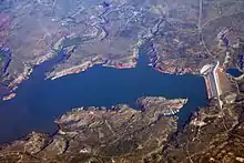 |
Texas 35.71°N 101.55°W |
NPS | Nov 28, 1990 | 44,977 acres (182.0 km2) | 1,328,340 | Lake Meredith on the Canadian River in the Texas Panhandle offers five hiking trails, 5 mi (8.0 km) of mountain biking trails, ATV areas, and horseback riding. The shortgrass prairie ecosystem is home to the Texas horned lizard, collared lizard, greater roadrunner, and painted bunting. The adjacent Alibates Flint Quarries National Monument shows the area's unique geology of agatized dolomite.[43] |
| Lake Roosevelt | .jpg.webp) |
Washington 48.09°N 118.31°W |
NPS | Jan 1, 1997 | 100,390 acres (406.3 km2) | 1,358,818 | Franklin D. Roosevelt Lake extends 150 miles (240 km) up the Columbia and Spokane Rivers from the Grand Coulee Dam, the largest power plant in the country. There are several campgrounds along the shores opposite the Colville and Spokane Indian Reservations, providing access for boating and fishing. The 1847 St. Paul's Mission near the former Kettle Falls and Fort Spokane provide interpretation of the history of the tribes, the Army, and missionaries.[44][45] |
| Land Between The Lakes |  |
Kentucky, Tennessee 36.85°N 88.07°W |
USFS | Oct 21, 1998 | 171,290 acres (693.2 km2) | Situated between 35 mi (56 km) of the parallel reservoirs Lake Barkley (Barkley Dam) and Kentucky Lake (Kentucky Dam), this large inland peninsula has more than 300 mi (480 km) of shoreline and 500 mi (800 km) of hiking, horse, and biking trails. This mostly flat forested area features an area with elk and bison, a historic working farm, a planetarium, and nature center.[46] | |
| Moosalamoo |  |
Vermont 43.91°N 73.01°W |
USFS | Dec 1, 2006 | 15,914 acres (64.4 km2) | This area around Mount Moosalamoo features a network of hiking trails and a lakeside campground in the Green Mountains. Green Mountain National Forest.[47] | |
| Mount Baker |  |
Washington 48.71°N 121.83°W |
USFS | July 3, 1984 | 8,789 acres (35.6 km2) | Hikers can traverse the south slope of Mount Baker to alpine campsites and a fire lookout. Snowmobiles can be ridden in the Schriebers Meadow area, unlike in the adjacent Mount Baker Wilderness. Mount Baker–Snoqualmie National Forest.[48] | |
| Mount Hood | .jpg.webp) |
Oregon 45.26°N 121.66°W |
USFS | Mar 30, 2009 | 34,598 acres (140.0 km2) | This NRA has three sections to the south and east of Mount Hood. The Pacific Crest Trail and Barlow Road pass through the largest section, which has parts of two wilderness areas. One includes a segment of Fifteenmile Creek, and it and the third feature mountain biking trails. Mount Hood National Forest.[49][50] | |
| Mount Rogers | 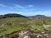 |
Virginia 36.64°N 81.58°W |
USFS | May 31, 1966 | 154,919 acres (626.9 km2) | This area based around Virginia's highest point, Mount Rogers, has more than 500 mi (800 km) of hiking trails, including part of the Appalachian Trail. It features four wilderness areas among the spruce-fir forests and the Mount Rogers Crest Zone. George Washington and Jefferson National Forests.[51][52] | |
| Oregon Dunes | 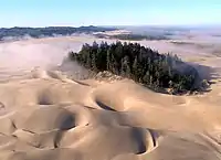 |
Oregon 43.72°N 124.17°W |
USFS | Mar 23, 1972 | 34,364 acres (139.1 km2) | The Oregon Dunes are the largest coastal sand dunes in North America, covering around 7,000 acres (28 km2) of a 40 mi (64 km) stretch of the Oregon Coast. Formed by thousands of years of wind and waves, the dunes offer off-road vehicle use, hiking, camping, and birdwatching. It is a protected nesting site for the western snowy plover. Siuslaw National Forest.[53] | |
| Pine Ridge | 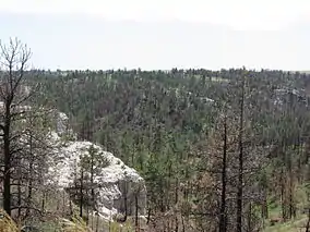 |
Nebraska 42.62°N 103.12°W |
USFS | Oct 21, 1986 | 6,636 acres (26.9 km2) | This small backcountry area with no roads or facilities offers non-motorized activities through a hilly ponderosa pine forest. Nebraska National Forest.[54] | |
| Rattlesnake | 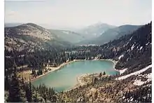 |
Montana 46.95°N 113.92°W |
USFS | Oct 19, 1980 | 60,104 acres (243.2 km2) | A network of trails traverse the peaks of the Rattlesnake Mountains, with forested ridges, alpine lakes, and open slopes. The pine-spruce-fir ecosystem is home to elk, white-tailed deer, mountain goat, and grizzly bear, as well as several species of orchid. About half is protected by the Rattlesnake Wilderness. Lolo National Forest.[55] | |
| Robert T. Stafford White Rocks | 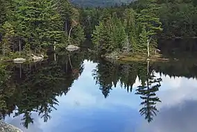 |
Vermont 43.38°N 72.91°W |
USFS | June 19, 1984 | 36,563 acres (148.0 km2) | Named for Senator Robert Stafford, this roadless part of the Green Mountains has the Big Branch and Peru Peak Wilderness areas. The white rocks are slopes of deposited Cheshire quartzite revealed by glaciers during the Ice Age. It has 30 mi (48 km) of the Appalachian Trail and Vermont's Long Trail, several forested peaks with ponds, and snowmobile routes. Green Mountain National Forest.[56] | |
| Ross Lake | 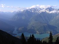 |
Washington 48.67°N 121.24°W |
NPS | Oct 2, 1968 | 117,574 acres (475.8 km2) | 1,088,528 | Part of the North Cascades National Park Complex along with Lake Chelan NRA, this surrounds the three reservoirs of Seattle City Light's Skagit River Hydroelectric Project: Gorge Lake, Diablo Lake, and Ross Lake, which extends into Canada. There are many boat-in backcountry campsites, and the surrounding mountains of the Cascades offer rugged hikes and mountaineering[41] |
| Santa Monica Mountains | .jpg.webp) |
California 34.10°N 118.60°W |
NPS | Nov 10, 1978 | 157,698 acres (638.2 km2) | 707,566 | This collaboration between five California state parks, local public park lands, and NPS properties spans the Santa Monica Mountains characterized by chaparral and woodlands. Trails lead hikers, mountain bikers, and horseback riders from beaches through scrub valleys to peak views of the ocean. The 70 mi (110 km) Backbone Trail and the scenic Mulholland Drive traverse ridges along the width of the park.[57] |
| Sawtooth | 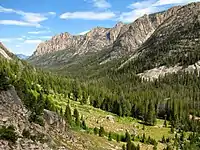 |
Idaho 44.00°N 114.7°W |
USFS | Aug 22, 1972 | 753,819 acres (3,050.6 km2) | The jagged Sawtooth Range and White Cloud, Boulder, and Smoky Mountains have more than 300 Alpine lakes among their peaks. More than 700 mi (1,100 km) of trails connect hikers from three dozen developed campgrounds to grasslands and forests home to at least 70 mammal species and 200 bird species. Sawtooth National Forest, Challis National Forest, Boise National Forest.[58] | |
| Smith River | 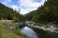 |
California 41.91°N 123.86°W |
USFS | Nov 16, 1990 | 329,827 acres (1,334.8 km2) | The Smith River and its tributaries, one of the longest National Wild and Scenic Rivers, run through this portion of the Klamath Mountains, offering fishing, rafting, and swimming. Trails lead to Darlingtonia pitcher plant groves in serpentine bogs and other unique botanical areas. Six Rivers National Forest.[59] | |
| Spring Mountains |  |
Nevada 36.27°N 115.69°W |
USFS | Aug 4, 1993 | 321,708 acres (1,301.9 km2) | Nevada's highest point, Mount Charleston, and its wilderness area have several snow-capped peaks rising above the desert. Summer visitors can hike loop trails to the summit, and in winter they can ski and snowboard at the Lee Canyon Resort. Humboldt–Toiyabe National Forest.[60] | |
| Spruce Knob-Seneca Rocks |  |
West Virginia 38.83°N 79.36°W |
USFS | Sep 28, 1965 | 99,824 acres (404.0 km2) | Spruce Knob is the highest point in West Virginia, with wide views of the Alleghenies from an observation tower. The Seneca Rocks is a steep cliff on the River Knobs ridge with premier technical rock climbing. The 20 mi (32 km)-long Smoke Hole Canyon was formed by the South Branch Potomac River parallel to the ridge of North Fork Mountain. Monongahela National Forest.[61] | |
| Whiskeytown–Shasta–Trinity | 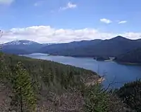 |
California 40.62°N 122.55°W |
NPS, USFS | Oct 21, 1972 | 244,814 acres (990.73 km2) (42,503 acres (172.0 km2) NPS, 202,311 acres (818.72 km2) USFS) |
687,159 (NPS) | In the Trinity Mountains, the Whiskeytown Lake unit (NPS) has four major waterfalls and a historic mining district from the California Gold Rush, when prospectors displaced the Wintu people. The Shasta Lake (Shasta Dam) and Trinity Lake (Trinity Dam) units (USFS) are known for trout fishing, watersports, and scenic views. Significant species include bald eagles, northern spotted owls, Pacific giant salamander, and Howell's alkali grass. Shasta–Trinity National Forest.[62][63] |
| White Mountains | .jpg.webp) |
Alaska 65.4°N 147.81°W |
BLM | Dec 2, 1980 | 1,000,000 acres (4,046.9 km2) | This vast area north of Fairbanks provides access to isolated hiking and camping among the White Mountains and fishing and floating on Beaver Creek. Groomed winter trails are used for skiing, dog sledding, and snowmobiling to remote cabins. Treasure-seekers can even pan for gold along Nome Creek.[64] | |
| Winding Stair Mountain | .jpg.webp) |
Oklahoma 34.74°N 94.78°W |
USFS | Oct 18, 1988 | 26,617 acres (107.7 km2) | The ridge of the Winding Stair Mountains runs the length of this NRA. It is traversed by the Talimena Scenic Drive and Ouachita National Recreation Trail, with scenic viewpoints along the way. Ouachita National Forest.[65] |
See also
- List of areas in the United States National Park System: National recreation areas
- Recreational Demonstration Area
- Protected areas of the United States
- List of national parks of the United States
- List of national monuments of the United States
- List of national memorials of the United States
- List of national lakeshores and seashores of the United States
References
- "Stats Report Viewer". irma.nps.gov. Retrieved April 18, 2019.
- "The National Park and U.S. Forest Services" (PDF).
- "Land Areas of the National Forest System" (PDF). U.S. Forest Service. September 30, 2017. p. 197. Retrieved January 17, 2021.
- "Listing of Acreage (Summary)" (PDF). NPS Stats. National Park Service. December 31, 2020. Retrieved January 25, 2021.
- Dodd, Douglas W. (December 1, 2006). "Boulder Dam Recreation Area: The Bureau of Reclamation, the National Park Service, and the Origins of the National Recreation Area Concept at Lake Mead, 1929-1936". Southern California Quarterly. 88 (4): 431–473. doi:10.2307/41172340. ISSN 0038-3929.
- "NPS Archeology Program: Antiquities Act Centennial". National Park Service. Retrieved December 12, 2020.
- "Administrative Policies for the Recreation Areas of the National Park System (General)". National Park Service. August 1968. Retrieved December 12, 2020.
- Hohmann, Heidi (June 21, 2016). "Solving the "Recreation Problem": The Development of the National Recreation Area". National Park Service. Retrieved January 18, 2021.
- Mackintosh, Barry. "Former National Park System Units: An Analysis". National Park Service. Retrieved December 12, 2020.
- Steen, Harold K. (December 1, 2013). The U.S. Forest Service: A Centennial History. University of Washington Press. ISBN 978-0-295-80348-7.
- West, Terry L. (July 1992). "Centennial Mini-Histories of the Forest Service (Chapter 24)". United States Department of Agriculture: Forest Service. Retrieved December 21, 2020.
- "Executive Order 11017—Providing for Coordination With Respect to Outdoor Recreation Resources and Establishing the Recreation Advisory Council". The American Presidency Project. April 27, 1962. Retrieved December 12, 2020.
- "Federal Executive Branch Policy Governing the Selection, Establishment, and Administration of National Recreation Areas by the Recreation Advisory Council, Circular No. 1, March 26, 1963". National Park Service. Retrieved December 12, 2020.
- Mackintosh, Barry (2005). The National Parks: Shaping the System. U.S. Department of the Interior. pp. 75–95. ISBN 978-0-912627-73-1.
- "Administrative Policies for the Recreation Areas of the National Park System". National Park Service. August 1968. Retrieved December 12, 2020.
- "Cuyahoga Valley National Park". National Geographic – Travel. November 15, 2015. Retrieved December 12, 2020.
- "Mapping the Land and Water Conservation Fund (LWCF) | The Wilderness Society". www.wilderness.org. Retrieved December 13, 2020.
- "National Forests: Funding the Sawtooth National Recreation Area" (PDF). U.S. General Accounting Office. February 1999. Retrieved January 1, 2021.
- "Recreation: National Recreation Areas at Bureau of Reclamation Federal Water Projects". Bureau of Reclamation. October 19, 2017. Retrieved December 21, 2020.
- 36 CFR 2.2
- "Here's Where You Can Hunt And Trap In The National Park System". National Parks Traveler. Retrieved December 12, 2020.
- "Other Congressionally Designated Areas". US Forest Service. Retrieved December 5, 2020.
- The National Parks: Index 2012–2016 (PDF). Washington, D.C.: National Park Service. Archived (PDF) from the original on November 13, 2018. Retrieved November 19, 2018.
- "Allegheny National Recreation Area". U.S. Forest Service. Retrieved December 7, 2020.
- "Amistad National Recreation Area". National Park Service. Retrieved December 7, 2020.
- "Arapaho National Recreation Area". U.S. Forest Service. Retrieved December 7, 2020.
- "Bighorn Canyon National Recreation Area". National Park Service. Retrieved December 7, 2020.
- "Boston Harbor Islands National Recreation Area". National Park Service. Retrieved December 7, 2020.
- "Chattahoochee National Recreation Area". National Park Service. Retrieved December 7, 2020.
- "Chickasaw National Recreation Area". National Park Service. Retrieved December 7, 2020.
- "Curecanti National Recreation Area". National Park Service. Retrieved December 7, 2020.
- "Delaware Water Gap National Recreation Area". National Park Service. Retrieved December 7, 2020.
- "Flaming Gorge National Recreation Area". U.S. Forest Service. Retrieved December 7, 2020.
- "Gateway National Recreation Area". National Park Service. Retrieved December 7, 2020.
- "Gauley River National Recreation Area". National Park Service. Retrieved December 7, 2020.
- "Glen Canyon National Recreation Area". National Park Service. Retrieved December 7, 2020.
- "Golden Gate National Recreation Area". National Park Service. Retrieved December 7, 2020.
- "Grand Island National Recreation Area". U.S. Forest Service. Retrieved December 7, 2020.
- "Hells Canyon National Recreation Area". U.S. Forest Service. Retrieved December 7, 2020.
- "Jemez Ranger District". U.S. Forest Service. Retrieved December 7, 2020.
- "North Cascades National Park". National Park Service. Retrieved December 7, 2020.
- "Lake Mead National Recreation Area". National Park Service. Retrieved December 7, 2020.
- "Lake Meredith Recreation Area". National Park Service. Retrieved December 7, 2020.
- "Lake Roosevelt National Recreation Area". National Park Service. Retrieved December 7, 2020.
- Lake Roosevelt National Recreation Area, General Management Plan: Environmental Impact Statement. National Park Service. 1999. pp. 141–143.
- "Land Between the Lakes National Recreation Area". Land Between the Lakes. Retrieved December 7, 2020.
- "Moosalamoo National Recreation Area". U.S. Forest Service. Retrieved December 7, 2020.
- "Mount Baker National Recreation Area". U.S. Forest Service. Retrieved December 7, 2020.
- "16 USC § 460uuu - Mount Hood National Recreation Area". Cornell University Law School. Retrieved April 30, 2012.
- Kloster, Tom (March 30, 2010). "The New Mount Hood National Recreation Area". WyEast Blog. Retrieved January 18, 2021.
- "Mount Rogers National Recreation Area". U.S. Forest Service. Retrieved December 7, 2020.
- "Mount Rogers National Recreation Area (detail)". U.S. Forest Service. Retrieved December 7, 2020.
- "Oregon Dunes National Recreation Area". U.S. Forest Service. Retrieved December 7, 2020.
- "Pine Ridge National Recreation Area". U.S. Forest Service. Retrieved December 7, 2020.
- "Rattlesnake National Recreation Area". U.S. Forest Service. Retrieved December 7, 2020.
- "Robert T. Stafford White Rocks National Recreation Area". U.S. Forest Service. Retrieved December 7, 2020.
- "Santa Monica Mountains National Recreation Area". National Park Service. Retrieved December 7, 2020.
- "Sawtooth National Recreation Area". U.S. Forest Service. Retrieved December 7, 2020.
- "Smith River National Recreation Area". U.S. Forest Service. Retrieved December 7, 2020.
- "Spring Mountains National Recreation Area". U.S. Forest Service. Retrieved December 7, 2020.
- "Spruce Knob-Seneca Rocks National Recreation Area". U.S. Forest Service. Retrieved December 7, 2020.
- "Whiskeytown National Recreation Area". National Park Service. Retrieved December 7, 2020.
- "Shasta–Trinity National Recreation Area". U.S. Forest Service. Retrieved December 7, 2020.
- "White Mountains National Recreation Area". Bureau of Land Management. Retrieved December 7, 2020.
- "Winding Stair Mountain National Recreation Area". U.S. Forest Service. Retrieved December 7, 2020.
External links
| Wikimedia Commons has media related to National recreation areas of the United States. |
- National Park System
- Other Congressionally Designated Areas – US Forest Service