Nebraska Highway 41
Nebraska Highway 41 is a highway in Nebraska. It runs for a length of 103.53 miles (166.62 km) in a west-to-east direction. Its western terminus is in Clay Center at an intersection with Nebraska Highway 14 and Nebraska Spur 18D. Its eastern terminus is at an intersection with Nebraska Highway 50 north of Tecumseh.
| ||||
|---|---|---|---|---|
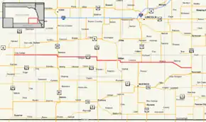 Nebraska Highway 41 highlighted in red | ||||
| Route information | ||||
| Maintained by NDOT | ||||
| Length | 103.57 mi[1] (166.68 km) | |||
| Existed | 1926[2]–present | |||
| Major junctions | ||||
| West end | ||||
| East end | ||||
| Location | ||||
| Counties | Clay, Fillmore, Saline, Gage, Johnson | |||
| Highway system | ||||
| ||||

Route description
Nebraska Highway 41 begins in Clay Center at an intersection with Nebraska Highway 14 and Nebraska Spur 18D. It goes east out of Clay Center into farmland until Geneva. In Geneva, it runs on an old alignment of U.S. Highway 81. It meets US 81 just east of Geneva and continues east until meeting Nebraska Highway 15. The two highways overlap for 2 miles (3.2 km). It turns east and at Wilber, meets Nebraska Highway 103. It continues east through Clatonia and briefly overlaps U.S. Highway 77. It continues east and meets Nebraska Highway 43 at Adams. Highway 41 continues east until Sterling, where it then angles southeasterly until St. Mary. After St. Mary, the highway turns straight east again and ends at Nebraska Highway 50 north of Tecumseh.[1][3]
Major intersections
| County | Location | mi[1] | km | Destinations | Notes |
|---|---|---|---|---|---|
| Clay | Clay Center | 0.00 | 0.00 | Western terminus | |
| Fillmore | Geneva | 25.02 | 40.27 | ||
| Milligan | 35.83 | 57.66 | |||
| Saline | | 46.82 | 75.35 | West end of N-15 overlap | |
| | 48.83 | 78.58 | East end of N-15 overlap | ||
| Swanton | 53.83 | 86.63 | |||
| Wilber | 60.37 | 97.16 | |||
| Gage | | 73.04 | 117.55 | West end of US 77 overlap | |
| | 74.54 | 119.96 | East end of US 77 overlap | ||
| Firth | 79.83 | 128.47 | |||
| Adams | 85.11 | 136.97 | |||
| 85.55 | 137.68 | ||||
| Johnson | | 103.57 | 166.68 | Eastern terminus | |
1.000 mi = 1.609 km; 1.000 km = 0.621 mi
| |||||
References
- "Nebraska Highway Reference Log Book" (PDF). Nebraska Department of Roads. 2015. pp. 136–138. Retrieved January 7, 2017.
- "The Nebraska Highways Page: Highways 31 to 60". Archived from the original on 2007-02-08. Retrieved 2007-10-16.
- Google (2010-11-09). "overview of Nebraska Highway 41" (Map). Google Maps. Google. Retrieved 2010-11-09.