Fillmore County, Nebraska
Fillmore County is one of 93 counties in the U.S. state of Nebraska. As of the 2010 United States Census, the population was 5,890.[1] Its county seat is Geneva.[2] The county was named for President Millard Fillmore.
Fillmore County | |
|---|---|
| County of Fillmore | |
.jpg.webp) Fillmore County Courthouse in Geneva | |
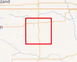
Interactive map of Fillmore County | |
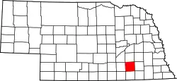 Location within the U.S. state of Nebraska | |
| Country | |
| State | |
| Established | January 26, 1856 |
| Organized | May 27, 1871 |
| Named for | Millard Fillmore |
| County seat | Geneva |
| Largest city | Geneva |
| Area | |
| • Total | 577 sq mi (1,490 km2) |
| • Land | 575 sq mi (1,490 km2) |
| • Water | 1.2 sq mi (3 km2) 0.2% |
| Highest elevation | 1,555 ft (474 m) |
| Lowest elevation | 1,171 ft (357 m) |
| Population | |
| • Estimate (2017) | 5,582 |
| • Density | 9.7/sq mi (3.7/km2) |
| Time zone | UTC−6 (Central) |
| • Summer (DST) | UTC−5 (CDT) |
| Area code | 402/531 |
| FIPS code | 31059 |
| GNIS feature ID | 835851 |
| Website | www.fillmorecounty.org |
In the Nebraska license plate system, Fillmore County is represented by the prefix 34 (it had the thirty-fourth largest number of vehicles registered in the county when the license plate system was established in 1922).
History
Fillmore County was established, and its boundaries defined, by the Nebraska Territorial Legislature in 1856. It was named for Millard Fillmore, the thirteenth president of the United States, who had left office in 1853.[3][4]
The first homesteaders arrived in the county in 1866. Ohio natives William O. Bussard and William C. Whitaker filed claims on the West Fork of the Big Blue River in the county's northeastern portion.[5][6] Settlement of the area was slow until 1870;[7] it was concentrated in the county's northern part, in part because the surveyed route of the Burlington and Missouri River Railroad ran through York County just north of the present-day York-Fillmore county line.[8] In 1870, Fillmore City, the county's first town, was established on the Big Blue about four miles (6 km) north of present-day Grafton;[8][9] in 1871, the county's first post office opened in Fillmore City.[10]
In 1871, the Burlington and Missouri laid its tracks through the area. A recent change in federal law allowed them to alter their route, shifting it about five miles (8 km) south of their original surveyed path. This placed the route on more level country, reducing the cost of cutting and bridging; it also shifted the line from York County to northern Fillmore County.[8]
The county was formally organized in 1871;[11] up to this time, it had been administered from, and taxed by, Saline County, its neighbor to the east. In April, an election was held to choose officers to organize the county; at this time, it was decided to place the county seat in the county's center. The town site was surveyed and platted, and given the name "Henry". It could not be occupied, since it was on school land owned by the State; an act of the Legislature was necessary before the land could be sold.[10][12][13]
The Legislature passed a bill in the summer of 1872 to allow sale of the school lands. At about that time, the new county seat's name was changed from "Henry" to "Geneva", at the suggestion of the daughter of a local settler, who wanted it named after her family's old home of Geneva, Illinois.[10][14][15]
The county grew rapidly through the first years of the 1870s. Three towns were established along the Burlington line; in keeping with the railroad's practice of naming their towns alphabetically, they were dubbed Exeter, Fairmont, and Grafton.[16] By 1873, the entire county had been "thickly settled".[10] Its growth suffered a check in the mid-1870s, due to the worldwide depression following the Panic of 1873 and an infestation of grasshoppers in the late summer of 1874.[10][17]
As additional railroad lines were constructed through the county, new towns were established. In about 1886, the Burlington built a branch line from Beatrice to Holdrege, running east–west through southern Fillmore County; Shickley, Strang, and Ohiowa were founded on or near the route. A north–south line connected this branch to the Burlington's main line, running from Strang to Fairmont.[18][19][20][21] Milligan was established in 1887, on the Kansas City and Omaha line.[22][23]
Several ethnic European enclaves developed during the time of the county's homesteading. An extensive Czech settlement covered much of Saline County and extended into eastern Fillmore County, including Milligan.[24] A concentration of Swedish immigrants developed in eastern Clay County, extending into southwestern Fillmore County in the area between Shickley and Ong.[25] German settlements formed in both the county's southeastern and southwestern corners.[10]
Geography
According to the US Census Bureau, the county has an area of 577 square miles (1,490 km2), of which 575 square miles (1,490 km2) is land and 1.2 square miles (3.1 km2) (0.2%) is water.[26]
The county lies within the watershed of the Big Blue River. Water in the county drains via the West Fork of the Big Blue; via Turkey Creek, which runs into the Big Blue near De Witt, Nebraska; and via the Little Blue, which joins the Big Blue in Kansas.[27]
Fillmore County lies within the eastern portion of Nebraska's loess plain, a region of soil deposited by the wind between 25,000 and 13,000 years ago, forming a plain that slopes to the southeast. The Big Blue and its tributaries have incised channels into the loess surface in places, but in much of the county the original plain remains. These loess-plain regions are characterized by extensive upland flats with shallow depressions, lined with fine-grained and relatively impermeable silt, and tend to form shallow ephemeral wetlands when filled with rain or snowmelt; such wetlands range in area from less than 40 acres (16 ha) to more than 500 acres (200 ha).[28]
The county's surface is underlain by Cretaceous sedimentary bedrock, topped with unconsolidated Quaternary sediments. The bedrock was eroded into hills and valleys before the deposition of the overlying sediments, so the thickness of the latter varies. The unconsolidated sediments range in thickness from 60 to 450 feet (18 to 137 m); they form an aquifer whose saturated zone ranges in thickness from 20 to 350 feet (6.1 to 106.7 m).[29]
Adjacent counties
- York County – north
- Seward County – northeast
- Saline County – east
- Jefferson County – southeast
- Thayer County – south
- Nuckolls County – southwest
- Clay County – west
- Hamilton County – northwest
Protected areas
- Bluebill State Wildlife Management Area[30]
- Marsh Hawk State Wildlife Management Area[31]
- Morphy Lagoon National Wildlife Management Area[32]
- Rauscher Lagoon National Wildlife Management Area[33]
- Redhead Wildlife Management Area[34]
- Rolland Lagoon National Wildlife Management Area[35]
- Sandpiper State Wildlife Management Area[36]
- Sora Wildlife Management Area[37]
Demographics
| Historical population | |||
|---|---|---|---|
| Census | Pop. | %± | |
| 1870 | 238 | — | |
| 1880 | 10,204 | 4,187.4% | |
| 1890 | 16,022 | 57.0% | |
| 1900 | 15,087 | −5.8% | |
| 1910 | 14,674 | −2.7% | |
| 1920 | 13,671 | −6.8% | |
| 1930 | 12,971 | −5.1% | |
| 1940 | 11,417 | −12.0% | |
| 1950 | 9,610 | −15.8% | |
| 1960 | 9,425 | −1.9% | |
| 1970 | 8,137 | −13.7% | |
| 1980 | 7,920 | −2.7% | |
| 1990 | 7,103 | −10.3% | |
| 2000 | 6,634 | −6.6% | |
| 2010 | 5,890 | −11.2% | |
| 2017 (est.) | 5,582 | [38] | −5.2% |
| US Decennial Census[39] 1790-1960[40] 1900-1990[41] 1990-2000[42] 2010-2013[1] | |||
As of the 2000 United States Census,[43] there were 6,634 people, 2,689 households, and 1,801 families in the county. The population density was 12 people per square mile (4/km2). There were 2,990 housing units at an average density of 5 per square mile (2/km2). The racial makeup of the county was 97.75% White, 0.21% Black or African American, 0.44% Native American, 0.06% Asian, 0.02% Pacific Islander, 0.83% from other races, and 0.69% from two or more races. 1.66% of the population were Hispanic or Latino of any race. 48.6% were of German, 10.4% Czech, 7.1% Irish and 7.0% English ancestry.
There were 2,689 households, out of which 30.20% had children under the age of 18 living with them, 59.10% were married couples living together, 5.00% had a female householder with no husband present, and 33.00% were non-families. 30.20% of all households were made up of individuals, and 16.30% had someone living alone who was 65 years of age or older. The average household size was 2.37 and the average family size was 2.95.
The county population contained 26.30% under the age of 18, 5.10% from 18 to 24, 24.00% from 25 to 44, 23.30% from 45 to 64, and 21.30% who were 65 years of age or older. The median age was 41 years. For every 100 females there were 93.50 males. For every 100 females age 18 and over, there were 91.30 males.
The median income for a household in the county was $35,162, and the median income for a family was $41,725. Males had a median income of $29,813 versus $18,507 for females. The per capita income for the county was $17,465. About 4.80% of families and 7.80% of the population were below the poverty line, including 8.20% of those under age 18 and 10.00% of those age 65 or over.
Transportation
- U.S. Route 81 – enters from Thayer County; runs northward into York County.
- U.S. Route 6 runs east–west across the northern part of the county.
- Nebraska Highway 41 runs east–west across the central portion of the county.
- Nebraska Highway 74 runs east–west through the southern part of the county.[44]
- BNSF Railway – runs east–west across northern Fillmore County, passing Exeter, Fairmont, and Grafton.[45][46]
In the Nebraska license plate system, Fillmore County is represented by the prefix 34: when the state began using county numbers on its license plates in 1922, it had the 34th-largest number of registered vehicles.[47][48]
Communities
City
- Geneva (county seat)
Politics
Fillmore County voters have been reliably Republican since the beginning, selecting the Republican Party candidate in 80% of national elections (as of 2016).
| Year | Republican | Democratic | Third Parties |
|---|---|---|---|
| 2016 | 72.4% 2,130 | 20.8% 613 | 6.7% 198 |
| 2012 | 69.7% 2,007 | 28.0% 807 | 2.3% 65 |
| 2008 | 64.9% 1,913 | 32.6% 962 | 2.4% 72 |
| 2004 | 72.5% 2,314 | 25.9% 828 | 1.6% 51 |
| 2000 | 67.5% 2,024 | 28.3% 848 | 4.2% 126 |
| 1996 | 54.8% 1,696 | 34.2% 1,058 | 11.0% 341 |
| 1992 | 42.9% 1,501 | 28.3% 990 | 28.8% 1,005 |
| 1988 | 57.2% 1,955 | 42.0% 1,435 | 0.8% 28 |
| 1984 | 70.5% 2,474 | 28.7% 1,009 | 0.8% 28 |
| 1980 | 65.0% 2,435 | 27.4% 1,025 | 7.6% 286 |
| 1976 | 57.2% 2,098 | 40.6% 1,489 | 2.3% 84 |
| 1972 | 66.4% 2,511 | 33.6% 1,270 | |
| 1968 | 59.6% 2,213 | 34.9% 1,297 | 5.5% 203 |
| 1964 | 43.7% 1,936 | 56.3% 2,497 | |
| 1960 | 61.1% 2,842 | 38.9% 1,810 | |
| 1956 | 66.9% 3,137 | 33.1% 1,549 | |
| 1952 | 74.8% 3,603 | 25.2% 1,216 | |
| 1948 | 58.5% 2,677 | 41.5% 1,896 | |
| 1944 | 65.3% 3,362 | 34.7% 1,788 | |
| 1940 | 65.1% 3,677 | 34.9% 1,969 | |
| 1936 | 47.2% 2,858 | 52.0% 3,154 | 0.8% 50 |
| 1932 | 37.0% 2,178 | 62.2% 3,655 | 0.8% 48 |
| 1928 | 60.6% 3,479 | 38.9% 2,235 | 0.6% 32 |
| 1924 | 51.5% 2,758 | 40.3% 2,156 | 8.2% 437 |
| 1920 | 63.4% 2,803 | 35.1% 1,549 | 1.5% 67 |
| 1916 | 44.0% 1,561 | 53.8% 1,911 | 2.3% 80 |
| 1912 | 26.9% 972 | 48.0% 1,736 | 25.1% 907 |
| 1908 | 46.1% 1,756 | 52.2% 1,989 | 1.7% 64 |
| 1904 | 56.7% 1,980 | 24.0% 837 | 19.3% 675 |
| 1900 | 49.6% 1,883 | 49.0% 1,860 | 1.4% 53 |
Notes
- "State & County QuickFacts". US Census Bureau. Archived from the original on June 7, 2011. Retrieved September 19, 2013.
- "Find a County". National Association of Counties. Archived from the original on May 31, 2011. Retrieved 7 June 2011.
- Perkey (2003), p. 67.
- Gannett, Henry (1905). The Origin of Certain Place Names in the United States. Govt. Print. Off. p. 125.
- Gaffney (1968), p. 1; the Bussard and Whitaker homesteads were located on Section 8, Township 8, Range 3 West of the sixth principal meridian.
- "1871 Fillmore County 1971". Nebraska State Historical Society. Retrieved 1 May 2013.
- "Archives Record: Fillmore County, Nebraska". Nebraska State Historical Society. Retrieved 1 May 2013.
- Gaffney (1968), p. 3.
- "Grafton - Fillmore County". Nebraska... Our Towns. Archived 2011-11-23 at the Wayback Machine Retrieved 1 May 2013.
- Fillmore County, Part 1. Andreas's History of the State of Nebraska. Retrieved 2 May 2013.
- Fitzpatrick, Lilian Linder (1925). Nebraska Place-Names. Lincoln: University of Nebraska Studies in Language, Literature, and Criticism. p. 59. Retrieved December 14, 2014.
- Gaffney (1968), pp. 4-5.
- Fillmore County, Part 3. Andreas's History of the State of Nebraska. Retrieved 2 May 2013.
- Gaffney (1968), p. 5.
- Sources differ on the source of Geneva's name. Lilian Linder Fitzpatrick, "Nebraska Place-Names", 1925, p. 59, states that it was named after Geneva, New York. Gaffney (1968), p. 5., and Perkey (2003), p. 68, state that Geneva, Illinois was the namesake. Perkey's introduction (p. v) states that he was motivated by Fitzpatrick's work; this suggests that he was aware of the New York hypothesis, and had some reason for choosing Illinois instead.
- Cordes, Henry J. "A railroad history lesson: Union Pacific and Burlington Northern". Brotherhood of Locomotive Engineers and Trainmen; originally appeared in Omaha World-Herald, 8 November 2009. Retrieved 8 May 2013. The three towns listed formed part of a sequence: Crete, Dorchester, Exeter, Fairmont, Grafton, Harvard, Inland, Juniata, Kenesaw.
- Gaffney (1968), p. 15.
- "Map of Nebraska, published by the Burlington Route, 1886". Library of Congress - American Memory. Retrieved 8 May 2013.
- "Shickley - Fillmore County". Nebraska... Our Towns. Archived 2011-11-23 at the Wayback Machine Retrieved 1 May 2013.
- "Strang - Fillmore County". Nebraska... Our Towns. Archived 2011-11-23 at the Wayback Machine Retrieved 1 May 2013.
- "Ohiowa - Fillmore County". Nebraska... Our Towns. Archived 2011-11-23 at the Wayback Machine Retrieved 8 May 2013.
- Gaffney (1968), p. 254.
- "Milligan - Fillmore County". Nebraska... Our Towns. Archived 2011-11-23 at the Wayback Machine Retrieved 8 May 2013.
- Murphy, D. "National Register of Historic Places Registration Form: Cesko-narodni sin/Milligan Auditorium". Nebraska State Historical Society. Retrieved 17 May 2013.
- Hendrickson, Joan E., Norman E. Landgre, and Joni Gilkerson. "National Register of Historic Places Registration Form: Stockholm Swedish Lutheran Church & Cemetery". Nebraska State Historical Society. Retrieved 17 May 2013.
- "2010 Census Gazetteer Files". US Census Bureau. August 22, 2012. Archived from the original on November 13, 2013. Retrieved December 7, 2014.
- "Fillmore County, Nebraska". Surf Your Watershed. U.S. Environmental Protection Agency. Archived October 20, 2013, at the Wayback Machine Retrieved 28 April 2013.
- Keech and Dreeszen (1968), pp. L1, L4-L5, L7; for age of loess deposits, see Muhs, Daniel R.; Bettis III, E. Arthur; Aleinikoff, John N.; McGeehin, John P.; Beann, Jossh; Skipp, Gary; Marshall, Brian D.; Roberts, Helen M.; Johnson, William C.; and Benton, Rachel (2008), "Origin and paleoclimatic significance of late Quaternary loess in Nebraska: Evidence from stratigraphy, chronology, sedimentology, and geochemistry", USGS Staff—Published Research, Paper 162, retrieved 28 April 2013.
- Keech and Dreeszen (1968), pp. L8, L12, L15.
- Bluebill State Wildlife Management Area, Grafton NE Google Maps (accessed 20 January 2019)
- Marsh Hawk State Wildlife Management Area, Grafton NE Google Maps (accessed 20 January 2019)
- Morphy Lagoon National Wildlife Mgt Area Google Maps (accessed 20 January 2019)
- Rauscher Lagoon National Wildlife Management Area, Grafton NE Google Maps (accessed 20 January 2019)
- Redhead Wildlife Management Area, Shickley NE Google Maps (accessed 20 January 2019)
- Rolland Lagoon N w M A, Sutton NE Google Maps (accessed 20 January 2019)
- Sandpiper State Wildlife Management Area, Geneva NE Google Maps (accessed 20 January 2019)
- Sora Wildlife Management Area, Shickley NE Google Maps (accessed 20 January 2019)
- "Population and Housing Unit Estimates". Retrieved 18 January 2019.
- "US Decennial Census". US Census Bureau. Retrieved December 7, 2014.
- "Historical Census Browser". University of Virginia Library. Retrieved December 7, 2014.
- "Population of Counties by Decennial Census: 1900 to 1990". US Census Bureau. Retrieved December 7, 2014.
- "Census 2000 PHC-T-4. Ranking Tables for Counties: 1990 and 2000" (PDF). US Census Bureau. Retrieved December 7, 2014.
- "U.S. Census website". UStates Census Bureau. Retrieved 31 January 2008.
- "General Highway Map: Fillmore County, Nebraska." Nebraska Department of Roads. Archived 2011-09-05 at the Wayback Machine Retrieved 28 April 2013.
- Map: Nebraska Operating Division. Archived 9 March 2013 at the Wayback Machine BNSF Railway. Retrieved 29 April 2013.
- "Nebraska Railroads". Nebraska Department of Roads. Archived 2011-09-05 at the Wayback Machine 2009-01-31. Retrieved 8 May 2013.
- "Counties and county seats by license plate prefix numbers". Nebraska Department of Economic Development. Retrieved 8 May 2013.
- "History Of Nebraska Passenger Vehicle License Plates". Nebraska Department of Motor Vehicles. Retrieved 8 May 2013.
- https://www.davidrumsey.com/luna/servlet/detail/RUMSEY~8~1~33299~1170717:Nebraska-?title=Search+Results%3A+List_No+equal+to+%272134.083%27&thumbnailViewUrlKey=link.view.search.url&fullTextSearchChecked=&dateRangeSearchChecked=&showShareIIIFLink=true&helpUrl=https%3A%2F%2Fdoc.lunaimaging.com%2Fdisplay%2FV75D%2FLUNA%2BViewer%23LUNAViewer-LUNAViewer&showTip=false&showTipAdvancedSearch=false&advancedSearchUrl=https%3A%2F%2Fdoc.lunaimaging.com%2Fdisplay%2FV75D%2FSearching%23Searching-Searching
- Election Results
References
- Gaffney, Wilbur G., ed. (1968). The Fillmore County Story. Copyrighted by Geneva Community Grange No. 403.
- Keech, C. F. and V. H. Dreeszen (1968). "Geology and Ground-Water Resources of Fillmore County, Nebraska". United States Geological Survey. Retrieved 28 April 2013.
- Perkey, Elton A. (2003). Perkey's Nebraska Place Names. Nebraska State Historical Society; revised edition.
External links
Places adjacent to Fillmore County, Nebraska | ||||||||||
|---|---|---|---|---|---|---|---|---|---|---|
| ||||||||||
Municipalities and communities of Fillmore County, Nebraska, United States | ||
|---|---|---|
| City | Map of Nebraska highlighting Fillmore County | |
| Villages | ||
| Townships | ||
| Unincorporated communities | ||
| Ghost town | ||
| ||

| Authority control |
|---|