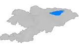
Nookat District
Nookat (also: Naukat) is a raion (district) of Osh Region in south-western Kyrgyzstan. Its area is 3,179 square kilometres (1,227 sq mi), and its resident population was 236,455 in 2009.[1] The capital lies at Nookat.[2]
Nookat | |
|---|---|
 Flag | |
 | |
| Country | Kyrgyzstan |
| Region | Osh Region |
| Area | |
| • Total | 3,179 km2 (1,227 sq mi) |
| Population (2009)[1] | |
| • Total | 236,455 |
| • Density | 74/km2 (190/sq mi) |
| Time zone | UTC+5 (GMT +5) |
Demographics
The population of Nookat District, according to the Population and Housing Census of 2009, was 236,455. 16,125 people live in urban areas, and 220,330 in rural ones.[1]
| Year | Pop. | ±% |
|---|---|---|
| 1970 | 76,970 | — |
| 1979 | 108,261 | +40.7% |
| 1989 | 144,225 | +33.2% |
| 1999 | 196,544 | +36.3% |
| 2009 | 236,455 | +20.3% |
| Note: enumerated de facto population; Source:[1] | ||
Ethnic composition
According to the 2009 Census, the ethnic composition of the Nookat District (de jure population) was:[1]
| Ethnic group | Population | Proportion of Kemin District population |
|---|---|---|
| Kyrgyzs | 173,920 | 73.6% |
| Uzbeks | 61,299 | 25.9% |
| Khemshils | 276 | 0.1% |
| Turks | 267 | 0.1% |
| Russians | 241 | 0.1% |
| Tatars | 123 | 0.1% |
| other groups | 329 | 0.1% |
Towns, rural communities and villages

village Sahaba
In total, Nookat District includes 1 town and 75 settlements in 16 rural communities (aiyl okmotus). Each rural community can consist of one or several villages. The rural communities and settlements in the Nookat District are:[3]
- town Nookat
- Nayman aiyl okmotu (1: center - village: Nayman)
- Bel' aiyl okmotu (2: center - village: Bel; and also village Borbash)
- Gulstan aiyl okmotu (2: center - village: Imeni Frunze; and also village Gulstan)
- Isanov aiyl okmotu (6: center - village: Jangy-Bazar; and also villages Jar-Korgon, Fedorovo, Chech-Döbö, Kojoke and Kichik-Alay)
- Karatash aiyl okmotu (2: center - village: Kara-Tash; and also village Noygut)
- Kulatov aiyl okmotu (5: center - village: Kojo-Aryk; and also villages Akchal, Baglan, Kosh-Döbö and Kyzyl-Bulak)
- Jangy-Nookat aiyl okmotu (3: center - village: Jangy-Nookat; and also villages Kyzyl-Teyit and Temir-Koruk)
- Kenesh aiyl okmotu (5: center - village: Kuu Maydan; and also villages Ak-Terek, Arbyn, Chegeden and Shankol)
- Kyrgyz-Ata aiyl okmotu (7: center - village: Kötörmö; and also villages Borko, Kara-Oy, Kara-Tash, Kyrgyz-Ata, Tash-Bulak and Ak-Bulak)
- Imeni Toktomata Zulpueva aiyl okmotu (10: center - village: Uchbay; and also villages Aybek, Ak-Chabuu, Internatsional, Karake, Kommunizm, Osor, Tashtak, Chuchuk and Yatan)
- Kök-Bel aiyl okmotu (2: center - village: Kök-Bel; and also village Kayyndy)
- Kyzyl Oktyabr aiyl okmotu (6: center - village: Kök-Jar; and also villages Alashan, Borbash, Jiyde, Karanay and Sarykandy)
- On Eki Bel aiyl okmotu (2: center - village: On Eki-Bel; and also village Naray)
- Teeles aiyl okmotu (8: center - village: Murkut; and also villages Ay-Tamga, Gerey-Shoron, Jayylma, Dodon, Kengesh, Merkit and Tolman)
- Mirmakhmud aiyl okmotu (6: center - village: Imeni Chapayeva; and also villages Aral, Baryn, Budaylyk, Kapchygay and Kara-Koktu)
- Yntymak aiyl okmotu (8: center - village: Yntymak; and also villages Besh-Burkan, Aryk Boyu, Don Maala, Akshar, Tash-Bulak, Chelekchi and Nichke-Suu)
References
- "2009 population census of the Kyrgyz Republic: Osh Region" (PDF). Archived from the original (PDF) on 10 August 2011. Retrieved 2011-08-10.
- Enrin.grida.no
- "Archived copy". Archived from the original on 2010-02-09. Retrieved 2010-03-14.CS1 maint: archived copy as title (link)
This article is issued from Wikipedia. The text is licensed under Creative Commons - Attribution - Sharealike. Additional terms may apply for the media files.
