North Kawartha
North Kawartha is a township in northern Peterborough County, Ontario, Canada.
North Kawartha | |
|---|---|
| Township of North Kawartha | |
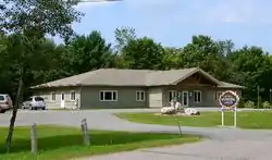 Municipal office in Apsley | |
 North Kawartha | |
| Coordinates: 44°45′N 78°06′W | |
| Country | |
| Province | |
| County | Peterborough |
| Incorporated | January 1, 1998 |
| Government | |
| • Type | Township |
| • Mayor | Carolyn Amyotte |
| • Federal riding | Peterborough—Kawartha |
| • Prov. riding | Peterborough—Kawartha |
| Area | |
| • Land | 776.01 km2 (299.62 sq mi) |
| Population (2016)[2] | |
| • Total | 2,479 |
| • Density | 3.2/km2 (8/sq mi) |
| Time zone | UTC-5 (EST) |
| • Summer (DST) | UTC-4 (EDT) |
| Postal Code | K0L 1A0 |
| Area code(s) | 705 & 249 |
| Website | www.northkawartha.on.ca |
North Kawartha was formed in 1998 through an amalgamation of the Townships of Burleigh and Anstruther and the Township of Chandos. For a while after this merger, it was known as Burleigh-Anstruther-Chandos.
Communities
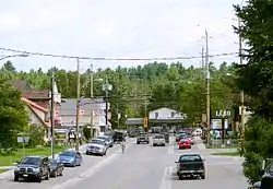
The township comprises the communities of Apsley (main village), Big Cedar, Glen Alda, Rose Island, Woodview and part of Burleigh Falls. These communities are surrounded by freshwater lakes including Chandos, Jack, Anstruther, Eels, and many more.
Etymology
- Anstruther was likely named for Sir Windham Carmichael-Anstruther, 8th Baronet. [3]:13
- Apsley was probably named for Apsley House, London residence of the Dukes of Wellington. [3]:14
- Burleigh was likely named for Burleigh Hall in Leicestershire.[3]:48
- Chandos was named in 1862 for Richard Temple-Nugent-Brydges-Chandos-Grenville, 3rd Duke of Buckingham and Chandos[3]:64
- Kawartha comes from an aboriginal word Ka-wa-tha, meaning "land of reflections". For more on this etymology, see Kawartha Lakes.[3]:176
Government
The local government is the Corporation of the Township of North Kawartha. The current mayor is Carolyn Amyotte.
Schools
Apsley Central Public School, is located in Apsley and provides education from kindergarten to grade 8. [4]
Recreation
North Kawartha is home to the North Kawartha Knights, a junior hockey team playing in the Jr. C Central League of the Ontario Hockey Association. They started play in 2014. The home arena for the Knights is the North Kawartha Community Centre located in Apsley. [5]
North Kawartha also has several golf courses, including Marvel Rapids golf course and Owenbrook golf course. [6]
Demographics
| Canada census – North Kawartha community profile | |||
|---|---|---|---|
| 2016 | 2011 | 2006 | |
| Population: | 2 479 (8.3% from 2011) | 2 289 (-2.3% from 2006) | 2 342 (9.2% from 2001) |
| Land area: | 776.01 km2 (299.62 sq mi) | 776.04 km2 (299.63 sq mi) | 765.02 km2 (295.38 sq mi) |
| Population density: | 3.2/km2 (8.3/sq mi) | 2.9/km2 (7.5/sq mi) | 3.1/km2 (8.0/sq mi) |
| Median age: | 55.4 (M: 55.2, F: 55.7) | 51.2 (M: 50.7, F: 51.4) | |
| Total private dwellings: | 3 552 | 3 489 | 3 433 |
| Median household income: | $57,792 | $43,091 | |
| References: 2016[7] 2011[1] 2006[8] earlier[9] | |||
According to the 2016 Canada Census,[8] the township is home to 2479 residents, making it the smallest municipality in Peterborough County in terms of population, though the seasonal population is estimated at over 12,000. The population grew by 8.3% between the 2011 and 2016 censuses. The area of the township 776.01 km² and has a population density of 3.2 per square kilometre. Private dwellings occupied by usual residents amount to 1114 (total dwellings: 3552). Mother tongue spoken by its population are:
- English as first language: 94%
- French as first language: 0.1%
- English and French as first language: 0%
- Other as first language: 5.9%
| Year | Pop. | ±% |
|---|---|---|
| 1996 | 2,104 | — |
| 2001 | 2,144 | +1.9% |
| 2006 | 2,342 | +9.2% |
| 2011 | 2,289 | −2.3% |
| 2016 | 2,479 | +8.3% |
| [10][1][2] | ||
Prior to amalgamation:
- Population in 1996: 2,104
- Burleigh and Anstruther (township): 1,451
- Chandos (township): 653
- Population in 1991:
- Burleigh and Anstruther (township): 1,331
- Chandos (township): 607
See also
References
- "2011 Community Profiles". 2011 Canadian Census. Statistics Canada. July 5, 2013. Retrieved 2012-02-29.
- "Census Profile, 2016 Census: North Kawartha, Township". Statistics Canada. Retrieved June 29, 2019.
- Rayburn, Alan (1997). Place names of Ontario. Toronto: University of Toronto Press. ISBN 0-8020-7207-0. Retrieved 13 October 2017.
- "School". www.northkawartha.ca. 2019-02-28. Retrieved 2019-04-10.
- "HISTORY | North Kawartha Knights". nkknights.pointstreaksites.com. Retrieved 2019-04-10.
- "THE BEST North Kawartha Golf Courses (with Photos) - Tripadvisor". www.tripadvisor.com. Retrieved 2020-03-28.
- "2016 Community Profiles". 2016 Canadian Census. Statistics Canada. February 21, 2017. Retrieved 2017-12-08.
- "2006 Community Profiles". 2006 Canadian Census. Statistics Canada. March 30, 2011. Retrieved 2012-02-29.
- "2001 Community Profiles". 2001 Canadian Census. Statistics Canada. February 17, 2012.
- Statistics Canada: 1996, 2001, 2006
External links
| Wikimedia Commons has media related to North Kawartha. |
Places adjacent to North Kawartha | ||||||||||
|---|---|---|---|---|---|---|---|---|---|---|
| ||||||||||