Paraćin
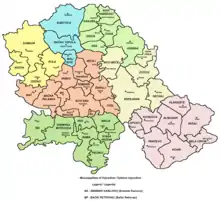
Paraćin (Serbian Cyrillic: Параћин, pronounced [pâratɕin]) is a town and municipality located in the Pomoravlje District of central Serbia. It is located in the valley of the Velika Morava river, north of Kruševac and southeast of Kragujevac. In 2011 the town had a population of 24,573. It also had a civil airport.
Paraćin
Параћин | |
|---|---|
Town and municipality | |
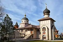    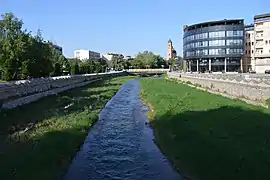 From top: Lešje monastery, Сultural center in Paraćin, A monument to warriors who died in the First World War, Fountain of freedom, Crnica river | |
 Coat of arms | |
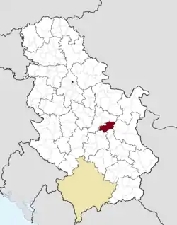 Location of the municipality of Paraćin within Serbia | |
| Coordinates: 43°52′N 21°25′E | |
| Country | |
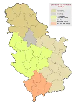
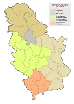
| Region | Šumadija and Western Serbia |
| District | Pomoravlje |
| Settlements | 35 |
| Government | |
| • Mayor | Vladimir Milićević (SNS) |
| Area | |
| • Municipality | 542 km2 (209 sq mi) |
| Elevation | 132 m (433 ft) |
| Population (2011 census)[2] | |
| • Town | 24,573 |
| • Municipality | 54,267 |
| Time zone | UTC+1 (CET) |
| • Summer (DST) | UTC+2 (CEST) |
| Postal code | 35250 |
| Area code | +381(0)35 |
| Car plates | PN |
| Website | www |
History
There is a Neolithic archaeological site in the village of Drenovac.[3] 8th century BC Basarabi pottery was found with the depiction of domestic cock.[4] The Roman fort at Momčilov Grad produced a great number of coins of Byzantine Emperor Justinian (525–565).[5]
A medieval town of Petrus was granted by Emperor Dušan to the local župan Vukoslav. Petrus was a center of Petruš region, one of the spiritual centers of Medieval Serbia. It comprised 14 monasteries and churches, all from the 14th century, along the rivers Crnica and Grza. As of 2017 several of the monasteries are being restored while there are plans to restore the town of Petrus, too, and to establish a touristic complex which would encompass both the town and the monasteries.[3]
Paraćin was mentioned for the first time in 1375. That year, Prince Lazar of Serbia issued a charter to the Monastery of Great Lavra by which he granted to the monastery villages in the Petruš region, and Trg Parakinov brod ("Town of Parakin's river crossing"). It is believed that the name of the town originated from Parakin, name of a ferryman who ferried the people across the Crnica river, on which the town is located. In time, the name evolved into Paraćin.[3]
In the 19th century, with the construction of the railway and its further branching, and already being located on the most important road route, Tsarigrad Road, Paraćin became a major traffic hub. The industry followed the traffic, so Paraćin was one of the largest industrial centers of Serbia in the 19th and 20th century, and the most densely populated town in country in the late 19th century.[3]
From 1929 to 1941, Paraćin was part of the Morava Banovina of the Kingdom of Yugoslavia.
Folklore
Nickname for an inhabitant of Paraćin is Džigeran, derived from the colloquial Serbian word for liver, džigerica, and originating from the 19th century. There are couple of jovial stories how it came about and both stem from the popular local rivalry between the towns of Paraćin and Jagodina. According to one story, Serbian ruler Prince Miloš Obrenović, visited Paraćin. The hosts didn't know what to prepare for the prince, so the townsfolk from the neighboring Jagodina told them to prepare liver, as the prince adores it. Actually, it was quite the opposite, so when prince tasted the liver, which he couldn't stand, he said: Oh liver, are you meat? Oh, people of Paraćin, are you humans? Another story goes that a train hit a turkey in Jagodina (turkey is town's symbol) and dragged it all the way to Paraćin, with only liver remaining on the locomotive.[3]
Settlements
Apart from the town of Paraćin, the municipality includes the following settlements, along with number of residents (2002 census):
|
Economy
The following table gives a preview of total number of registered people employed in legal entities per their core activity (as of 2018):[6]
| Activity | Total |
|---|---|
| Agriculture, forestry and fishing | 127 |
| Mining and quarrying | 17 |
| Manufacturing | 2,664 |
| Electricity, gas, steam and air conditioning supply | 65 |
| Water supply; sewerage, waste management and remediation activities | 164 |
| Construction | 554 |
| Wholesale and retail trade, repair of motor vehicles and motorcycles | 2,421 |
| Transportation and storage | 870 |
| Accommodation and food services | 350 |
| Information and communication | 102 |
| Financial and insurance activities | 162 |
| Real estate activities | 35 |
| Professional, scientific and technical activities | 385 |
| Administrative and support service activities | 254 |
| Public administration and defense; compulsory social security | 468 |
| Education | 762 |
| Human health and social work activities | 804 |
| Arts, entertainment and recreation | 158 |
| Other service activities | 189 |
| Individual agricultural workers | 507 |
| Total | 11,058 |
Culture
The town has a Home Museum, a library and a "Pitagora" gallery.[3]
Tourism
The Sisevac excursion place is the most popular excursion sites in the municipality. Located in the small village with only 15 inhabitants in 2011,[7] it is located in the structural basin on the Kučaj mountains, at an altitude of 360 m (1,180 ft). Sisevac is surrounded by forests and is the location of the Crnica river spring. Due to the favorable microclimate and the natural springs of the mineral water, it was known as the weather spa already in the 14th century.[3]
Another excursion site is Grza, through which the river of the same name runs through. Popular attraction is the village of Gornja Mutnica and the river Suvara. Though it runs through the village only for a length of 500 m (1,600 ft), there are 30 bridges over it.[3]
Notable citizens
- Svetolik Dragačevac, retired police chief who sent a threatening letter to Adolf Hitler in March 1941
- Ana Nikolić, Serbian pop singer
- Bojan Krkić, Spanish footballer of Serbian origin
- Ivana Sert, Serbian-Turkish TV personality, model, and fashion designer.
- Marčelo, Serbian hip hop musician
- Nenad Đorđević, Serbian footballer
- Ivica Radosavljević, Serbian / Swiss basketball player
International relations
Twin towns — Sister cities
Paraćin is twinned with:
References
- "Municipalities of Serbia, 2006". Statistical Office of Serbia. Retrieved 2010-11-28.
- "2011 Census of Population, Households and Dwellings in the Republic of Serbia: Comparative Overview of the Number of Population in 1948, 1953, 1961, 1971, 1981, 1991, 2002 and 2011, Data by settlements" (PDF). Statistical Office of Republic Of Serbia, Belgrade. 2014. ISBN 978-86-6161-109-4. Retrieved 2014-06-27.
- G.Zorkić (24 December 2017), "Prkosni grad na Carigradskom drumu" [Defiant town on Tsarigrad Road], Politika-Magazin, No. 1066 (in Serbian), pp. 20–21
- Función depuradora de los humedales I: una revisión bibliográfica sobre el papel de los macrófitos (in Spanish)
- "MUNICIPALITIES AND REGIONS OF THE REPUBLIC OF SERBIA, 2019" (PDF). stat.gov.rs. Statistical Office of the Republic of Serbia. 25 December 2019. Retrieved 28 December 2019.
- Comparative overview of the number of population in 1948, 1953, 1961, 1971, 1981, 1991, 2002 and 2011 – Data by settlements, page 74. Statistical Office of the Republic of Serbia, Belgrade. 2014. ISBN 978-86-6161-109-4.
