Surčin
Surčin (Serbian Cyrillic: Сурчин, pronounced [sǔrt͡ʃiːn]) is a municipality of the city of Belgrade. As of 2011 census, it has a population of 43,819 inhabitants.
Surčin
Сурчин | |
|---|---|
 | |
 Flag  Coat of arms | |
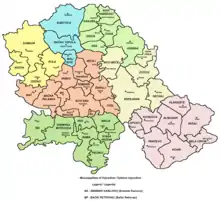
 Location of Surčin within the city of Belgrade | |
| Coordinates: 44°48′N 20°17′E | |
| Country | |
| City | |
| Municipality status | 2003 |
| Settlements | 7 |
| Government | |
| • Mayor | Stevan Šuša[1] (SNS) |
| Area | |
| • Urban | 61.21 km2 (23.63 sq mi) |
| • Municipality | 288.48 km2 (111.38 sq mi) |
| Population (2011 census)[4] | |
| • Municipality | 43,819 |
| • Municipality density | 150/km2 (390/sq mi) |
| Time zone | UTC+1 (CET) |
| • Summer (DST) | UTC+2 (CEST) |
| Postal code | 11271 |
| Area code | +381 11 |
| Car plates | BG |
| Website | www |

It is the youngest municipality of Belgrade, as it split from the municipality of Zemun in 2003. Its most important feature is the Belgrade Nikola Tesla Airport, located just a few kilometers west of the town.
History
The area of the town has been settled since prehistoric times, and archaeological findings from ancient eras are common. So far, it is established that previous settlements existed in the Stone Age, Neolithic, Bronze Age, and Roman era.[5]
From 1991 to 2002, the population of the municipality grew from 35,591 to 38,695. Most of that growth came from the refugees from the Yugoslav Wars (mostly Croatia and Bosnia and Herzegovina). Since many of the refugees were integrated into the Serbian citizenship after 2002, it is to be expected that the official population has grown significantly.
Surčin was the seat of its own municipality until 1965 when it was annexed to the municipality of Zemun (prior to that, municipalities of Boljevci and Dobanovci were annexed to the municipality of Surčin). A movement for splitting from Zemun has been very vocal since the 1990s and though it did not fulfill some of the conditions required by the Belgrade City statute for creation of a new municipality (mainly, a population of over 50,000), Belgrade City assembly voted to detach Surčin from Zemun officially on 24 November 2003. The newly-formed municipality remained under the administration of the municipality of Zemun until the next municipal elections and finally got its own administration on 3 November 2004. However, municipal administration and the overall political situation in Surčin has been highly unstable ever since.[6][7]
Geography
Surčin is located in the eastern Syrmia region, 20 km west of downtown Belgrade. It borders the municipalities of Zemun (north) and Novi Beograd (east). The western border of the municipality is the administrative border of the province of Vojvodina, while the Sava river forms the border to the municipalities of Čukarica (south-east) and Obrenovac (south).
The area of the municipality is flat and marshy as the entire southern section belongs to the floodplain of the Sava. Numerous smaller streams (mostly channeled) flow through the municipality, most notably the Galovica and Jarčina. Other distinct geographical features are the ponds of Fenek and Živača, a large woody area of Bojčin (Serbian: Bojčinska šuma) and Progarska ada, one of the largest islands in the Sava.
Surčin lies just south of the Belgrade–Zagreb highway, on the Belgrade beltway which is expected to allow heavy traffic from the Belgrade's urban core to move directly to the city's southern outskirts (for now, it is the only European capital with a highway going through it). The Syrmian section of the beltway (which separates from the highway at Dobanovci, then goes to Surčin–Jakovo–Ostružnica) is already built and operational. A local Belgrade freight railway runs parallel to the beltway.
Crni Lug ("Black Grove") is a low, forested floodplain along the bend of the Sava river, between Progar and Boljevci. It is a patch of an oak forest. Crni Lug is located 30 km (19 mi) from downtown Belgrade and 20 km (12 mi) south of the Nikola Tesla Airport. Part of the region is organized as a hunting ground with a total area of 9.73 km2 (3.76 sq mi), of which 7.2 km2 (2.8 sq mi) is fenced. The venue is known for the organized group wild boar hunting. Apart from wild boar, European deer and roe deer are also being bred in the facility. There are two other hunting grounds in the municipality, Dobanovački Zabran ("Dobanovci Grove"), operated by the military, and Donji Srem ("Lower Syrmia").[8]
Demographics
| Year | Pop. | ±% p.a. |
|---|---|---|
| 1948 | 15,650 | — |
| 1953 | 16,107 | +0.58% |
| 1961 | 21,099 | +3.43% |
| 1971 | 28,081 | +2.90% |
| 1981 | 33,704 | +1.84% |
| 1991 | 35,636 | +0.56% |
| 2002 | 38,814 | +0.78% |
| 2011 | 43,819 | +1.36% |
| Source: [9] | ||
According to the 2011 census results, the municipality of Surčin has a population of 43,819 inhabitants. Though in the past the municipality had no urban connection with Belgrade on the east, that is, Novi Beograd's westernmost neighborhood of Ledine connected it to the city, an urban zone has developed along that road, turning Belgrade and Surčin into one continuous built-up area. Similar developments surround Surčin which, with the growth of population, grows into a single urban area with Dobanovci (north), Jakovo (south) and Bečmen (west).
Ethnic groups
The municipality of Surčin has Serb ethnic majority, followed by Romani, Slovaks, Croats and other ethnic groups. The ethnic composition of the municipality:
| Ethnic group | Population 2011 |
|---|---|
| Serbs | 37,866 |
| Romani | 1,415 |
| Slovaks | 1,254 |
| Croats | 373 |
| Muslims | 102 |
| Macedonians | 95 |
| Yugoslavs | 93 |
| Montenegrins | 89 |
| Others | 2,532 |
| Total | 43,819 |
Administration
Former presidents of the municipality of Surčin are:
- 24 November 2003 – 3 November 2004: Vojislav Janošević (b. 1946) (Democratic Party, local community)
- 3 November 2004 – 24 November 2005: Rajko Matović (b. 1960) (Serbian Radical Party)
- 13 August 2004 – 24 November 2005: Vladimir Aleksandrov (b. 1940) (Serbian Radical Party; not confirmed by the Ministry for local self-rule)
- 24 November 2005 – August 2012: Vojislav Janošević (Democratic Party)
- August 2012 – present: Vesna Šalović (Socialist Party of Serbia)
Economy
The majority of the population works in agriculture. Extensive farms for pig breeding are located in Surčin itself while in the smaller settlements the production is mostly for the Belgrade market, growing fruits and early vegetables.
The most important facility is the Belgrade Nikola Tesla airport, opened on April 28, 1962, replacing the old one in Bežanija. The new and modern airport put the small village on the map. The aeronautics museum is also located in the airport complex.
The following table gives a preview of total number of registered people employed in legal entities per their core activity (as of 2018):[10]
| Activity | Total |
|---|---|
| Agriculture, forestry and fishing | 386 |
| Mining and quarrying | 13 |
| Manufacturing | 2,942 |
| Electricity, gas, steam and air conditioning supply | 6 |
| Water supply; sewerage, waste management and remediation activities | 78 |
| Construction | 691 |
| Wholesale and retail trade, repair of motor vehicles and motorcycles | 4,506 |
| Transportation and storage | 4,879 |
| Accommodation and food services | 539 |
| Information and communication | 84 |
| Financial and insurance activities | 61 |
| Real estate activities | 8 |
| Professional, scientific and technical activities | 310 |
| Administrative and support service activities | 291 |
| Public administration and defense; compulsory social security | 331 |
| Education | 445 |
| Human health and social work activities | 331 |
| Arts, entertainment and recreation | 109 |
| Other service activities | 123 |
| Individual agricultural workers | 95 |
| Total | 16,228 |
See also
References
- Mala Prosvetina Enciklopedija, Third edition (1985); Prosveta; ISBN 86-07-00001-2
- Jovan Đ. Marković (1990): Enciklopedijski geografski leksikon Jugoslavije; Svjetlost-Sarajevo; ISBN 86-01-02651-6
- "SNS SAMOSTALNO U SURČINU Stevan Šuša novi predsednik opštine". Blic. 11 June 2016.
- "Municipalities of Serbia, 2006". Statistical Office of Serbia. Retrieved 2010-11-28.
- "Насеља општине Сурчин" (PDF). stat.gov.rs (in Serbian). Statistical Office of Serbia. Retrieved 22 October 2019.
- "2011 Census of Population, Households and Dwellings in the Republic of Serbia: Comparative Overview of the Number of Population in 1948, 1953, 1961, 1971, 1981, 1991, 2002 and 2011, Data by settlements" (PDF). Statistical Office of Republic Of Serbia, Belgrade. 2014. ISBN 978-86-6161-109-4. Retrieved 2014-06-27.
- http://www.balkaninstitut.com/pdf/izdanja/balcanica/Balcanica_XXXVI_2005.pdf
- "Surčinski obračun". Press (in Serbian). 2008-03-20. Archived from the original on 2012-03-15. Retrieved 2010-11-30.
- "Ruše me mafijaši!". Press (in Serbian). 2008-03-20. Archived from the original on 2012-03-15. Retrieved 2010-11-30.
- Branka Vasiljević (5 August 2018). "Lovci u Beograd stižu porodično" [Hunters travel to Belgrade with their families]. Politika (in Serbian).
- "2011 Census of Population, Households and Dwellings in the Republic of Serbia" (PDF). stat.gov.rs. Statistical Office of the Republic of Serbia. Retrieved 26 February 2017.
- "MUNICIPALITIES AND REGIONS OF THE REPUBLIC OF SERBIA, 2019" (PDF). stat.gov.rs. Statistical Office of the Republic of Serbia. 25 December 2019. Retrieved 28 December 2019.
External links
| Wikimedia Commons has media related to Surčin. |