Parker, Pennsylvania
Parker is a city located in Armstrong County, Pennsylvania, United States. It is in the extreme northwestern portion of the county. The population was 840 at the 2010 census. The city was named for Judge John Parker, a lead surveyor of Lawrenceburg and founder/owner of Parker's Landing, the two villages combined to create Parker.
Parker, Pennsylvania | |
|---|---|
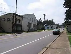 The Old Lawrenceburg section of Parker | |
| Nickname(s): Smallest City in the U.S.A. | |
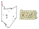 Location of Parker in Armstrong County, Pennsylvania. | |
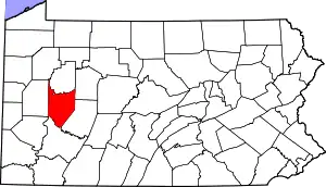 Location in the state of Pennsylvania | |
| Coordinates: 41°5′39″N 79°40′58″W | |
| Country | United States |
| State | Pennsylvania |
| County | Armstrong County |
| Settled | 1797 |
| Incorporated | 1873 |
| Government | |
| • Mayor | William R. McCall. Jr. |
| Area | |
| • Total | 0.96 sq mi (2.48 km2) |
| • Land | 0.96 sq mi (2.48 km2) |
| • Water | 0.00 sq mi (0.00 km2) |
| Population (2010) | |
| • Total | 840 |
| • Estimate (2019)[2] | 802 |
| • Density | 838.91/sq mi (323.78/km2) |
| Time zone | UTC-5 (EST) |
| • Summer (DST) | UTC-4 (EDT) |
| FIPS code | 42-57976 |
| Website | www |
Parker is sometimes referred to as the "Smallest City in the USA." Parker was incorporated as a city on March 1, 1873, by special state legislation in the midst of the northwestern Pennsylvania oil boom. The new municipality was called "Parker" and made up the earlier villages of Parker's Landing (on the Allegheny River) and Lawrenceburg (on the bluff above the river). Residents assumed that Parker would quickly become a major population center, and at the height of the oil boom, the population of Parker grew to over 20,000. The boom quickly went bust, however, and by the 1880s the "city" returned to its historic small village size—a population of approximately 1,000.
Parker received national attention again in 2014 when a massive ice jam along the Allegheny River formed and started some minor flooding. The jam was so massive that it attracted tourists to the area, and a local bar even named a drink after the ice jam. The ice jam was severe enough that the National Weather Service issued a flood warning for the area in case the ice started melting.[3][4]
Transportation
- Roads
There are two highways that pass through Parker. From the east, PA 268 goes right through downtown, then proceeds north towards Foxburg, and Emlenton. There is also an intersection with PA 368 at the Parker Bridge.
- Waterways
The Allegheny River, at this point is not used to transport goods and materials, but is still a navigable waterway for boating. The first lock (Allegheny River Lock and Dam No. 9) is located south of Parker, just past the borough of East Brady.
Geography
Parker is located at 41°5′39″N 79°40′58″W (41.094151, −79.682771).[5]
According to the United States Census Bureau, the city has a total area of 1.1 square miles (2.8 km2), all of it land.
Surrounding and adjacent neighborhoods
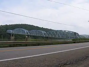
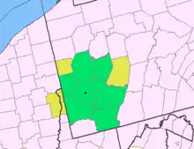
Parker has two land borders with the townships of Hovey to the north and Perry to the south. Across the Allegheny River to the east, Parker runs adjacent with Clarion County's Perry Township with a direct connection via Parker Bridge.
Demographics
| Historical population | |||
|---|---|---|---|
| Census | Pop. | %± | |
| 1880 | 1,835 | — | |
| 1890 | 1,317 | −28.2% | |
| 1900 | 1,070 | −18.8% | |
| 1910 | 1,244 | 16.3% | |
| 1920 | 1,188 | −4.5% | |
| 1930 | 902 | −24.1% | |
| 1940 | 976 | 8.2% | |
| 1950 | 979 | 0.3% | |
| 1960 | 945 | −3.5% | |
| 1970 | 843 | −10.8% | |
| 1980 | 808 | −4.2% | |
| 1990 | 853 | 5.6% | |
| 2000 | 799 | −6.3% | |
| 2010 | 840 | 5.1% | |
| 2019 (est.) | 802 | [2] | −4.5% |
| Sources:[6][7][8] | |||
As of the census[7] of 2000, there were 799 people, 309 households, and 221 families residing in the city. The population density was 728.6 people per square mile (280.5/km2). There were 356 housing units at an average density of 324.6 per square mile (125.0/km2). The racial makeup of the city was 98.12% White and 1.88% African American.
There were 309 households, out of which 32.4% had children under the age of 18 living with them, 58.9% were married couples living together, 8.7% had a female householder with no husband present, and 28.2% were non-families. 25.2% of all households were made up of individuals, and 15.9% had someone living alone who was 65 years of age or older. The average household size was 2.59 and the average family size was 3.09.
In the city, the population was spread out, with 26.0% under the age of 18, 10.1% from 18 to 24, 26.0% from 25 to 44, 21.2% from 45 to 64, and 16.6% who were 65 years of age or older. The median age was 36 years. For every 100 females, there were 95.4 males. For every 100 females age 18 and over, there were 89.4 males.
The median income for a household in the city was $29,844, and the median income for a family was $35,250. Males had a median income of $28,750 versus $21,875 for females. The per capita income for the city was $14,627. About 10.2% of families and 9.8% of the population were below the poverty line, including 9.7% of those under age 18 and 9.0% of those age 65 or over.
History
A post office called Parker's Landing was established in 1871. In 1894 its name was changed to Parkers Landing and in 1950 the name was changed to Parker. It remains in operation to the present.[9] Parker appears in the 1876 Atlas of Armstrong County, Pennsylvania.[10]
References
- "2019 U.S. Gazetteer Files". United States Census Bureau. Retrieved July 28, 2020.
- "Population and Housing Unit Estimates". United States Census Bureau. May 24, 2020. Retrieved May 27, 2020.
- http://www.wpxi.com/news/news/local/ice-jam-allegheny-river-prompts-flood-warning/ndZZR/
- http://pittsburgh.cbslocal.com/2014/02/24/armstrong-co-ice-jam-continues-to-draw-spectators/
- "US Gazetteer files: 2010, 2000, and 1990". United States Census Bureau. 2011-02-12. Retrieved 2011-04-23.
- "Census of Population and Housing". U.S. Census Bureau. Retrieved 11 December 2013.
- "U.S. Census website". United States Census Bureau. Retrieved 2008-01-31.
- "Incorporated Places and Minor Civil Divisions Datasets: Subcounty Resident Population Estimates: April 1, 2010 to July 1, 2012". Population Estimates. U.S. Census Bureau. Archived from the original on June 11, 2013. Retrieved 11 December 2013.
- "Post Offices". Jim Forte Postal History. Retrieved 6 November 2018.
- "Atlas of Armstrong County Pennsylvania, pages 37, 40, and 41". Pomeroy, Whitman & Co., 1876. Retrieved 9 November 2018.
- "Grand Army of the Republic Cemetery". Geographic Names Information System. United States Geological Survey.
- "Parker Presbyterian Cemetery". Geographic Names Information System. United States Geological Survey.
