Pitou, Changhua
Pitou Township (Chinese: 埤頭鄉; pinyin: Pítóu[1][2] Xiāng) is a rural township in Changhua County, Taiwan. The district had a population of 30,737 as of January 2017 and an area of 42.75 square kilometres (16.51 sq mi).[3] One of the attractions in Pitou is the Kopok Flower Boulevard.[4]
Pitou
埤頭 | |
|---|---|
| Pitou Township · 埤頭鄉 | |
| Chinese transcription(s) | |
| • Traditional | 埤頭鄉 |
| • Pinyin | Pítóu Xiāng |
 | |
 Pitou | |
| Coordinates: 23°52′39″N 120°28′14″E | |
| Country | Taiwan |
| County | Changhua |
| Government | |
| • Mayor | Chen Cang Giong |
| Area | |
| • Total | 42.75 km2 (16.51 sq mi) |
| Population (December 2014) | |
| • Total | 31,045 |
| • Density | 730/km2 (1,900/sq mi) |
| Postal code | 523 |
| Website | www |
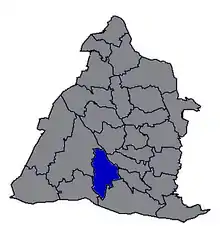
Administrative divisions
The township comprises 17 villages: Beitou, Dahu, Fuzhao, Gexing, Heli, Lilun, Liujia, Lunjiao, Lunzi, Pingyuan, Xingnong, Xinzhuang, Yongli, Yuanpu, Zhonghe, Zhuangnei and Zhuwei.
Education
Tourist attractions
Nanyun Temple in Pitou is one of the stops on the annual Dajia Matsu pilgrimage.[5]
Transportation
Pitou is adjacent to National Highway No. 1, with Zhangshui Road another major arterial route through the township. Pitou's location around major highways plays an important role in facilitating transportation of the township's agricultural produce.
| Wikimedia Commons has media related to Pitou Township, Changhua County. |
References
- 【埤】. 教育部國語辭典簡編本.
注音 (二)ㄆㄧˊ 漢語拼音 (二)pí{...}灌溉用的蓄水池。多用於地名。如彰化縣的埤頭鄉、臺南縣的虎頭埤。
- 【埤頭鄉】. 教育部重編國語辭典修訂本.
注音 ㄆㄧˊ ㄊㄡˊ ㄒㄧㄤ 漢語拼音 pí tóu xiāng{...}灌溉用的蓄水池。多用於地名。如彰化縣的埤頭鄉、臺南縣的虎頭埤。
- 統計資料 | 一月 | 表四 [Statistics|January|Table 4]. accounting.chcg.gov.tw (in Chinese). Changhua County Government. 10 February 2017. Retrieved 11 February 2017.
- Leisure and Tour, Changhua Pitou Country.
- Buchan, Noel: Walking with Matsu, Taipei Times, 7 April 2011.
External links
- Pitou Government website (in English)
Cities and townships of Changhua County | ||
|---|---|---|
| Cities | 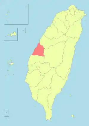 | |
| Urban townships | ||
| Rural townships | ||