Roosevelt Road
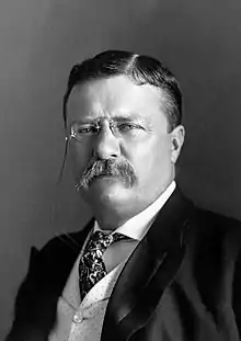
Roosevelt Road (originally named 12th Street) is a major east-west street in the city of Chicago, Illinois, and its western suburbs. It is 1200 South in the city's street numbering system, but[lower-alpha 1] only 1 mile (1.6 km) south of Madison Street. It runs under this name from Columbus Drive to the western city limits,[1] then continues through the western suburbs including Lombard, Wheaton and, West Chicago until it reaches Geneva, where it is known as State Street. 12th Street was renamed to Roosevelt Road on May 25, 1919, in recognition of President Theodore Roosevelt, who had died the previous January.[2][3] In 1928 the new U.S. Route 330 (US 330), a different alignment of US 30, went down Roosevelt Road to Geneva, in 1942 it was redesignated as US 30 Alternate. In 1972, after the route had been discontinued, Roosevelt Road outside Chicago became Illinois Route 38.[4]
 | |
|---|---|
| 1200 South Illinois Route 38 Theodore Roosevelt Memorial Highway | |
 | |
| Location | Chicago |
| East end | Lake Shore Drive (300 E) in Chicago |
| West end | Geneva - West Chicago city line |
Route
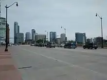
In Grant Park (for which it serves as the southern boundary west of Lake Shore Drive), it is named Roosevelt Drive.[1] The road begins at Lake Shore Drive and heads west, forming the southern boundary of the Chicago Loop. The area between Clark Street (100 W) and Jefferson Street (600 W) is a fast-growing commercial district, mostly home to large chain stores, including Best Buy, The Home Depot, Staples, Whole Foods Market and Target. This area used to be and remains to a lesser extent, a major fabric retail area. The famous Maxwell Street Market can be found just south of Roosevelt at Canal Street (500 W). Continuing west, it passes the University of Illinois at Chicago's two campuses and St. Ignatius College Preparatory School between Halsted Street and Damen Avenue. It also passes Douglass Park at California Avenue. Once past Mannheim Road it becomes Illinois Route 38.
Transit
Roosevelt Road is served by the 12 Roosevelt bus route. This was an electric trolley bus line from May 1953 until January 1973.[5] The Chicago 'L' Roosevelt station is a stop and transfer point on the Red, Green and Orange lines. The former Roosevelt Road station on the Metra Electric Line has been replaced with the Museum Campus/11th Street station.
Major intersections
| County | Location | mi[6] | km | Destinations | Notes |
|---|---|---|---|---|---|
| Kane | Geneva | Continuation beyond Kautz Road | |||
| Kane–DuPage county line | Geneva–West Chicago line | 0.0 | 0.0 | Kautz Road | Western terminus |
| DuPage | West Chicago | 3.9 | 6.3 | Interchange | |
| Glen Ellyn | 11.1 | 17.9 | |||
| Glen Ellyn–Lombard line | 11.9 | 19.2 | |||
| Oakbrook Terrace–Elmhurst line | 16.1 | 25.9 | Entering eastbound IL 38 via eastbound IL 56 | ||
| 16.4 | 26.4 | Eastbound entrance not accessible for westbound IL 56 | |||
| Elmhurst | 17.6 | 28.3 | York Road | ||
| Oak Brook | 18.0 | 29.0 | Eastbound exit and westbound entrance; exit ramp closes during rush hour | ||
| Cook | Hillside | 18.2 | 29.3 | Southbound I-294 entrance and northbound exit only; toll required | |
| Hillside–Westchester line | 20.1 | 32.3 | Eastern terminus of IL 38; eastern end of IL 38 overlap | ||
| Maywood–Hines– Forest Park tripoint | 22.6 | 36.4 | |||
| Forest Park–Berwyn– Oak Park tripoint | 24.1 | 38.8 | |||
| Cicero–Chicago line | 27.2 | 43.8 | |||
| Chicago | 32.3 | 52.0 | |||
| 33.1 | 53.3 | South Clark Street | Interchange | ||
| 33.6 | 54.1 | Eastern terminus | |||
1.000 mi = 1.609 km; 1.000 km = 0.621 mi
| |||||
See also
 Illinois portal
 Chicago portal
 U.S. Roads portal
Notes
- A mile is usually a unit of 800 in Chicago's grid.
References
- Hayner, Don and Tom McNamee, Streetwise Chicago, "Roosevelt Drive/Roosevelt Road", p. 110, Loyola University Press, 1988, ISBN 0-8294-0597-6
- Broden, Scott (19 Feb 1995). "By The Numbers - Where Did Those Street Designations Come From?". Chicago Tribune. Archived from the original on 15 October 2012. Retrieved 2012-10-15.
12th Street was changed on May 25, 1919, in recognition of Theodore Roosevelt, who had died the previous January.
- "Alderman vote Twelfth street Roosevelt road". Chicago Daily Tribune. 8 May 1919. p. 9. Archived from the original on July 3, 2015. Retrieved 2 June 2015 – via Newspapers.com.

- "Illinois State Highway Maps". Illinois Digital Archives. Retrieved 14 March 2013.
- Sebree, Mac; and Ward, Paul (1974). The Trolley Coach in North America, pp. 56–58. Los Angeles: Interurbans. LCCN 74-20367.
- "Overview Map of Roosevelt Road".
| By topic | |
|---|---|
| |