S.N.P.J., Pennsylvania
S.N.P.J. is a borough in Lawrence County, Pennsylvania, United States. As of the 2010 U.S. census, the borough had a population of 19.
S.N.P.J., Pennsylvania | |
|---|---|
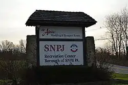 Welcome sign along Pennsylvania Route 108 | |
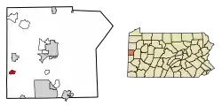 Location in Lawrence County, Pennsylvania | |
 S.N.P.J. Location in Pennsylvania  S.N.P.J. Location in the United States | |
| Coordinates: 40°55′44″N 80°29′55″W | |
| Country | United States |
| State | Pennsylvania |
| County | Lawrence |
| Established | 1978 |
| Government | |
| • Mayor | Gerald Sankovich |
| Area | |
| • Total | 0.78 sq mi (2.01 km2) |
| • Land | 0.75 sq mi (1.94 km2) |
| • Water | 0.03 sq mi (0.07 km2) |
| Highest elevation [2] (northeast corner) | 1,250 ft (380 m) |
| Lowest elevation [2] (tributary to Sugar Creek) | 1,055 ft (322 m) |
| Population (2010) | |
| • Total | 19 |
| • Estimate (2019)[3] | 19 |
| • Density | 25.37/sq mi (9.80/km2) |
| Time zone | UTC-4 (EST) |
| • Summer (DST) | UTC-5 (EDT) |
| Area code(s) | 724 |
| FIPS code | 42-71620 |
| GNIS feature ID | 2390560 |
| Website | snpjrec |
S.N.P.J. stands for "Slovenska Narodna Podporna Jednota" (Slovene National Benefit Society), a fraternal society and financial co-operative based in North Fayette, Pennsylvania (mailing address is Imperial, Pennsylvania).
The society applied to have their 500-acre (200 ha) recreation center in western Pennsylvania designated as a separate municipality in 1977. The S.N.P.J. borough was created so that the society could, among other things, get its own liquor license. North Beaver Township, the municipality in which the center was originally located, restricted the sale of alcohol on Sundays (blue law).
S.N.P.J. once had the distinction of being the least-populated borough in the state (but not municipality; East Fork Road District, population 14, was less populous) until a mine fire beneath Centralia made that borough unsafe to live in.
Geography
S.N.P.J. is located at 40°55′44″N 80°29′55″W (40.928916, −80.498828).[4]
According to the United States Census Bureau, the borough has a total area of 0.7 square miles (1.8 km2), with 20 acres (8.1 ha; 0.031 sq mi) of the area covered by water.
It is more of a recreation complex than a community, and has 60 rental cabins, 115 mobile home slots, and an artificial lake. It is open to the public as a summertime resort and facility for bingo, weddings, and dances. Members of the society get a discount on the events.
Demographics
| Historical population | |||
|---|---|---|---|
| Census | Pop. | %± | |
| 1980 | 16 | — | |
| 1990 | 12 | −25.0% | |
| 2000 | 14 | 16.7% | |
| 2010 | 19 | 35.7% | |
| 2019 (est.) | 19 | [3] | 0.0% |
| Sources:[5][6][7] | |||
See also
References
- "2019 U.S. Gazetteer Files". United States Census Bureau. Retrieved July 28, 2020.
- "Hickory Run Topo Map, Lawrence County PA (Bessemer Area)". TopoZone. Locality, LLC. Retrieved 5 September 2019.
- "Population and Housing Unit Estimates". United States Census Bureau. May 24, 2020. Retrieved May 27, 2020.
- "US Gazetteer files: 2010, 2000, and 1990". United States Census Bureau. 2011-02-12. Retrieved 2011-04-23.
- "Census of Population and Housing". U.S. Census Bureau. Retrieved 11 December 2013.
- "U.S. Census website". United States Census Bureau. Retrieved 2008-01-31.
- "Incorporated Places and Minor Civil Divisions Datasets: Subcounty Resident Population Estimates: April 1, 2010 to July 1, 2012". Population Estimates. U.S. Census Bureau. Archived from the original on 11 June 2013. Retrieved 11 December 2013.
External links
Places adjacent to S.N.P.J., Pennsylvania | ||||||||||
|---|---|---|---|---|---|---|---|---|---|---|
| ||||||||||
Municipalities and communities of Lawrence County, Pennsylvania, United States | ||
|---|---|---|
| City | 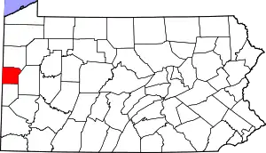 | |
| Boroughs | ||
| Townships | ||
| CDPs | ||
| Unincorporated communities | ||
| Footnotes | ‡This populated place also has portions in an adjacent county or counties | |
| ||
| Counties |  Map of the Pittsburgh Tri-State with green counties in the metropolitan area and yellow counties in the combined area | |
|---|---|---|
| Major cities | ||
| Cities and towns 15k–50k (in 2010) | ||
| Airports | ||
| Topics | ||
| ||
| Authority control |
|---|