Saint-Basile Parish, New Brunswick
Saint-Basile is a civil parish in Madawaska County, New Brunswick, Canada.[2]
Saint-Basile
St. Basil, St. Basile | |
|---|---|
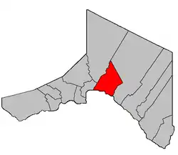 Location within Madawaska County. | |
| Coordinates: 47.36°N 68.255°W | |
| Country | |
| Province | |
| County | Madawaska |
| Erected | 1850 |
| Area | |
| • Land | 129.61 km2 (50.04 sq mi) |
| Population (2016)[1] | |
| • Total | 592 |
| • Density | 4.6/km2 (12/sq mi) |
| • Pop 2011-2016 | |
| • Dwellings | 270 |
| Time zone | UTC-4 (AST) |
| • Summer (DST) | UTC-3 (ADT) |
For governance purposes it is divided between the city of Edmundston,[3] the St. Basile 10 Indian Reserve, and the local service district of the parish of Saint-Basile.[4] The city and LSD are both members of the Northwest Regional Service Commission (NWRSC).[5]
Origin of name
The parish was named for the Roman Catholic church.[6]
History
Saint-Basile was erected as Saint Basil in 1850 from Madawaska Parish.[7]
In 1852 the parish's boundaries were extended northward to include territory awarded in the boundary settlement with the Province of Canada.[8]
In 1874 the core of modern Edmundston was removed from Saint-Basile and added to Madawaska Parish.[9]
In 1877 the newly erected Sainte-Anne Parish included part of Saint-Basile.[10]
In 1896 the boundary along Green River was altered.[11]
In 1920 part of Saint-Basile was erected as Rivière-Verte Parish.[12]
In 1973 the name was officially changed to Saint-Basile.[13]
Delineation
Saint-Basile Parish is defined in the Territorial Division Act[2] as being bounded:
- Southeasterly by Sainte-Anne [Parish]; northeasterly by the County line; southwesterly by the St. John River; and northwesterly by the lower line of grant numbered eighteen hundred and eight, near the mouth of the Madawaska River, granted to Simon Herbert in the year of our Lord one thousand eight hundred and twenty-five, and its northeasterly prolongation,[lower-alpha 1] including the islands in front, and excluding the Ordnance lands at the mouth of the Madawaska River, and all lands lying on the northwestern side of Green River[lower-alpha 2] from the mouth of Little Belone Brook[lower-alpha 3] at the Second Falls[lower-alpha 4] up stream to the Little Forks,[lower-alpha 5] except the part thereof heretofore described establishing the Parish of Rivière-Verte.
Communities
Parish population total does not include incorporated municipalities (in bold) and communities within their respective boundaries (in italics).
|
|
Bodies of water
Bodies of water at least partly in the parish
- Saint John River
Demographics
Population
| Canada census – Saint-Basile Parish, New Brunswick community profile | |||
|---|---|---|---|
| 2016 | 2011 | 2006 | |
| Population: | 592 (-17.4% from 2011) | 717 (-10.3% from 2006) | 799 (+13.3% from 2001) |
| Land area: | 129.61 km2 (50.04 sq mi) | 129.74 km2 (50.09 sq mi) | 129.73 km2 (50.09 sq mi) |
| Population density: | 4.6/km2 (12/sq mi) | 5.5/km2 (14/sq mi) | 6.2/km2 (16/sq mi) |
| Median age: | 47.5 (M: 48.0, F: 47.1) | 44.7 (M: 46.1, F: 42.9) | 42.3 (M: 43.6, F: 41.0) |
| Total private dwellings: | 270 | 313 | 400 |
| Median household income: | $58,048 | $46,535 | $47,973 |
| References: 2016[18] 2011[19] 2006[20] earlier[21] | |||
|
|
| |||||||||||||||||||||||||||
| [22][1] | |||||||||||||||||||||||||||||
Language
| Canada Census Mother Tongue - Saint-Basile Parish, New Brunswick[22] | ||||||||||||||||||
|---|---|---|---|---|---|---|---|---|---|---|---|---|---|---|---|---|---|---|
| Census | Total | French |
English |
French & English |
Other | |||||||||||||
| Year | Responses | Count | Trend | Pop % | Count | Trend | Pop % | Count | Trend | Pop % | Count | Trend | Pop % | |||||
2011 |
715 |
695 | 97.20% | 20 | 2.80% | 0 | 0.00% | 0 | 0.00% | |||||||||
2006 |
800 |
785 | 98.13% | 15 | 1.87% | 0 | 0.00% | 0 | 0.00% | |||||||||
2001 |
710 |
660 | 92.96% | 15 | 2.11% | 35 | 4.93% | 0 | 0.00% | |||||||||
1996 |
670 |
650 | n/a | 97.01% | 10 | n/a | 1.49% | 10 | n/a | 1.49% | 0 | n/a | 0.00% | |||||
See also
Notes
- The prolongation only extends a bit beyond the Iroquois River, after which the boundary follows an irregular path along various grants lines until it strikes the Green River, then turns left and follows grant lines until it rejoins the river at Étang Deuxième-Sault.[14]
- Also known as Rivière Verte; both forms are official.[15]
- Now officially Petit ruisseau Belone;[16] the boundary actually strikes to the east within Étang Deuxième-Sault.
- Also known as Deuxième Sault; both names are official.[17]
- Little Forks Branch Green River
References
- "Census Profile, 2016 Census Saint-Basile, Parish [Census subdivision], New Brunswick". Statistics Canada. Retrieved August 29, 2019.
- "Chapter T-3 Territorial Division Act". Government of New Brunswick. Retrieved 13 November 2020.
- "New Brunswick Regulation 85-6 under the Municipalities Act (O.C. 85-45)". Government of New Brunswick. Retrieved 19 July 2020.
- "New Brunswick Regulation 84-168 under the Municipalities Act (O.C. 84-582)". Government of New Brunswick. Retrieved 19 July 2020.
- "Communities in each of the 12 Regional Service Commissions (RSC) / Les communautés dans chacune des 12 Commissions de services régionaux (CSR)" (PDF), Government of New Brunswick, July 2017, retrieved 2 February 2021
- Ganong, William F. (1896). A Monograph of the Place-Nomenclature of the Province of New Brunswick. Royal Society of Canada. p. 267.
- "13 Vic. c. 51 An Act to consolidate all the Laws now in force for the division of the Province into Counties, Towns and Parishes.". Acts of the General Assembly of Her Mjaesty's Province of New Brunswick, Passed in the Year 1850. Fredericton: Government of New Brunswick. 1850. pp. 142–152, 145–149. Book was poorly proofread, resulting in title typo and reuse of page numbers 145–152.
- "15 Vic. c. 6 An Act to annex the Territory awarded to this Province by the New Brunswick and Canadian Arbitrators in the recent settlement of the Boundary question between the Provinces of New Brunswick and Canada, to the Counties of Victoria and Restigouche, and to alter the present Boundary Line between these counties.". Acts of the General Assembly of Her Majesty's Province of New Brunswick, Passed in the Year 1852. Fredericton: Government of New Brunswick. 1852. pp. 4–5.
- "37 Vic. c. 47 An Act to include certain Lands in the Parish of Saint Basil in the Parish of Madawaska, in the County of Madawaska.". Acts of the General Assembly of Her Majesty's Province of New Brunswick. Passed in the Months of March & April 1874. Fredericton: Government of New Brunswick. 1874. p. 129.
- "41 Vic. c. 30 An Act to erect parts of the Parishes of Saint Leonard, Saint Basil, Madawaska, and Saint Francis, in the County of Madawaska, into three additional Parishes.". Acts of the General Assembly of Her Majesty's Province of New Brunswick. Passed in the Month of March 1877. Fredericton: Government of New Brunswick. 1877. pp. 125–128.
- "59 Vic. c. 8 An Act to Revise and Codify an Act to Provide for the Division of the Province into Counties, Towns and Parishes.". Acts of the General Assembly of Her Majesty's Province of New Brunswick. Passed in the Month of March, 1896. Fredericton: Government of New Brunswick. 1896. pp. 86–123.
- "9 Geo. V c. 55 An Act to amend Chapter 2 of the Consolidated Statutes, 1903, respecting the division of the Province into Counties, Towns and Parishes.". Acts of the Legislative Assembly of New Brunswick Passed in the Month of April 1919. Fredericton: Government of New Brunswick. 1919. pp. 258–265.
- "Chapter T-3 Territorial Division Act". Revised Statutes of New Brunswick 1973 Volume IV. Fredericton: Government of New Brunswick. 1973. pp. 1–70.
- "Crown Grant Reference Map Viewer". GeoNB. Government of New Brunswick. Retrieved 25 August 2016.
- "Green River". Canadian Geographical Names. Natural Resources Canada. Retrieved 25 August 2016.
- "Belone Brook". Canadian Geographical Names. Natural Resources Canada. Retrieved 25 August 2016.
- "Second Falls". Canadian Geographical Names. Natural Resources Canada. Retrieved 25 August 2016.
- "2016 Community Profiles". 2016 Canadian Census. Statistics Canada. February 21, 2017. Retrieved 2019-08-29.
- "2011 Community Profiles". 2011 Canadian Census. Statistics Canada. July 5, 2013. Retrieved 2014-03-28.
- "2006 Community Profiles". 2006 Canadian Census. Statistics Canada. March 30, 2011. Retrieved 2014-03-28.
- "2001 Community Profiles". 2001 Canadian Census. Statistics Canada. February 17, 2012.
- Statistics Canada: 1996, 2001, 2006, 2011 census
Places adjacent to Saint-Basile Parish, New Brunswick | ||||||||||
|---|---|---|---|---|---|---|---|---|---|---|
| ||||||||||
| Subdivisions | |
|---|---|
| Cities | |
| Counties | |
| |