Saint Andrews Parish, New Brunswick
Saint Andrews is a civil parish in Charlotte County, New Brunswick, Canada,[2] located east of St. Stephen. It comprises one town and one local service district (LSD), both of which are members of the Southwest New Brunswick Service Commission (SNBSC).[3]
Saint Andrews
St. Andrews | |
|---|---|
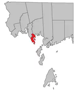 Location within Charlotte County. | |
| Country | |
| Province | |
| County | Charlotte County |
| Erected | 1786 |
| Area | |
| • Land | 24.27 km2 (9.37 sq mi) |
| Population (2016)[1] | |
| • Total | 553 |
| • Density | 22.8/km2 (59/sq mi) |
| • Pop (2011-2016) | |
| • Dwellings | 312 |
| Time zone | UTC-4 (AST) |
| • Summer (DST) | UTC-3 (ADT) |
The Census subdivision of the same name includes all of the parish except the town of Saint Andrews.[1]
Origin of name
Ganong notes the use of St. Andrews Point in the Owen Journal of 1770 but considered the name to date back to French times.[4]
Five of the original six mainland parishes of Charlotte County used names of major saints recognised by the Church of England: Andrew (Scotland), David (Wales), George (England), Patrick (Ireland), and Stephen.
History
Saint Andrews Parish as one of the county's original parishes[5] and included most of modern Saint Croix Parish as well as part of Saint David Parish.
Saint Croix Parish was erected as its own parish in 1874.[6]
Boundaries
Saint Andrews Parish is surrounded by the St. Croix River, Passamaquoddy Bay, Big Bay, and Birch Cove. From Birch Cove, its boundary run northwesterly before turning westerly toward Little Chamcook Lake; from there it runs southerly along the eastern shore of Little Chamcook Lake and Chamcook Lake, turning to follow the southern end of Chamcook Lake before running southwesterly to the rear of grants along the St. Croix River. Following the grants lines southeasterly to Edwards Corner, the boundary turns 90° and runs southwesterly to the river. Ministers Island and Navy Island are also part of the parish.[2]
Municipality
The town of Saint Andrews runs as far north as Clark Road and includes Navy Island.
Local service district
Chamcook comprises all of the mainland north of Saint Andrews as well as Ministers Island.[7]
The LSD was established in 1997 to assess for fire service, replacing the parish of Saint Andrews.[8]
Today Chamcook assesses for only the basic LSD services of fire protection, police services, land use planning, emergency measures, and dog control.[9] The taxing authority is 513.00 Chamcook.
Former local service district
The local service district of the parish of Saint Andrews comprised all of the parish outside Saint Andrews.
The LSD was established in 1970 to assess for fire protection.[10] First aid and ambulance services were added in 1975.[11]
This LSD was replaced by Chamcook in 1997.
Communities
Communities at least partly in the parish;[12][13][14] bold indicates a municipality; italics indicates a deprecated name.[lower-alpha 1]
|
|
Bodies of water
Bodies of water at least partly in the parish;[12][13][14] italics indicates a deprecated name.[lower-alpha 1]
|
|
|
Islands
Islands in the parish;[12][13][14] italics indicates a deprecated name.[lower-alpha 1]
- Ministers Island
- Navy Island (St. Andrews Island)
Conservation areas
Parks, historic sites, and related entities in the parish.[12][15][16][17]
|
|
Demographics
Population
| Canada census – Saint Andrews Parish, New Brunswick community profile | |||
|---|---|---|---|
| 2016 | 2011 | 2006 | |
| Population: | 553 (-6.7% from 2011) | 593 (+0.2% from 2006) | 592 (+7.2% from 2001) |
| Land area: | 24.27 km2 (9.37 sq mi) | 24.38 km2 (9.41 sq mi) | 24.38 km2 (9.41 sq mi) |
| Population density: | 22.8/km2 (59/sq mi) | 24.3/km2 (63/sq mi) | 24.3/km2 (63/sq mi) |
| Median age: | 52.2 (M: 51.8, F: 52.4) | 47.6 (M: 47.2, F: 47.9) | 42.8 (M: 42.9, F: 42.6) |
| Total private dwellings: | 312 | 311 | 306 |
| Median household income: | $68,864 | $.N/A | $53,136 |
| Notes: 2011 income data for this area has been suppressed for data quality or confidentiality reasons. – References: 2016[18] 2011[19] 2006[20] earlier[21] | |||
|
|
| ||||||||||||||||||||||||||||||
(A) adjustment due to boundary change. [22][1] | ||||||||||||||||||||||||||||||||
Language
| Canada Census Mother Tongue - Saint Andrews Parish, New Brunswick[22] | ||||||||||||||||||
|---|---|---|---|---|---|---|---|---|---|---|---|---|---|---|---|---|---|---|
| Census | Total | English |
French |
English & French |
Other | |||||||||||||
| Year | Responses | Count | Trend | Pop % | Count | Trend | Pop % | Count | Trend | Pop % | Count | Trend | Pop % | |||||
2011 |
590 |
555 | 94.07% | 25 | 4.24% | 0 | 0.00% | 10 | 1.69% | |||||||||
2006 |
0 |
545 | 0.00% | 20 | 0.00% | 0 | 0.00% | 20 | 0.00% | |||||||||
2001 |
545 |
525 | 96.33% | 20 | 3.67% | 0 | 0.00% | 0 | 0.00% | |||||||||
1996 |
460 |
450 | n/a | 97.83% | 0 | n/a | 0.00% | 0 | n/a | 0.00% | 10 | n/a | 2.17% | |||||
Access Routes
Highways and numbered routes that run through the parish, including external routes that start or finish at the parish limits:[23]
|
|
|
|
See also
Notes
- Categorised as Historical rather than Official by the Canadian Geographic Name Service; only those significantly different from modern names are noted.
References
- "Census Profile, 2016 Census Saint Andrews, Parish [Census subdivision], New Brunswick". Statistics Canada. Retrieved 30 August 2019.
- "Chapter T-3 Territorial Division Act". Government of New Brunswick. Retrieved 14 August 2020.
- "Communities in each of the 12 Regional Service Commissions (RSC) / Les communautés dans chacune des 12 Commissions de services régionaux (CSR)" (PDF), Government of New Brunswick, July 2017, retrieved 1 February 2021
- Ganong, William F. (1896). A Monograph of the Place-Nomenclature of the Province of New Brunswick. Royal Society of Canada. pp. 266–267.
- "26 Geo. III Chapter I. An Act for the better ascertaining and confirming the Boundaries of the several Counties within this Province, and for subdividing them into Towns or Parishes.". Acts of the General Assembly of His Majesty's Province of New-Brunswick, passed in the year 1786. Saint John, New Brunswick: Government of New Brunswick. 1786. pp. 3–12.
- "37 Vic. c. 37 An Act to establish a new Parish in the County of Charlotte.". Acts of the General Assembly of Her Majesty's Province of New Brunswick. Passed in the Months of March & April 1874. Fredericton: Government of New Brunswick. 1874. pp. 109–111.
- "New Brunswick Regulation 84-168 under the Municipalities Act (O.C. 84-582)". Government of New Brunswick. Retrieved 6 February 2021.
- New Brunswick Regulation 97-94.
- "2020 Local Government Statistics for New Brunswick" (PDF). Department of Environment and Local Government. p. 55. Retrieved 6 February 2021.
- "Regulation 70–63 under the Municipalities Act (O. C. 70–385)". The Royal Gazette. Fredericton. 128: 343–344. 17 June 1970.
- "Regulation 75–4 under the Municipalities Act (O. C. 75–33)". The Royal Gazette. Fredericton. 133: 80. 29 January 1975.
- "untitled spreadsheet of New Brunswick place names". Geographical names in Canada. Natural Resources Canada. Retrieved 20 July 2020.
- "No. 161". Provincial Archives of New Brunswick. Department of Natural Resources and Energy Development. Retrieved 27 September 2020.
- Official place names of New Brunswick checked against the cadastral map of the area.
- "Order in Council 2017-293". Executive Council Office. Government of New Brunswick. 14 November 2017. Retrieved 28 September 2020.
- "Regulation 94-43 under the Fish and Wildlife Act". Justice and Office of the Attorney General. Province of New Brunswick. Retrieved 27 September 2020.
- "St. Andrews Blockhouse National Historic Site". Parks Canada. Government of Canada. Retrieved 28 September 2020.
- "2016 Community Profiles". 2016 Canadian Census. Statistics Canada. 21 February 2017. Retrieved 30 August 2019.
- "2011 Community Profiles". 2011 Canadian Census. Statistics Canada. 5 July 2013. Retrieved 15 March 2014.
- "2006 Community Profiles". 2006 Canadian Census. Statistics Canada. 30 March 2011. Retrieved 15 March 2014.
- "2001 Community Profiles". 2001 Canadian Census. Statistics Canada. 17 February 2012.
- Statistics Canada: 1996, 2001, 2006, 2011 census
- Atlantic Canada Back Road Atlas ISBN 978-1-55368-618-7 Pages 4, 12
Places adjacent to Saint Andrews Parish, New Brunswick | |
|---|---|
| Subdivisions | |
|---|---|
| Cities | |
| Counties | |
| |