Samaná Province
Samaná (Spanish pronunciation: [samaˈna]) is a province of the Dominican Republic in the Samaná Peninsula located in the eastern region. Its capital is Santa Bárbara de Samaná, usually known as Samaná.
Samaná | |
|---|---|
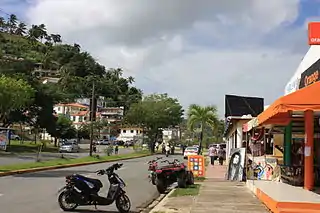
_Saman%C3%A1%252C_DR.JPG.webp) Rincon Beach, Samana, Dominican Republic | |
 Coat of arms | |
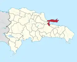 Location of the Samaná Province | |
| Coordinates: 19°14′44″N 69°27′03″W | |
| Country | |
| Province since | 1867 |
| Capital | Santa Bárbara de Samaná |
| Government | |
| • Type | Subdivisions |
| • Body | 3 municipalities 3 municipal districts |
| • Congresspersons | 1 Senator 2 Deputies |
| Area | |
| • Total | 853.74 km2 (329.63 sq mi) |
| Population (2014) | |
| • Total | 139,707 |
| • Density | 160/km2 (420/sq mi) |
| Time zone | UTC−4 (AST) |
| Area code | 1-809 1-829 1-849 |
| ISO 3166-2 | DO-20 |
| Postal code | 32000 |
Samaná is on the coast of the Atlantic Ocean in the northeastern part of the Dominican Republic. It is known for the mountains of which it is almost entirely formed. Samaná has numerous beaches.
On 6 November 2006 the Samaná El Catey International Airport, started operations.[1]
Geography
The Samana province is occupied by the Sierra de Samaná mountain range, which reaches many of the coastal areas. The highest mountain in this range (and in the province) is located in the eastern portion and is called La Meseta. Samana has a tropical rainforest climate, with an annual average temperature of 25.9 degrees Celsius. Annual precipitation in the Sierra de Samaná is greater than 2,000 millimeters. There are numerous rivers and streams throughout the province, including the final part of the Yuna River, which flows into the western end of the Samaná Bay.
History
Samana was discovered by Europeans on January 12, 1493 by Christopher Columbus who was greeted with a barrage of spears and arrows from native Taíno warriors. It is said that this was the first instance of violent opposition to the Spanish conquistadors in the Americas. The Samaná Province is also home to what are known in the Dominican Republic as Americanos de Samaná (Samaná-Americans) where descendants of free black Americans immigrated beginning in 1824. They took advantage of the pro-African immigration policy of then president Jean Pierre Boyer when Samaná was under Haitian rule. This migration to Santa Bárbara, Samaná began with 34 African-American families. Naturally, this African-American culture distinguished themselves from the rest of the Dominican Republic as they maintain many elements of 19th century African-American culture—such as their brand of English, food, games, community organizations, African-American names, manners, music and some recipes that have been preserved as a result of their isolation, which until the 20th century was accessible only by boat. Most are of the African Methodist Episcopal and Wesleyan faith brought to the island by their ancestors.
Samaná is one of the breeding places of the humpback whale. Thousands of humpback whales come to the coast off Samaná from January to March.
At one time proposed to be the capital of the country, Samaná was to be sold to the United States as a military base during Pedro Santana's presidency, but the deal was never realized, because the United States felt that the cost was too much.
A highway connecting the Samaná peninsula to Santo Domingo opened to the public in 2008. It more than halved the driving time from 4 hours to 1.5 hours as it is a straight 120 kilometres (75 mi), connecting from just east of Santo Domingo (near the SDQ airport) to just west of Sanchez. There is a significant tourist development evident throughout the Samaná peninsula, particularly that of large all-inclusive resorts, in anticipation of the increased tourism to follow the road's completion.
Municipalities and municipal districts
The province as of June 20, 2006 is divided into the following municipalities (municipios) and municipal districts (distrito municipal - D.M.) within them:[2]
.jpg.webp)
- Sánchez
- Samaná
- Arroyo Barril (D.M.)
- El Limón (D.M.)
- Las Galeras (D.M.)
- Las Terrenas
The following is a sortable table of the municipalities with population figures as of an estimate on the 2012 census. Urban population are those living in the seats (cabeceras literally heads) of municipalities or of municipal districts. Rural population are those living in the districts (Secciones literally sections) and neighborhoods (Parajes literally places) outside of them.[3]
| Name | Total population | Urban population | Rural population |
|---|---|---|---|
| Las Terrenas | 39,221 | 1,858 | 37,363 |
| Santa Bárbara de Samaná | 108,179 | 88,698 | 19,481 |
| Sánchez | 20,865 | 14,217 | 6,648 |
| Samaná province | 168,265 | 104,773 | 63,492 |
For comparison with the municipalities and municipal districts of other provinces see the list of municipalities and municipal districts of the Dominican Republic.
Transportation
Samaná has three airports and one harbor.
Airports
- El Portillo Airport, Located in El Portillo, Samaná.
- Arroyo Barril Airport, Located in Arroyo Barril, Samaná.
- Samaná El Catey International Airport, Located in Sanchez, Samaná
Ports
- Cayo Levantado Port, located in Arroyo Barril, near Arroyo Barril International Airport, Samaná.
See also
References
- Article about El Catey International Airport, Samaná
- Oficina Nacional de Estadistica, Departamento de Cartografia, Division de Limites y Linderos. "Listado de Codigos de Provincias, Municipio y Distritos Municipales, Actualizada a Junio 20 del 2006" (in Spanish). Archived from the original on 2007-03-14. Retrieved 2007-01-24.CS1 maint: multiple names: authors list (link)
- Consejo Nacional de Población y Familia. "Censos y Proyecciones de la Población Dominicana por Regiones, Provincias, Municipios y Distritos Municipales, 2012" (PDF) (in Spanish). Retrieved 2012-01-11.
External links
| Wikimedia Commons has media related to Samaná Province. |
- El Catey International Airport Samana
- (in Spanish) Oficina Nacional de Estadística, Statistics Portal of the Dominican Republic
- A blog post about the Dominican Republic's African-American descendants that established themselves in Samaná
- Clips of a documentary by Nestor Montilla Sr. that depicts the saga of thousands of free African-Americans who fled and settled in Samaná
| Authority control |
|---|