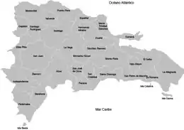
Provinces of the Dominican Republic
The Dominican Republic is divided into thirty–one provincias (provinces; singular provincia), while the national capital, Santo Domingo, is contained within its own Distrito Nacional ("National District"; "D.N." on the map below).
The division of the country into provinces is laid down in the constitution (Title I, Section II, Article 5)[1] and enacted by law. The latter is currently Law 5220 on the Territorial Division of the Dominican Republic (Ley No. 5220 sobre División Territorial de la República Dominicana), issued 1959 and frequently amended to create new provinces and lower-level administrative units.
The provinces as administrative divisions
The provinces are the first–level administrative subdivisions of the country. The headquarters of the central government's regional offices are normally found in the capital cities of provinces. The president appoints an administrative governor (Gobernador Civil) for each province but not for the Distrito Nacional (Title IX of the constitution).[1]
The provinces are divided into municipalities (municipios), which are the second–level political and administrative subdivisions of the country.[1]
The Distrito Nacional was created in 1936. Prior to this, the Distrito National was the old Santo Domingo Province, in existence since the country's independence in 1844. It is not to be confused with the new Santo Domingo Province split off from it in 2001. While it is similar to a province in many ways, the Distrito Nacional differs in its lack of an administrative governor and consisting only of one municipality, Santo Domingo, the city council (ayuntamiento) and mayor (síndico) which are in charge of its administration.[2]
The provinces as constituencies
The provinces are also constituencies for the elections to the bicameral National Congress (Congreso de la República). Each province elects one member of the Senate (Senado) and a guaranteed minimum of two members of the Chamber of Deputies (Cámara de Diputados).[1][3]
Statistics
The following is a table of the provinces and their capital cities. The population figures are from the 2014 population estimate.[4]
| Coat Of Arms | Province National District |
Capital | Region | Department | Area
(km²)[5] |
Population
2015[6] |
Density | Map |
|---|---|---|---|---|---|---|---|---|
 |
Azua | South | Valdesia | 2,531.77 | 219,224 | 86.59 | 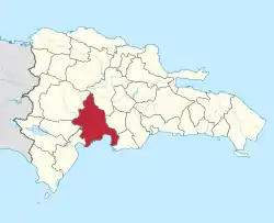 | |
 |
Baoruco | South | Enriquillo | 1,282.23 | 99,244 | 77.40 | 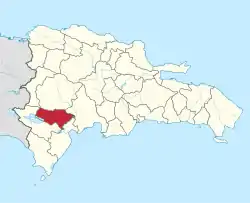 | |
 |
Barahona | South | Enriquillo | 1,739.38 | 188,706 | 108.49 | 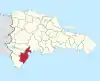 | |
 |
Dajabón | Cibao | Cibao Noroeste | 1,020.73 | 65,271 | 63.95 | 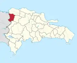 | |
 |
Distrito Nacional | East | Ozama | 104.44 | 1,007,997 | 9,651.45 |  | |
 |
Duarte | Cibao | Cibao Nordeste | 1,605.35 | 294,906 | 183.70 | 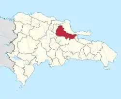 | |
 |
Elías Piña | South | El Valle | 1,426.20 | 63,450 | 35.51 | 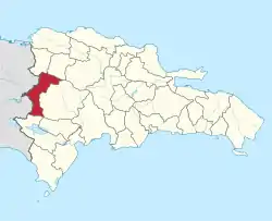 | |
 |
El Seibo | East | Yuma | 1,786.80 | 90,676 | 63.58 | 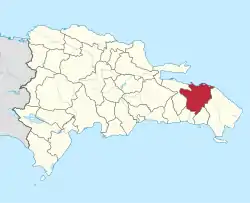 | |
 |
Espaillat | Cibao | Cibao Norte | 838.62 | 236,467 | 281.97 | 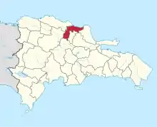 | |
 |
Hato Mayor | East | Higuamo | 1,329.29 | 85,561 | 64.37 | 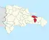 | |
 |
Hermanas Mirabal | Cibao | Cibao Nordeste | 440.43 | 92,394 | 209.78 | 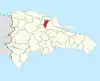 | |
 |
Independencia | South | Enriquillo | 2,006.44 | 55,638 | 27.73 | 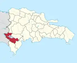 | |
 |
La Altagracia | East | Yuma | 3,010.34 | 314,916 | 104.61 | 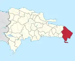 | |
 |
La Romana | East | Yuma | 653.95 | 260,002 | 397.59 | 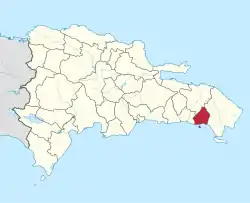 | |
 |
La Vega | Cibao | Cibao Sur | 2,287.24 | 404,013 | 176.64 | 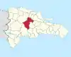 | |
 |
María Trinidad Sánchez | Cibao | Cibao Nordeste | 1,271.71 | 141,372 | 111.17 | 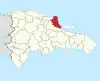 | |
 |
Monseñor Nouel | Cibao | Cibao Sur | 992.39 | 170,208 | 171.51 | 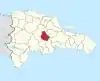 | |
 |
Monte Cristi | Cibao | Cibao Noroeste | 1,924.35 | 113,954 | 59.22 | 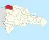 | |
 |
Monte Plata | East | Higuamo | 2,632.14 | 188,671 | 71.68 | 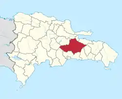 | |
 |
Pedernales | South | Enriquillo | 2,074.53 | 33,439 | 16.12 | 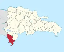 | |
 |
Peravia | South | Valdesia | 792.33 | 191,439 | 241.62 | 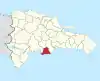 | |
 |
Puerto Plata | Cibao | Cibao Norte | 1,852.90 | 328,498 | 177.29 | 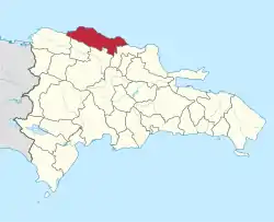 | |
 |
Samaná | Cibao | Cibao Nordeste | 853.74 | 107,243 | 125.62 | 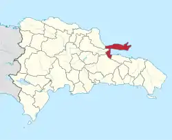 | |
 |
San Cristóbal | South | Valdesia | 1,265.77 | 605,153 | 505.93 | 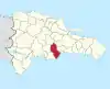 | |
 |
San José de Ocoa | South | Valdesia | 855.4 | 57,096 | 45.11 | 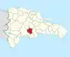 | |
 |
San Juan | South | El Valle | 3,569.39 | 227,640 | 266.12 | 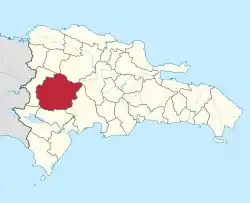 | |
 |
San Pedro de Macorís | East | Higuamo | 1,255.46 | 298,633 | 83.66 | 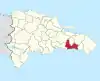 | |
 |
Sánchez Ramírez | Cibao | Cibao Sur | 1,196.13 | 152,023 | 121.09 | 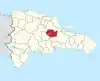 | |
 |
Santiago | Cibao | Cibao Norte | 2,836.51 | 1,017,808 | 355.30 | 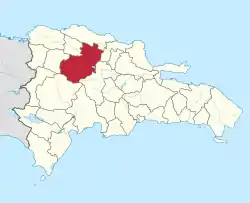 | |
 |
Santiago Rodríguez | Cibao | Cibao Noroeste | 1,111.14 | 57,460 | 51.71 | 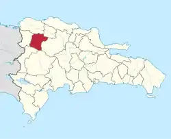 | |
 |
Santo Domingo | South | Ozama | 1,301.84 | 2,650,651 | 2036.08 | 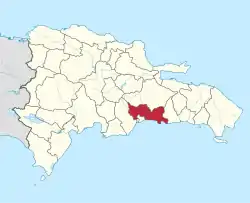 | |
 |
Valverde | Cibao | Cibao Noroeste | 823.38 | 170,490 | 207.06 | 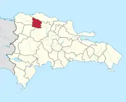 |
Map
References
- Asamblea Nacional. "CONSTITUCION DE LA REPUBLICA DOMINICANA" (in Spanish). Retrieved 2007-03-11.
- EL CONGRESO NACIONAL. "Ley No. 163-01 que crea la provincia de Santo Domingo, y modifica los Artículos 1 y 2 de la Ley No. 5220, sobre División Territorial de la República Dominicana" (in Spanish). Archived from the original on 2007-05-18. Retrieved 2007-03-08.
- EL CONGRESO NACIONAL. "Ley Electoral, No. 275-97" (in Spanish). Retrieved 2007-03-11.
- Consejo Nacional de Población y Familia. "Estamaciones y Proyecciones de la Población Dominicana por Regiones, Provincias, Municipios y Distritos Municipales, 2014" (in Spanish). Archived from the original (PDF) on 2014-02-02. Retrieved 2014-02-02.
- "Provincias Dominicanas - Portal Oficial del Estado Dominicano". Archived from the original on 1 January 2017. Retrieved 1 January 2017.
- "Oficina Nacional de Estadística". Estimaciones y proyecciones de la población total por año calendario, según región y provincia, 2000-2030. Archived from the original on 2 January 2017. Retrieved 31 December 2016.
External links
- (in Spanish) Oficina Nacional de Estadística (National Statistics Office). Official statistics portal of the Dominican Republic.
- (in Spanish) Blog of the Dominican Republic, videos, news, culture and music
Administrative divisions of the Americas | ||
|---|---|---|
| ||
| Sovereign states |
| .svg.png.webp) |
| ||