Norton Parish, New Brunswick
Norton is a civil parish in Kings County, New Brunswick, Canada.[2]
Norton Parish | |
|---|---|
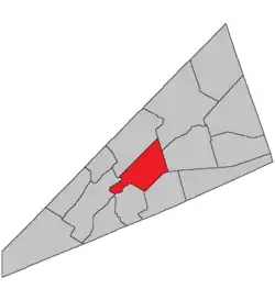 Location within Kings County, New Brunswick. | |
| Coordinates: 45.84°N 64.59°W | |
| Country | |
| Province | |
| County | Queens County |
| Erected | 1795 |
| Area | |
| • Land | 144.76 km2 (55.89 sq mi) |
| Population (2016)[1] | |
| • Total | 1,301 |
| • Density | 9.0/km2 (23/sq mi) |
| • Pop 2011-2016 | |
| • Dwellings | 536 |
| Time zone | UTC-4 (AST) |
| • Summer (DST) | UTC-3 (ADT) |
For governance purposes it is divided between the town of Hampton,[3] the village of Norton,[3] and the local service district of the parish of Norton,[4] all of which are members of Regional Service Commission 8 (RSC8).[5]
Origin of name
William F. Ganong gave no origin for the name.[6] It may have been taken from Norton, Massachusetts, near Taunton, which was the original home of many of the first settlers to this area.
History
Norton was erected in 1795[7] from Sussex Parish and Kingston Parish.
In 1844 the boundary with Kingston was adjusted.[8]
Writer Emily Elizabeth Shaw Beavan worked in the parish as a young teacher.[9]
Delineation
Norton Parish is defined in the Territorial Division Act[2] as being bounded:
- East by Sussex and Studholm Parishes; north by Kingston and Springfield Parishes; south by the Kennebecasis River and the centre of the old Westmorland Road,[lower-alpha 1] and west by Kingston Parish and the lower line of lot number fourteen, granted to John Fritch, prolonged southeasterly.
Communities
Parish population total does not include incorporated municipalities (in bold):
|
|
Demographics
Access Routes
Highways and numbered routes that run through the parish, including external routes that start or finish at the parish limits:[13]
See also
Notes
- The old Westmorland Road no longer appears on provincial highway maps.[10]
References
- "Census Profile, 2016 Census: Norton, Parish [Census subdivision], New Brunswick". Statistics Canada. Retrieved August 30, 2019.
- "Chapter T-3 Territorial Division Act". Government of New Brunswick. Retrieved 13 November 2020.
- "New Brunswick Regulation 85-6 under the Municipalities Act (O.C. 85-45)". Government of New Brunswick. Retrieved 19 July 2020.
- "New Brunswick Regulation 84-168 under the Municipalities Act (O.C. 84-582)". Government of New Brunswick. Retrieved 19 July 2020.
- "Communities in each of the 12 Regional Service Commissions (RSC) / Les communautés dans chacune des 12 Commissions de services régionaux (CSR)" (PDF), Government of New Brunswick, July 2017, retrieved 2 February 2021
- Ganong, William F. (1896). A Monograph of the Place-Nomenclature of the Province of New Brunswick. Royal Society of Canada. p. 258.
- "35 Geo. III c. 3 An Act in addition to an Act intitled, 'An Act for the better Ascertaining and Confirming the Boundaries of the several Counties within this Province, and for subdividing them into Towns or Parishes.'". Acts of the General Assembly of His Majesty's Province of New-Brunswick, Passed in the Year 1795. Fredericton: Government of New Brunswick. 1795. pp. 338–340.
- "7 Vic. c. 24 An Act to alter the Division Line between the Parishes of Kingston and Norton, in King's County.". Acts of the General Assembly of Her Majesty's Province of New Brunswick, Passed in the Year 1844. Fredericton: Government of New Brunswick. 1844. p. 24.
- "SHAW, EMILY ELIZABETH". Home – Dictionary of Canadian Biography. 2019-09-25. Retrieved 2019-09-25.
- "No. 447" (PDF). 2015 Designated Highway Maps. Government of New Brunswick. Retrieved 24 August 2016.
- Statistics Canada: 2001, 2006 census
- 2011 Statistics Canada Census Profile: Norton Parish, New Brunswick
- Atlantic Canada Back Road Atlas ISBN 978-1-55368-618-7
Places adjacent to Norton Parish, New Brunswick | |
|---|---|
| Subdivisions | |
|---|---|
| Cities | |
| Counties | |
| |