Temanggung Regency
Temanggung Regency (Indonesian: Kabupaten Temanggung) is a regency in the Central Java Province of Indonesia. Its capital is Temanggung.
Temanggung Regency
Kabupaten Temanggung ꦏꦨꦸꦥꦠꦺꦤ꧀ꦠꦼꦩꦔ꧀ꦒꦸꦁ | |
|---|---|
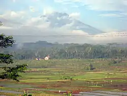 Rice fields in Pringsurat, Temanggung Regency | |
 Coat of arms | |
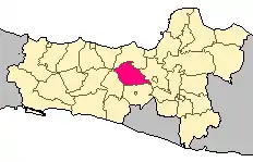 Location within Central Java | |
| Coordinates: 7°18′S 110°10′E | |
| Country | Indonesia |
| Region | Java |
| Province | Central Java |
| Named for | Temanggung Village |
| Capital | Temanggung |
| Government | |
| • Body | Local Government of Temanggung Regency |
| • Regent | M Al Khadziq |
| Time zone | UTC+7 (IWST) |
| Area code | (+62) 293 |
| Vehicle registration | AA |
| Website | temanggungkab |

All travelers going to the Dieng temple complex from Yogya or Semarang have to pass this regency.
Temanggung Regency is famous for longan, a small sweet fruit that is harvested in January and February.
Geography
Temanggung Regency is located on the volcanic Dieng Plateau with an average elevation between 500 and 1450 meters. It is landlocked. The volcanoes Mount Sundoro and Mount Sumbing rise on its border with the Wonosobo Regency. Its major drainage system is the Progo River and its tributaries.
Borders
It is bordered by:
- Pekalongan Regency to the northeast
- Batang Regency to the north
- Semarang Regency to the east
- Magelang Regency to the south
- Wonosobo Regency to the southwest
Administrative districts
Temanggung Regency is divided into the following 20 districts (kecamatan).
|
|
|
|
Communities
The major towns of Temanggung Regency, aside from the capital of Temanggung, include Candiroto, Jumo, Kaloran, Kandangan, Kranggan, Muntung, Ngadirejo, Parakan, and Tretep.
Climate
Temanggung has an elevation moderated tropical rainforest climate (Af) with moderate rainfall from June to September and heavy to very heavy rainfall from October to May. The following climate data is for the town of Temanggung.
| Climate data for Temanggung | |||||||||||||
|---|---|---|---|---|---|---|---|---|---|---|---|---|---|
| Month | Jan | Feb | Mar | Apr | May | Jun | Jul | Aug | Sep | Oct | Nov | Dec | Year |
| Average high °C (°F) | 26.9 (80.4) |
27.0 (80.6) |
27.5 (81.5) |
27.9 (82.2) |
28.2 (82.8) |
28.3 (82.9) |
28.3 (82.9) |
28.8 (83.8) |
29.0 (84.2) |
29.1 (84.4) |
28.0 (82.4) |
27.0 (80.6) |
28.0 (82.4) |
| Daily mean °C (°F) | 22.9 (73.2) |
22.9 (73.2) |
23.3 (73.9) |
23.5 (74.3) |
23.8 (74.8) |
23.3 (73.9) |
23.0 (73.4) |
23.2 (73.8) |
23.6 (74.5) |
24.1 (75.4) |
23.6 (74.5) |
22.8 (73.0) |
23.3 (74.0) |
| Average low °C (°F) | 18.9 (66.0) |
18.9 (66.0) |
19.2 (66.6) |
19.2 (66.6) |
19.4 (66.9) |
18.4 (65.1) |
17.7 (63.9) |
17.7 (63.9) |
18.3 (64.9) |
19.1 (66.4) |
19.2 (66.6) |
18.7 (65.7) |
18.7 (65.7) |
| Average rainfall mm (inches) | 343 (13.5) |
310 (12.2) |
353 (13.9) |
251 (9.9) |
161 (6.3) |
90 (3.5) |
74 (2.9) |
62 (2.4) |
89 (3.5) |
150 (5.9) |
239 (9.4) |
331 (13.0) |
2,453 (96.4) |
| Source: Climate-Data.org[1] | |||||||||||||
History
After World War II, Temanggung Regency was one of the areas in central Java where the Communist Party (PKI) had its rural strongholds. In the 21st century Temanggung Regency provided a hideout for members of the Islamist Jemaah Islamiyah.[2]
Religion

The majority of the population of the Temanggung Regency is Muslim. It was once predominately Hindu for thousands of years. The oldest stone structure in Indonesia is found here; four temples of Shiva, and one of the trinity of Hinduism. Though there were 400, only four remain.[3]
Economy
The big cash crop in the Temanggung Regency is tobacco.[4] Other cash crops include patchouli oil, honey and soy oil. The traditional herbal medicine, jamu, is the basis of a local industry, as is the production of cigars. Silkworms are raised in the area around the town of Candiroto.
Transportation
There is a rail line from Parakan through the town of Temanggung south to Magelang and on to junction with the coastal rail lines;[5] however, it is currently closed by the government due to the operational costs.
Culture and tourism

- Gondosuli Temple – A newly discovered temple located 13 km from the town of Temanggung.
- Kledung – a scenic pass between Mount Sumbing (3371 M) and Mount Sundoro (3133 M), it is crossed at around 2340 M. Located 20 km from Temanggung, it is a site for relaxing and mountaineering.
- Jumprit – a pool on the slope of Mount Sundoro, located 22 km from Temanggung. The water is cool and clean, and to some meditators considered as a holy place.
- Pringapus Temple- located near Jumprit. It was built by Sanjaya kingdom.
- Pakitan and Parakan – two small towns in the regency. Pakitan is situated between the hills, and has a cool climate.
- Meteorit – located in Wonotirto subdistrict Bulu
- Mbelang Sari Hills – a hill which borders on three different areas, located in Mblawong
- Water Fall Trocoh / Curug Trocoh – Located in Wonoboyo
Notes
- "Climate: Temanggung". Climate-Data.org. Retrieved 12 November 2020.
- Blomfield, Adrian (8 August 2009) "Police foil plot to kill Indonesian president after raid on top terror suspect" The Telegraph (UK)
- Staff (8 February 2011) "Indonesia: Angry Muslim crowd attacks Java churches" BBC News
- Hanusz, Mark (2000) Kretek: The culture and heritage of Indonesia's clove cigarettes Equinox Publishing, Jakarta, Indonesia, page 82, ISBN 979-95898-0-0
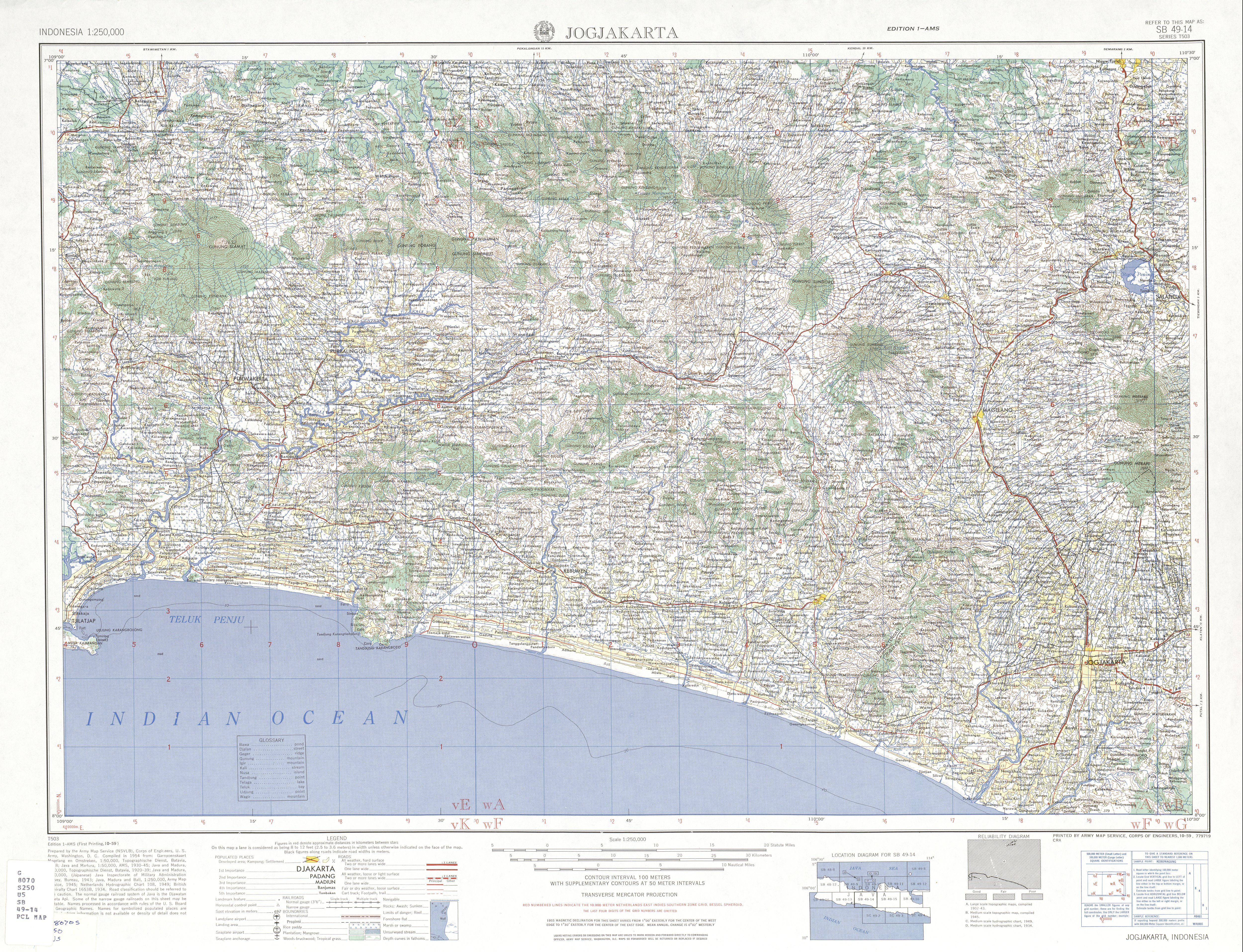
- "Indonesia 1:250,000 topographic map, Series T503, Jogjakarta SB49-14" US Army Mapping Service, October 1959
External links
![]() Media related to Temanggung Regency at Wikimedia Commons
Media related to Temanggung Regency at Wikimedia Commons
- "Temanggung Google Satellite Map" Maplandia World Gazetteer
Regencies and cities of Central Java | ||
|---|---|---|
Capital: Semarang | ||
| Regencies |  | |
| Cities | ||