Tower, Minnesota
Tower is a city located in Saint Louis County, Minnesota, United States. As of the 2010 census, the city had a total population of 500.[6]
Tower | |
|---|---|
| Motto(s): "Your Gateway To Beautiful Lake Vermilion" | |
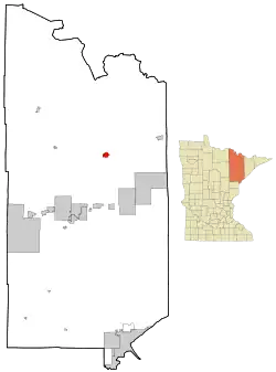 Location of the city of Tower within Saint Louis County, Minnesota | |
| Coordinates: 47°48′25″N 92°16′46″W | |
| Country | United States |
| State | Minnesota |
| County | Saint Louis |
| Incorporated | March 13, 1889 |
| Area | |
| • Total | 2.86 sq mi (7.41 km2) |
| • Land | 2.86 sq mi (7.41 km2) |
| • Water | 0.00 sq mi (0.00 km2) |
| Elevation | 1,394 ft (425 m) |
| Population | |
| • Total | 500 |
| • Estimate (2019)[3] | 486 |
| • Density | 169.81/sq mi (65.58/km2) |
| Time zone | UTC−6 (Central (CST)) |
| • Summer (DST) | UTC−5 (CDT) |
| ZIP codes | 55790 |
| Area code(s) | 218 |
| FIPS code | 27-65272[4] |
| GNIS feature ID | 0662661[5] |
| Website | Official website |
State Highways 1 (MN 1), 169 (MN 169), and 135 (MN 135) are three of the main routes in Tower.
Tower is located near the southern shore of Lake Vermilion.
History
The city was incorporated March 13, 1889,[7] which makes it the oldest city in the Arrowhead region. It owes its establishment to the Soudan Mine, and was named after mining financier Charlemagne Tower.[8] Tower is home to the Tower Train Museum; near the museum is McKinley Monument, the first erected in honor of former U.S. President William McKinley shortly after his assassination in 1901. President McKinley was in office from 1897 to 1901.
Tower set the Minnesota record for coldest temperature on February 2, 1996, when the temperature dropped to -60 °F (-51 °C). This was the lowest temperature ever recorded in the United States east of the Great Plains. Tower and the Embarrass Valley to the south are the coldest inhabited locations in the Lower 48 states, based on average winter temperatures. Embarrass fell to -64 on the same date by a verified thermometer, but at an unofficial station.25th Anniversary
Geography
According to the United States Census Bureau, the city has a total area of 3.41 square miles (8.83 km2), 3.00 square miles (7.77 km2) is land and 0.41 square miles (1.06 km2) is water.[9]
Climate
Tower has a humid continental climate (Köppen Dfb), with long, bitterly cold winters and humid and warm summers. January averages 5.0 °F or −15.0 °C, and lows reach 0 °F or −17.8 °C on 67 nights annually.[10] Highs only reach the freezing point 18–19 days during December to February, and in combination with a seasonal snowfall of 67.2 inches or 1.71 metres, snow cover is thick and long−lasting.[10] Spring, and more especially autumn, are short but mild transition seasons. July averages 63.9 °F or 17.7 °C, with highs reaching 90 °F or 32.2 °C on only 3.2 days annually, with only about four-fifths of all years seeing temperatures that high. Summer nights are cool despite the warm days, with the average window for freezing temperatures August 25 thru June 22. Precipitation averages about 27.77 inches or 705.4 millimetres per year, and is concentrated in the warmer months. The all−time record high temperature is 101 °F (38.3 °C), while the all−time record low is −60 °F (−51.1 °C), a range of 161 °F (89 °C), the second highest temperature variation in the state behind Federal Dam, Minnesota.[11] Tower is slightly colder than International Falls, but a couple degrees warmer overall than Embarrass.
| Climate data for Tower, Minnesota (1981–2010) | |||||||||||||
|---|---|---|---|---|---|---|---|---|---|---|---|---|---|
| Month | Jan | Feb | Mar | Apr | May | Jun | Jul | Aug | Sep | Oct | Nov | Dec | Year |
| Record high °F (°C) | 52 (11) |
59 (15) |
77 (25) |
87 (31) |
95 (35) |
98 (37) |
101 (38) |
98 (37) |
95 (35) |
84 (29) |
75 (24) |
57 (14) |
101 (38) |
| Average high °F (°C) | 17.9 (−7.8) |
24.5 (−4.2) |
36.6 (2.6) |
51.6 (10.9) |
64.7 (18.2) |
73.3 (22.9) |
77.6 (25.3) |
75.8 (24.3) |
66.0 (18.9) |
51.7 (10.9) |
35.2 (1.8) |
21.8 (−5.7) |
49.7 (9.8) |
| Average low °F (°C) | −7.8 (−22.1) |
−4.1 (−20.1) |
9.6 (−12.4) |
24.9 (−3.9) |
35.9 (2.2) |
45.6 (7.6) |
50.3 (10.2) |
47.9 (8.8) |
40.0 (4.4) |
29.7 (−1.3) |
16.7 (−8.5) |
0.5 (−17.5) |
24.1 (−4.4) |
| Record low °F (°C) | −57 (−49) |
−60 (−51) |
−42 (−41) |
−22 (−30) |
10 (−12) |
18 (−8) |
24 (−4) |
21 (−6) |
11 (−12) |
−7 (−22) |
−39 (−39) |
−52 (−47) |
−60 (−51) |
| Average precipitation inches (mm) | 0.58 (15) |
0.57 (14) |
0.74 (19) |
1.77 (45) |
3.17 (81) |
4.03 (102) |
4.17 (106) |
3.74 (95) |
4.14 (105) |
2.86 (73) |
1.36 (35) |
0.63 (16) |
27.77 (705) |
| Average snowfall inches (cm) | 14.5 (37) |
9.1 (23) |
8.3 (21) |
7.4 (19) |
0.3 (0.76) |
0 (0) |
0 (0) |
0 (0) |
0 (0) |
2.7 (6.9) |
13.5 (34) |
11.4 (29) |
67.2 (170.66) |
| Average precipitation days (≥ 0.01 in) | 6.1 | 5.5 | 6.0 | 7.9 | 12.4 | 13.4 | 12.5 | 11.4 | 12.5 | 10.4 | 8.0 | 6.6 | 112.8 |
| Average snowy days (≥ 0.1 in) | 6.7 | 5.4 | 4.1 | 2.6 | 0.2 | 0 | 0 | 0 | 0 | 1.3 | 5.6 | 6.3 | 32.1 |
| Source: NOAA (extremes 1897–present)[10] | |||||||||||||
Entertainment and sports

Fortune Bay Resort and Casino is located a few miles west of Tower. It is near Lake Vermilion, a well-known lake which attracts tourists and locals alike. The casino is owned and operated by the Bois Forte Band of Chippewa.
Tower has a simple sports ground with bleacher stands, close by the Tower School. At Lake Vermillion, a run tournament named after the lake is staged every year.
Education
Tower is part of the St. Louis County school district based in Virginia, Minnesota. In town there is the Tower-Soudan Elementary School that serves students K–6. Students 7–12 are transported to other secondary schools nearby as Tower-Soudan does not have a secondary school at this point.
Outside of the district, Tower has a public charter school that serves students 7–12, called Vermilion Country School. Based in the old PowerRain building, this project-based secondary school was set up by parents and townspeople who advocated for a local secondary school. Opened in 2013, VCS graduated their first 6 seniors in May 2014.
Demographics
| Historical population | |||
|---|---|---|---|
| Census | Pop. | %± | |
| 1890 | 1,110 | — | |
| 1900 | 1,366 | 23.1% | |
| 1910 | 1,111 | −18.7% | |
| 1920 | 706 | −36.5% | |
| 1930 | 801 | 13.5% | |
| 1940 | 820 | 2.4% | |
| 1950 | 773 | −5.7% | |
| 1960 | 878 | 13.6% | |
| 1970 | 699 | −20.4% | |
| 1980 | 640 | −8.4% | |
| 1990 | 502 | −21.6% | |
| 2000 | 479 | −4.6% | |
| 2010 | 500 | 4.4% | |
| 2019 (est.) | 486 | [3] | −2.8% |
| U.S. Decennial Census | |||
2010 census
As of the census[2] of 2010, there were 500 people, 265 households, and 126 families residing in the city. The population density was 166.7 inhabitants per square mile (64.4/km2). There were 331 housing units at an average density of 110.3 per square mile (42.6/km2). The racial makeup of the city was 94.6% White, 2.4% Native American, 0.6% Asian, 0.2% from other races, and 2.2% from two or more races. Hispanic or Latino of any race were 1.2% of the population.
There were 265 households, of which 20.4% had children under the age of 18 living with them, 32.5% were married couples living together, 10.2% had a female householder with no husband present, 4.9% had a male householder with no wife present, and 52.5% were non-families. 45.7% of all households were made up of individuals, and 20% had someone living alone who was 65 years of age or older. The average household size was 1.89 and the average family size was 2.61.
The median age in the city was 48.4 years. 18.8% of residents were under the age of 18; 5.6% were between the ages of 18 and 24; 21.6% were from 25 to 44; 30% were from 45 to 64; and 24% were 65 years of age or older. The gender makeup of the city was 50.8% male and 49.2% female.
2000 census
As of the census[4] of 2000, there were 479 people in the city, organized into 233 households and 137 families. The population density was 176.8 people per square mile (68.2/km2). There were 295 housing units at an average density of 108.9 per square mile (42.0/km2). The racial makeup of the city was 97.70% White, 1.46% Native American, 0% Asian, 0% African American, 0% Pacific Islander, 0.84% from other races, and 0.00% from two or more races. 1.88% of the population were Hispanic or Latino of any race. 31.4% were of Finnish, 13.7% Norwegian, 11.1% Swedish, 8.6% German, 6.6% Slovene and 5.8% Italian ancestry according to Census 2000.
There were 233 households, out of which 20.2% had children under the age of 18 living with them, 48.9% were married couples living together, 6.0% had a female householder with no husband present, and 41.2% were non-families. 37.8% of all households were made up of individuals, and 22.3% had someone living alone who was 65 years of age or older. The average household size was 2.06 and the average family size was 2.69.
In the city, the population was spread out, with 18.6% under the age of 18, 6.5% from 18 to 24, 24.0% from 25 to 44, 26.1% from 45 to 64, and 24.8% who were 65 years of age or older. The median age was 45 years. For every 100 females, there were 93.9 males. For every 100 females age 18 and over, there were 91.2 males.
The median income for a household in the city was $26,429, and the median income for a family was $37,500. Males had a median income of $35,000 versus $21,875 for females. The per capita income for the city was $17,169. 10.7% of the population and 3.7% of families were below the poverty line. Out of the total population, 12.5% of those under the age of 18 and 10.9% of those 65 and older were living below the poverty line.
References
- "2019 U.S. Gazetteer Files". United States Census Bureau. Retrieved July 26, 2020.
- "U.S. Census website". United States Census Bureau. Retrieved 2012-11-13.
- "Population and Housing Unit Estimates". United States Census Bureau. May 24, 2020. Retrieved May 27, 2020.
- "U.S. Census website". United States Census Bureau. Retrieved 2008-01-31.
- "US Board on Geographic Names". United States Geological Survey. 2007-10-25. Retrieved 2008-01-31.
- "2010 Census Redistricting Data (Public Law 94-171) Summary File". American FactFinder. U.S. Census Bureau, 2010 Census. Retrieved 23 April 2011.
- Minnesota Place Names: A Geographical Encyclopedia. Minnesota Historical Society website. "Archived copy". Archived from the original on 2007-06-20. Retrieved 2007-06-19.CS1 maint: archived copy as title (link)
- Upham, Warren (1920). Minnesota Geographic Names: Their Origin and Historic Significance. Minnesota Historical Society. p. 490.
- "US Gazetteer files 2010". United States Census Bureau. Archived from the original on 2012-01-25. Retrieved 2012-11-13.
- "NOWData - NOAA Online Weather Data". National Oceanic and Atmospheric Administration. Retrieved November 17, 2012.
- "Federal Dam, Minnesota Travel Weather Averages (Weatherbase)". Weatherbase. Retrieved 2021-01-21.
External links
| Wikimedia Commons has media related to Tower, Minnesota. |
- Official website
- Photos taken in Tower – photos taken during August 1937 – from the Library of Congress
- Lake Vermilion Chamber of Commerce website
| Authority control |
|---|