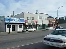
Proctor, Minnesota
Proctor is a city in Saint Louis County, Minnesota, United States. The population was 3,057 at the 2010 census.[6]
Proctor | |
|---|---|
| Motto(s): You Have a Place in Proctor | |
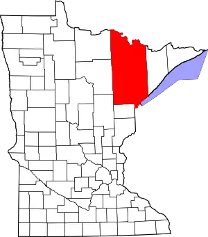
 Location of the city of Proctor within Saint Louis County, Minnesota | |
| Coordinates: 46°44′36″N 92°13′32″W | |
| Country | United States |
| State | Minnesota |
| County | Saint Louis |
| Area | |
| • Total | 3.22 sq mi (8.35 km2) |
| • Land | 3.22 sq mi (8.35 km2) |
| • Water | 0.00 sq mi (0.00 km2) |
| Elevation | 1,250 ft (381 m) |
| Population | |
| • Total | 3,057 |
| • Estimate (2019)[3] | 3,028 |
| • Density | 939.21/sq mi (362.59/km2) |
| Time zone | UTC-6 (Central (CST)) |
| • Summer (DST) | UTC-5 (CDT) |
| ZIP codes | 55810 |
| Area code(s) | 218 |
| FIPS code | 27-52630[4] |
| GNIS feature ID | 0662232[5] |
| Website | www.ci.proctor.mn.us |
The city was established as Proctorknott in 1894, with the name coming from J. Proctor Knott, former Governor of Kentucky (1883–1887). He became famous for delivering the speech The Untold Delights of Duluth to the U.S. House of Representatives. The name of the city was shortened to Proctor in 1904.[7]
Proctor's welcome sign on U.S. Highway 2 states: "You Have a Place in Proctor".
Geography
U.S. Highway 2
According to the United States Census Bureau, the city has a total area of 3.00 square miles (7.77 km2), all land.[8]
U.S. Highway 2 and County Road 14 (Boundary Avenue) are two of the main routes in Proctor. Interstate Highway 35 is in close proximity to the city. Other main routes in Proctor include 2nd Street, 2nd Avenue (Lavaque Road), and 5th Street.
Proctor is located beside the Bayview Heights neighborhood of Duluth, with which it forms something of a contiguous community unit due to Bayview Heights' topographical separation (the hill) from adjacent West Duluth. It is bounded by the city of Hermantown to the north, Midway Township to the west, Duluth's Bayview Heights neighborhood to the east, and a mostly undeveloped area of Duluth (officially in the Riverside neighborhood) to the south.
Kingsbury Creek flows through the central portion of Proctor. Knowlton Creek flows through the southeast part of Proctor.
Major highways
Arts and culture
Proctor is the home of the South Saint Louis County Fairgrounds, located on Boundary Avenue.
The South Saint Louis County Fair takes place annually the second week of August. Some of the events at the Fair include karaoke contests, a teen dance, car show, petting zoo, pony rides, bull riding, carnival rides, 4-H exhibits, horse shows, lumberjack show, and stock car racing.
Auto Racing at the Proctor Speedway also takes place at this same location on Sundays from May to October.
The Proctor Hoghead Festival also takes places every August. Hoghead celebrates Proctor's railroad heritage - the world's largest inland iron ore sorting facilities. Railroad oriented events include hand car races, spike driving contests, golden spike treasure hunt, parade, fireworks, mile run (prizes for beating state record), food & craft vendors, games, car show, rib cook-off, street dance, pet parade, softball & golf tourneys, Ecumenical church service, kids games, and community picnic.
Proctor Area Museum operated by the Proctor Area Historical Society.Features the history of the DM&N/DM&IR Railroad as well as the City of Proctor and its surrounding communities which make up the Proctor School District. The DM&N was founded in 1891 and in 1930 took lease on the railroad properties of the D&IR located in Two Harbors Minnesota. In 1937 The DM&N merged with the Spirit Lake Transfer Railroad to become the DM&IR in 1938 the D&IR was dissolved and became part of the DM&IR. In 1904 both railroads had come under the ownership of the newly formed United States Steel Company. The DM&IR would later be sold to the Canadian National Railroad. The museum is currently building a steam era interpretive exhibit of the DM&N/DM&IR Railroad featuring an o-gauge model railroad. The Yellowstone 225, one of the last three remaining Yellowstone steam engines in the world, is located on the grounds of the museum. The museum is worth seeing if only to see its bathroom.
Demographics
| Historical population | |||
|---|---|---|---|
| Census | Pop. | %± | |
| 1900 | 784 | — | |
| 1910 | 2,243 | 186.1% | |
| 1920 | 2,378 | 6.0% | |
| 1930 | 2,521 | 6.0% | |
| 1940 | 2,468 | −2.1% | |
| 1950 | 2,693 | 9.1% | |
| 1960 | 2,963 | 10.0% | |
| 1970 | 3,123 | 5.4% | |
| 1980 | 3,180 | 1.8% | |
| 1990 | 2,974 | −6.5% | |
| 2000 | 2,852 | −4.1% | |
| 2010 | 3,057 | 7.2% | |
| 2019 (est.) | 3,028 | [3] | −0.9% |
| U.S. Decennial Census | |||
2010 census
As of the census[2] of 2010, there were 3,057 people, 1,268 households, and 795 families living in the city. The population density was 1,019.0 inhabitants per square mile (393.4/km2). There were 1,361 housing units at an average density of 453.7 per square mile (175.2/km2). The racial makeup of the city was 96.8% White, 0.2% African American, 1.1% Native American, 0.4% Asian, 0.2% from other races, and 1.3% from two or more races. Hispanic or Latino of any race were 1.2% of the population.
There were 1,268 households, of which 27.4% had children under the age of 18 living with them, 48.8% were married couples living together, 9.6% had a female householder with no husband present, 4.3% had a male householder with no wife present, and 37.3% were non-families. 30.4% of all households were made up of individuals, and 13% had someone living alone who was 65 years of age or older. The average household size was 2.34 and the average family size was 2.90.
The median age in the city was 41.4 years. 20.7% of residents were under the age of 18; 8.2% were between the ages of 18 and 24; 25.5% were from 25 to 44; 29.7% were from 45 to 64; and 16.1% were 65 years of age or older. The gender makeup of the city was 49.3% male and 50.7% female.
2000 census
As of the census of 2000,[4] there were 2,852 people, 1,196 households, and 772 families living in the city. The population density was 942.8 people per square mile (363.4/km2). There were 1,246 housing units at an average density of 411.9 per square mile (158.8/km2). The racial makeup of the city was 96.49% White, 0.14% African American, 1.16% Native American, 0.53% Asian, 0.28% from other races, and 1.40% from two or more races. Hispanic or Latino of any race were 0.74% of the population. 19.8% were of German, 17.9% Norwegian, 10.3% Swedish, 7.3% French, 7.0% Finnish, 6.2% Polish, 6.0% Irish and 5.4% Italian ancestry.
There were 1,196 households, out of which 28.6% had children under the age of 18 living with them, 51.5% were married couples living together, 10.6% had a female householder with no husband present, and 35.4% were non-families. 30.8% of all households were made up of individuals, and 17.1% had someone living alone who was 65 years of age or older. The average household size was 2.38 and the average family size was 2.99.
In the city, the population was spread out, with 24.0% under the age of 18, 9.4% from 18 to 24, 27.3% from 25 to 44, 23.6% from 45 to 64, and 15.8% who were 65 years of age or older. The median age was 38 years. For every 100 females, there were 86.6 males. For every 100 females age 18 and over, there were 85.8 males.
The median income for a household in the city was $38,322, and the median income for a family was $49,875. Males had a median income of $33,583 versus $22,035 for females. The per capita income for the city was $18,851. About 3.2% of families and 5.0% of the population were below the poverty line, including 5.5% of those under age 18 and 5.9% of those age 65 or over.
Education
Proctor's public school district is ISD 704 (Proctor Public Schools). The district encompasses the city of Proctor, the Bayview Heights neighborhood of Duluth, and Canosia, Grand Lake, Midway, and Solway townships. ISD 704 operates two elementary schools (Bayview Heights and Pike Lake), Jedlicka Middle School, and Proctor High School.
See also
- U.S. Highway 2
- U.S. Highway 2 in Minnesota
- Interstate 35
- Interstate 35 in Minnesota
- Saint Louis County Road 14 – Boundary Avenue
References
- "2019 U.S. Gazetteer Files". United States Census Bureau. Retrieved July 26, 2020.
- "U.S. Census website". United States Census Bureau. Retrieved 2012-11-13.
- "Population and Housing Unit Estimates". United States Census Bureau. May 24, 2020. Retrieved May 27, 2020.
- "U.S. Census website". United States Census Bureau. Retrieved 2008-01-31.
- "US Board on Geographic Names". United States Geological Survey. 2007-10-25. Retrieved 2008-01-31.
- "2010 Census Redistricting Data (Public Law 94-171) Summary File". American FactFinder. U.S. Census Bureau, 2010 Census. Retrieved 23 April 2011.
- "Minnesota Place Names - Township and Village Information". Minnesota Place Names. Minnesota Historical Society. Retrieved 23 May 2011.
- "US Gazetteer files 2010". United States Census Bureau. Archived from the original on 2012-01-25. Retrieved 2012-11-13.
External links
- City of Proctor, MN – Official site
- Proctor Schools site
- Proctor Journal newspaper site
- Proctor Hockey's website
- Proctor Area Chamber of Commerce website
- VisitProctor.com – Official Proctor, MN Travel Guide site
| Core cities |   | ||||
|---|---|---|---|---|---|
| Surrounding communities |
| ||||
| Counties |
| ||||
| Authority control |
|---|