U.S. Route 97 in Oregon
U.S. Route 97 (US 97) in the U.S. state of Oregon is a major north–south United States highway which runs from the California border, south of Klamath Falls, to the Washington border on the Columbia River, between Biggs Junction, Oregon and Maryhill, Washington. Other than the northernmost stretch (which is known as the Sherman Highway), US 97 (along with US 197) is known as The Dalles-California Highway. In May 2009, Oregon Senate passed a bill to rename US 97 as "World War II Veterans Historic Highway".
| ||||
|---|---|---|---|---|

US 97 highlighted in red | ||||
| Route information | ||||
| Maintained by ODOT | ||||
| Length | 289.31 mi (465.60 km) | |||
| Existed | 1930s–present | |||
| Major junctions | ||||
| South end | ||||
| North end | ||||
| Location | ||||
| Counties | Klamath, Deschutes, Jefferson, Wasco, Sherman | |||
| Highway system | ||||
| ||||

With the exception of Interstate 5 (I-5), US 97 is the most important north–south highway corridor in the state. It serves two major population centers (Klamath Falls and Bend), and is the main corridor east of the Cascade Mountains. While much of the highway remains in two-lane undivided configuration, significant sections have been upgraded to expressway or freeway status.
Route description
The run of US 97 in Oregon (running from south to north) starts at the border between Oregon and California, south of the city of Klamath Falls. The highway starts out as a two-lane road, running through the arid Klamath River basin. Approaching the city of Klamath Falls, 97 becomes a freeway just south of the junction with OR 140 and OR 66. The freeway then runs along the western edge of the downtown region, ending at an interchange with Oregon Route 39 near the Oregon Institute of Technology. Within Klamath Falls is a business route, which runs through downtown via Main Street/Klamath Avenue and Esplanade Avenue, then which turns back to the US 97 mainline via the East Side Bypass (this latter segment co-signed with OR 39). This section of Highway 97 has been identified as an important alternative to I-5 for traffic in the Medford area in the event of a major earthquake in the region.[1] Various proposals have also identified US 97 as a potential freeway corridor.[2]
Highway 97, once again primarily a two-lane road, continues north along the eastern shore of Upper Klamath Lake. In the town of Chiloquin is an intersection with Oregon Route 62, which provides access to Crater Lake National Park from the southeast; further north is an interchange with Oregon Route 138 which provides access to the park from the northeast. Continuing north, near the town of Chemult is an interchange with Oregon Route 58, which heads northwest to Eugene and the Willamette Valley.
In La Pine is a junction with Oregon Route 31; this city marks the start of the Deschutes River recreation area; (Crane Prairie Reservoir, the river's source, is located due west of La Pine). North of La Pine, the highway becomes an expressway as it passes by the resort community of Sunriver and heads towards the city of Bend.
In Bend, the highway travels on an expressway known as the Bend Parkway with right-in, right-out access at intersections. The parkway opened in November 2001 and replaced a parallel alignment on 3rd Street that now carries a signed business route.[3] Expected interchange construction over the approaching years will increase the RIRO distance miles past the southern city limits of Bend, linking up with prior ODOT improvements and eliminating two of the five traffic signals along US 97 in Bend, and in the entire 44 miles (71 km)[4] between La Pine and Redmond. Similar upgrades are possible at the northern boundary of Bend, dependent upon taxpayer and state approval.[5][6] In Bend one finds interchanges with the Century Drive Highway, as well as U.S. Route 20. The busiest part of US 97 is in Bend, with an average of 42,000 cars a day. This is also the busiest section of road in Oregon east of the Cascade Mountains.
North of Bend, the highway continues as an expressway until it reaches the city of Redmond. US 97 follows a new alignment bypassing the downtown area, with the old route designated U.S. Route 97 Business. It maintains a standard 65-mile-per-hour (105 km/h) speed limit on the northern section of this parkway.[7] In Redmond is an intersection with Oregon Route 126. Continuing north out of Redmond, one enters a high desert region marked by numerous deep river gorges, including the Crooked River gorge (which 97 passes over near the Peter Skene Ogden State Scenic Viewpoint and rest area). Towns along the route include Terrebonne, which provides access to Smith Rock State Park, a climbing mecca, and Culver. North of Culver, the highway enters the agricultural community of Madras.
South of Madras is an intersection with U.S. Route 26 headed eastbound; the two routes share an alignment through the city. On the northern edge of town, 97 forks off to the right, heading northeast; and 26 continues northwest towards Portland. The importance of 97 as a transportation corridor diminishes north of Madras, as most traffic continues to Portland.
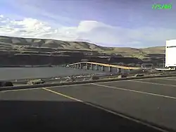
South of the community of Shaniko, US 97 forks off its only spur route, U.S. Route 197 which continues heading parallel to the Deschutes River towards Tygh Valley and The Dalles. Route 97 takes a more easterly course, passing through the high desert region of the Columbia Plateau. Towns along the route include Grass Valley and Wasco. Just south of Biggs Junction, the highway descends from the plateau into the Columbia River Gorge. In Biggs is an interchange with Interstate 84 and U.S. Route 30; immediately north of the interchange is the Biggs Rapids-Sam Hill Bridge over the Columbia River. The river serves as the state line between Oregon and Washington. Work on US 97 near Biggs in 1966 led to the discovery of the Biggs jasper, a sought-after gemstone.
Highways comprised
US 97 comprises the following highways (see Oregon highways and routes), from south to north:
- Part of The Dalles-California Highway No. 4; and
- The Sherman Highway No. 42.
It was also designated as the World War II Veterans Historic Highway in 2009, primarily because it connected several training facilities used by the military during the war.[8]
US 97 Business in Klamath Falls, from south to north, comprises:
- Part of the Klamath Falls-Lakeview Highway No. 20 concurrent with Oregon Route 39;
- The Esplanade Spur, concurrent with Oregon Route 39; and
- Part of the Klamath Falls-Malin Highway No. 50.
US 97 Business in Bend runs from its intersection with the main highway at East 1st Street north of Bend, south on East 1st Street, Deschutes Place, and Wall Street to Newport Avenue, concurrent with U.S. 20 Business, then continues south on a Wall Street-Bond Street couplet and east on Franklin Avenue until it rejoins the main highway at East 3rd Street.
Major intersections
Mileposts are measured from north to south. They do not reflect actual mileage due to realignments.
| County | Location | mi[9][10] | km | Exit | Destinations | Notes |
|---|---|---|---|---|---|---|
| Klamath | | 291.73 | 469.49 | Continuation into California | ||
| | 282.87 | 455.24 | Merrill, Malin | Former Lower Klamath Highway | ||
| | 280.16 | 450.87 | Miller Island Road (Midland Highway) | |||
| Klamath Falls | 277.47 | 446.54 | South end of freeway | |||
| 277.13 | 446.00 | 277 | ||||
| 276.74 | 445.37 | Green Springs Drive | Northbound exit only | |||
| 275.06 | 442.67 | |||||
| 273.62 | 440.35 | 275 | Oregon Avenue, Lakeshore Drive | |||
| 272.79 | 439.01 | No southbound entrance | ||||
| 272.56 | 438.64 | North end of freeway | ||||
| Modoc Point | 257.83 | 414.94 | Modoc Point Road | Former Modoc Point Highway | ||
| Lobert Junction | 251.74 | 405.14 | ||||
| | 249.08 | 400.86 | ||||
| | 247.54 | 398.38 | 247 | Interchange | ||
| Mazama Junction | 216.12 | 347.81 | Sun Mountain Road | Former OR 232 | ||
| Diamond Lake Junction | 213.09 | 342.94 | ||||
| | 195.05 | 313.90 | Interchange | |||
| Deschutes | | 169.68 | 273.07 | |||
| | 153.08 | 246.36 | 153 | South Century Drive - Sunriver | Interchange | |
| | 151.30 | 243.49 | 151 | Cottonwood Road | Interchange | |
| | 143.45 | 230.86 | 143 | Baker Road / Knott Road | Interchange | |
| Bend | 140.87 | 226.71 | 141 | interchange; northbound exit and southbound entrance | ||
| Powers Road | intersection with jughandles | |||||
| 139.68 | 224.79 | South end of freeway | ||||
| 139.17 | 223.97 | 139 | Reed Market Road – Old Mill District | |||
| Truman Avenue | southbound right-in/right-out | |||||
| 138.24 | 222.48 | 138 | Downtown, Mount Bachelor | |||
| Hawthorne Avenue | southbound right-in/right-out | |||||
| Lafayette Avenue | southbound right-in/right-out | |||||
| 137.13 | 220.69 | 137 | Revere Avenue – Downtown | |||
| 136.31 | 219.37 | 136 | Butler Market Road | No northbound exit | ||
| 135.46 | 218.00 | 135B | Empire Boulevard – State Offices | No southbound exit | ||
| 134.97 | 217.21 | 135A | Southbound exit and northbound entrance | |||
| Northbound exit and southbound entrance | ||||||
| 134.75 | 216.86 | North end of freeway | ||||
| Deschutes | Deschutes Market Road / Tumalo Road | interchange | ||||
| Redmond | 123.60 | 198.91 | 124 | Airport Way / Yew Avenue – Redmond Airport | Interchange | |
| 121.45 | 195.45 | South end of OR 126 overlap | ||||
| 121.21 | 195.07 | North end of OR 126 overlap | ||||
| 119.17 | 191.79 | 119 | Interchange | |||
| | 118.52 | 190.74 | ||||
| Jefferson | | 105.73 | 170.16 | |||
| | 97.29 | 156.57 | South end of US 26 overlap | |||
| Madras | 92.45 | 148.78 | ||||
| 92.08 | 148.19 | North end of US 26 overlap | ||||
| | 74.83 | 120.43 | ||||
| Wasco | | 67.17 68.66 | 108.10 110.50 | |||
| Shaniko | 56.53 | 90.98 | ||||
| Sherman | Grass Valley | 28.36 | 45.64 | |||
| | 10.34 | 16.64 | Old Sherman Highway – Wasco | Former US 97 north | ||
| | 8.82 | 14.19 | Interchange | |||
| | 7.50 | 12.07 | Wasco (Wasco-Heppner Highway) | Former US 97 south | ||
| Biggs | 0.03 | 0.048 | Deschutes State Park (Celilo-Wasco Highway) | |||
| Biggs Junction | −0.13 | −0.21 | I-84 exit 104 | |||
| Columbia River | −0.18– −0.43 | −0.29– −0.69 | Sam Hill Memorial Bridge | |||
1.000 mi = 1.609 km; 1.000 km = 0.621 mi
| ||||||
Related routes
Klamath Falls business route
| |
|---|---|
| Location | Klamath Falls |
Bend business route
| |
|---|---|
| Location | Bend |
Redmond business route
| |
|---|---|
| Location | Redmond |
References
| Wikimedia Commons has media related to U.S. Route 97 in Oregon. |
- "Big quake could cut off S. Ore". Ashland Daily Tidings. Retrieved October 9, 2014.
- Chiang, Chuck (May 5, 2006). "Widening Highway 97". Bend Bulletin. Retrieved September 4, 2018.
- Lundgren, Steve (January 6, 2002). "Bend starts life in fast lane". The Oregonian. p. A19.
- Google (June 8, 2009). "U.S. Route 97 in Oregon" (Map). Google Maps. Google. Retrieved June 8, 2009.
- "Murphy Road project, others in Bend could cost city $40M". The Bulletin. Retrieved October 9, 2014.
- "Bend narrows options for Cooley fix - What's the best fix for the Cooley/97 intersection?". The Bulletin. Retrieved October 9, 2014.
- AASHO October 2008 meeting
- Juillerat, Lee (February 18, 2015). "Highway 395 may be dedicated in honor of veterans groups". Herald and News. Klamath Falls, Oregon. Retrieved September 9, 2018.
- "The Dalles-California Highway No. 4 Straightline Chart" (PDF). Oregon Department of Transportation. May 2012. pp. 3–12. Retrieved May 23, 2014.
- "Sherman Highway No. 42 Straightline Chart" (PDF). Oregon Department of Transportation. June 2011. pp. 1–3. Retrieved May 26, 2014.
| Previous state: California |
Oregon | Next state: Washington |