Jefferson County, Oregon
Jefferson County is one of the 36 counties in the U.S. state of Oregon. At the 2010 census, the population was 21,720.[1] The county seat is Madras.[2] The county is named after Mount Jefferson.[3]
Jefferson County | |
|---|---|
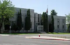 Jefferson County Courthouse in Madras | |
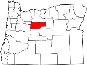 Location within the U.S. state of Oregon | |
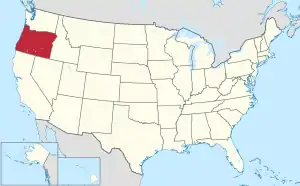 Oregon's location within the U.S. | |
| Coordinates: 44°38′N 121°10′W | |
| Country | |
| State | |
| Founded | December 12, 1914 |
| Seat | Madras |
| Largest city | Madras |
| Area | |
| • Total | 1,791 sq mi (4,640 km2) |
| • Land | 1,781 sq mi (4,610 km2) |
| • Water | 10 sq mi (30 km2) 0.6%% |
| Population (2010) | |
| • Total | 21,720 |
| • Estimate (2019) | 24,658 |
| • Density | 12/sq mi (5/km2) |
| Time zone | UTC−8 (Pacific) |
| • Summer (DST) | UTC−7 (PDT) |
| Congressional district | 2nd |
| Website | www |
History
Jefferson County was created on December 12, 1914, from a portion of Crook County. The county owes much of its agricultural prosperity to the railroad, which links Madras with the Columbia River, and was completed in 1911, and to the development of irrigation projects in the late 1930s. The railroad was completed despite constant feuds and battles between two lines working on opposite sides of the Deschutes River.
Madras was incorporated in 1911, and has been the permanent county seat since a general election in 1916. The first (temporary) county seat was Culver, which was selected by a three-man commission appointed by the governor. Due to repeated tie votes over several days (with one vote each cast for Culver, Metolius and Madras). The deadlock was eventually broken by allowing the Metolius Commissioner to post the tie-breaker, by voting for Culver.
Rapid development in adjacent Deschutes County during the 1990s had farmers in Jefferson County concerned that they may be priced out of their own farmlands, which could be replaced by destination resorts, golf courses and other amenities for recent arrivals.
Geography
According to the U.S. Census Bureau, the county has a total area of 1,791 square miles (4,640 km2), of which 1,781 square miles (4,610 km2) is land and 10 square miles (26 km2) (0.6%) is water.[4]
Adjacent counties
- Marion County (northwest)
- Wasco County (north)
- Wheeler County (east)
- Crook County (south)
- Deschutes County (south)
- Linn County (west)
National protected areas
Demographics
| Historical population | |||
|---|---|---|---|
| Census | Pop. | %± | |
| 1920 | 3,211 | — | |
| 1930 | 2,291 | −28.7% | |
| 1940 | 2,042 | −10.9% | |
| 1950 | 5,536 | 171.1% | |
| 1960 | 7,130 | 28.8% | |
| 1970 | 8,548 | 19.9% | |
| 1980 | 11,599 | 35.7% | |
| 1990 | 13,676 | 17.9% | |
| 2000 | 19,009 | 39.0% | |
| 2010 | 21,720 | 14.3% | |
| 2019 (est.) | 24,658 | [5] | 13.5% |
| U.S. Decennial Census[6] 1790-1960[7] 1900-1990[8] 1990-2000[9] 2010-2019[1] | |||
2000 census
At the 2000 census,[10] there were 19,009 people, 6,727 households and 5,166 families living in the county. The population density was 11 per square mile (4.2/km2). There were 8,319 housing units at an average density of 5 per square mile (1.9/km2). The racial make-up was 68.98% White, 0.26% Black or African American, 15.68% Native American, 0.30% Asian, 0.22% Pacific Islander, 11.32% from other races, and 3.23% from two or more races. 17.74% of the population were Hispanic or Latino of any race. 13.6% were of German, 9.5% English, 8.7% American and 5.3% Irish ancestry. 82.2% spoke English, 15.5% Spanish and 1.0% Sahaptian as their first language.
There were 6,727 households, of which 35.60% had children under the age of 18 living with them, 60.50% were married couples living together, 10.50% had a female householder with no husband present, and 23.20% were non-families. 18.60% of all households were made up of individuals, and 6.90% had someone living alone who was 65 years of age or older. The average household size was 2.80 and the average family size was 3.16.
29.80% of the population were under the age of 18, 7.70% from 18 to 24, 26.90% from 25 to 44, 23.20% from 45 to 64, and 12.40% who were 65 years of age or older. The median age was 35 years. For every 100 females there were 101.90 males. For every 100 females age 18 and over, there were 100.80 males.
The median household income was $35,853 and the median family income was $39,151. Males had a median income of $31,126 and females $22,086s. The per capita income was $15,675. About 10.40% of families and 14.60% of the population were below the poverty line, including 22.20% of those under age 18 and 5.90% of those age 65 or over.
2010 census
At the 2010 United States Census, there were 21,720 people, 7,790 households and 5,646 families living in the county.[11] The population density was 12.2 per square mile (4.7/km2). There were 9,815 housing units at an average density of 5.5 per square mile (2.1/km2).[12] The racial make-up was 69.0% white, 16.9% American Indian, 0.6% black or African American, 0.4% Asian, 0.1% Pacific islander, 9.1% from other races, and 3.8% from two or more races. Those of Hispanic or Latino origin made up 19.3% of the population.[11] In terms of ancestry, 15.0% were German, 9.4% were Irish, 8.3% were English, and 4.9% were American.[13]
Of the 7,790 households, 34.0% had children under the age of 18 living with them, 53.6% were married couples living together, 12.6% had a female householder with no husband present, 27.5% were non-families, and 22.2% of all households were made up of individuals. The average household size was 2.68 and the average family size was 3.11. The median age was 39.6 years.[11]
The median household income was $41,425 and the median family income was $48,818. Males had a median income of $37,370 and females $30,047. The per capita income was $20,009. About 13.5% of families and 20.1% of the population were below the poverty line, including 33.6% of those under age 18 and 6.5% of those age 65 or over.[14]
Communities
Census-designated places
Unincorporated communities
- Ashwood
- Crooked River Ranch
- Kilts
- Gateway
- Geneva
- Grandview
- Grizzly
- Horse Heaven
- Opal City
- Willowdale
Politics
Though Jefferson County is located in central Oregon, politically it falls in line with the eastern side of the state. The majority of registered voters who are part of a political party in Jefferson County, as well as most counties in eastern Oregon, are members of the Republican Party.[15] In the 2008 presidential election, 51.47% of Jefferson County voters voted for Republican John McCain, while 43.05% voted for Democrat Barack Obama and 5.46% of voters either voted for a Third Party candidate or wrote in a candidate.[16] These numbers show a small shift towards the Democratic candidate as well as a Third Party candidate when compared to the 2004 presidential election, in which 58.7% of Jefferson Country voters voted for George W. Bush, while 40% voted for John Kerry, and 1.3% of voters either voted for a Third Party candidate or wrote in a candidate.[17]
.gif)
| Year | Republican | Democratic | Third parties |
|---|---|---|---|
| 2016 | 58.0% 5,483 | 31.5% 2,980 | 10.5% 996 |
| 2012 | 56.8% 4,642 | 40.4% 3,301 | 2.8% 232 |
| 2008 | 52.9% 4,402 | 44.3% 3,682 | 2.8% 234 |
| 2004 | 58.7% 4,762 | 40.0% 3,243 | 1.4% 110 |
| 2000 | 55.7% 3,838 | 38.9% 2,681 | 5.5% 378 |
| 1996 | 42.5% 2,634 | 41.2% 2,555 | 16.2% 1,006 |
| 1992 | 33.2% 1,962 | 36.6% 2,161 | 30.2% 1,783 |
| 1988 | 50.2% 2,509 | 47.0% 2,346 | 2.8% 140 |
| 1984 | 62.9% 3,283 | 36.8% 1,920 | 0.3% 13 |
| 1980 | 53.3% 2,523 | 34.9% 1,654 | 11.8% 560 |
| 1976 | 47.9% 1,810 | 46.8% 1,769 | 5.2% 198 |
| 1972 | 56.4% 1,816 | 38.2% 1,229 | 5.5% 176 |
| 1968 | 55.3% 1,669 | 38.4% 1,160 | 6.3% 191 |
| 1964 | 40.7% 1,197 | 59.2% 1,739 | 0.1% 2 |
| 1960 | 53.8% 1,413 | 46.2% 1,214 | 0.1% 2 |
| 1956 | 54.8% 1,356 | 45.2% 1,117 | |
| 1952 | 67.1% 1,488 | 32.6% 723 | 0.3% 6 |
| 1948 | 50.7% 622 | 45.6% 559 | 3.8% 46 |
| 1944 | 58.0% 419 | 41.1% 297 | 1.0% 7 |
| 1940 | 47.2% 423 | 52.1% 467 | 0.7% 6 |
| 1936 | 31.5% 253 | 64.0% 514 | 4.5% 36 |
| 1932 | 33.0% 253 | 62.3% 477 | 4.7% 36 |
| 1928 | 59.3% 481 | 38.0% 308 | 2.7% 22 |
| 1924 | 39.0% 374 | 25.2% 242 | 35.8% 343 |
| 1920 | 61.6% 623 | 29.6% 300 | 8.8% 89 |
| 1916 | 36.1% 581 | 56.2% 904 | 7.7% 123 |
Economy
Agriculture is the predominant source of income in the county, with vegetable, grass and flower seeds, garlic, mint and sugar beets cultivated on some 60,000 acres (240 km2) of irrigated land. Jefferson County also has vast rangelands and until 2016 had an industrial base related to forest products. The Warm Springs Forest Products Industry, a multimillion-dollar complex owned by the Confederated Tribes of Warm Springs — partially located in the northwestern corner of the county — was the single biggest industry. With 300 days of sunshine and a low yearly rainfall, fishing, hunting, camping, boating, water-skiing and rock hunting are major tourist activities.
The major landowners in the county are the Forest Service, which manages National Forest System Lands the comprise 24% of the lands within the county boundaries, and the Confederated Tribes of Warm Springs-Warm Springs Reservation, which owns and manages 21% of the lands within the county boundaries.
References
- "State & County QuickFacts". United States Census Bureau. Archived from the original on June 20, 2011. Retrieved November 15, 2013.
- "Find a County". National Association of Counties. Archived from the original on May 31, 2011. Retrieved June 7, 2011.
- McArthur, Lewis A.; McArthur, Lewis L. (2003) [1928]. Oregon Geographic Names (7th ed.). Portland, Oregon: Oregon Historical Society Press. p. 509. ISBN 978-0875952772.
- "2010 Census Gazetteer Files". United States Census Bureau. August 22, 2012. Retrieved February 26, 2015.
- "Population and Housing Unit Estimates". Retrieved March 26, 2020.
- "U.S. Decennial Census". United States Census Bureau. Retrieved February 26, 2015.
- "Historical Census Browser". University of Virginia Library. Retrieved February 26, 2015.
- Forstall, Richard L., ed. (March 27, 1995). "Population of Counties by Decennial Census: 1900 to 1990". United States Census Bureau. Retrieved February 26, 2015.
- "Census 2000 PHC-T-4. Ranking Tables for Counties: 1990 and 2000" (PDF). United States Census Bureau. April 2, 2001. Retrieved February 26, 2015.
- "U.S. Census website". United States Census Bureau. Retrieved January 31, 2008.
- "DP-1 Profile of General Population and Housing Characteristics: 2010 Demographic Profile Data". United States Census Bureau. Archived from the original on February 13, 2020. Retrieved February 23, 2016.
- "Population, Housing Units, Area, and Density: 2010 - County". United States Census Bureau. Archived from the original on February 13, 2020. Retrieved February 23, 2016.
- "DP02 SELECTED SOCIAL CHARACTERISTICS IN THE UNITED STATES – 2006-2010 American Community Survey 5-Year Estimates". United States Census Bureau. Archived from the original on February 13, 2020. Retrieved February 23, 2016.
- "DP03 SELECTED ECONOMIC CHARACTERISTICS – 2006-2010 American Community Survey 5-Year Estimates". United States Census Bureau. Archived from the original on February 13, 2020. Retrieved February 23, 2016.
- "2018 October Voter Registration". Oregon Secretary of State. November 15, 2018. p. 2. Archived from the original on July 23, 2019. Retrieved November 20, 2018.
- http://www.co.jefferson.or.us/LinkClick.aspx?fileticket=h%2bgR0D7cuqc%3d&tabid=1421&mid=10139&language=en-US%5B%5D. Retrieved May 20, 2009.
- http://www.city-data.com/county/Jefferson_County-OR.html Retrieved April 21, 2009.
- Leip, David. "Dave Leip's Atlas of U.S. Presidential Elections". US Election Atlas. Retrieved April 11, 2018.
Places adjacent to Jefferson County, Oregon | ||||||||||
|---|---|---|---|---|---|---|---|---|---|---|
| ||||||||||
Municipalities and communities of Jefferson County, Oregon, United States | ||
|---|---|---|
| Cities | Jefferson County map | |
| CDPs | ||
| Other unincorporated communities | ||
| Indian reservation | ||
| Ghost towns | ||
| Footnotes | ‡This populated place also has portions in an adjacent county or counties | |
| ||

| Authority control |
|---|