Vyšní Lhoty
Vyšní Lhoty (German: Ober Ellgoth, Polish: Ligota Górna) is a village in the Frýdek-Místek District, Moravian-Silesian Region of the Czech Republic.
Vyšní Lhoty | |
|---|---|
Village | |
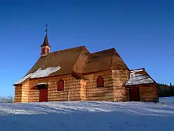 Saint Anthony of Padua Church on the Prašivá mountain | |
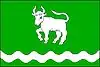 Flag 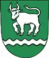 Coat of arms | |
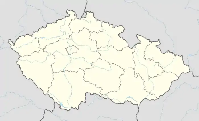 Location in the Czech Republic | |
| Coordinates: 49°38′1″N 18°28′21″E | |
| Country | Czech Republic |
| Region | Moravian-Silesian |
| District | Frýdek-Místek |
| First mentioned | 1524(?), 1584 |
| Government | |
| • Mayor | Roman Čagala |
| Area | |
| • Total | 11.48 km2 (4.43 sq mi) |
| Elevation | 375 m (1,230 ft) |
| Population (2019)[1] | |
| • Total | 858 |
| • Density | 75/km2 (190/sq mi) |
| Postal code | 739 51 |
| Website | www |
It lies on the Morávka River, on the foothills of the Moravian-Silesian Beskids and the Prašivá mountain in the historical region of Těšín Silesia. There is a wooden Saint Anthony of Padua church from 1640 on the Prašivá mountain.[2]
There is a refugee camp of the Ministry of Interior in the municipality. Students of Refugee Law Clinic of Centre for Clinical Legal Education (Palacký University, Faculty of Law) get clinical experience there by assisting in providing pro bono legal help there.
History
Some sources state that the village was first mentioned in a Latin document of Diocese of Wrocław called Liber fundationis episcopatus Vratislaviensis from around 1305 as item in Warmnuthowitz,[3][4][5] however it is very unlikely and disputed.[6] Moudreho Lhota mentioned in 1524 still leaves doubts.[3][6][lower-alpha 1] Surely it was mentioned in 1584 as Hornÿ Lhota in the document sealing the selling of Friedeck state country by Stanislaus Pavlovský von Pavlovitz, Bishop of Olomouc, to Bartholomew von Wrbno.[3] The adjective Hornÿ (lit. Upper, later also Superiori, Ober, Górne, Vyšní) was used to differentiate it from the older sister settlement lying down Morávka river, called Dolny neb Spodny Lhota in the same document from 1584.[3]
The Friedeck state country was split from the Duchy of Teschen in 1573 when the village must have already existed. It was a part of the Kingdom of Bohemia and the Habsburg Monarchy. After World War I and fall of Austria-Hungary it became a part of Czechoslovakia. In March 1939 it became a part of Protectorate of Bohemia and Moravia. After World War II it was restored to Czechoslovakia.
Notes
- This leaves the question what happened to Warmnuthowitz, as it indeed lay somewhere in the vicinity but is now considered lost. It was probably absorbed by another nearby village, but not necessarily by Vyšní Lhoty. Compare: I. Panic, 2010, p. 298.
References
- "Population of municipalities of the Czech Republic". Czech Statistical Office. 1 January 2019.
- Historie obce Vyšní Lhoty
- Mrózek, Robert (1984). Nazwy miejscowe dawnego Śląska Cieszyńskiego [Local names of former Cieszyn Silesia] (in Polish). Katowice: Uniwersytet Śląski w Katowicach. p. 106. ISSN 0208-6336.
- Schulte, Wilhelm (1889). Codex Diplomaticus Silesiae T.14 Liber Fundationis Episcopatus Vratislaviensis (in German). Breslau.
- "Liber fundationis episcopatus Vratislaviensis" (in Latin). Retrieved 13 July 2014.
- Panic, Idzi (2010). Śląsk Cieszyński w średniowieczu (do 1528) [Cieszyn Silesia in Middle Ages (until 1528)] (in Polish). Cieszyn: Starostwo Powiatowe w Cieszynie. pp. 298, 312. ISBN 978-83-926929-3-5.
External links
| Wikimedia Commons has media related to Vyšní Lhoty. |

| Authority control |
|
|---|