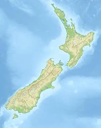
List of cities in New Zealand
The word "city" began to take on two meanings in New Zealand after the local government reforms of 1989. Before the reforms, a borough council with more than 20,000 people could be proclaimed a city. The boundaries of councils tended to follow the edge of the built-up area, so there was little difference between the urban area and the local government area.
In 1989, the structure of the local government in New Zealand was significantly reorganised. The new district councils and city councils were nearly always much larger geographically, and they covered both urban land and the surrounding rural land. Many locations that once had had a "city council" are now governed by a "district council".
The word "city" is used in a general sense to describe the urban areas of New Zealand, independent of local body boundaries. This informal usage is jealously guarded. The district government of the town of Gisborne, for example, adamantly described itself as the first "city" in the world to see the new millennium. However, Gisborne is governed by a "district council", though its status as a city is not generally disputed in New Zealand. Similarly, there is no "city council" in Auckland, though its status as a city is not generally disputed due to its size.
Today an urban area has to be at least 50,000 residents before it can be proclaimed as a city.[1]
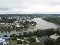
Urban areas by population
Population based on 2018 standard
One of the roles of Statistics New Zealand is to define standards for geographical areas and those standards are the basis for determining population. Statistics New Zealand announced in late 2017 that the Statistical Standard for Geographic Areas 2018 (SSGA18) would replace the New Zealand Standard Areas Classification 1992 (NZSAC92). That change in standard most heavily impacted Wellington by being split into four, these being the Wellington city and Lower Hutt city "major urban areas" and Porirua and Upper Hutt "large urban areas". Wellington, as defined by Statistics New Zealand, approximately halved in size, and Lower Hutt first entered the city ranking in sixth place between Tauranga and Dunedin.[2] Many satellite towns included within the NZSAC92 urban areas became urban areas in their own right under SSGA18, resulting in the addition of Hibiscus Coast (previously part of Auckland) to the list of large urban areas. Napier-Hastings was also split into its constituent cities rather than being one combined urban areas.
The table below contains all "major urban areas" (100,000 or more residents) and all "large urban areas" (30,000 to 99,999 residents).[3] The two urban areas that will next move from the "medium urban area" category to the "large urban area" category are Paraparaumu (30,100) and Timaru (28,700).

.jpg.webp)

| Rank | Urban area | Population | Area (km²)[4] | Population density (per km²) | Notes |
|---|---|---|---|---|---|
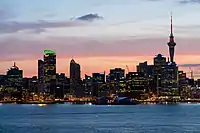
| 1 | Auckland | 1,470,100 | 607.10 | 2,421.9 | |
| 2 | Christchurch | 383,200 | 295.15 | 1,298.3 | |
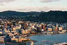
| 3 | Wellington | 215,100 | 112.29 | 1,915.6 | |
| 4 | Hamilton | 176,500 | 110.37 | 1,599.2 | |
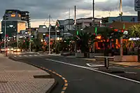
| 5 | Tauranga | 151,300 | 135.12 | 1,119.7 | |
| 6 | Lower Hutt | 110,700 | 78.52 | 1,409.8 | |
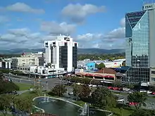
| 7 | Dunedin | 106,200 | 91.58 | 1,159.6 | |
| 8 | Palmerston North | 81,500 | 76.92 | 1,059.5 | |
| 9 | Napier | 66,300 | 104.90 | 632.0 | |
| 10 | Hibiscus Coast | 59,800 | 42.90 | 1,393.9 | |
| 11 | Porirua | 59,600 | 60.96 | 977.7 | |
| 12 | Rotorua | 58,500 | 48.12 | 1,215.7 | |
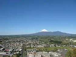
| 13 | New Plymouth | 57,600 | 75.49 | 763.0 | |
| 14 | Whangārei | 54,400 | 57.06 | 953.4 | |
| 15 | Nelson | 51,100 | 54.33 | 940.5 | |
| 16 | Invercargill | 50,200 | 60.70 | 827.0 | |
| 17 | Hastings | 49,000 | 24.42 | 2,006.6 | |
| 18 | Upper Hutt | 44,300 | 540.1 | 865.7 | |
| 19 | Whanganui | 42,200 | 40.35 | 1,045.8 | |
| 20 | Gisborne | 37,000 | 36.17 | 1,022.9 | |
Population based on 1992 standard
Until the end of 2017, the standard devised in 1991 that applied was the New Zealand Standard Areas Classification 1992.[2] The populations given in the table below are provisional June 2018[5] New Zealand resident populations and they refer to the entire urban area as defined in NZSAC92.
| Rank | Urban area | Population | Area (km²)[6] |
Population density (per km²) |
Notes |
|---|---|---|---|---|---|
| 1 | Auckland | 1,570,100 | 1,086 | 1,445.8 | |
| 2 | Wellington | 418,500 | 444 | 942.6 | 1 |
| 3 | Christchurch | 404,500 | 608 | 665.3 | |
| 4 | Hamilton | 241,200 | 877 | 275.0 | 2 |
| 5 | Tauranga | 141,600 | 178 | 795.5 | |
| 6 | Napier-Hastings | 134,500 | 375 | 358.7 | 3 |
| 7 | Dunedin | 122,000 | 255 | 478.4 | |
| 8 | Palmerston North | 86,600 | 178 | 486.5 | |
| 9 | Nelson | 67,500 | 146 | 462.3 | |
| 10 | Rotorua | 59,500 | 89 | 668.5 | |
| 11 | Whangārei | 58,700 | 133 | 441.4 | |
| 12 | New Plymouth | 58,300 | 112 | 520.5 | |
| 13 | Invercargill | 51,200 | 123 | 416.3 | |
| 14 | Whanganui | 40,900 | 105 | 389.5 | 4 |
| 15 | Gisborne | 37,200 | 85 | 437.6 | |
Notes:
- Kapiti Urban Area (42,700) is the only Statistics New Zealand main urban area not listed. It spans the towns of Ōtaki, Paekākāriki, Paraparaumu, Raumati Beach, Raumati South, Peka Peka and Waikanae, and is not considered to be a city. It is part of the Greater Wellington Regional Council's area – though listed separately by Statistics New Zealand.
- The population for the Hamilton urban zone is 203,100, the Cambridge urban zone is 20,600 and the Te Awamutu urban zone is 17,500.
- The population for the Hastings urban zone is 70,600 and for the Napier urban zone is 63,900.
- Still widely referred to by its older spelling of Wanganui.
- Blenheim (31,600) is rarely referred to as a city.
- Pukekohe, a town in the south of the Auckland Region, has an estimated population of 31,400.
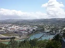
- Timaru (29,100) once had a city council, but is now administered by a district council. It is classified as a secondary urban area by Statistics New Zealand. It is still considered a city and the principal centre of South Canterbury. Road signs state "city centre" rather than "town centre".
- Taupo (24,700) is rarely referred to as a city.
- Masterton (22,200), the main centre and the town with the largest population in the Wairarapa, is rarely referred to as a city.
- Levin (21,200), the main centre in the Horowhenua district, is not considered to be a city.
- Tokoroa was long expected to become a city when its population continued to grow past 18,000 during the 1980s. However, with the fallback in the forestry industry, Tokoroa's main industry, many jobs were lost and Tokoroa's population declined. It now has 14,050 residents.
City councils
Populations of present-day city (and Auckland) councils
The populations given are the latest (June 2018)[5] Statistics New Zealand estimated resident populations.
| Rank | City council | Population | First proclaimed |
|---|---|---|---|
| 1 | Auckland | 1,618,400 | 1871 |
| 2 | Christchurch | 380,200 | 1868 |
| 3 | Wellington | 209,000 | 1870 |
| 4 | Hamilton | 165,900 | 1936 |
| 5 | Tauranga | 140,800 | 1963 |
| 6 | Dunedin | 130,500 | 1865 |
| 7 | Lower Hutt | 107,600 | 1941 |
| 8 | Palmerston North | 87,300 | 1930 |
| 9 | Napier | 64,100 | 1950 |
| 10 | Porirua | 58,200 | 1965 |
| 11 | Invercargill | 55,800 | 1930 |
| 12 | Nelson | 52,400 | 1874 |
| 13 | Upper Hutt | 45,300 | 1966 |
Many cities were reorganised into districts by the Local Government Commission in 1989 under the Local Government Act 1974, for example Timaru. Other urban areas that are no longer cities, such as Rotorua and Whangārei, have higher populations than some present cities. The most recently proclaimed city is Tauranga, which became a city, for the second time, from 1 March 2004. Christchurch (1862 and 1868) and Invercargill (1930 and 1991) have also been declared cities more than once.
Under Section 27 of the Local Government Act 2002, a district may become a city by either a "reorganisation scheme" with the Local Government Commission, or under Section 27(1) it may apply for a change in status under Schedule 3, Clause 7. The new city must have "a population of not less than 50,000 persons", be "predominantly urban" and "a distinct entity and a major centre of activity within the region" (or regions) that it is encompassed by. Existing cities are grandfathered under Schedule 2, Part 2 of the Act. The only new city council so far under this section is the Tauranga City Council, from 1 March 2004.
Previously, under Section 37L of the Local Government Act 1974, new cities could only be formed from a "reorganisation scheme". The same criteria were used. The last city to be constituted under this section was Invercargill, which was re-reorganised into a city in 1991.
In 1991 the Lower Hutt City Council became the Hutt City Council by a special Act of Parliament that which did not change the name of the city of Lower Hutt; the city's coat of arms still refers to the "City of Lower Hutt".
Cities during provincialism, 1852 to 1876
During provincialism in New Zealand, from 1852 until abolition in 1876, there was no uniform system of local authorities in New Zealand. There is thus some argument over which of the following cities was the first.
- Nelson (1858, by Letters Patent)
- Christchurch (November 1862, revoked June 1868, both by provincial ordinance, and restored October 1868 by Act of Parliament)
- Otago (later Dunedin) (July 1865)
The Municipal Corporations Act 1876 included the first schedule of cities, with the dates they were constituted. Dunedin was the first city in New Zealand to be described in an Act of Parliament as 'City of...', something now automatic under the Local Government Act 2002.
- Dunedin (4 July 1865)
- Christchurch (28 May 1868)
- Wellington (16 September 1870)
- Auckland (24 April 1871)
- Nelson (30 March 1874)
Cities, 1877 to 1989
Up to October 1989, the Local Government Commission under took reorganisations of local government. As a result, some cities were reorganised into other larger cities or changed to districts, and some of these areas are still considered cities by many New Zealanders. This is a list as at circa 1986.
- North Island
- Whangārei (1964)
- Auckland
- Auckland (1871)
- East Coast Bays
- Takapuna
- Birkenhead
- Waitemata (1974)
- Mt Albert
- Papatoetoe
- Manukau (1965)
- Papakura
- Tamaki
- Hamilton (1936)
- New Plymouth (1949)
- Tauranga (1963) (lost city status 1989, regained 2004)
- Bethlehem
- Mount Maunganui
- Papamoa
- Welcome Bay
- Rotorua (1962, merged into Rotorua District, 1979)
- Gisborne (1955)
- Napier (1950)
- Hastings (1956)
- Wanganui (1924) (merged with surrounding counties to become Whanganui District, 1989)
- Palmerston North (1930)
- Wellington
- Wellington (1870)
- Upper Hutt (1966)
- Lower Hutt (1941)
- Porirua (1965)
- South Island
- Nelson (1874)
- Christchurch (1868)
- Timaru (1948)
- Dunedin (1865)
- Invercargill (1930)
See also
Notes
- "Local Government Act 2002, Schedule 3 part 16, Cities". New Zealand Government. Retrieved 28 November 2016.
- Mitchell, Charlie (15 January 2020). "Christchurch is New Zealand's second city, deal with it". Stuff. Retrieved 20 January 2020.
- Statistical standard for geographic areas 2018 (PDF). Wellington: Statistics New Zealand. 2017. p. 15. ISBN 978-1-98-852841-0. Retrieved 20 January 2020.
- "Urban Rural 2018 (generalised) - GIS | New Zealand | GIS Map Data Datafinder Geospatial Statistics | Stats NZ Geographic Data Service". datafinder.stats.govt.nz. Retrieved 11 August 2020.
- "Subnational Population Estimates: At 30 June 2019". Statistics New Zealand. 22 October 2019. Retrieved 11 January 2020. For urban areas, "Subnational population estimates (UA, AU), by age and sex, at 30 June 1996, 2001, 2006–18 (2017 boundaries)". Statistics New Zealand. 23 October 2018. Retrieved 23 October 2018.
- "Freedom from Crowding: Living Density Table 1". Statistics New Zealand. Archived from the original on 11 September 2012. Retrieved 28 January 2010. (Areas are based on 2001 boundaries. Water bodies of areas greater than 15 hectares are excluded)
References
- Gordon McLauchlan (ed.), Illustrated Encyclopedia of New Zealand, The, Auckland: David Bateman, 1989 (second edition) (ISBN 1-86953-007-1) – confirmation, pre-1989 dates
External links
- Statistics New Zealand Subnational Population Estimates
- Tauranga status change, 2003 – specific details
- Local Government (Tauranga City Council) Order 2003 (Governor-General's Order-in-Council, 2 October 2003)
- Local Government Commission press release (PDF)
- Local Government Commission decision full text (PDF)
- Tauranga's city status returns (The New Zealand Herald, 12 August 2003)
- Local Government Online Limited site – confirmation, post-1989 council names