Wharton, New Jersey
Wharton is a borough in Morris County, New Jersey, United States.
Wharton, New Jersey | |
|---|---|
| Borough of Wharton | |
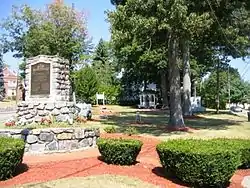 Memorial Park in central Wharton | |
| Motto(s): Tradition with Progress! | |
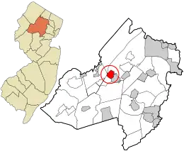 Location in Morris County and the state of New Jersey. | |
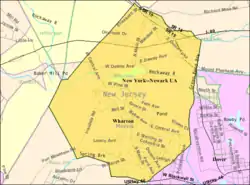 Census Bureau map of Wharton, New Jersey | |
| Coordinates: 40.897055°N 74.574512°W[1][2] | |
| Country | |
| State | |
| County | |
| Incorporated | June 26, 1895 as Port Oram |
| Renamed | April 16, 1902 as Wharton |
| Named for | Joseph Wharton |
| Government | |
| • Type | Borough |
| • Body | Borough Council |
| • Mayor | William J. Chegwidden (R, term ends December 31, 2022)[4][5] |
| • Municipal clerk | Gabrielle Evangelista[6] |
| Area | |
| • Total | 2.13 sq mi (5.51 km2) |
| • Land | 2.07 sq mi (5.37 km2) |
| • Water | 0.06 sq mi (0.14 km2) 2.63% |
| Area rank | 399th of 565 in state 33rd of 39 in county[1] |
| Elevation | 666 ft (203 m) |
| Population | |
| • Total | 6,522 |
| • Estimate (2019)[11] | 6,369 |
| • Rank | 327th of 566 in state 26th of 39 in county[12] |
| • Density | 3,039.0/sq mi (1,173.4/km2) |
| • Density rank | 213th of 566 in state 10th of 39 in county[12] |
| Time zone | UTC−05:00 (Eastern (EST)) |
| • Summer (DST) | UTC−04:00 (Eastern (EDT)) |
| ZIP Code | |
| Area code(s) | 973[15] |
| FIPS code | 3402780390[1][16][17] |
| GNIS feature ID | 0885443[1][18] |
| Website | www |
Wharton was originally incorporated as the borough Port Oram by an act of the New Jersey Legislature on June 26, 1895, created from portions of Randolph Township and Rockaway Township, subject to the results of a referendum passed on the previous day; the name was changed to Wharton on April 16, 1902, based on a referendum held that day and subject to legislation passed on March 27, 1902.[19][20][21] The borough was named for Joseph Wharton of the Wharton Steel Company.[22][23]
As of the 2010 United States Census, the borough's population was 6,522,[8][9][10] reflecting an increase of 224 (+3.6%) from the 6,298 counted in the 2000 Census, which had in turn increased by 893 (+16.5%) from the 5,405 counted in the 1990 Census.[24]
History
In 1831, the Morris Canal was completed from Newark to Phillipsburg, New Jersey across the Delaware River from the terminus of the Lehigh Canal. On the way, it passed through Boonton, Dover and Port Oram. On this route it tapped the Morris County ore fields and became a carrier for both ore and pig iron. Its main purpose, however, was as an extension of the Lehigh Canal to furnish a route for anthracite coal from the Pennsylvania mines to seaboard. Any local traffic was a gain to supplement the through anthracite freight and iron ore and its products soon became important sources of revenue. Sites on the canal were selected for docks and industry, including iron works.[25]
On June 28, 1895, voters from the settlements Port Oram, Irondale, Luxemburg, Maryville and Mount Pleasant voted 143 to 51 to incorporate as the borough Port Oram, the largest of the communities in the area covering 2.25 square miles (5.8 km2) west of Dover, New Jersey. A mayor, six councilmen, an assessor and a collector were elected to govern the new borough which had started life as an ore shipping port on the Morris Canal. These elected officials (mine superintendents, store owners, a railroad superintendent and a school teacher) represented the leaders of these settlements where iron ore was mined, smelted and shipped.[25]
The borough was renamed in 1902 in honor of Joseph Wharton, who was born in 1826 in Philadelphia to an old family of Quakers. Wharton first studied at a local Quaker school after which he worked on a farm rather than attend college because his parents wanted him to mature,[26] and during the winter studied chemistry at the laboratory of Martin Hans Boyè in Philadelphia. He started producing zinc and nickel, and gradually bought a controlling interest in Bethlehem Iron Works. As his business interests expanded he purchased substantial shares of several railroads involved in the coal and iron trade, also purchasing iron mines and furnaces near Port Oram. After selling his interest in Bethlehem Iron Works in 1901 and his nickel works to CVRD Inco in 1902, he continued to actively acquire and manage a large and diverse business empire that included iron smelting in Wharton until just before his death in January, 1909. Wharton also endowed the Wharton School of the University of Pennsylvania. The town was named after him at after a referendum in 1902.[25]
In 1984, the long-time local bar The Heslin House and Hartley's Store were destroyed in a gas leak explosion, in which flames as high as 100 feet (30 m) destroyed several area buildings.[27]
Wharton was used as a filming location for Cyndi Lauper's music video "Time After Time" in 1984.[28]
Geography
According to the United States Census Bureau, the borough had a total area of 2.13 square miles (5.51 km2), including 2.07 square miles (5.37 km2) of land and 0.06 square miles (0.14 km2) of water (2.63%).[1][2]
The borough borders the Morris County municipalities of Dover, Jefferson Township, Mine Hill Township, Rockaway Township, Roxbury Township.[29][30][31]
Unincorporated communities in the borough include Irondale, Luxemburg, Maryville, Mount Pleasant and Port Oram.[21]
Climate
The climate in this area is characterized by hot, humid summers and generally mild to cool winters. According to the Köppen Climate Classification system, Wharton has a humid subtropical climate, abbreviated "Cfa" on climate maps.[32]
Demographics
| Historical population | |||
|---|---|---|---|
| Census | Pop. | %± | |
| 1890 | 775 | — | |
| 1900 | 2,069 | 167.0% | |
| 1910 | 2,983 | 44.2% | |
| 1920 | 2,877 | −3.6% | |
| 1930 | 3,683 | 28.0% | |
| 1940 | 3,854 | 4.6% | |
| 1950 | 3,853 | 0.0% | |
| 1960 | 5,006 | 29.9% | |
| 1970 | 5,535 | 10.6% | |
| 1980 | 5,485 | −0.9% | |
| 1990 | 5,405 | −1.5% | |
| 2000 | 6,298 | 16.5% | |
| 2010 | 6,522 | 3.6% | |
| 2019 (est.) | 6,369 | [11][33][34] | −2.3% |
| Population sources: 1890[35] 1900-1920[36] 1900-1910[37] 1910-1930[38] 1930-1990[39] 2000[40][41] 2010[8][9][10] | |||
2010 Census
The 2010 United States Census counted 6,522 people, 2,304 households, and 1,590 families in the borough. The population density was 3,039.0 per square mile (1,173.4/km2). There were 2,426 housing units at an average density of 1,130.4 per square mile (436.4/km2). The racial makeup was 75.85% (4,947) White, 4.57% (298) Black or African American, 0.18% (12) Native American, 5.67% (370) Asian, 0.06% (4) Pacific Islander, 9.61% (627) from other races, and 4.05% (264) from two or more races. Hispanic or Latino of any race were 40.33% (2,630) of the population.[8]
Of the 2,304 households, 33.5% had children under the age of 18; 48.1% were married couples living together; 14.8% had a female householder with no husband present and 31.0% were non-families. Of all households, 25.0% were made up of individuals and 10.7% had someone living alone who was 65 years of age or older. The average household size was 2.83 and the average family size was 3.34.[8]
23.9% of the population were under the age of 18, 8.4% from 18 to 24, 28.6% from 25 to 44, 27.4% from 45 to 64, and 11.7% who were 65 years of age or older. The median age was 38.2 years. For every 100 females, the population had 96.9 males. For every 100 females ages 18 and older there were 92.7 males.[8] The Census Bureau's 2006-2010 American Community Survey showed that (in 2010 inflation-adjusted dollars) median household income was $73,571 (with a margin of error of +/- $8,504) and the median family income was $75,176 (+/- $9,601). Males had a median income of $48,750 (+/- $12,951) versus $31,105 (+/- $5,994) for females. The per capita income for the borough was $27,233 (+/- $2,723). About 6.6% of families and 6.8% of the population were below the poverty line, including 8.6% of those under age 18 and none of those age 65 or over.[42]
2000 Census
As of the 2000 United States Census[16] there were 6,298 people, 2,328 households, and 1,599 families residing in the borough. The population density was 2,882.4 people per square mile (1,110.4/km2). There were 2,394 housing units at an average density of 1,095.6 per square mile (422.1/km2). The racial makeup of the borough was 82.09% White, 4.40% African American, 0.44% Native American, 3.14% Asian, 7.21% from other races, and 2.72% from two or more races. Hispanic or Latino of any race were 23.21% of the population.[40][41]
There were 2,328 households, out of which 34.6% had children under the age of 18 living with them, 52.1% were married couples living together, 12.0% had a female householder with no husband present and 31.3% were non-families. 26.5% of all households were made up of individuals, and 10.4% had someone living alone who was 65 years of age or older. The average household size was 2.70 and the average family size was 3.28.[40][41]
In the borough the population age was spread out, with 26.0% under the age of 18, 6.8% from 18 to 24, 34.0% from 25 to 44, 21.9% from 45 to 64, and 11.3% who were 65 years of age or older. The median age was 36 years. For every 100 females, there were 93.5 males. For every 100 females age 18 and over, there were 88.8 males.[40][41]
The median income for a household in the borough was $56,580, and the median income for a family was $64,957. Males had a median income of $42,311 versus $36,016 for females. The per capita income for the borough was $25,168. About 6.4% of families and 8.3% of the population were below the poverty line, including 15.0% of those under age 18 and 4.2% of those age 65 or over.[40][41]
Government
Local government
Wharton is governed under the Borough form of New Jersey municipal government, which is used in 218 municipalities (of the 565) statewide, making it the most common form of government in New Jersey.[43] The governing body is comprised of the Mayor and the Borough Council, with all positions elected at-large on a partisan basis as part of the November general election. The Mayor is elected directly by the voters to a four-year term of office. The Borough Council is comprised of six members elected to serve three-year terms on a staggered basis, with two seats coming up for election each year in a three-year cycle.[3] The Borough form of government used by Wharton is a "weak mayor / strong council" government in which council members act as the legislative body with the mayor presiding at meetings and voting only in the event of a tie. The mayor can veto ordinances subject to an override by a two-thirds majority vote of the council. The mayor makes committee and liaison assignments for council members, and most appointments are made by the mayor with the advice and consent of the council.[44][45]
As of 2020, the Mayor of Wharton is Republican Bill Chegwidden, whose term of office ends December 31, 2022. Members of the Borough Council are Council President Vincent Binkoski (R, 2020), Sandra L. Hayes (R, 2020), Robert Norton (R, 2022), Paola Vasquez (R, 2022), Thomas C. Yeager (R, 2021) and Nicole Wickenheisser (R, 2021).[4][46][47][48][49][50][51]
Dover serves as the lead agency operating a joint municipal court that includes Wharton and the neighboring municipalities of Mine Hill Township, Mount Arlington and Victory Gardens.[52] Established in 2009, the joint municipal court was forecast to offer annual savings in excess of $250,000 over the 10-year life of the agreement.[53]
Federal, state and county representation
Wharton is located in the 7th Congressional District[54] and is part of New Jersey's 25th state legislative district.[9][55][56] Prior to the 2010 Census, Wharton had been part of the 11th Congressional District, a change made by the New Jersey Redistricting Commission that took effect in January 2013, based on the results of the November 2012 general elections.[57]
For the 116th United States Congress. New Jersey's Seventh Congressional District is represented by Tom Malinowski (D, Ringoes).[58] New Jersey is represented in the United States Senate by Democrats Cory Booker (Newark, term ends 2021)[59] and Bob Menendez (Paramus, term ends 2025).[60][61]
For the 2020–2021 session (Senate, General Assembly), the 25th Legislative District of the New Jersey Legislature is represented in the State Senate by Tony Bucco (R, Boonton Township) and in the General Assembly by Brian Bergen (R, Denville) and Aura K. Dunn (R, Mendham Borough).[62][63]
Morris County is governed by a seven-member Board of County Commissioners, who are elected at-large in partisan elections, to three-year terms on a staggered basis, with either one or three seats up for election each year as part of the November general election. The Commissioner Board sets policies for the operation of six super-departments, more than 30 divisions plus authorities, commissions, boards and study committees.[64] Actual day-to-day operation of departments is supervised by County Administrator, John Bonanni.[65] As of 2021, Morris County's Commissioners are Commissioner Director Stephen H. Shaw (R, Mountain Lakes, 2021),[66] Commissioner Deputy Director Deborah Smith (R, Denville, 2021),[67] John Krickus (R, Washington Township, 2021),[68] Douglas Cabana (R, Boonton Township, 2022),[69] Kathryn A. DeFillippo (R, Roxbury, 2022),[70] Thomas J. Mastrangelo (R, Montville, 2022),[71] and Tayfun Selen (R, Chatham Township, 2023).[72] [73]
Tayfun Selen was elected by a county Republican convention to the vacant seat of Heather Darling, who was elected Morris County Surrogate in 2019.[74] He served the remainder of her term which ended in 2020 and was elected to a full three-year term in the November general election that year.[75]
Pursuant to Article VII Section II of the New Jersey State Constitution, each county in New Jersey is required to have three elected administrative officials known as "constitutional officers." These officers are the County Clerk and County Surrogate (both elected for five-year terms of office) and the County Sheriff (elected for a three-year term).[76] As of 2021, they are County Clerk Ann F. Grossi (R, Parsippany, 2023),[77] Sheriff James M. Gannon (R, Boonton Township, 2022)[78] and Surrogate Heather Darling (R, Roxbury, 2024).[79]
Politics
As of March 23, 2011, Wharton had a total of 3,258 registered voters, of which 923 (28.3%) were registered as Democrats, 935 (28.7%) were registered as Republicans and 1,397 (42.9%) were registered as Unaffiliated. Three voters were registered to other parties.[80]
In the 2012 presidential election, Democrat Barack Obama received 56.0% of the vote (1,310 cast), ahead of Republican Mitt Romney with 43.0% (1,006 votes), and other candidates with 1.0% (24 votes), among the 2,359 ballots cast by the borough's 3,455 registered voters (19 ballots were spoiled), for a turnout of 68.3%.[81][82] In the 2008 presidential election, Democrat Barack Obama received 51.8% of the vote (1,326 cast), ahead of Republican John McCain with 47.0% (1,202 votes) and other candidates with 0.7% (19 votes), among the 2,559 ballots cast by the borough's 3,432 registered voters, for a turnout of 74.6%.[83] In the 2004 presidential election, Republican George W. Bush received 54.4% of the vote (1,334 ballots cast), outpolling Democrat John Kerry with 44.6% (1,092 votes) and other candidates with 0.5% (16 votes), among the 2,451 ballots cast by the borough's 3,510 registered voters, for a turnout percentage of 69.8.[84]
In the 2013 gubernatorial election, Republican Chris Christie received 65.9% of the vote (892 cast), ahead of Democrat Barbara Buono with 32.1% (434 votes), and other candidates with 2.0% (27 votes), among the 1,381 ballots cast by the borough's 3,449 registered voters (28 ballots were spoiled), for a turnout of 40.0%.[85][86] In the 2009 gubernatorial election, Republican Chris Christie received 52.9% of the vote (848 ballots cast), ahead of Democrat Jon Corzine with 36.6% (586 votes), Independent Chris Daggett with 8.6% (137 votes) and other candidates with 1.1% (17 votes), among the 1,602 ballots cast by the borough's 3,357 registered voters, yielding a 47.7% turnout.[87]
Education
The Wharton Borough School District serves public school students in kindergarten through eighth grade. As of the 2018–19 school year, the district, comprised of two schools, had an enrollment of 738 students and 73.7 classroom teachers (on an FTE basis), for a student–teacher ratio of 10.0:1.[88] Schools in the district (with 2018–19 enrollment data from the National Center for Education Statistics[89]) are Marie V. Duffy Elementary School[90] with 462 students in grades K - 5 and Alfred C. MacKinnon Middle School[91] with 271 students in grades 6 - 8.[92]
Public school students in ninth through twelfth grades attend Morris Hills High School, located in Rockaway Borough, and which also serves portions of Rockaway Borough and Rockaway Township.[93] As of the 2018–19 school year, the high school had an enrollment of 1,279 students and 118.4 classroom teachers (on an FTE basis), for a student–teacher ratio of 10.8:1.[94] The high school is part of the Morris Hills Regional High School District, which also includes students from Denville Township, who attend Morris Knolls High School along with students from parts of Rockaway Borough and Rockaway Township.[95][96]
Parks and recreation
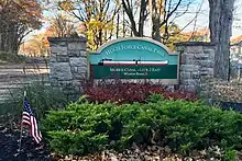
The Hugh Force Canal Park provides hiking trails along the former Morris Canal and abandoned railroad beds. It features Lock 2 East of the canal.[97]
Transportation
_in_Wharton%252C_Morris_County%252C_New_Jersey.jpg.webp)
Roads and highways
As of May 2010, the borough had a total of 22.12 miles (35.60 km) of roadways, of which 16.67 miles (26.83 km) were maintained by the municipality, 3.31 miles (5.33 km) by Morris County and 2.14 miles (3.44 km) by the New Jersey Department of Transportation.[98]
Interstate 80 and New Jersey Route 15 are the main highways serving Wharton. I-80 travels east–west, while Route 15 is oriented north–south.
Notable people
People who were born in, residents of, or otherwise closely associated with Wharton include:
- Kirk Alyn (1910–1999), the first on-screen Superman, lived during his youth in Wharton, the son of Hungarian immigrants.[102]
- Bonnie Lee Bakley (1956-2001), the murdered second wife of actor Robert Blake.
See also
- Hungarian Presbyterian Church of Wharton, New Jersey
References
- 2019 Census Gazetteer Files: New Jersey Places, United States Census Bureau. Accessed July 1, 2020.
- US Gazetteer files: 2010, 2000, and 1990, United States Census Bureau. Accessed September 4, 2014.
- 2012 New Jersey Legislative District Data Book, Rutgers University Edward J. Bloustein School of Planning and Public Policy, March 2013, p. 116.
- Governing Body, Borough of Wharton. Accessed March 12, 2020.
- 2020 New Jersey Mayors Directory, New Jersey Department of Community Affairs. Accessed February 1, 2020.
- Borough Clerk, Borough of Wharton. Accessed March 12, 2020.
- U.S. Geological Survey Geographic Names Information System: Borough of Wharton, Geographic Names Information System. Accessed March 14, 2013.
- DP-1 - Profile of General Population and Housing Characteristics: 2010 Demographic Profile Data for Wharton borough, Morris County, New Jersey Archived February 12, 2020, at Archive.today, United States Census Bureau. Accessed May 16, 2012.
- Municipalities Sorted by 2011-2020 Legislative District, New Jersey Department of State. Accessed February 1, 2020.
- Profile of General Demographic Characteristics: 2010 for Wharton borough Archived April 24, 2014, at the Wayback Machine, New Jersey Department of Labor and Workforce Development. Accessed May 16, 2012.
- QuickFacts for Wharton borough, New Jersey; Morris County, New Jersey; New Jersey from Population estimates, July 1, 2019, (V2019), United States Census Bureau. Accessed May 21, 2020.
- GCT-PH1 Population, Housing Units, Area, and Density: 2010 - State -- County Subdivision from the 2010 Census Summary File 1 for New Jersey Archived February 12, 2020, at Archive.today, United States Census Bureau. Accessed December 23, 2012.
- Look Up a ZIP Code for Wharton, NJ, United States Postal Service. Accessed May 16, 2012.
- Zip Codes, State of New Jersey. Accessed September 1, 2013.
- Area Code Lookup - NPA NXX for Wharton, NJ, Area-Codes.com. Accessed September 1, 2013.
- U.S. Census website , United States Census Bureau. Accessed September 4, 2014.
- Geographic codes for New Jersey, Missouri Census Data Center. Accessed September 1, 2019.
- US Board on Geographic Names, United States Geological Survey. Accessed September 4, 2014.
- Snyder, John P. The Story of New Jersey's Civil Boundaries: 1606-1968, Bureau of Geology and Topography; Trenton, New Jersey; 1969. p. 196. Accessed May 16, 2012.
- Honeyman, Abraham Van Doren. Index-analysis of the Statutes of New Jersey, 1896-1909: Together with References to All Acts, and Parts of Acts, in the 'General Statutes' and Pamphlet Laws Expressly Repealed: and the Statutory Crimes of New Jersey During the Same Period, p. 210. New Jersey Law Journal Publishing Company, 1910. Accessed September 21, 2015.
- Historical Timeline of Morris County Boundaries, Morris County Library. Accessed December 24, 2016. "1895, June 28. Port Oram is established from Roxbury. The community is made up of the settlements of Port Oram, Irondale, Luxemburg, Maryville and Mount Pleasant. The name is changed to Wharton Borough in 1902."
- Hutchinson, Viola L. The Origin of New Jersey Place Names, New Jersey Public Library Commission, May 1945. Accessed October 29, 2015.
- History of Wharton Borough; Morris County, New Jersey, NY-NJ-CT Botany Online. Accessed October 29, 2015. "1902 – named changed to Wharton to honor Joseph Wharton."
- Table 7. Population for the Counties and Municipalities in New Jersey: 1990, 2000 and 2010, New Jersey Department of Labor and Workforce Development, February 2011. Accessed December 23, 2012.
- Borough Information, Borough of Wharton. Accessed May 16, 2012.
- "Joseph Wharton: Quaker Industrial Pioneer", W. Ross Yates, 1987, Lehigh University Press, pp 31-35.
- Armental, Maria. "New state rules burn firefighters: Deployment limits could slow response times, officials say", Daily Record (Morristown), January 24, 2004. Accessed May 16, 2012. "Wharton suffered one of the county's largest fires in 1984, when a gas explosion shot flames 100 feet in the air, destroyed several downtown buildings and damaged more than a dozen others."
- Staff. "Banner Year For N.J. Film Industry Production Companies Spent $15.4 Million In '84", The Philadelphia Inquirer, January 3, 1985. Accessed May 16, 2012. "Lauper's hit 'Time After Time' was shot in Morristown, Ledgewood and Wharton."
- Areas touching Wharton, MapIt. Accessed March 12, 2020.
- Morris County Municipalities Map, Morris County, New Jersey Department of Planning and Preservation. Accessed March 4, 2020.
- New Jersey Municipal Boundaries, New Jersey Department of Transportation. Accessed November 15, 2019.
- Climate Summary for Wharton, New Jersey
- Annual Estimates of the Resident Population for Minor Civil Divisions in New Jersey: April 1, 2010 to July 1, 2019, United States Census Bureau. Accessed May 21, 2020.
- Census Estimates for New Jersey April 1, 2010 to July 1, 2019, United States Census Bureau. Accessed May 21, 2020.
- Report on Population of the United States at the Eleventh Census: 1890. Part I, p. 239. United States Census Bureau, 1895. Accessed October 20, 2016.
- Compendium of censuses 1726-1905: together with the tabulated returns of 1905, New Jersey Department of State, 1906. Accessed September 1, 2013.
- Thirteenth Census of the United States, 1910: Population by Counties and Minor Civil Divisions, 1910, 1900, 1890, United States Census Bureau, p. 338. Accessed May 16, 2012.
- Fifteenth Census of the United States : 1930 - Population Volume I, United States Census Bureau, p. 718. Accessed May 16, 2012.
- Table 6. New Jersey Resident Population by Municipality: 1930 - 1990, New Jersey Department of Labor and Workforce Development. Accessed June 28, 2015.
- Census 2000 Profiles of Demographic / Social / Economic / Housing Characteristics for Wharton borough, New Jersey Archived February 1, 2015, at the Wayback Machine, United States Census Bureau. Accessed December 23, 2012.
- DP-1: Profile of General Demographic Characteristics: 2000 - Census 2000 Summary File 1 (SF 1) 100-Percent Data for Wharton borough, Morris County, New Jersey Archived February 12, 2020, at Archive.today, United States Census Bureau. Accessed December 23, 2012.
- DP03: Selected Economic Characteristics from the 2006-2010 American Community Survey 5-Year Estimates for Wharton borough, Morris County, New Jersey Archived February 12, 2020, at Archive.today, United States Census Bureau. Accessed December 23, 2012.
- Inventory of Municipal Forms of Government in New Jersey, Rutgers University Center for Government Studies, July 1, 2011. Accessed November 18, 2019.
- Cerra, Michael F. "Forms of Government: Everything You've Always Wanted to Know, But Were Afraid to Ask" Archived September 24, 2014, at the Wayback Machine, New Jersey State League of Municipalities. Accessed November 30, 2014.
- "Forms of Municipal Government in New Jersey", p. 6. Rutgers University Center for Government Studies. Accessed June 3, 2015.
- 2019 Municipal Data Sheet, Borough of Wharton. Accessed March 12, 2020.
- Morris County Manual 2020, Morris County, New Jersey Clerk. Accessed June 3, 2020.
- Morris County Municipal Elected Officials For The Year 2020, Morris County, New Jersey Clerk, updated March 17, 2020. Accessed June 3, 2020.
- General Election November 5, 2019, Official Results, Morris County, New Jersey, updated November 15, 2019. Accessed January 31, 2020.
- General Election Winners List For November 6, 2018, Morris County, New Jersey Clerk. Accessed January 1, 2019.
- General Election November 7, 2017 Official Results, Morris County, New Jersey Clerk, updated November 17, 2017. Accessed January 1, 2018.
- Mayor and Board of Aldermen, Town of Dover Minutes of the Reorganization Meeting for January 1, 2015, Town of Dover. Accessed July 29, 2015.
- Forrest, Cindy. "Victory Gardens Council judges proposal for joint municipal court", The Record, May 18, 2012. Accessed July 29, 2015. "With Dover as the lead agency, four other area towns - Rockaway Borough, Wharton, Mine Hill, and Mt. Arlington - entered into a landmark municipal court shared-services agreement in 2009 anticipating an estimated $2.65 million savings over the 10-year life of the contract."
- Plan Components Report, New Jersey Redistricting Commission, December 23, 2011. Accessed February 1, 2020.
- 2019 New Jersey Citizen's Guide to Government, New Jersey League of Women Voters. Accessed October 30, 2019.
- Districts by Number for 2011-2020, New Jersey Legislature. Accessed January 6, 2013.
- 2011 New Jersey Citizen's Guide to Government Archived June 4, 2013, at the Wayback Machine, p. 66, New Jersey League of Women Voters. Accessed May 22, 2015.
- Directory of Representatives: New Jersey, United States House of Representatives. Accessed June 1, 2020.
- About Cory Booker, United States Senate. Accessed January 26, 2015. "He now owns a home and lives in Newark's Central Ward community."
- Biography of Bob Menendez, United States Senate, January 26, 2015. "He currently lives in Paramus and has two children, Alicia and Robert."
- Senators of the 116th Congress from New Jersey. United States Senate. Accessed April 17, 2019. "Booker, Cory A. - (D - NJ) Class II; Menendez, Robert - (D - NJ) Class I"
- Legislative Roster 2020-2021 Session, New Jersey Legislature. Accessed February 28, 2020.
- District 25 Legislators, New Jersey Legislature. Accessed February 28, 2020.
- , Morris County, New Jersey. Accessed January 15, 2021.
- Morris County Manual 2019, Morris County Clerk. Accessed April 16, 2019.
- Stephen H. Shaw, Morris County, New Jersey. Accessed January 15, 2021.
- Deborah Smith, Morris County, New Jersey. Accessed January 15, 2021.
- John Krickus, Morris County, New Jersey. Accessed January 15, 2021.
- Douglas R. Cabana, Morris County, New Jersey. Accessed January 15, 2021).
- Kathryn A. DeFillippo, Morris County, New Jersey. Accessed January 15, 2021.
- Thomas J. Mastrangelo, Morris County, New Jersey. Accessed January 15, 2021.
- Tayfun Selen, Morris County, New Jersey. Accessed January 15, 2021.
- Commissioners, Morris County, New Jersey. Accessed January 15, 2021.
- Filler, Marion. "Morris County's next freeholder is…Tayfun Selen". Morristown Green. Retrieved May 12, 2020.
- "2020 General Election Summary Report" (PDF). Morris County Clerk. Office of the Morris County Clerk. Retrieved January 15, 2021.
- New Jersey State Constitution (1947), Article VII, Section II, Paragraph 2, New Jersey Department of State. Accessed October 26, 2017.
- Ann F. Grossi, Esq., Office of the Morris County Clerk. Accessed April 16, 2019.
- About Us: Sheriff James M. Gannon, Morris County Sheriff's Office. Accessed April 16, 2019.
- Morris County Surrogate Court, Morris County, New Jersey. Accessed May 12, 2020.
- Voter Registration Summary - Morris, New Jersey Department of State Division of Elections, March 23, 2011. Accessed December 23, 2012.
- "Presidential General Election Results - November 6, 2012 - Morris County" (PDF). New Jersey Department of Elections. March 15, 2013. Retrieved December 24, 2014.
- "Number of Registered Voters and Ballots Cast - November 6, 2012 - General Election Results - Morris County" (PDF). New Jersey Department of Elections. March 15, 2013. Retrieved December 24, 2014.
- 2008 Presidential General Election Results: Morris County, New Jersey Department of State Division of Elections, December 23, 2008. Accessed December 23, 2012.
- 2004 Presidential Election: Morris County, New Jersey Department of State Division of Elections, December 13, 2004. Accessed December 23, 2012.
- "Governor - Morris County" (PDF). New Jersey Department of Elections. January 29, 2014. Retrieved December 24, 2014.
- "Number of Registered Voters and Ballots Cast - November 5, 2013 - General Election Results - Morris County" (PDF). New Jersey Department of Elections. January 29, 2014. Retrieved December 24, 2014.
- 2009 Governor: Morris County Archived October 17, 2012, at the Wayback Machine, New Jersey Department of State Division of Elections, December 31, 2009. Accessed December 23, 2012.
- District information for Wharton Borough School District, National Center for Education Statistics. Accessed April 1, 2020.
- School Data for the Wharton Borough Public Schools, National Center for Education Statistics. Accessed April 1, 2020.
- Marie V. Duffy Elementary School, Wharton Borough Public Schools. Accessed June 19, 2020.
- Alfred C. MacKinnon Middle School, Wharton Borough Public Schools. Accessed June 19, 2020.
- New Jersey School Directory for the Wharton Borough Public Schools, New Jersey Department of Education. Accessed December 29, 2016.
- Morris Hills High School 2015 Report Card Narrative, New Jersey Department of Education. Accessed Morris Hills High School is a comprehensive, four-year public school located in the heart of Morris County. The school is part of a regional school district that includes our sister school, Morris Knolls High School. There are over 1,300 students enrolled in grades 9-12. The school serves the local communities of Wharton, Rockaway Township, and Rockaway Borough where the school resides."
- School data for Morris Hills High School, National Center for Education Statistics. Accessed April 1, 2020.
- Morris Hills Regional High School District 2015 Report Card Narrative, New Jersey Department of Education. Accessed March 12, 2020. "Our schools' success is directly attributed to the support we receive from the residents of Denville, Rockaway Borough, Rockaway Township and Wharton - people who care about their children and who value education."
- Overview, Morris Hills High School. Accessed January 2, 2017. Morris Hills High School, located in Rockaway, New Jersey, serves the residential communities of Rockaway Borough, Rockaway Township, and Wharton."
- "Hugh Force Canal Park". New York–New Jersey Trail Conference.
- Morris County Mileage by Municipality and Jurisdiction, New Jersey Department of Transportation, May 2010. Accessed July 18, 2014.
- Morris County System Map, NJ Transit. Accessed August 6, 2015.
- Morris County Bus / Rail Connections, NJ Transit, backed up by the Internet Archive as of May 22, 2009. Accessed December 23, 2012.
- NJ TRANSIT RESTRUCTURES MORRIS COUNTY BUS SERVICE; Four current 'MCM' routes will be expanded to six new bus routes, NJ Transit, September 13, 2010. Accessed August 6, 2015.
- Wharton's Own Superman: Kirk Alyn, Borough of Wharton. Accessed February 27, 2008.
External links
| Wikimedia Commons has media related to Wharton, New Jersey. |
- Wharton Borough website
- Wharton Borough Public Schools
- Wharton Borough Public Schools's 2015–16 School Report Card from the New Jersey Department of Education
- School Data for the Wharton Borough Public Schools, National Center for Education Statistics
- Daily Record - Regional area newspaper
- History of Wharton Borough
- Abandoned Mines of NJ
- Wharton
Municipalities and communities of Morris County, New Jersey, United States | ||
|---|---|---|
| Boroughs | 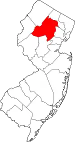 Map of New Jersey highlighting Morris County | |
| Towns | ||
| Townships | ||
| CDPs | ||
| Other unincorporated communities |
| |
| ||
| Authority control |
|---|