Wigram
Wigram is a suburb in the southwest of Christchurch, New Zealand. The suburb lies close to the industrial estates of Sockburn and the satellite retail and residential zone of Hornby, and has undergone significant growth in recent years due to housing developments. It is seven kilometres to the west of the city centre.
Wigram | |
|---|---|
Suburb | |
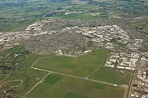 The former Wigram Aerodrome, which has since been converted into the Wigram Skies development | |
 Wigram 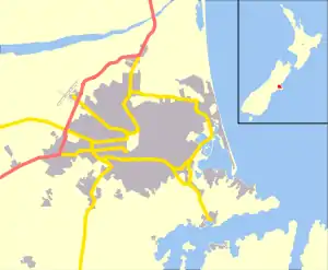 Wigram | |
| Coordinates: 43.5496°S 172.5472°E | |
| Country | New Zealand |
| Local authority | Christchurch |
| Electoral ward | Halswell[1] |
| Area | |
| • Land | 1,940 ha (4,790 acres) |
| Population (2018)[2] | |
| • Total | 4,131 |
| Airport(s) | Wigram Aerodrome (former) |
| Hei Hei | Sockburn | Upper Riccarton |
| Hornby |
|
Middleton |
| Aidanfield | Hillmorton |
Until 1995, Wigram was home to RNZAF Wigram, one of the main bases of the Royal New Zealand Air Force , but this was closed in 1995 after cutbacks in military spending.[3] The majority of Wigram Aerodrome was purchased by Ngāi Tahu in 1997, and continued to be used as a private airfield until it was finally closed on 1 March 2009.[4] The RNZAF retained the original portion of the aerodrome which had been first gifted to the Crown for the purpose of an Air Force base in 1923, an area which includes the Air Force Museum of New Zealand. The remainder of the former airfield was subdivided by Ngāi Tahu Property into the Wigram Skies development following its closure. Street names in the new development reflect the area's aviation heritage, with names such as Corsair Drive, Kittyhawk Avenue and Skyhawk Road alongside The Runway - a road which follows the route of the former runway.[5]
The recent development of the Wigram Aerodrome into housing has resulted in the suburb growing significantly in recent years. At the 2013 census, the area had a population of just 432 - roughly one tenth of the 2018 population.[2] This has made Wigram one of the fastest growing suburbs in post-earthquake Christchurch.[6]
References
- "Wards, Councillors and Community Boards map". ccc.govt.nz. Christchurch City Council. Retrieved 14 August 2020.
- The population and area are the sum of the population and area in statistical areas of Wigram North, Wigram East, Wigram South, and Wigram West.
- "Wigram Airbase Timeline". Christchurch City Libraries. Retrieved 3 September 2018.
- "Historic Wigram Aerodrome closed". RNZ. Radio New Zealand. 28 February 2009. Retrieved 15 August 2020.
- "About Wigram Skies". wigramskies.co.nz. Ngai Tahu Property. Retrieved 15 August 2020.
- Canterbury: the rebuild by the numbers (PDF). Wellington, New Zealand: Statistics New Zealand. February 2018. ISBN 978-1-98-852858-8.
