Halswell
Originally a separate village, Halswell is now a residential suburb of Christchurch, New Zealand, located 9 kilometres (5.6 mi) southwest of Cathedral Square on State Highway 75.
Halswell | |
|---|---|
Suburb | |
 Te Hāpua, a city library and community centre in Halswell | |
 Halswell 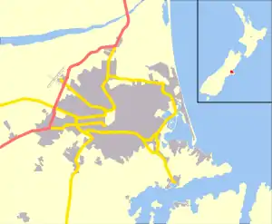 Halswell | |
| Coordinates: 43°35′S 172°34′E | |
| Country | New Zealand |
| Local authority | Christchurch |
| Electoral ward | Halswell[1] |
| Area | |
| • Land | 10,760 ha (26,590 acres) |
| Population (2018)[2] | |
| • Total | 8,139 |
| Oaklands | Hoon Hay | |
| Prebbleton |
|
|
History
Halswell is named after Edmund Halswell QC (1790–1874), a government officer and member of the management commission of the Canterbury Association. He arrived in New Zealand in 1841 and was appointed Commissioner of Native Reserves. The Māori name of Tai Tapu for the area is preserved in the name of a village located some 9 kilometres (5.6 mi) south of the centre of Halswell.[3]
Overview
Until recently, Halswell was completely separated from the city geographically, but in recent years many new subdivisions have been created to the north of the suburb, creating the new suburbs of Oaklands and Westlake. These have effectively joined Halswell to the Christchurch urban area. The Halswell area is growing rapidly with subdivisions expanding the residential areas of Aidanfield to the north east, and The Rocks at the top of Kennedy's Bush Road to the south, which is on a hill, with the rest of Halswell on the flat ground of the Canterbury Plains.
The centre of the Halswell community is the Halswell School catering for boys and girls from the age of 5 up to 14. In 2011 the roll was 626 students and its decile rating was 10.[4]
Halswell has a public swimming pool, library, Catholic, Anglican, United and Baptist churches, a post office with Kiwibank. The Halswell Quarry Park is a 60.4 hectares (0.604 km2) family orientated park maintained by the Christchurch City Council. The park features all weather walking tracks, a mountain bike track, dog and horse exercise areas as well as native and exotic planted areas. Although named for this suburb, the quarry is located in the adjacent suburb Kennedys Bush.
Halswell Domain is a park in the centre of Halswell. It includes a boating pond and a miniature railway, which runs on Sunday afternoons.[5] On the edge of Halswell Domain is the Halswell War Memorial, unveiled in 1924 by Sir Heaton Rhodes MP.[6]
Halswell is growing in popularity after the Canterbury earthquakes with several residential subdivisions being developed allowing many East Christchurch residents to relocate.
The Nottingham Stream flows through the suburb and joins the Halswell River.
References
- "Wards, Councillors and Community Boards map". ccc.govt.nz. Christchurch City Council. Retrieved 14 August 2020.
- The population and area are the sum of the population and area in statistical areas of Halswell North, Halswell South and Halswell West
- Reed, A. W. (2010). Peter Dowling (ed.). Place Names of New Zealand. Rosedale, North Shore: Raupo. p. 153. ISBN 978-0-14-320410-7.
- "Halswell School". Ministry of Education. Retrieved 30 September 2011.
- "Halswell Domain + Miniature Trains". 14 November 2015.
- "Halswell war memorial". ketechristchurch.peoplesnetworknz.info.
- Pawson, Eric. "Ell, Henry George – Biography". Dictionary of New Zealand Biography. Ministry for Culture and Heritage. Retrieved 1 October 2011.